Category:Wartling
Vai alla navigazione
Vai alla ricerca
village in the United Kingdom  | |||||
| Carica un file multimediale | |||||
| Istanza di | |||||
|---|---|---|---|---|---|
| Luogo | Wealden, East Sussex, Sud Est dell'Inghilterra, Inghilterra | ||||
| Superficie |
| ||||
 | |||||
English: Wartling is a village and civil parish in the Wealden District of East Sussex, England. The village is located between Bexhill and Hailsham, ten miles (16 km) west of the latter, and at the northern edge of the Pevensey Levels. The parish includes the two settlements of Wartling itself and Boreham Street, two miles to the north-east on the A271 road to the north. There are seven members on the Wartling Parish Council.
Voce principale su Wikipedia: Wartling.

Sottocategorie
Questa categoria contiene le 3 sottocategorie indicate di seguito, su un totale di 3.
File nella categoria "Wartling"
Questa categoria contiene 200 file, indicati di seguito, su un totale di 391.
(pagina precedente) (pagina successiva)-
 1066 Country Walk - geograph.org.uk - 2199180.jpg 640 × 430; 118 KB
-
 1066 Country Walk - geograph.org.uk - 2816057.jpg 640 × 480; 80 KB
-
 1066 Country Walk along Wartling Wood - geograph.org.uk - 2199186.jpg 640 × 430; 139 KB
-
-
 1066 Country Walk beside Wartling Wood - geograph.org.uk - 2975124.jpg 4 320 × 3 240; 4,45 MB
-
 1066 Country walk by Wartling Wood - geograph.org.uk - 2199191.jpg 640 × 430; 150 KB
-

-

-
 1066 Country Walk leaves Wartling Wood - geograph.org.uk - 2199202.jpg 640 × 430; 188 KB
-
 1066 Country Walk off Jenners Lane - geograph.org.uk - 2199174.jpg 640 × 430; 119 KB
-
 1066 Country Walk off Wartling Rd - geograph.org.uk - 2199205.jpg 640 × 430; 165 KB
-

-
 1066 Country Walk to Boreham Street - geograph.org.uk - 2197504.jpg 640 × 430; 131 KB
-
 1066 Country Walk to Wartling Rd - geograph.org.uk - 2199204.jpg 640 × 430; 140 KB
-
 1066 Country Walk, Wartling Wood - geograph.org.uk - 2199194.jpg 640 × 430; 147 KB
-
 1066 Country Walk, Wartling Wood - geograph.org.uk - 2199200.jpg 640 × 430; 203 KB
-

-
 A 271 at Windmill Hill, East Sussex - geograph.org.uk - 2334948.jpg 1 600 × 1 081; 390 KB
-
 A field of Brassicas, Boreham Lane - geograph.org.uk - 2198911.jpg 640 × 430; 117 KB
-

-
 A lot of post and rail fencing - geograph.org.uk - 3475389.jpg 640 × 480; 131 KB
-

-
 A271 Boreham Hill, Boreham Street - geograph.org.uk - 2831499.jpg 4 320 × 3 240; 3,73 MB
-
 A271 in Boreham Street - geograph.org.uk - 2975150.jpg 4 320 × 3 240; 2,75 MB
-
 A271 near Boreham Street - geograph.org.uk - 5914925.jpg 1 024 × 658; 198 KB
-
 A271 through Boreham Street - geograph.org.uk - 2198755.jpg 640 × 430; 142 KB
-
 Access road, Court Lodge Farm, Wartling - geograph.org.uk - 3297349.jpg 1 600 × 1 143; 492 KB
-
 Access track to Lower Barn - geograph.org.uk - 4985802.jpg 4 608 × 3 456; 3,37 MB
-

-
 Alder by a frozen Waller's Haven - geograph.org.uk - 2800124.jpg 640 × 480; 102 KB
-
 Alma House, Boreham Lane, Boreham Street - geograph.org.uk - 2198883.jpg 640 × 430; 126 KB
-
 Approaching the A271 from Tilley Lane - geograph.org.uk - 5914921.jpg 1 024 × 656; 226 KB
-
 Approaching Wartling Wood - geograph.org.uk - 2975021.jpg 4 320 × 3 240; 3,86 MB
-
 Apps Brook - geograph.org.uk - 1815257.jpg 1 024 × 768; 164 KB
-
 Ardings - geograph.org.uk - 1815202.jpg 1 024 × 768; 130 KB
-
 At the edge of the levels - geograph.org.uk - 2800098.jpg 640 × 480; 114 KB
-
 Autumn colours, Champney Farm - geograph.org.uk - 2199173.jpg 640 × 430; 109 KB
-
 Autumnal colours, Boreham Lane - geograph.org.uk - 2198893.jpg 640 × 430; 186 KB
-
 Baldocks, Boreham Street - geograph.org.uk - 2198772.jpg 640 × 430; 121 KB
-
 Baled Field off Boreham Lane - geograph.org.uk - 1372303.jpg 640 × 213; 60 KB
-
 Barely a leguminous crop^ - geograph.org.uk - 2199192.jpg 640 × 430; 122 KB
-
 Barley Croft - geograph.org.uk - 1824629.jpg 1 024 × 768; 284 KB
-
 Barn, Champney's Farm - geograph.org.uk - 2199171.jpg 640 × 430; 115 KB
-
 Barn, Place Farm - geograph.org.uk - 902176.jpg 640 × 491; 105 KB
-
 Batts Hill House - geograph.org.uk - 743468.jpg 479 × 640; 132 KB
-
 Beacon Green - geograph.org.uk - 902158.jpg 640 × 509; 105 KB
-
 Bee Fly - geograph.org.uk - 1824704.jpg 1 024 × 768; 296 KB
-
 Bellhurst Farm - geograph.org.uk - 5914907.jpg 1 024 × 664; 252 KB
-
 Blackstock Bridge - geograph.org.uk - 3440000.jpg 4 320 × 3 240; 4,83 MB
-
 Blackthorn by Tilley Lane - geograph.org.uk - 2962893.jpg 640 × 480; 132 KB
-
 Bluebells in Wartling Wood - geograph.org.uk - 3475374.jpg 640 × 480; 236 KB
-
 Boreham Bridge - geograph.org.uk - 3867777.jpg 4 896 × 3 672; 6,13 MB
-
 Boreham Hill (A271) - geograph.org.uk - 2197531.jpg 640 × 430; 165 KB
-
 Boreham Hill - geograph.org.uk - 2062552.jpg 1 024 × 679; 148 KB
-
 Boreham Hill, Boreham Street - geograph.org.uk - 3675732.jpg 1 600 × 1 200; 785 KB
-
 Boreham Lane - geograph.org.uk - 2198891.jpg 640 × 430; 144 KB
-
 Boreham Lane - geograph.org.uk - 2198908.jpg 640 × 430; 164 KB
-
 Boreham Lane - geograph.org.uk - 2198913.jpg 640 × 430; 133 KB
-
 Boreham Lane - geograph.org.uk - 2198914.jpg 640 × 430; 143 KB
-
 Boreham Lane - geograph.org.uk - 2800184.jpg 640 × 428; 83 KB
-
 Boreham Lane - geograph.org.uk - 3962050.jpg 4 896 × 3 672; 5,63 MB
-
 Boreham Lane - geograph.org.uk - 743969.jpg 479 × 640; 63 KB
-
 Boreham Lane heading south - geograph.org.uk - 2198896.jpg 640 × 430; 170 KB
-
 Boreham Lane off A271, Boreham Street - geograph.org.uk - 2198810.jpg 640 × 430; 119 KB
-
 Boreham Street - geograph.org.uk - 2416493.jpg 640 × 480; 88 KB
-
 Brick barn, Boreham Street - geograph.org.uk - 2198886.jpg 640 × 430; 116 KB
-
 Brick built house, Boreham Street - geograph.org.uk - 2198794.jpg 640 × 430; 109 KB
-
 Brick Cottage, Boreham Street - geograph.org.uk - 2198767.jpg 640 × 430; 114 KB
-
 Bridge Farm, Rickney - geograph.org.uk - 210026.jpg 640 × 479; 158 KB
-
 Bull's Head sign - geograph.org.uk - 2416409.jpg 640 × 480; 53 KB
-
 Bull's Head, Boreham Street - geograph.org.uk - 2198843.jpg 640 × 430; 124 KB
-
 Bulls Head Public House, Boreham Street - geograph.org.uk - 2334978.jpg 1 600 × 1 200; 330 KB
-
 Chestnut Lodge, Boreham Street - geograph.org.uk - 2198804.jpg 640 × 430; 131 KB
-
 Collecting the bales, Pevensey Levels - geograph.org.uk - 210030.jpg 640 × 479; 112 KB
-
 Communication Mast, Place Farm - geograph.org.uk - 902187.jpg 479 × 640; 113 KB
-
 Comphurst House - geograph.org.uk - 3738866.jpg 3 072 × 2 048; 4,71 MB
-
 Comphurst Lane - geograph.org.uk - 5915050.jpg 1 024 × 670; 214 KB
-
 Cottage in Comphurst Lane - geograph.org.uk - 3589429.jpg 1 600 × 895; 423 KB
-
 Cottage, Boreham Lane - geograph.org.uk - 2198901.jpg 640 × 430; 147 KB
-
 Deserted Medieval Village of Manxey - geograph.org.uk - 109631.jpg 640 × 479; 138 KB
-

-
 Direction Sign - Signpost by Wartling Road, Wartling - geograph.org.uk - 6098134.jpg 2 592 × 3 872; 380 KB
-
 Drain, Hooe Level - geograph.org.uk - 743874.jpg 479 × 640; 89 KB
-
 Drainage Channel beside the 1066 Country Walk - geograph.org.uk - 3440012.jpg 4 320 × 3 240; 3,42 MB
-
 Dried up pond by the 1066 Country Walk - geograph.org.uk - 2197506.jpg 640 × 430; 171 KB
-
 Electricity Pylon near Waterhouse Farm - geograph.org.uk - 743961.jpg 479 × 640; 101 KB
-
 Entrance to Converted Barn - geograph.org.uk - 902248.jpg 640 × 479; 89 KB
-
 Entrance to Old Barn Farm south of Boreham Street - geograph.org.uk - 2334985.jpg 1 600 × 1 200; 442 KB
-
 Field at Chilthurst, Windmill Hill - geograph.org.uk - 3589709.jpg 1 600 × 1 300; 653 KB
-
 Field at Waller's Haven - geograph.org.uk - 1383798.jpg 640 × 480; 69 KB
-
 Field by Nunningham Stream - geograph.org.uk - 2962880.jpg 640 × 480; 96 KB
-
 Field by the 1066 Country Walk - geograph.org.uk - 2197508.jpg 640 × 430; 120 KB
-
 Field with bales - geograph.org.uk - 1360108.jpg 640 × 480; 70 KB
-
 Fields beside the A271 - geograph.org.uk - 5914932.jpg 1 600 × 1 091; 401 KB
-
 Fields near Boreham Street - geograph.org.uk - 3817646.jpg 1 600 × 1 176; 365 KB
-
 Fields near Boreham Street - geograph.org.uk - 3817649.jpg 1 600 × 1 200; 326 KB
-
 Fields near Marshfoot Farm - geograph.org.uk - 1360096.jpg 640 × 480; 74 KB
-
 Fields next to Wallers Haven - geograph.org.uk - 1360113.jpg 640 × 480; 62 KB
-
 Fields of Gold - geograph.org.uk - 902200.jpg 640 × 479; 107 KB
-
 Fields off Boreham Lane - geograph.org.uk - 2012281.jpg 1 600 × 1 061; 366 KB
-
 Fields off Tilley Lane - geograph.org.uk - 2062559.jpg 1 024 × 679; 178 KB
-
 Fields towards Hooe - geograph.org.uk - 2375172.jpg 2 256 × 1 496; 914 KB
-

-
 First Brook - geograph.org.uk - 1815250.jpg 1 024 × 768; 122 KB
-
 Footbridge over Pevensey Haven - geograph.org.uk - 210023.jpg 640 × 479; 131 KB
-
 Footpath from Wartling to Herstmonceux - geograph.org.uk - 3066825.jpg 2 256 × 1 496; 899 KB
-
 Footpath near Boreham Hill - geograph.org.uk - 3867767.jpg 4 896 × 3 672; 5,78 MB
-
 Footpath off Boreham Lane - geograph.org.uk - 2198895.jpg 640 × 430; 174 KB
-
 Footpath Sign, Boreham Lane - geograph.org.uk - 6211123.jpg 2 736 × 3 648; 4,27 MB
-
 Footpath to Boreham Street - geograph.org.uk - 1372292.jpg 640 × 427; 137 KB
-
 Footpath Wartling 24 - geograph.org.uk - 3475427.jpg 640 × 480; 168 KB
-
 Frosty field - geograph.org.uk - 2815975.jpg 640 × 480; 122 KB
-
 Gardner's Farm near Boreham Street - geograph.org.uk - 3817644.jpg 1 600 × 1 186; 379 KB
-
 Glenmore, Boreham Lane, Boreham Street - geograph.org.uk - 2198872.jpg 640 × 430; 124 KB
-
 Grazing Cows on the Levels, near Wartling - geograph.org.uk - 3066807.jpg 2 256 × 1 496; 900 KB
-
 Great Coney Wood Piece - geograph.org.uk - 1824614.jpg 1 024 × 768; 210 KB
-
 Harris Bros. garage, Boreham Street - geograph.org.uk - 2831496.jpg 4 320 × 3 240; 3,95 MB
-
 Hither Stocks Marsh - geograph.org.uk - 1824587.jpg 1 024 × 768; 216 KB
-
 Hither Stocks Marsh - geograph.org.uk - 1824598.jpg 1 024 × 768; 242 KB
-
 Hockham Farm - geograph.org.uk - 5914903.jpg 1 024 × 649; 206 KB
-
 Horse Bridge - geograph.org.uk - 1383812.jpg 640 × 480; 116 KB
-
 Horsewalk - geograph.org.uk - 1824551.jpg 1 024 × 768; 508 KB
-
 Horsewalk near Horse Bridge - geograph.org.uk - 4985545.jpg 4 608 × 3 456; 3,39 MB
-
 Horsewalk near Wartling - geograph.org.uk - 1360100.jpg 640 × 480; 115 KB
-
 Horsewalk, Wartling, East Sussex - geograph.org.uk - 1957626.jpg 1 600 × 1 200; 724 KB
-
 Horton by Tilley Lane - geograph.org.uk - 5914917.jpg 1 024 × 667; 187 KB
-
 House on the edge of Boreham Street - geograph.org.uk - 2197529.jpg 640 × 430; 137 KB
-
 Houses beside Tilley Lane - geograph.org.uk - 5914898.jpg 1 024 × 695; 151 KB
-
 In Wartling Wood - geograph.org.uk - 2199197.jpg 640 × 430; 209 KB
-

-

-

-

-

-

-
-

-

-

-
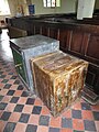
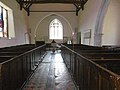
 Interior of St Mary Magdalene Church, Wartling - geograph.org.uk - 4985597.jpg 4 608 × 3 456; 3,32 MB
-
 Interior of St Mary Magdalene Church, Wartling - geograph.org.uk - 4985605.jpg 4 397 × 3 297; 2,28 MB
-
 Jenners Lane - geograph.org.uk - 2199169.jpg 640 × 430; 156 KB
-
 Jenners Lane - geograph.org.uk - 2199170.jpg 640 × 430; 154 KB
-
 Junction of A269 and Boreham Lane - geograph.org.uk - 1353912.jpg 640 × 424; 90 KB
-
 Kissing gate approaching Boreham Street - geograph.org.uk - 2197510.jpg 640 × 430; 203 KB
-
 Ladywell Shaw - geograph.org.uk - 1825069.jpg 1 024 × 768; 277 KB
-
 Large fallow field by Jenners Lane - geograph.org.uk - 2199175.jpg 640 × 430; 110 KB
-
 Late Apps - geograph.org.uk - 1815239.jpg 1 024 × 768; 147 KB
-
 Lawn Cottage, Boreham Street - geograph.org.uk - 3475410.jpg 640 × 480; 95 KB
-
 Legumes by the 1066 Country Walk - geograph.org.uk - 2199187.jpg 640 × 430; 125 KB
-
 Little Coney Wood Piece - geograph.org.uk - 1824639.jpg 1 024 × 768; 279 KB
-
 Looking towards Nut Brown Farm, Hooe - geograph.org.uk - 3297353.jpg 1 600 × 1 197; 292 KB
-
 Lower Bakers Field - geograph.org.uk - 1824719.jpg 1 024 × 768; 183 KB
-
 Manxey Pumping Station - geograph.org.uk - 1815300.jpg 768 × 1 024; 181 KB
-
 Marshfoot Farm - geograph.org.uk - 1815288.jpg 1 024 × 768; 140 KB
-
 Marshy Ground - geograph.org.uk - 743380.jpg 479 × 640; 90 KB
-
 Marshy Ground next to Horsewalk road - geograph.org.uk - 1360103.jpg 640 × 480; 105 KB
-
 Metal gate, Windmill Hill, East Sussex - geograph.org.uk - 2793879.jpg 1 600 × 1 191; 497 KB
-
 Middle Brook - geograph.org.uk - 1815183.jpg 1 024 × 768; 141 KB
-
 Minor road north of Windmill Hill, East Sussex - geograph.org.uk - 2453462.jpg 1 600 × 1 200; 713 KB
-
 Morning sun through the fog - geograph.org.uk - 2704337.jpg 640 × 480; 111 KB
-
 Morning sun through the fog - geograph.org.uk - 2704341.jpg 640 × 480; 39 KB
-
 Mushroom Shaped Tree at Wartling - geograph.org.uk - 1383801.jpg 640 × 427; 75 KB
-
 Nunningham Stream - geograph.org.uk - 2197497.jpg 640 × 430; 189 KB
-
 Nunningham Stream - geograph.org.uk - 2962878.jpg 640 × 480; 97 KB
-
 Nunningham Stream - geograph.org.uk - 2962888.jpg 640 × 480; 158 KB
-
 Nunningham Stream - geograph.org.uk - 2962896.jpg 640 × 480; 95 KB
-
 Nunningham Stream, upstream - geograph.org.uk - 2197498.jpg 640 × 430; 199 KB
-
 Official diversion for Footpath Wartling 1 - geograph.org.uk - 3540884.jpg 3 264 × 2 448; 3,57 MB
-
 Old Barn in Wartling - geograph.org.uk - 3686567.jpg 4 896 × 3 672; 5,49 MB
-

-
-
 Old Hop Garden - geograph.org.uk - 1824713.jpg 1 024 × 768; 219 KB
-
-
 Paddocks near Chamneys Farm - geograph.org.uk - 2816060.jpg 640 × 480; 98 KB
-
 Painted cottage, Boreham Street - geograph.org.uk - 2198775.jpg 640 × 430; 130 KB
-
 Path towards Hogtrough Bridge - geograph.org.uk - 2375159.jpg 2 256 × 1 496; 938 KB
-
 Perimeter Fence, Wartling Rotor Station - geograph.org.uk - 743857.jpg 479 × 640; 110 KB
-
 Pevensey Levels - geograph.org.uk - 743349.jpg 479 × 640; 84 KB
-
 Pond - geograph.org.uk - 743865.jpg 479 × 640; 123 KB
-
 Pond, Court Lodge Farm - geograph.org.uk - 743514.jpg 640 × 479; 95 KB
-
 Postbox, A271, Boreham Street - geograph.org.uk - 2198760.jpg 640 × 430; 164 KB
-
 Preston Farmhouse - geograph.org.uk - 2198763.jpg 640 × 430; 201 KB
-
 Public footpath at Boreham Bridge, East Sussex - geograph.org.uk - 2199147.jpg 1 600 × 1 200; 399 KB
-
 Public footpath sign near Hooe - geograph.org.uk - 3297355.jpg 1 600 × 1 200; 512 KB
-
 Public house sign - geograph.org.uk - 4046872.jpg 480 × 640; 115 KB
-
 Puddledock, Boreham Lane - geograph.org.uk - 2198905.jpg 640 × 430; 122 KB
-
 Pylon in Field - geograph.org.uk - 2481096.jpg 1 496 × 2 256; 827 KB
-
 Pylon in the Nunningham Valley - geograph.org.uk - 2196507.jpg 640 × 430; 109 KB
-
 Pylon near Boreham Hill - geograph.org.uk - 2514097.jpg 640 × 480; 99 KB
-
 Radar House - geograph.org.uk - 743849.jpg 640 × 479; 80 KB
-
 Ripening Corn - geograph.org.uk - 902195.jpg 640 × 479; 123 KB
-
 Road sign, Boreham Street - geograph.org.uk - 2198816.jpg 640 × 430; 118 KB
-
 School Farm House, Wartling - geograph.org.uk - 743491.jpg 479 × 640; 99 KB
-
 Scolfes Restaurant and Tea Rooms - geograph.org.uk - 3783443.jpg 1 600 × 1 200; 618 KB
-
 Shaw Field - geograph.org.uk - 1824726.jpg 1 024 × 768; 145 KB
-

-
 Smokey Pond - geograph.org.uk - 902219.jpg 479 × 640; 111 KB
-
 Smugglers Wheel Restaurant, Boreham Street - geograph.org.uk - 2374869.jpg 1 600 × 1 061; 468 KB
-
 Snow at Boreham Hill - geograph.org.uk - 5713992.jpg 4 000 × 3 000; 2,12 MB


_-_geograph.org.uk_-_2197531.jpg)


_-_geograph.org.uk_-_5464051.jpg)
_-_geograph.org.uk_-_5464052.jpg)
_-_geograph.org.uk_-_5464053.jpg)
_-_geograph.org.uk_-_5464055.jpg)
_-_geograph.org.uk_-_5464066.jpg)
_-_geograph.org.uk_-_5464057.jpg)
_-_geograph.org.uk_-_5464060.jpg)
_-_geograph.org.uk_-_5464062.jpg)
_-_geograph.org.uk_-_5464063.jpg)
_-_geograph.org.uk_-_5464067.jpg)


