Category:Warton, Lancaster
Aller à la navigation
Aller à la recherche
English: Warton is a village and civil parish in north Lancashire in the north-west of England, close to the boundary with Cumbria, with a population of around 2,000. It is a village steeped in history; its earliest recording as a settlement is made in Domesday Book written in 1086. The nearest town to Warton is Carnforth, which was originally part of Warton parish. It has connections to the first President of the United States, George Washington: Washington's ancestor of seven generations, Lawrence Washington, is rumoured to have helped build the village church of St Oswald. The parish covers an area in excess of and is predominantly rural. The parish of Warton had a population of 2360 recorded in the 2011 census, (→Warton, Lancaster)
Nederlands: Warton is een plaats en civil parish in het bestuurlijke gebied Lancaster, in het Engelse graafschap Lancashire met 2360 inwoners. (→Warton)
Polski: Warton – wieś w Anglii, w hrabstwie Lancashire, w dystrykcie Lancaster. Leży 84 km na północny zachód od miasta Manchester i 343 km na północny zachód od Londynu. W 2001 miejscowość liczyła 2360 mieszkańców. (→Warton (Lancaster))
localité britannique du comté anglais de Lancashire  | |||||
| Téléverser des médias | |||||
| Nature de l’élément | |||||
|---|---|---|---|---|---|
| Lieu | cité de Lancaster, Lancashire, Angleterre du Nord-Ouest, Angleterre | ||||
 | |||||
Sous-catégories
Cette catégorie comprend 6 sous-catégories, dont les 6 ci-dessous.
A
- A601(M) motorway (5 F)
L
- Leighton Moss RSPB reserve (67 F)
O
S
- St Oswald's Vicarage, Warton (1 F)
W
Média dans la catégorie « Warton, Lancaster »
Cette catégorie comprend 670 fichiers, dont les 200 ci-dessous.
(page précédente) (page suivante)-
 "Boulder" on the salt-marsh, Warton Sands - geograph.org.uk - 1843277.jpg 640 × 480 ; 76 kio
-
 'Canyons' in the sands - geograph.org.uk - 4617285.jpg 800 × 600 ; 171 kio
-
 'Circle in the Sand' - geograph.org.uk - 2723898.jpg 800 × 600 ; 143 kio
-
 'How to make your call' - geograph.org.uk - 3967380.jpg 640 × 480 ; 125 kio
-
 'The Lion and The Lamb' of Warton Sands - geograph.org.uk - 2608133.jpg 600 × 800 ; 109 kio
-
 'There IS a mouse down there^' - geograph.org.uk - 3640793.jpg 600 × 800 ; 109 kio
-

-
 'Towser' memorial, Warton Crag Quarry - geograph.org.uk - 3232937.jpg 480 × 640 ; 133 kio
-
 'Wishing well', Hyning Priory - geograph.org.uk - 4593122.jpg 640 × 480 ; 186 kio
-
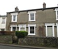 105 Main Street, Warton.jpg 4 077 × 3 456 ; 2,55 Mio
-
 115 Main Street, Warton.jpg 4 608 × 3 456 ; 5,09 Mio
-
 148 Main Street, Warton.jpg 4 608 × 3 456 ; 4,41 Mio
-
 150 and 152 Main Street, Warton.jpg 3 883 × 3 456 ; 2,44 Mio
-
 168 Main Street, Warton.jpg 2 753 × 3 456 ; 2,35 Mio
-
 170 Main Street, Warton.jpg 2 572 × 3 141 ; 1,94 Mio
-
 5 Main Street, Warton.jpg 4 151 × 3 385 ; 2,67 Mio
-
 61 and 63 Main Street, Warton.jpg 3 392 × 3 307 ; 1,99 Mio
-
 65 and 67 Main Street, Warton.jpg 4 493 × 3 371 ; 2,46 Mio
-
 68 to 72 Main Street, Warton.jpg 3 750 × 3 093 ; 2,31 Mio
-
 74 and 76 Main Street, Warton.jpg 4 608 × 3 456 ; 4,44 Mio
-
 78 Main Street, Warton.jpg 3 054 × 2 506 ; 1,86 Mio
-
 94 and 96 Main Street, Warton.jpg 4 607 × 3 455 ; 2,84 Mio
-
 A balloon passes over Warton - geograph.org.uk - 4042717.jpg 800 × 600 ; 63 kio
-
 A brand new dragonfly enters the world - geograph.org.uk - 3541772.jpg 622 × 800 ; 211 kio
-
 A carpet of gold, Hyning Scout Wood - geograph.org.uk - 5203076.jpg 800 × 600 ; 249 kio
-
 A channel in the sand, Warton Sands - geograph.org.uk - 2607671.jpg 627 × 800 ; 128 kio
-
 A Chinook passes by - geograph.org.uk - 5483861.jpg 800 × 574 ; 121 kio
-
 A cow at sunset, Cote Stones - geograph.org.uk - 3131211.jpg 800 × 589 ; 55 kio
-
 A desolate shore, Warton Sands - geograph.org.uk - 1843264.jpg 1 280 × 960 ; 388 kio
-
 A giant Ammonite^ - geograph.org.uk - 2716413.jpg 480 × 640 ; 125 kio
-
 A goat at Tewitfield Locks - geograph.org.uk - 4642366.jpg 480 × 640 ; 131 kio
-
 A hail storm on the Keer - geograph.org.uk - 2723861.jpg 800 × 549 ; 108 kio
-
 A line in the sand (Warton Sands) - geograph.org.uk - 2311895.jpg 480 × 640 ; 78 kio
-
 A load of old slag by the Keer estuary - geograph.org.uk - 2354707.jpg 678 × 800 ; 163 kio
-
 A rainbow at sunset, Warton Sands - geograph.org.uk - 3275629.jpg 800 × 600 ; 120 kio
-
 A stormy dawn over Ingleborough - geograph.org.uk - 2633708.jpg 800 × 392 ; 44 kio
-
 A stormy sunset on Morecambe Bay - geograph.org.uk - 2744961.jpg 800 × 600 ; 95 kio
-
 A stormy sunset on the Keer estuary - geograph.org.uk - 2743959.jpg 800 × 600 ; 68 kio
-
 A train at Crag Foot - geograph.org.uk - 3933932.jpg 800 × 573 ; 118 kio
-
 A train passes below Warton Crag - geograph.org.uk - 2608203.jpg 640 × 444 ; 77 kio
-

-
 A Warton cat watches the sun set - geograph.org.uk - 3639174.jpg 600 × 800 ; 85 kio
-
 A Warton house at Christmas - geograph.org.uk - 3784547.jpg 800 × 600 ; 145 kio
-
 A6 heading north near Yealand Conyers - geograph.org.uk - 4691315.jpg 640 × 480 ; 80 kio
-
 A6 near South Lakeland Leisure Village - geograph.org.uk - 5683916.jpg 640 × 481 ; 47 kio
-
 A6 nears A601(M) junction - geograph.org.uk - 5683910.jpg 640 × 481 ; 48 kio
-
 A6 northbound at Skew Bridge - geograph.org.uk - 5683917.jpg 640 × 480 ; 91 kio
-
 A6 northbound near Hyning Home Farm - geograph.org.uk - 4691310.jpg 640 × 480 ; 72 kio
-

-
 A6 south passing Pine Lake leisure centre - geograph.org.uk - 2961088.jpg 640 × 447 ; 64 kio
-
 A6070 - geograph.org.uk - 4665808.jpg 2 876 × 2 555 ; 1,7 Mio
-
 A6070 bridge over M6 at Tewitfield - geograph.org.uk - 5225308.jpg 1 600 × 1 197 ; 548 kio
-
 A6070 bridge, M6 - geograph.org.uk - 2637150.jpg 640 × 430 ; 28 kio
-
 A6070 Bridge, M6 - geograph.org.uk - 3231960.jpg 640 × 430 ; 33 kio
-
 Above the clouds, Warton Crag - geograph.org.uk - 4726783.jpg 800 × 600 ; 89 kio
-
 Above Warton - geograph.org.uk - 3339315.jpg 2 560 × 1 920 ; 511 kio
-
 Across the Keer - geograph.org.uk - 2154177.jpg 960 × 720 ; 252 kio
-
 After the grass cut, Warton - geograph.org.uk - 2441505.jpg 800 × 600 ; 224 kio
-
 Allen Hide at Leighton Moss - geograph.org.uk - 4903779.jpg 640 × 427 ; 71 kio
-
 Allen Hide, RSPB Leighton Moss - geograph.org.uk - 4472715.jpg 1 024 × 683 ; 623 kio
-
 Allen Pool, Leighton Moss - geograph.org.uk - 4698538.jpg 3 264 × 2 448 ; 1,79 Mio
-
 Angling at Jenny Brown's Point - geograph.org.uk - 4577737.jpg 600 × 800 ; 188 kio
-
 Angling ponds - geograph.org.uk - 3881121.jpg 2 816 × 2 112 ; 1,06 Mio
-
 Another sunset over the slag - geograph.org.uk - 3308382.jpg 800 × 566 ; 56 kio
-
 Anvil cloud over Warton Crag - geograph.org.uk - 4887578.jpg 800 × 600 ; 83 kio
-
 Approaching Manor Farm - geograph.org.uk - 4690851.jpg 640 × 480 ; 73 kio
-
 At Brown's Houses - geograph.org.uk - 5691409.jpg 640 × 413 ; 116 kio
-
 Autumnal birches at Warton Main Quarry - geograph.org.uk - 2667496.jpg 800 × 531 ; 233 kio
-
 Autumnal silver birches, Warton Crag Quarry - geograph.org.uk - 3732355.jpg 800 × 600 ; 257 kio
-
 Avocet (Recurvirostra avosetta) - geograph.org.uk - 3956560.jpg 1 600 × 1 205 ; 210 kio
-
 Avocet (Recurvirostra avosetta) - geograph.org.uk - 3958927.jpg 1 600 × 1 197 ; 217 kio
-
 Banded clouds at sunset near Warton - geograph.org.uk - 2948761.jpg 800 × 600 ; 66 kio
-
 Barn at Scar Close, Warton Crag - geograph.org.uk - 3934252.jpg 640 × 463 ; 115 kio
-
 Barn near Warton Crag - geograph.org.uk - 2443620.jpg 800 × 521 ; 96 kio
-
 Barrow Scout - geograph.org.uk - 1586524.jpg 640 × 480 ; 99 kio
-
 Barrow Scout - geograph.org.uk - 2352116.jpg 3 653 × 2 739 ; 4,47 Mio
-
 Barrow Scout Fields - geograph.org.uk - 2200617.jpg 640 × 480 ; 141 kio
-
 Barrow Scout fields - geograph.org.uk - 2744119.jpg 640 × 425 ; 329 kio
-
 Bench mark, St Oswald's Church, Warton - geograph.org.uk - 2274578.jpg 480 × 640 ; 138 kio
-
 Bench mark, Warton - geograph.org.uk - 2260952.jpg 640 × 480 ; 130 kio
-
 Bench on the edge of the Bay - geograph.org.uk - 2744166.jpg 800 × 576 ; 45 kio
-
 Bench, Pine Lake resort - geograph.org.uk - 1748920.jpg 640 × 480 ; 114 kio
-
 Big cats spotted in north Lancashire village^ - geograph.org.uk - 2731097.jpg 800 × 600 ; 137 kio
-
 Big trees, Borwick Lane - geograph.org.uk - 2444551.jpg 800 × 600 ; 186 kio
-
 Bird watcher in Warton Crag Quarry - geograph.org.uk - 3335937.jpg 800 × 600 ; 254 kio
-
 Bird watchers at Warton Crag Quarry - geograph.org.uk - 3335951.jpg 600 × 800 ; 236 kio
-
 Bird watching at Warton Main Quarry - geograph.org.uk - 2662647.jpg 644 × 800 ; 282 kio
-
 Biting stonecrop on Warton Crag - geograph.org.uk - 4547138.jpg 600 × 800 ; 199 kio
-
 Blue leviathan^ - geograph.org.uk - 4828188.jpg 600 × 800 ; 195 kio
-
 Borwick Lane - geograph.org.uk - 4665804.jpg 4 587 × 3 181 ; 1,72 Mio
-
 Borwick Lane - geograph.org.uk - 4690856.jpg 640 × 480 ; 81 kio
-
 Borwick Lane - geograph.org.uk - 4690862.jpg 640 × 480 ; 56 kio
-
 Borwick Lane Bridge - geograph.org.uk - 3100834.jpg 4 120 × 2 593 ; 5,07 Mio
-
 Borwick Lane Bridge over the M6 - geograph.org.uk - 3944262.jpg 640 × 427 ; 202 kio
-
 Borwick Lane Bridge, M6 - geograph.org.uk - 2637148.jpg 640 × 430 ; 21 kio
-
 Borwick, leisure village - geograph.org.uk - 2956971.jpg 1 024 × 768 ; 119 kio
-
 Boulders on Warton Crag - geograph.org.uk - 2841590.jpg 800 × 618 ; 121 kio
-
 Boundary stone by Hyning Road - geograph.org.uk - 4386829.jpg 480 × 640 ; 185 kio
-
 Building work, Brown's Houses - geograph.org.uk - 5037657.jpg 720 × 540 ; 123 kio
-
 Bunting in Warton (2) - geograph.org.uk - 4066132.jpg 600 × 800 ; 84 kio
-
 Bunting in Warton (3) - geograph.org.uk - 4071019.jpg 600 × 800 ; 107 kio
-
 Bunting in Warton (4) - geograph.org.uk - 4073825.jpg 600 × 800 ; 114 kio
-
 Bunting in Warton (5) - geograph.org.uk - 4078201.jpg 800 × 600 ; 128 kio
-
 Bunting in Warton - geograph.org.uk - 4064830.jpg 800 × 600 ; 62 kio
-
 Bus stop and shelter on Main Street, Warton - geograph.org.uk - 4691439.jpg 640 × 480 ; 72 kio
-
 Bushes and a rainbow near Cote Stones - geograph.org.uk - 2724291.jpg 800 × 564 ; 128 kio
-
 By the Keer estuary - geograph.org.uk - 2354717.jpg 800 × 585 ; 129 kio
-
 Cafe at Catch 23 Fisheries - geograph.org.uk - 3120873.jpg 4 608 × 3 456 ; 3,31 Mio
-
 Car park, Crag Road, Warton - geograph.org.uk - 6238973.jpg 2 000 × 1 352 ; 3,26 Mio
-
 Carnforth slag heaps - geograph.org.uk - 2969607.jpg 640 × 425 ; 220 kio
-
 Carnforth slag heaps - geograph.org.uk - 2969613.jpg 640 × 425 ; 172 kio
-
 Carnforth slag heaps - geograph.org.uk - 2969615.jpg 640 × 425 ; 211 kio
-
 Carnforth slag heaps - geograph.org.uk - 2969619.jpg 640 × 425 ; 177 kio
-
 Carnforth slag heaps - geograph.org.uk - 2969625.jpg 640 × 425 ; 215 kio
-
 Carved inscription on standing stone near Warton - geograph.org.uk - 3787544.jpg 640 × 480 ; 189 kio
-
 Cast iron, headstone, St Oswald's Church, Warton - geograph.org.uk - 4119285.jpg 600 × 800 ; 189 kio
-
 Cat at The Piggeries - geograph.org.uk - 2747463.jpg 640 × 491 ; 108 kio
-
 Cat on a hot tin coal bunker - geograph.org.uk - 3527525.jpg 640 × 480 ; 79 kio
-
 Cat on a Warton window sill - geograph.org.uk - 4645945.jpg 600 × 800 ; 95 kio
-
 Catch 23 - geograph.org.uk - 3881130.jpg 2 816 × 2 112 ; 2,25 Mio
-
 Caton Moor wind farm - geograph.org.uk - 2430522.jpg 960 × 446 ; 81 kio
-
 Cattle 'grazing' in the woods above Warton - geograph.org.uk - 5314736.jpg 720 × 540 ; 184 kio
-
 Cattle at Cote Stones - geograph.org.uk - 3019825.jpg 800 × 600 ; 154 kio
-
 Cattle near Yealand Conyers - geograph.org.uk - 3515362.jpg 640 × 425 ; 209 kio
-
 Celandine flower, Warton Crag - geograph.org.uk - 4887579.jpg 800 × 600 ; 106 kio
-
 Channel on the saltmarsh, Warton Sands - geograph.org.uk - 1658581.jpg 480 × 640 ; 109 kio
-
 Channels in the Keer estuary - geograph.org.uk - 3107994.jpg 600 × 800 ; 100 kio
-
 Channels in the mud below the waste heaps - geograph.org.uk - 4819440.jpg 800 × 600 ; 116 kio
-
 Channels on Warton Sands - geograph.org.uk - 2606715.jpg 960 × 643 ; 176 kio
-
 Chimney at Crag Foot - geograph.org.uk - 1281439.jpg 640 × 407 ; 95 kio
-
 Chimney pots at dusk, Warton - geograph.org.uk - 4638225.jpg 596 × 800 ; 65 kio
-
 Christmas 2015 - look, a mince pie^ - geograph.org.uk - 4773359.jpg 480 × 640 ; 162 kio
-
 Christmas lights in Warton - geograph.org.uk - 3262763.jpg 800 × 600 ; 100 kio
-
 Christmas lights, Warton - geograph.org.uk - 4281250.jpg 600 × 800 ; 110 kio
-
 Cinnabar moth caterpillars - geograph.org.uk - 4570952.jpg 503 × 640 ; 83 kio
-
 Circular plug of iron waste, Warton Sands - geograph.org.uk - 4237388.jpg 480 × 640 ; 102 kio
-
 Cleared area. Warton Crag - geograph.org.uk - 5312034.jpg 640 × 425 ; 480 kio
-
 Cloud galleons sail across Morecambe Bay - geograph.org.uk - 2840620.jpg 800 × 553 ; 59 kio
-
 Cloud over Clougha Pike - geograph.org.uk - 2403645.jpg 800 × 600 ; 70 kio
-
 Clouds at dusk, St Oswald's Church, Warton - geograph.org.uk - 4940272.jpg 800 × 600 ; 70 kio
-
 Clouds over Heysham - geograph.org.uk - 5255838.jpg 800 × 590 ; 104 kio
-
 Cloudscape over the Keer - geograph.org.uk - 2730857.jpg 960 × 720 ; 73 kio
-
 Collapsing fence on the saltmarsh - geograph.org.uk - 827825.jpg 472 × 478 ; 72 kio
-
 Conservation grazing, Warton Crag - geograph.org.uk - 5593361.jpg 800 × 600 ; 192 kio
-
 Copse by the River Keer - geograph.org.uk - 3753849.jpg 4 320 × 3 240 ; 5,84 Mio
-
 Corroded iron detritus, Warton Sands - geograph.org.uk - 4617295.jpg 640 × 480 ; 180 kio
-
 Cote Stones - geograph.org.uk - 2964499.jpg 640 × 425 ; 214 kio
-
 Cote Stones - geograph.org.uk - 4878008.jpg 5 184 × 2 961 ; 1,49 Mio
-
 Cote Stones cow at sunset - geograph.org.uk - 3131232.jpg 800 × 588 ; 60 kio
-
 Cotoneaster on Warton Crag Quarry - geograph.org.uk - 3225396.jpg 800 × 600 ; 286 kio
-
 Cottages on New Road, Crag Foot - geograph.org.uk - 4678688.jpg 640 × 480 ; 79 kio
-
 Cowslips, Warton Crag Quarry - geograph.org.uk - 4438015.jpg 480 × 640 ; 201 kio
-
 Crystal Well, Crag Foot - geograph.org.uk - 4470109.jpg 480 × 640 ; 228 kio
-
 Cut bench mark on Main Street, Warton - geograph.org.uk - 4386818.jpg 640 × 480 ; 139 kio
-
 Dale House, Tewitfield - geograph.org.uk - 2173611.jpg 640 × 480 ; 113 kio
-
 Date stone, Washington House, Warton - geograph.org.uk - 2323776.jpg 431 × 364 ; 83 kio
-
 Dawn over Bowland - geograph.org.uk - 3804416.jpg 800 × 600 ; 87 kio
-
 Dawn over Warton (2) - geograph.org.uk - 5093955.jpg 600 × 800 ; 98 kio
-
 Dawn over Warton - geograph.org.uk - 5092294.jpg 596 × 800 ; 100 kio
-
 Dawn over Warton - geograph.org.uk - 5225882.jpg 800 × 608 ; 82 kio
-
 Dead fawn, Warton Crag - geograph.org.uk - 5538771.jpg 640 × 480 ; 178 kio
-
 Death on the sands - geograph.org.uk - 2169328.jpg 480 × 640 ; 116 kio
-

-
 Deer beside Occupation Road - geograph.org.uk - 4488604.jpg 684 × 480 ; 155 kio
-
 Detail on 'wishing well', Hyning Priory - geograph.org.uk - 4593126.jpg 640 × 480 ; 197 kio
-
 Detail on a monument, Warton graveyard - geograph.org.uk - 3686115.jpg 640 × 480 ; 197 kio
-
 Disused Canal Lock, Tewitfield - geograph.org.uk - 5737219.jpg 1 600 × 1 200 ; 502 kio
-
 Disused lime kiln, Warton Crag - geograph.org.uk - 4483606.jpg 480 × 640 ; 189 kio
-
 Dog on the rocks, Warton Crag - geograph.org.uk - 2747844.jpg 640 × 480 ; 90 kio
-
 Doorway, Warton Old Rectory - geograph.org.uk - 3691154.jpg 600 × 800 ; 112 kio
-
 Drain, Pool Bridge - geograph.org.uk - 4691482.jpg 480 × 640 ; 75 kio
-
 Drainage Channel near Quaker's Stang - geograph.org.uk - 2302668.jpg 600 × 450 ; 282 kio
-
 Drainage patterns in the sand, Cote Stones - geograph.org.uk - 2911993.jpg 720 × 960 ; 227 kio
-
 Drainage patterns in the sand, Cote Stones - geograph.org.uk - 2912001.jpg 720 × 960 ; 228 kio
-
 Drainage patterns in the sand, Cote Stones - geograph.org.uk - 2912362.jpg 720 × 960 ; 163 kio
-
 Drainage patterns, Warton Sands - geograph.org.uk - 3850395.jpg 600 × 800 ; 132 kio
-
 Drama at dusk, Warton - geograph.org.uk - 5137034.jpg 600 × 800 ; 70 kio
-
 Dramatic sunset, Morecambe Bay - geograph.org.uk - 4748391.jpg 800 × 600 ; 91 kio
-
 Drum-shaped plug of iron waste, Warton Sands - geograph.org.uk - 4237391.jpg 480 × 640 ; 127 kio
-
 Dusk at Jenny Brown's Point - geograph.org.uk - 4250192.jpg 800 × 600 ; 101 kio
-
 Dusk at the beacon on top of Warton Crag - geograph.org.uk - 2747472.jpg 800 × 571 ; 80 kio
-
 Dusk by the stock car track - geograph.org.uk - 2744434.jpg 615 × 800 ; 83 kio
-

-
 Dusk falls over the salt marsh at Crag Foot - geograph.org.uk - 3264272.jpg 600 × 800 ; 88 kio
-
 Dusk on Main Street, Warton - geograph.org.uk - 2762458.jpg 800 × 668 ; 91 kio
-
 Dusk on Warton Crag - geograph.org.uk - 4748874.jpg 800 × 600 ; 85 kio
-
 Dusk over St Oswald's Church, Warton - geograph.org.uk - 4672091.jpg 800 × 600 ; 73 kio
-
 Dusk over St Oswald's, Warton - geograph.org.uk - 2762442.jpg 800 × 588 ; 63 kio
-
 Dusk over St Oswald's, Warton - geograph.org.uk - 2762451.jpg 800 × 600 ; 64 kio
-
 Dusk, Easter Monday - geograph.org.uk - 4886421.jpg 720 × 540 ; 60 kio
-
 Dwarf yews, Warton Crag - geograph.org.uk - 5334569.jpg 720 × 540 ; 188 kio
-
 Elephant Hawk Moth caterpillar - geograph.org.uk - 4073812.jpg 640 × 480 ; 233 kio
-
 Embankment repair north of Carnforth - geograph.org.uk - 4887828.jpg 1 295 × 960 ; 391 kio
-
 Entrance to holiday park - geograph.org.uk - 4690859.jpg 640 × 480 ; 56 kio
-
 Eric Morecambe Hide, RSPB Leighton Moss - geograph.org.uk - 4472689.jpg 1 024 × 683 ; 736 kio
-
 Evening dog walk, Warton Main Quarry - geograph.org.uk - 2662654.jpg 800 × 600 ; 214 kio
-
 Evening falls over church and pub, Warton - geograph.org.uk - 4728028.jpg 600 × 800 ; 77 kio
-
 Evening in the graveyard, Warton - geograph.org.uk - 3820182.jpg 600 × 800 ; 70 kio
-
 Evening stroll, Cote Stones - geograph.org.uk - 3850776.jpg 800 × 600 ; 104 kio
-
 Exposed limestone, Brown's Houses - geograph.org.uk - 4545803.jpg 600 × 800 ; 219 kio


_-_geograph.org.uk_-_2311895.jpg)


_junction_-_geograph.org.uk_-_5683910.jpg)


_-_geograph.org.uk_-_3956560.jpg)
_-_geograph.org.uk_-_3958927.jpg)


_-_geograph.org.uk_-_4066132.jpg)
_-_geograph.org.uk_-_4071019.jpg)
_-_geograph.org.uk_-_4073825.jpg)
_-_geograph.org.uk_-_4078201.jpg)


_-_geograph.org.uk_-_5093955.jpg)


