Category:Wasco County, Oregon
Saltar para a navegação
Saltar para a pesquisa
Counties of Oregon: Baker · Benton · Clackamas · Clatsop · Columbia · Coos · Crook · Curry · Deschutes · Douglas · Gilliam · Grant · Harney · Hood River · Jackson · Jefferson · Josephine · Klamath · Lake · Lane · Lincoln · Linn · Malheur · Marion · Morrow · Multnomah · Polk · Sherman · Tillamook · Umatilla · Union · Wallowa · Wasco · Washington · Wheeler · Yamhill
county in Oregon, United States   | |||||
| Carregar ficheiro | |||||
| Instância de | |||||
|---|---|---|---|---|---|
| Nomeado em referência a | |||||
| Localização | Óregon, EUA | ||||
| Capital | |||||
| Data de criação ou fundação |
| ||||
| População |
| ||||
| Área |
| ||||
| Diferente de | |||||
| sítio web oficial | |||||
 | |||||
Subcategorias
Esta categoria contém as seguintes 44 subcategorias (de um total de 44).
- Maps of Wasco County, Oregon (25 F)
A
B
- Badger Creek Wilderness (2 F)
- Boyd, Oregon (3 F)
C
- Celilo Converter Station (4 F)
- Clarno, Oregon (2 F)
D
F
- Fairbanks, Oregon (2 F)
- Frog Lake (Wasco County, Oregon) (15 F)
I
- Interstate 80N in Oregon (1 F)
K
- Kah-Nee-Ta (19 F)
L
- Long Hollow Fire (5 F)
- Lower White River Wilderness (16 F)
M
- Maupin, Oregon (36 F)
O
- Olallie Butte (3 F)
- Ortley, Oregon (1 F)
P
- Pine Grove, Oregon (8 F)
R
S
T
- Tom McCall Preserve (1 P, 135 F)
- Tooley Lake (Oregon) (5 F)
W
- Wasco County Fair (11 F)
Multimédia na categoria "Wasco County, Oregon"
Esta categoria contém os seguintes 73 ficheiros (de um total de 73).
-

-
 2017-07-15 Wasco-Clackamas county line.jpg 3 648 × 2 736; 2,1 MB
-
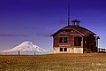 2021-11-20 Center Ridge Schoolhouse and Mount Adams.jpg 8 735 × 5 827; 30,88 MB
-
 8milewheat.jpg 3 872 × 2 592; 1,75 MB
-
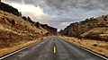
 A Road in Warm Spring Reservation.jpg 4 032 × 2 268; 979 kB
-
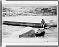
 Affidavit of Harriet Skitus regarding the treaties of 1855 and 1865. - NARA - 296356.jpg 2 410 × 3 150; 4,34 MB
-
 Affidavit of Pipeshire regarding the treaties of 1855 and 1865. - NARA - 296357.jpg 2 416 × 3 150; 4,75 MB
-
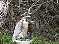
 Bird at the Columbia Gorge Discover Center, Feb 10 1.jpg 2 816 × 2 112; 2,55 MB
-
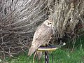
 Bird at the Columbia Gorge Discover Center, Feb 10 2.jpg 2 816 × 2 112; 2,77 MB
-
 Bird at the Columbia Gorge Discover Center, Feb 10 3.jpg 2 816 × 2 112; 2,72 MB
-
 Bird at the Columbia Gorge Discover Center, Feb 10 4.jpg 2 816 × 2 112; 2,75 MB
-
 Celio Village Oregon Longhouse.jpg 4 752 × 3 168; 5,56 MB
-
 Cemetery Hood.jpg 1 944 × 2 592; 1,96 MB
-
 Central Oregon 2017 03.jpg 5 184 × 3 456; 6,98 MB
-
 Central Oregon 2017 04.jpg 5 184 × 3 456; 7,42 MB
-
 Central Oregon 2017 05.jpg 5 184 × 3 456; 5,42 MB
-
 Central Oregon 2017 06.jpg 5 184 × 3 456; 8,47 MB
-
 Central Oregon 2017 07.jpg 5 056 × 3 370; 4,4 MB
-
 Central Oregon 2017 08.jpg 5 022 × 3 347; 6,08 MB
-
 Central Oregon 2017 09.jpg 5 184 × 3 456; 5,3 MB
-
 CentralOregonFarm-Oct2001-MathewDodson.JPG 800 × 550; 427 kB
-
 Clarno Recreation Site.JPG 4 000 × 3 000; 2,64 MB
-
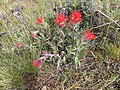
 Columbia Plateau spring flowers 1 - Wasco County Oregon.jpg 3 024 × 4 032; 5,04 MB
-
 Columbia Plateau spring flowers 2 - Wasco County Oregon.jpg 4 032 × 3 024; 5,81 MB
-
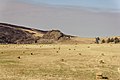
 Cows (7051813203).jpg 1 024 × 602; 282 kB
-
 CRH abandoned RR grade - The Dalles Oregon.jpg 3 000 × 4 000; 3,97 MB
-
 CRH Memaloose Overlook winter.jpg 2 048 × 1 536; 1,06 MB
-
 Dasymutilla occindentalis, rear, Eastern Oregon.jpg 1 280 × 960; 346 kB
-
 Eighteenmile Island - Columbia River Gorge.jpg 1 600 × 1 200; 748 kB
-
 Eighteenmile island.jpg 1 080 × 821; 121 kB
-
 Fifteenmile Creek Watershed.png 1 425 × 1 124; 1,63 MB
-
 Frozen Fence near Maupin Forrest (23773540865).jpg 2 560 × 1 920; 2,73 MB
-
 Gopher snake by John Day River.JPG 4 608 × 3 456; 3,51 MB
-
 Heading home (8729480081).jpg 640 × 392; 144 kB
-
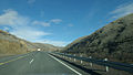
 Heading home on I-84 (8695635490).jpg 3 165 × 2 100; 2,72 MB
-

-
 Hulse Ranch site (11074674446).jpg 2 560 × 1 920; 1,04 MB
-
 John Day River canyon near Clarno, OR.jpg 4 608 × 3 456; 3,31 MB
-
 John Day River, view downstream.JPG 4 608 × 3 456; 3,32 MB
-
 Memaloose State Park - panoramio.jpg 3 072 × 3 487; 6,85 MB
-
 Memaloose State Park II - panoramio.jpg 3 072 × 3 823; 6,33 MB
-
 Memaloose State Park.jpg 2 272 × 1 704; 1,41 MB
-
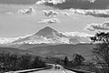
 Mount Hood (6632428661).jpg 1 024 × 465; 126 kB
-
 Mt Adams from south - Wasco County Oregon.jpg 2 592 × 1 944; 1,92 MB
-
 Mt Hood from east - Wasco County Oregon.jpg 1 944 × 2 592; 1,4 MB
-
-
 Olallie Butte top (cropped).jpg 611 × 729; 60 kB
-
 Old barn in Wasco County, Oregon.jpg 1 600 × 778; 473 kB
-
 Pig Club Judging Practice, Wasco County, ca. 1918 (5710804099).jpg 1 000 × 669; 125 kB
-
 Ramsey Park Grange - Wasco County Oregon.jpg 3 998 × 1 678; 2,13 MB
-
 Ramsey Park Grange 2 - Wasco County Oregon.jpg 4 000 × 3 000; 4,53 MB
-
 Rattlesnakes in Mermaloose - panoramio.jpg 3 888 × 2 592; 1,48 MB
-
 Road to Kah-Nee-Ta Resort -- 2.jpg 4 032 × 2 268; 1,65 MB
-
 Rowena Oregon.jpg 4 752 × 3 168; 9,41 MB
-
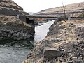 Sherars Bridge.jpg 3 456 × 2 592; 3,17 MB
-
 Shoe Tree - August 2009 - panoramio.jpg 1 728 × 3 072; 2,91 MB
-
 The dry side (21363379888).jpg 5 478 × 3 499; 19,25 MB
-
 The dry side edit (22437338427).jpg 4 636 × 3 009; 14,81 MB
-
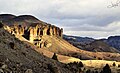 The Palisades, John Day Fossil Beds, Clarno Unit, Oregon (6632468007).jpg 1 024 × 621; 204 kB
-
 Trout Creek Watershed.png 1 050 × 1 125; 1,53 MB
-
 Tyghgrade.jpg 3 839 × 2 165; 1,44 MB
-
 Tyghsummit.jpg 2 280 × 1 646; 549 kB
-
 USA Wasco, Oregon age pyramid.svg 520 × 600; 7 kB
-
 View from Rowena Crest - Flickr - Joe Parks.jpg 2 955 × 1 967; 7,55 MB
-
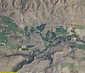
 Wamic Oregon aerial view.jpg 3 706 × 2 790; 4,75 MB
-
 Warm Springs map2.png 422 × 359; 7 kB
-
 Warm Springs.jpg 2 341 × 2 418; 2,45 MB
-
 Wasco County aerial.JPG 640 × 550; 96 kB
-
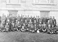 Wasco County Agricultural Council of Defense, 1917 (5763638242).jpg 4 821 × 3 490; 2,13 MB
-
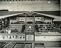 Wasco County display at the Oregon State Fair fruits (5858461428).jpg 2 000 × 1 588; 469 kB
-
 Wasco County, OR, USA - panoramio (2).jpg 3 264 × 2 448; 2,48 MB
-
 Wasco County, OR, USA - panoramio.jpg 2 592 × 1 936; 1,5 MB
-
 Wasco Warehouse Milling Company (3717805349).jpg 2 348 × 1 750; 256 kB


.jpg)


.jpg)

.jpg)
.jpg)
.jpg)
.jpg)


.jpg)


fford,_The_Dalles,_Or._LCCN90710756.jpg)
.jpg)

.jpg)


.jpg)
.jpg)
.jpg)


.jpg)
.jpg)
.jpg)

.jpg)