Category:Douglas County, Oregon
Jump to navigation
Jump to search
Counties of Oregon: Baker · Benton · Clackamas · Clatsop · Columbia · Coos · Crook · Curry · Deschutes · Douglas · Gilliam · Grant · Harney · Hood River · Jackson · Jefferson · Josephine · Klamath · Lake · Lane · Lincoln · Linn · Malheur · Marion · Morrow · Multnomah · Polk · Sherman · Tillamook · Umatilla · Union · Wallowa · Wasco · Washington · Wheeler · Yamhill
county in Oregon, United States   | |||||
| Upload media | |||||
| Instance of | |||||
|---|---|---|---|---|---|
| Named after | |||||
| Location | Oregon | ||||
| Capital | |||||
| Inception |
| ||||
| Population |
| ||||
| Area |
| ||||
| official website | |||||
 | |||||
Subcategories
This category has the following 62 subcategories, out of 62 total.
A
B
- Mount Bailey (Oregon) (12 F)
C
- 2015 Cable Crossing Fire (25 F)
- Canyonville, Oregon (11 F)
- Cavitt Creek Falls (9 F)
D
- Devil's Staircase Wilderness (46 F)
- Diamond Lake, Oregon (66 F)
E
- Elkton, Oregon (7 F)
G
- Green, Oregon (2 F)
K
- Kalmiopsis fragrans (1 F)
L
- Lake Marie (20 F)
M
- Maidu Lake (Oregon) (2 F)
- Maps of Douglas County, Oregon (28 F)
- Minerals of Bohemia District (4 F)
- Myrtle Creek, Oregon (40 F)
N
- North Umpqua River Trail (8 F)
O
- Oregon Route 138 (46 F)
- Oregon Route 38 (28 F)
P
R
- Rabbit Ears (Oregon) (13 F)
- Riddle Mine (2 F)
- Riddle, Oregon (14 F)
S
- Siltcoos Lake (8 F)
- Siltcoos River (9 F)
- Steamboat Island (9 F)
- Susan Creek Falls (13 F)
T
- Tahkenitch Lake (10 F)
U
- Umpqua Lighthouse State Park (9 F)
W
- Winchester dam (4 F)
Y
Media in category "Douglas County, Oregon"
The following 200 files are in this category, out of 270 total.
(previous page) (next page)-
 10-View from Bob Butte (16189800446).jpg 1,600 × 1,200; 1.28 MB
-
 101 from Ridge above Silver Creek - panoramio.jpg 4,320 × 2,432; 7.36 MB
-
 130808-Z-B7541-1398 (9472488605) (3).jpg 7,360 × 4,912; 13.8 MB
-
 18630617 Affidavit.jpg 2,000 × 1,099; 756 KB
-
 18630617 Application.jpg 2,000 × 1,082; 943 KB
-

-

-

-

-

-

-

-

-
-

-

-
 220227 Indigo wolves odfw (52015876923).jpg 2,100 × 1,500; 2.14 MB
-
 A Forest near Roseburg, Oregon (14000015638).jpg 2,592 × 1,944; 1.83 MB
-
 A Forest near Roseburg, Oregon (14000052697).jpg 2,448 × 3,264; 3.31 MB
-
 A symmetree - panoramio.jpg 2,416 × 4,288; 6.26 MB
-
 A'eron island from Henderson Cove sandbar - panoramio.jpg 4,284 × 1,840; 5.25 MB
-
 Abandoned barge - panoramio.jpg 4,288 × 2,416; 5.03 MB
-
 Abandoned metal barge - panoramio.jpg 4,288 × 2,416; 4.25 MB
-
 Across from the cutoff on Cannery Isalnd - panoramio.jpg 4,320 × 2,432; 4.55 MB
-
 Actual homestead up Smith River - panoramio.jpg 4,608 × 2,592; 7.08 MB
-
 Advantage Dental - panoramio.jpg 4,320 × 2,432; 6.46 MB
-
 Affidavit Required of Homestead Claimants - Letitia Carson, 17 June 1863.jpg 1,600 × 1,680; 861 KB
-
 Anarchy Tressel - panoramio.jpg 4,320 × 2,432; 7 MB
-
 Another look at Henderson Cove - panoramio.jpg 4,288 × 2,416; 5.72 MB
-
 Approaching Echo island - panoramio.jpg 4,288 × 2,416; 5.32 MB
-
 Approaching Haiden island - panoramio.jpg 4,288 × 2,416; 5.16 MB
-
 Approaching Loon Lake - panoramio.jpg 2,432 × 4,320; 3.69 MB
-
 Approaching Tom Fool RV and Growing Crazy Farm Loop - panoramio.jpg 3,072 × 4,608; 7.33 MB
-
 Arctostaphylos sp. (3021501827).jpg 3,264 × 2,448; 5.79 MB
-
 Backside of Rowe St - panoramio.jpg 4,320 × 2,432; 7.49 MB
-
 Behind Harbour and Henley island - panoramio.jpg 4,288 × 2,416; 5.69 MB
-
 BILD5830wp.jpg 3,000 × 2,000; 6.31 MB
-
 BLM Firefighting near Roseburg, Oregon (14000052867).jpg 1,600 × 1,200; 666 KB
-
 BLM Firefighting near Roseburg, Oregon (14184071382).jpg 2,592 × 1,944; 1.23 MB
-
 Boat moored in Galesville Reservoir.jpg 4,752 × 3,168; 6.25 MB
-
 Bolon Island dock - panoramio.jpg 4,320 × 2,432; 6.58 MB
-
 Brandy bar from NE Umpqua - panoramio.jpg 4,288 × 2,416; 3.64 MB
-
 Brilliant Sunset At Bandon Beach (239881931).jpeg 515 × 768; 128 KB
-
 Butt Shot - panoramio.jpg 3,648 × 2,736; 2.17 MB
-
 Watershed work plan, Sutherlin Creek Watershed, Douglas County, Oregon (IA CAT10754681).pdf 1,166 × 1,585, 103 pages; 5.42 MB
-
 Letters to home - life in C.C.C. camps of Douglas County, Oregon, 1933-1934 (IA CAT11135436).pdf 1,225 × 1,622, 166 pages; 9.16 MB
-
 Cinnamon Butte LeeSiebert 065040.jpg 634 × 480; 57 KB
-
 Clear Lake from Route 101 in Oregon.jpg 4,288 × 2,848; 8.77 MB
-
 Clearwater Falls, Oregon.jpg 2,328 × 2,912; 1.73 MB
-
 Cliffs across the Umpqua - panoramio.jpg 4,320 × 2,432; 5.26 MB
-
 Colliding Rivers - Glide Oregon.jpg 3,000 × 4,000; 3.9 MB
-
 Columnar andesite along North Umpqua river (3022327208).jpg 3,264 × 2,448; 5.27 MB
-
 Columnar basalt along North Umpqua river (3022311164).jpg 2,448 × 3,264; 5.86 MB
-
 Columnar basalt along North Umpqua river (3022316328).jpg 3,264 × 2,448; 6.12 MB
-
 Confluence of Drainage Pond sloughs - panoramio.jpg 4,320 × 2,432; 7.89 MB
-
 Cooper Creek Reservoir.jpg 2,100 × 1,500; 1.98 MB
-
 Crews clear debris (3786945900).jpg 3,072 × 2,304; 2.05 MB
-
 Culvert clogged with debris (6726268821).jpg 3,264 × 1,836; 1.06 MB
-
 Culvert on Umpqua Highway (32099105424).jpg 1,600 × 1,200; 975 KB
-
 Culvert on Umpqua Highway (32127885173).jpg 1,200 × 1,600; 800 KB
-
 Curtin, Oregon.jpg 4,608 × 3,072; 3.77 MB
-
 DeFazio with seniors at Douglas county fair.jpg 212 × 152; 20 KB
-
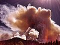
 Douglas Complex Fire (13999558978).jpg 2,048 × 1,536; 966 KB
-
 Douglas County Fat Lamb Show, ca. 1934 (5711361468).jpg 1,000 × 632; 129 KB
-
 Douglas County, OR aerial.JPG 640 × 550; 126 KB
-
 Douglas County, OR from Callahans.JPG 4,608 × 3,456; 3.39 MB
-
 Douglas County, Oregon, 1884.png 428 × 317; 7 KB
-
 Douglas firs on timberland.JPG 4,608 × 3,456; 3.25 MB
-
 Drain (31563464).jpg 683 × 1,024; 285 KB
-
 Draw in the cutoff - panoramio.jpg 4,288 × 2,416; 5.84 MB
-
 Draw to the sourthern end of the ridge road - panoramio.jpg 2,432 × 4,320; 8.07 MB
-
 Driftwood on the north beach. - panoramio.jpg 3,566 × 2,563; 6.06 MB
-
 Driftwood on the Point in the cutoff - panoramio.jpg 4,288 × 2,416; 5.92 MB
-
 East end of Echo island's island - panoramio.jpg 2,416 × 4,288; 6.06 MB
-
 East end of the northern Levee - panoramio.jpg 4,320 × 2,432; 4.66 MB
-
 East Rail and 4th - panoramio.jpg 4,320 × 2,432; 4.15 MB
-
 East side of Stella island - panoramio.jpg 4,288 × 2,416; 5.98 MB
-
 Eastern tip of Cannery - panoramio.jpg 4,320 × 2,432; 3.92 MB
-
 Echo island's island - panoramio.jpg 4,288 × 2,416; 5.38 MB
-
 Elk stag (8508342021).jpg 2,339 × 1,994; 4.44 MB
-
 End of my float up Schofield Creek June 2011 - panoramio.jpg 4,320 × 2,432; 9.26 MB
-
 End of other Drainage Pond slough - panoramio.jpg 2,432 × 4,320; 8.04 MB
-
 End the Drainage Ponds Slough - panoramio.jpg 2,432 × 4,320; 7.64 MB
-
 Entroposity.jpg 448 × 336; 90 KB
-
 Farm from Callahans, Douglas Co, OR.JPG 4,608 × 3,456; 3.54 MB
-
 Fire burns close to OR 138 (3786137599).jpg 3,072 × 2,304; 2.01 MB
-
 Fire Lookouts along North Umpqua river (3021476001).jpg 3,264 × 2,448; 2.57 MB
-
 First wooden tressel up Schofield Creek - panoramio.jpg 4,320 × 2,432; 6.1 MB
-
 Fort Umpqua Reproduction.jpg 1,000 × 369; 112 KB
-
 Growing Crazy Farm - panoramio.jpg 3,072 × 4,608; 7.26 MB
-
 Haiden island - panoramio.jpg 3,993 × 2,860; 5.1 MB
-
 Haiden island from eastern sandbar - panoramio.jpg 4,288 × 2,416; 4.57 MB
-
 Haiden island from the cat-tails - panoramio.jpg 4,288 × 2,416; 4.74 MB
-
 Haiden island from western sandbar - panoramio.jpg 4,288 × 2,416; 4.97 MB
-
 Half-Fast backside of the County Annex - panoramio.jpg 4,320 × 2,432; 3.87 MB
-
 Half-Fast Catering - panoramio.jpg 4,320 × 2,432; 4.6 MB
-
 Half-Fast from Crestview and Elm - panoramio.jpg 4,320 × 2,432; 4.11 MB
-
 Halfway down Frontage Road - panoramio.jpg 4,320 × 2,432; 4.71 MB
-
 Harbour island from Henley island - panoramio.jpg 4,288 × 2,416; 5.79 MB
-
 Harbour island inlet - panoramio.jpg 4,288 × 2,416; 5.65 MB
-
 Heading to Reedsport - panoramio.jpg 2,432 × 4,320; 7.24 MB
-
 Henderson Cove - panoramio.jpg 4,288 × 2,416; 5.61 MB
-
 Henley island - panoramio.jpg 4,020 × 2,860; 6.77 MB
-
 Henley island from eastern tip of Hudson island - panoramio.jpg 4,288 × 2,416; 5.2 MB
-
 Henley island from the eastern sandbar - panoramio.jpg 4,288 × 2,416; 4.62 MB
-
 Hike into Watson Falls (3022328514).jpg 3,264 × 2,448; 5.34 MB
-
 History of southern Oregon, comprising Jackson, Josephine, Douglas, Curry and Coos counties (IA historyofsouthe00wall).pdf 1,154 × 1,750, 818 pages; 75.55 MB
-
 Hoxie.gif 211 × 303; 62 KB
-

-
 Hudson and Haiden island - panoramio.jpg 4,288 × 2,416; 5.37 MB
-
 Hudson island - panoramio.jpg 4,288 × 3,216; 6.71 MB
-
 Hudson island view from Henley island - panoramio.jpg 4,288 × 2,416; 4.74 MB
-
 Hunt Cove from Northern Ridge - panoramio.jpg 4,320 × 2,432; 7.12 MB
-
 I-5 at Roberts Mountain (32944906140).jpg 1,250 × 700; 383 KB
-
 I-5- Anlauf to Elkhead Paving Project (32561425300).jpg 1,000 × 750; 433 KB
-
 Irrigation, 1923, Douglas County (5710802531).jpg 1,000 × 568; 63 KB
-
 John Emmitt, Oregon State Senator, 1884-1888.png 339 × 437; 113 KB
-
 KDUN 1030 AM radio tower - panoramio.jpg 2,432 × 4,320; 4.32 MB
-
 Kentucky Falls (222888329).jpeg 2,048 × 1,363; 1.69 MB
-
 Lake Marie in Umpqua Lighthouse State Park, Douglas County, Oregon.jpg 4,608 × 3,456; 6.83 MB
-
 Lake Marie reflections in Umpqua Lighthouse State Park.jpg 4,608 × 3,456; 6.84 MB
-
 Lake Marie signs in Umpqua Lighthouse State Park.jpg 3,333 × 4,608; 7.2 MB
-
 Lake Marie Trail in Umpqua Lighthouse State Park near Winchester Bay, Oregon.jpg 4,608 × 3,456; 6.31 MB
-
 Lake Marie Trail sign in Umpqua Lighthouse State Park.jpg 4,608 × 3,456; 6.05 MB
-
 Lemolo Lake (Oregon).jpg 2,100 × 1,500; 3.03 MB
-
 Lemolo Lake and Mt. Thielsen.jpg 1,600 × 1,200; 491 KB
-
 Leona, Oregon.jpg 640 × 384; 118 KB
-
 Lichen at a roadside stop (3018331545).jpg 2,448 × 3,264; 3.76 MB
-
 Light Trails along the North Umpqua Highway - Ray Lapke (11409290176).jpg 1,200 × 794; 300 KB
-
 Looking down Gumby Hill On Interstate 5 Saturday morning (11254940196).jpg 1,836 × 3,264; 932 KB
-
 Looking up Oar Creek - panoramio.jpg 4,484 × 2,828; 5.99 MB
-
 Lookingglass, Oregon - Palmer Camp.jpg 640 × 404; 86 KB
-
 Loon Lake turnoff - panoramio.jpg 2,432 × 4,320; 5.32 MB
-
 Lot for sale - panoramio.jpg 4,320 × 2,432; 4.02 MB
-
 LUMBER MILL POLLUTES AIR IN RECREATION AREA - NARA - 545112.jpg 3,000 × 2,018; 1.38 MB
-
 LUMBER MILL POLLUTES AIR IN RECREATION AREA - NARA - 545113.jpg 2,012 × 3,000; 912 KB
-
 Me at the North Umpqua river (3022307384).jpg 3,264 × 2,448; 5.1 MB
-

-
 Mill Creek near mile marker 5 - panoramio.jpg 2,432 × 4,320; 4.54 MB
-
 Mills Creek Falls Oregon May 2018.jpg 3,024 × 4,032; 4.54 MB
-
 Mistic Steamboat Island - panoramio.jpg 4,320 × 2,432; 6.62 MB
-
 N 19TH ST Bench - panoramio.jpg 4,288 × 3,216; 3.02 MB
-
 Narrow under the Dump - panoramio.jpg 4,320 × 2,432; 3.86 MB
-
 Near Plunkett Creek turnoff - panoramio.jpg 2,432 × 4,320; 5.7 MB
-
 Near Watson Falls (3022331992).jpg 3,264 × 2,448; 4.63 MB
-
 Near Watson Falls - panoramio.jpg 1,067 × 1,600; 401 KB
-
 North inlet on Cannery Island - panoramio.jpg 4,320 × 2,432; 4.61 MB
-
 North Roseburg, Oregon.jpg 3,789 × 2,259; 957 KB
-
 North Umpqua river (3021483147).jpg 3,264 × 2,448; 4.93 MB
-
 North Umpqua river (3021488917).jpg 3,264 × 2,448; 4.96 MB
-
 North Umpqua river (3022312328).jpg 3,264 × 2,448; 4.47 MB
-
 North Umpqua river (3022317658).jpg 3,264 × 2,448; 4.65 MB
-
 North Umpqua river with lone fisherman (3021494385).jpg 3,264 × 2,448; 5.2 MB
-
 North Umpqua Wild and Scenic River (16033830856).jpg 2,592 × 3,400; 8.65 MB
-
 Notable Stand and Com Tower from ridge west of Silver Creek - panoramio.jpg 4,320 × 2,432; 7.37 MB
-
 NPLD 2016 at North Umpqua Trail (29345899783).jpg 4,032 × 3,024; 4.43 MB
-
 NPLD 2016 at North Umpqua Trail (29345902763).jpg 4,032 × 3,024; 3.65 MB
-
 NPLD 2016 at North Umpqua Trail (29345905953).jpg 4,032 × 3,024; 4.5 MB
-
 NPLD 2016 at North Umpqua Trail (29678943530).jpg 4,032 × 3,024; 3.67 MB
-
 NPLD 2016 at North Umpqua Trail (29678947990).jpg 4,032 × 3,024; 3.35 MB
-
 Oandc-rac.jpg 180 × 115; 13 KB
-
 Olalla mining dam (3230054482).jpg 4,304 × 2,670; 4.85 MB
-
 OldManRock NorthUmpquaRiver.jpg 1,252 × 1,900; 588 KB
-
 One of the Lake Marie day use areas in Umpqua Lighthouse State Park.jpg 4,976 × 2,800; 5.69 MB
-
 Oregon 42 at milepost 45 (23565929999).jpg 3,264 × 1,836; 936 KB
-
 Oregon Dunes National Recreation Area Signage (32292779594).jpg 4,662 × 3,188; 9.48 MB
-
 Oregon Purple Salsify flower (14183370601).jpg 6,000 × 4,000; 10.29 MB
-
 Owls (13547671214).jpg 2,560 × 1,920; 1.27 MB
-
 Pacific madrone in Oregon.JPG 4,608 × 3,456; 3.41 MB
-
 Palmer Camp at Lookingglass, Oregon (3229144955).jpg 4,270 × 2,696; 4.7 MB
-
 Pastureland out on Brainard Creek - panoramio.jpg 4,608 × 2,592; 7.3 MB
-
 Pear orchard in Douglas County, Oregon, 1920 (5858429964).jpg 2,000 × 1,601; 639 KB
-
 Picnic table in the Lake Marie day use aera in Umpqua Lighthouse State Park.jpg 4,608 × 3,456; 9.29 MB
-
 Picnic tables in the day use area of Umpqua Lighthouse State Park.jpg 4,976 × 2,800; 5.49 MB
-
 Pilings on Cannery Island - panoramio.jpg 4,320 × 2,432; 6.66 MB
-
 Pillings up Schofield Creek - panoramio.jpg 4,320 × 2,432; 3.64 MB
-

-

-
 Pumpkin Patch (Winchester, Oregon).jpg 4,608 × 3,072; 5.23 MB
-
 Putnam Valley (near Drain, Oregon).jpg 4,608 × 3,072; 4.65 MB
-
 Ranch Rd and Providence Creek from SE ridge - panoramio.jpg 4,320 × 2,432; 5.46 MB
-
 Red top pond swart odfw (14929749664).jpg 2,100 × 1,500; 4.31 MB
-
 Residence of S. I. Thornton, Deer Creek Valley, Douglas County, 1884.jpg 2,334 × 1,518; 1.48 MB
-
 Restrooms in the Lake Marie day use area at Umpqua Lighthouse State Park.jpg 4,608 × 3,456; 6.77 MB
-
 Rice Hill, Oregon.jpg 4,000 × 3,000; 2.61 MB
-
 Ricehill (31563474).jpg 1,024 × 672; 259 KB
-
 Ridge road above Hunt Cove, Last dune up Umpqua. - panoramio.jpg 2,432 × 4,320; 7.5 MB
-
 Runoff in the cutoff - panoramio.jpg 2,416 × 4,288; 5.53 MB
-
 Salal interpretive sign along the Lake Marie Trail in Umpqua Lighthouse State Park.jpg 4,976 × 2,800; 4.52 MB
-
 Salbasgeon Inn Opportunity - panoramio.jpg 4,320 × 2,432; 4.55 MB
-
 Scene at stage line near Roseburg, Oregon (3229229237).jpg 4,280 × 2,669; 7.35 MB
-
 Schofield Creek below the dump - panoramio.jpg 2,313 × 3,284; 5.84 MB
-
 Scott Mountain Lookout - panoramio.jpg 3,648 × 2,736; 2.11 MB
-
 Slide and pavement damage on Oregon 42 (23565929959).jpg 1,280 × 960; 451 KB
-
 Slide mitigation Oregon Highway 138 (6771841543).jpg 512 × 384; 36 KB
-
 Slough into wetlands up Schofeild Creek - panoramio.jpg 4,320 × 2,432; 7.84 MB
-
 Smith River Ranch Land - panoramio.jpg 4,460 × 2,445; 6.51 MB
-
 Snags of the sourthern cutoff - panoramio.jpg 4,320 × 2,432; 5.26 MB
-
 South side of Haiden island - panoramio.jpg 4,288 × 2,416; 5.39 MB
-
 South side of Harbour island - panoramio.jpg 4,288 × 2,416; 4.97 MB
.jpg)

_(3).jpg)


.jpg)
.jpg)
.jpg)
.jpg)
.jpg)
.jpg)
.jpg)
.jpg)
.jpg)
.jpg)
.jpg)
.jpg)
.jpg)
.jpg)


.jpg)


.jpg)
.jpg)


.jpeg)


.jpg)
.jpg)
.jpg)


.jpg)
.jpg)
.jpg)


.jpg)
.jpg)


.jpg)


.jpg)


.jpg)
.jpg)


.jpg)


.jpg)
.jpg)
.jpg)


.jpeg)


.jpg)


.jpg)
.jpg)
.jpg)


.jpg)
.jpg)


.jpg)


.jpg)
.jpg)
.jpg)
.jpg)
.jpg)
.jpg)

.jpg)
.jpg)
.jpg)
.jpg)
.jpg)

.jpg)


.jpg)
.jpg)
.jpg)
.jpg)

.jpg)

.jpg)


.jpg)
.jpg)

.jpg)


.jpg)


.jpg)


.jpg)
.jpg)


.jpg)