Category:Washington County, Maryland
Zur Navigation springen
Zur Suche springen
Counties of Maryland: Allegany · Anne Arundel · Baltimore · Calvert · Caroline · Carroll · Cecil · Charles · Dorchester · Frederick · Garrett · Harford · Howard · Kent · Montgomery · Prince George's · Queen Anne's · Somerset · St. Mary's · Talbot · Washington · Wicomico · Worcester · Independent city: Baltimore
County im US-Bundesstaat Maryland  .png)  | |||||
| Medium hochladen | |||||
| Ist ein(e) | |||||
|---|---|---|---|---|---|
| Benannt nach | |||||
| Ort | Maryland | ||||
| Schulbezirk | |||||
| Hauptstadt | |||||
| Datum der Gründung, Erstellung, Entstehung, Erbauung |
| ||||
| Einwohnerzahl |
| ||||
| Fläche |
| ||||
| Verschieden von | |||||
| offizielle Website | |||||
 | |||||
Unterkategorien
Es werden 17 von insgesamt 17 Unterkategorien in dieser Kategorie angezeigt:
In Klammern die Anzahl der enthaltenen Kategorien (K), Seiten (S), Dateien (D)
Seiten in der Kategorie „Washington County, Maryland“
Diese Kategorie enthält nur die folgende Seite.
Medien in der Kategorie „Washington County, Maryland“
Folgende 47 Dateien sind in dieser Kategorie, von 47 insgesamt.
-

-

-

-

-

-

-
-

-

-
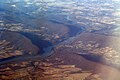
 Airborne Batimore to Minneapolis (3357397285).jpg 2.592 × 1.490; 1,48 MB
-
 Airborne Batimore to Minneapolis (3357397975).jpg 2.592 × 1.944; 1,45 MB
-
 Amos Baer And Son In Maugansville, Maryland (6836056958).jpg 302 × 453; 27 KB
-
 Anna And Allen Horst In Maugansville, Maryland (7454943788).jpg 400 × 597; 171 KB
-
 Barnes Road Bridge (21006527994).jpg 1.024 × 768; 344 KB
-
 Barnes Road Bridge (21638299961).jpg 1.024 × 768; 345 KB
-
 Bearpond Mountains.jpg 2.247 × 1.287; 1,07 MB
-
 Bike Past Farmland - panoramio.jpg 1.533 × 1.178; 707 KB
-
 Brooklane Farm Mental Hospital Grounds (5933408531).jpg 461 × 304; 71 KB
-
 Brooklane Farm Mental Hospital Office (5933407975).jpg 600 × 400; 39 KB
-
 Crystal Grottoes Ceiling Formations.jpg 2.640 × 1.980; 2,51 MB
-
 Crystal Grottoes Fairy Land.JPG 3.264 × 2.448; 3,01 MB
-
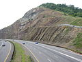
 Devil's Eyebrow Anticline - panoramio.jpg 2.048 × 1.536; 1,13 MB
-
 Earl Strite And Sons In Maugansville, Maryland (6836055752).jpg 301 × 454; 44 KB
-
 Fox Gap MD1.jpg 3.888 × 2.376; 7,92 MB
-
 LibraryTruckMaryland1916.jpg 1.024 × 677; 314 KB
-
 Mapleville MD1.jpg 5.472 × 3.648; 17,81 MB
-
 Maryland, Elk Mountain, Signal Tower - NARA - 533296.jpg 2.247 × 3.000; 2,46 MB
-
 Maryland, Pleasant Valley - NARA - 533298.jpg 3.000 × 2.379; 2,81 MB
-
 MD-VA-WV tripoint in Potomac River.jpg 4.288 × 3.216; 6,65 MB
-
 Mrs Amos Baer And Son In Maugansville, Maryland (6982197399).jpg 303 × 445; 21 KB
-
 Mt. Pleasant (21617983962).jpg 5.312 × 2.988; 5,83 MB
-
 Mt. Pleasant (21638363401).jpg 5.312 × 2.988; 5,5 MB
-
-
 Potomac River Water Gaps Harpers Ferry.jpg 1.068 × 712; 260 KB
-
 Preservation Maryland Bicycle Trip, Washington County, 1980s(?) (24442066533).jpg 2.079 × 1.470; 306 KB
-
 Quiet Peaceful Country - panoramio.jpg 2.032 × 1.355; 2,09 MB
-
 Reno Monument, U.S. 40A (1) (2836619413).jpg 1.280 × 960; 184 KB
-
 River View Cemetery (2416151469).jpg 3.072 × 2.304; 3,32 MB
-
 Roundtop Hill outcrop1.jpg 788 × 1.178; 298 KB
-
 Roundtop Hill outcrop2.jpg 1.175 × 773; 297 KB
-
 Seal of Washington County, Maryland (1950–1988).png 196 × 193; 64 KB
-
 Sideling Hill Geology - Syncline - panoramio.jpg 1.600 × 1.200; 617 KB
-

-
 USA Washington County, Maryland age pyramid.svg 520 × 600; 7 KB
-
 Washington County Transit logo.svg 214 × 220; 336 KB
-
 Wea03015 - Flickr - NOAA Photo Library.jpg 1.024 × 1.536; 606 KB
-
 William Chapline House street view.jpg 600 × 400; 91 KB

_between_Washington_County,_Maryland_and_Shepherdstown,_Jefferson_County,_West_Virginia.jpg)
_between_Washington_County,_Maryland_and_Shepherdstown,_Jefferson_County,_West_Virginia.jpg)


_just_south_of_the_Pennsylvania_state_line_in_western_Washington_County,_Maryland.jpg)
.jpg)
.jpg)
.jpg)
.jpg)
.jpg)
.jpg)


.jpg)
.jpg)


.jpg)


.jpg)
.jpg)
.jpg)
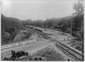
_Western_Maryland_R._R.,_(along)_C._%26_O._Canal,_east_of_Hancock,_Md._LCCN2012649621.jpg)

_(24442066533).jpg)

_(2836619413).jpg)
.jpg)


