Category:Water level recorders
Zur Navigation springen
Zur Suche springen
Čeština: Limnigrafy
Svenska: Vattenståndsmätare
system for automatically recording water level on a continuous or near-continuous basis, using an attached sensing device. | |||||
| Medium hochladen | |||||
| Unterklasse von | |||||
|---|---|---|---|---|---|
| |||||
Unterkategorien
Es werden 6 von insgesamt 6 Unterkategorien in dieser Kategorie angezeigt:
In Klammern die Anzahl der enthaltenen Kategorien (K), Seiten (S), Dateien (D)
Medien in der Kategorie „Water level recorders“
Folgende 35 Dateien sind in dieser Kategorie, von 35 insgesamt.
-
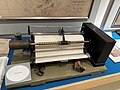
 SAPUNOV(1893) -17- p243.jpg 5.017 × 3.247; 9,27 MB
-
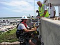
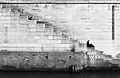 2sitting@seewall(byElisabettaFoco).jpg 2.972 × 1.932; 2,21 MB
-

-
 Auderghem - Region Bruxelloise - Rouge-Cloître - Wasserstandsanzeige - P1010763.jpg 4.000 × 2.672; 2,65 MB
-
 Avignon - échelle crue.jpg 4.000 × 3.000; 2,55 MB
-
 Barrage de Gabillou, écluse et repère de niveau de crue.jpg 4.608 × 3.456; 4,17 MB
-
 Barranc de l'Horteta 02.JPG 3.648 × 2.736; 4,72 MB
-
 Cacapon River West Virginia Route 127 Bridge Forks of Cacapon WV 2008 10 12 07.jpg 2.448 × 3.264; 1,83 MB
-
 Fox Lake in Huntsville Ontario (2622553238).jpg 3.264 × 2.448; 1,8 MB
-
 Kaczawa 01.jpg 4.080 × 3.072; 10,82 MB
-
 Lekkende houten damwand. Locatie, Natuurterrein De Famberhorst 02.jpg 5.184 × 3.456; 23,28 MB
-
 Mula Mutha confluence Water level measuring scale.jpg 3.024 × 4.032; 4,01 MB
-
 Nivell de l'aigua a un pas sota la carretera al camí de la Carraqueta, Gandia.jpg 3.072 × 4.608; 1,03 MB
-
 Nivell de l'aigua al barranc del Carraixet (entre Alfara i Foios).jpg 2.993 × 4.545; 1,77 MB
-
 Nivell de l'aigua al costat del pont del Llavador, Xàbia.jpg 4.495 × 3.039; 1,84 MB
-
 Nivell de l'aigua i graffiti al pont de la carretera del Pla, Xàbia.jpg 4.503 × 3.006; 1,63 MB
-

-
 Onekaka-927.jpg 3.024 × 4.032; 2,76 MB
-
 Oullins - Pont, repère niveau de l'Yzeron numéro 3.jpg 3.096 × 4.128; 5,1 MB
-
 Quissac7483.JPG 2.048 × 1.536; 795 KB
-
 Riu Gorgos, nivell de l'aigua al pont de la carretera del Pla, Xàbia.jpg 4.535 × 3.042; 1,72 MB
-
 Réservoir de Passy - panoramio - Bruno Wilmart (6).jpg 1.200 × 797; 211 KB
-
 Saint-Jory-las-Bloux Glane échelle.JPG 3.264 × 2.448; 3,93 MB
-
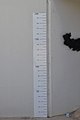
 Statens Kartverk Hønefoss (kartmuseet) - Vannstandsmåler ca 1880.jpg 4.032 × 3.024; 2,91 MB
-
 Statens Kartverk Hønefoss (kartmuseet) - Vannstandsmåler.jpg 4.032 × 3.024; 2,81 MB
-
 Surface water monitoring station.jpg 2.048 × 1.536; 260 KB
-
 Tekapo River water level monitoring station.jpg 4.000 × 6.000; 7,55 MB
-
 The drain to another place (8369927783).jpg 1.000 × 667; 461 KB
-
 Three Gorges Reservoir flood mark.jpg 3.834 × 2.556; 8,76 MB
-
 USGS gauge 2 (6466591541).jpg 920 × 1.147; 551 KB
-
 Vézère Montignac jauge.jpg 2.448 × 3.264; 1,54 MB
-
 Water Level Sensor - NOAA.jpg 912 × 684; 433 KB
-
 Water Level, Mutha River in August 2019 Flood Near Nanaso Peshve Samadhi, Pune.jpg 5.184 × 3.456; 3,23 MB
-
 Water levels (15827463277).jpg 5.472 × 3.648; 6,71 MB
-
 Скеля - гранітний реєстр. Кременчук. Україна.jpg 3.504 × 2.299; 2,13 MB
_-17-_p243.jpg)
.jpg)
.JPG)


.jpg)


.jpg)


.jpg)

_-_Vannstandsm%C3%A5ler_ca_1880.jpg)
_-_Vannstandsm%C3%A5ler.jpg)


.jpg)

.jpg)


.jpg)
