Category:Waterford
둘러보기로 이동
검색으로 이동
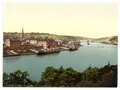
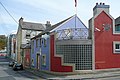
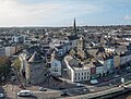
English: Waterford is a city in Ireland. It is located in the South-East Region and is also part of the province of Munster.
Italiano: Waterford è una città di oltre 50.000 abitanti dell'Irlanda sud-orientale, capitale storica dell'omonima contea.
Português: Waterford é uma cidade da República da Irlanda que fica no Condado de Waterford, na província de Munster.
city in the Republic of Ireland     | |||||
| 미디어 올리기 | |||||
| 다음 종류에 속함 |
| ||||
|---|---|---|---|---|---|
| 위치 |
| ||||
| 입법부 |
| ||||
| 행정부 |
| ||||
| 인구수 |
| ||||
| 면적 |
| ||||
| 해발고도 |
| ||||
| 다음과 다름 | |||||
| 공식 웹사이트 | |||||
 | |||||
하위 분류
다음은 이 분류에 속하는 하위 분류 17개 가운데 17개입니다.
B
- Bilberry Goat (6 F)
C
F
- Ferrybank, Waterford (34 F)
H
J
K
N
- Newtown School, Waterford (2 F)
P
S
- Sports in Waterford (4 F)
T
W
- Waterford City walls (5 F)
"Waterford" 분류에 속하는 미디어
다음은 이 분류에 속하는 파일 502개 가운데 200개입니다.
(이전 페이지) (다음 페이지)-
 Waterford 1714 (Moll).jpg 1,115 × 870; 241 KB
-
 1876 doorway Waterford.jpg 4,320 × 3,240; 5.71 MB
-
 1968 Velorex 16-350 1GFP703-Dashboard.jpg 4,896 × 2,752; 6.07 MB
-

-
 A Message from the Fairies of Magic Wood - geograph.org.uk - 5821614.jpg 800 × 600; 930 KB
-
 A sunny summer Saturday in Waterford - geograph.org.uk - 3748856.jpg 800 × 451; 211 KB
-
 A View across the River Suir - geograph.org.uk - 5822080.jpg 800 × 533; 552 KB
-
 A view of the road bridge across the River Suir - geograph.org.uk - 4607089.jpg 1,477 × 1,201; 426 KB
-
 A-wear, Waterford - geograph.org.uk - 3652324.jpg 640 × 480; 68 KB
-
 Abbey Junction.jpg 2,629 × 1,504; 903 KB
-

-
 Admiralty Chart No 1123 South Coast of Ireland to Lands End, Published 1967.jpg 16,348 × 11,219; 9.13 MB
-
 Admiralty Chart No 2046 Waterford Harbour, Published 1882.jpg 11,126 × 16,238; 70.55 MB
-
 Admiralty Chart No 2049 Ireland south coast Kinsale to Wexford, Published 1890.jpg 14,836 × 8,251; 13.53 MB
-
 AIB bank - geograph.org.uk - 3723631.jpg 2,592 × 1,936; 1.8 MB
-
 AIB Bank, Waterford - geograph.org.uk - 3652366.jpg 640 × 480; 66 KB
-
 Aldi, The Glen, Waterford - geograph.org.uk - 5145963.jpg 2,000 × 1,333; 1.37 MB
-
 Alfie Hale pub by Ballybricken Green - geograph.org.uk - 4685772.jpg 640 × 427; 68 KB
-
 Altar panel, Christ Church Cathedral - geograph.org.uk - 3746684.jpg 600 × 800; 298 KB
-
 American Civil War memorial - geograph.org.uk - 836703.jpg 448 × 640; 64 KB
-
 An award-winning facade - geograph.org.uk - 3530635.jpg 640 × 427; 293 KB
-

-
 Approaching Waterford - geograph.org.uk - 1823440.jpg 640 × 426; 148 KB
-
 Ardoginna House (geograph 4360298).jpg 1,600 × 960; 217 KB
-

-
 Arundel Square, Waterford - geograph.org.uk - 1543089.jpg 480 × 640; 62 KB
-
 Arundel Square, Waterford - geograph.org.uk - 3652251.jpg 640 × 480; 54 KB
-
 Arundel Square, Waterford - geograph.org.uk - 3652349.jpg 640 × 480; 63 KB
-
 Bachelor's Walk, Waterford - geograph.org.uk - 4684437.jpg 640 × 427; 65 KB
-
 Bailey's New Street - geograph.org.uk - 5537025.jpg 480 × 640; 240 KB
-
-
 Ballybricken Green - geograph.org.uk - 5154807.jpg 2,000 × 1,333; 1.17 MB
-
 Ballybricken Green Waterford - geograph.org.uk - 690529.jpg 640 × 480; 45 KB
-
 Ballybricken Green, Waterford - geograph.org.uk - 1483887.jpg 640 × 480; 66 KB
-

-
 Barronstrand Street - geograph.org.uk - 3652368.jpg 640 × 480; 70 KB
-
 Barronstrand Street name sign - geograph.org.uk - 3652370.jpg 640 × 481; 50 KB
-
 Barronstrand Street, Waterford - geograph.org.uk - 3641289.jpg 2,592 × 1,952; 1.03 MB
-
 Beach Tower, Waterford - geograph.org.uk - 4685810.jpg 640 × 427; 82 KB
-

-
 Bike stand, Waterford - geograph.org.uk - 3652357.jpg 640 × 480; 60 KB
-
 Bilberry Road - geograph.org.uk - 5821378.jpg 800 × 600; 601 KB
-
 Bishop's Palace - geograph.org.uk - 5536990.jpg 640 × 480; 274 KB
-
 Blacktie, Waterford - geograph.org.uk - 3652333.jpg 640 × 480; 51 KB
-

-
 Blowing glass, Waterford Crystal Factory - geograph.org.uk - 3652121.jpg 3,240 × 4,320; 4.68 MB
-
 Blue plaque for Thomas Hussey.jpg 1,756 × 1,756; 757 KB
-
 Blue plaque Geoffrey of Waterford.png 1,847 × 1,847; 5 MB
-
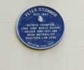 Blue plaque Peter O'Connor.png 1,152 × 954; 1.64 MB
-
 Boats on the river Suir, Waterford (2016).jpg 6,000 × 2,496; 10.29 MB
-
 Boats on the river Suir, Waterford - geograph.org.uk - 1540699.jpg 640 × 443; 58 KB
-
 Bridge at Waterford - geograph.org.uk - 5127698.jpg 2,000 × 1,333; 1.08 MB
-
 Bridge over the N25 near Kilmeadan - geograph.org.uk - 5824912.jpg 800 × 454; 505 KB
-
 Bridge Parapet - geograph.org.uk - 5839568.jpg 800 × 600; 208 KB
-
 Broad Street - geograph.org.uk - 5536323.jpg 640 × 480; 321 KB
-
 Broad Street, Waterford - geograph.org.uk - 1542946.jpg 640 × 480; 89 KB
-
 Buildings on Military Road - geograph.org.uk - 1824336.jpg 640 × 427; 207 KB
-
 Bull Post at Ballybricken in Waterford -155243 (48646807022).jpg 7,952 × 5,304; 26.37 MB
-
 Bull Post at Ballybricken, Waterford -142628 (43689191001).jpg 7,952 × 5,304; 31.11 MB
-

-
 Bus station building - geograph.org.uk - 3510231.jpg 640 × 427; 275 KB
-
 Bus station seats - geograph.org.uk - 3516794.jpg 640 × 427; 518 KB
-
 Bust in Waterford.jpg 896 × 1,200; 175 KB
-
 Car Ferry - geograph.org.uk - 5839550.jpg 800 × 600; 130 KB
-
 Car Park, Waterford - geograph.org.uk - 3652382.jpg 640 × 480; 60 KB
-

-
 Cathedral Square, Waterford - geograph.org.uk - 5145992.jpg 2,000 × 1,333; 1.17 MB
-
 Celebrating 30,000,000 Views (16244689524).png 1,318 × 624; 1.21 MB
-
 Celtic Knot 2024 Blackwater River.png 969 × 728; 1 MB
-
 Celtic Knot 2024 Reginold Tower.png 1,280 × 705; 1.14 MB
-
 Celtic Knot 2024 Waterford.png 640 × 512; 627 KB
-
 Celtic Knot Kisalebeg Church.png 1,280 × 720; 1.38 MB
-
 Celtic Knot River Suir.png 2,560 × 1,065; 4.04 MB
-
 Cemetery of Holy Trinity Church, Waterford - geograph.org.uk - 5145968.jpg 2,000 × 1,333; 1.47 MB
-
 Cemetery of Holy Trinity Church, Waterford - geograph.org.uk - 5154823.jpg 2,000 × 1,333; 1.16 MB
-
 Champagne flute, Waterford Crystal factory - geograph.org.uk - 3652105.jpg 3,240 × 4,320; 4.79 MB
-

-
 Cheekpoint Harbour - geograph.org.uk - 5839614.jpg 800 × 600; 182 KB
-
 Cheekpoint Lime Kiln - geograph.org.uk - 5712310.jpg 3,648 × 2,736; 5.53 MB
-
 Cheekpoint Village - geograph.org.uk - 5712245.jpg 3,648 × 2,736; 2.84 MB
-
 Christ Church Cathedral, Waterford - geograph.org.uk - 3746670.jpg 600 × 800; 248 KB
-
 Christ Church Cathedral, Waterford - geograph.org.uk - 3809589.jpg 3,240 × 4,320; 2.73 MB
-
 Christ Church Cathedral, Waterford - geograph.org.uk - 5743402.jpg 3,672 × 4,896; 5.96 MB
-

-

-
 Church in Waterford.jpg 1,200 × 900; 125 KB
-
 City of Waterford - geograph.org.uk - 33684.jpg 640 × 434; 56 KB
-
 Cleaboy Avenue - geograph.org.uk - 3519723.jpg 640 × 427; 283 KB
-
 Clock Tower, Waterford - geograph.org.uk - 3652364.jpg 640 × 480; 45 KB
-
 Clock Tower, Waterford Quay - 154121.jpg 480 × 640; 51 KB
-

-
 Communications Tower - geograph.org.uk - 5840390.jpg 600 × 800; 143 KB
-
 Convent building, Waterford - geograph.org.uk - 3652283.jpg 640 × 480; 61 KB
-
 Corvus frugilegus -Waterford, Ireland-8.jpg 2,017 × 1,345; 1.92 MB
-
 Cotton motorbike January 3, 1930.jpg 2,469 × 1,890; 1.53 MB
-

-
 Crane at the Quay - geograph.org.uk - 1543187.jpg 480 × 640; 61 KB
-
 Crane on Custom House Quay - geograph.org.uk - 5536324.jpg 640 × 480; 256 KB
-
 Crane on the riverfront at Waterford - geograph.org.uk - 6121113.jpg 3,888 × 5,184; 3.55 MB
-
 Customers' Advice - geograph.org.uk - 5840408.jpg 800 × 600; 87 KB
-
 Cycle racks on the Quay - geograph.org.uk - 5537016.jpg 480 × 640; 258 KB
-
 De La Salle College, Waterford - geograph.org.uk - 3530648.jpg 640 × 427; 285 KB
-
 De La Salle Hall, Waterford - geograph.org.uk - 3652343.jpg 640 × 480; 55 KB
-
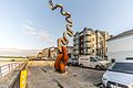 Denis o'connor sculpture, Waterford.jpg 7,952 × 5,304; 21.45 MB
-
 DENIS O’CONNOR’S SCULPTURE (GRATTAN QUAY WATERFORD).jpg 5,230 × 5,304; 18.21 MB
-
 Dense Undergrowth - geograph.org.uk - 5839642.jpg 800 × 600; 150 KB
-
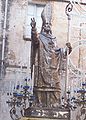 Desciption- Statue of St. Cataldo bishop (Taranto) (Taranto).jpg 343 × 480; 162 KB
-
 Detail showing damage to The Hansa (8660430642).jpg 2,000 × 2,011; 1.84 MB
-
 Dignity - Sunbed Malibu - geograph.org.uk - 3652227.jpg 640 × 480; 58 KB
-
 Doorway with hanging CCTV camera - geograph.org.uk - 3516748.jpg 427 × 640; 320 KB
-
 Dragon Slayer (49158127731).jpg 1,024 × 768; 200 KB
-
 Dry Channel - geograph.org.uk - 5839623.jpg 800 × 600; 99 KB
-
 Dunmore Road - geograph.org.uk - 3510236.jpg 640 × 427; 304 KB
-
 Dunnes Stores, Waterford - geograph.org.uk - 3746735.jpg 800 × 451; 204 KB
-
 Edmund Rice Bridge, Waterford (2016).jpg 6,000 × 4,000; 13.2 MB
-

-
 Entrance and Drive - geograph.org.uk - 5840395.jpg 800 × 600; 138 KB
-
 Entrance and Track - geograph.org.uk - 5839593.jpg 800 × 600; 157 KB
-
 Entrance to Duncannon Fort - geograph.org.uk - 1388536.jpg 640 × 480; 219 KB
-
 Entry of Waterford Crystal Building.jpg 2,272 × 1,704; 1.44 MB
-
 Estatua Waterford.jpg 3,456 × 2,304; 3.3 MB
-
 Estuary View - geograph.org.uk - 5839585.jpg 800 × 600; 141 KB
-
 Estuary View - geograph.org.uk - 5839600.jpg 800 × 600; 103 KB
-

-
 Fairy Houses at Magic Wood - geograph.org.uk - 5821606.jpg 800 × 600; 809 KB
-
 Farronshoneen Roundabout, Waterford - geograph.org.uk - 1476924.jpg 640 × 480; 97 KB
-
 Ferrybank bus, Waterford - geograph.org.uk - 3652383.jpg 640 × 480; 64 KB
-
 Ferrybank church Waterford.jpg 640 × 612; 349 KB
-
 Flyover on the N25 - geograph.org.uk - 5822026.jpg 800 × 600; 904 KB
-
 Forest Entrance - geograph.org.uk - 5839648.jpg 800 × 600; 128 KB
-
 Former harbour office, Waterford - geograph.org.uk - 3059768.jpg 640 × 390; 99 KB
-
 Francis Street - geograph.org.uk - 3510676.jpg 640 × 427; 289 KB
-

-
 Freight yard in Waterford - geograph.org.uk - 6121086.jpg 5,151 × 3,863; 5.04 MB
-
 From east, Waterford. County Waterford, Ireland-LCCN2002717444.tif 3,727 × 2,800; 29.86 MB
-
 From northwest, Waterford. County Waterford, Ireland-LCCN2002717445.tif 3,707 × 2,780; 29.49 MB
-
 Furry Friends (6321342465).jpg 1,235 × 945; 593 KB
-
 Gallery and pottery - geograph.org.uk - 1824327.jpg 640 × 427; 176 KB
-
 Ganoderma curtisii (Berk.) Murrill 794673.jpg 3,024 × 4,032; 3.15 MB
-
 Geoff's Café and Bar, Waterford - geograph.org.uk - 3652166.jpg 640 × 480; 54 KB
-
 Giant chessboard - geograph.org.uk - 5536854.jpg 640 × 480; 342 KB
-
 Gratton Quay-Waterford Greenway - geograph.org.uk - 5821367.jpg 800 × 600; 682 KB
-
 Grayfriar's, Waterford - geograph.org.uk - 5154859.jpg 2,000 × 1,333; 1.46 MB
-
 Green Seat - geograph.org.uk - 5839590.jpg 800 × 600; 182 KB
-

-
 H Samuel, Waterford - geograph.org.uk - 3652327.jpg 640 × 480; 58 KB
-
 Hall's silo, Waterford harbour - geograph.org.uk - 3778409.jpg 640 × 334; 50 KB
-
 Henrietta Walk - geograph.org.uk - 3516735.jpg 427 × 640; 318 KB
-
 Historical remarks of the city of Waterford Fleuron N033583-7.png 840 × 962; 62 KB
-
 Holy Trinity Cathedral, Waterford - geograph.org.uk - 3652359.jpg 640 × 480; 63 KB
-
 Holy Trinity Cathedral, Waterford - geograph.org.uk - 3746698.jpg 800 × 600; 274 KB
-
 Holy Trinity Church, Waterford - geograph.org.uk - 4684443.jpg 640 × 427; 48 KB
-
 House flag of the Waterford Steamship Company.svg 720 × 480; 2 KB
-
 House of Waterford Crystal - geograph.org.uk - 5536852.jpg 640 × 480; 249 KB
-
 House of Waterford Crystal - geograph.org.uk - 5820966.jpg 800 × 533; 510 KB
-
 House on Knockhouse Road, Waterford - geograph.org.uk - 1485457.jpg 640 × 480; 83 KB
-
 Houses at Bilberry - geograph.org.uk - 1823435.jpg 640 × 426; 155 KB
-
 Houses in Avondale Lawn, Waterford - geograph.org.uk - 1475122.jpg 640 × 480; 67 KB
-

-

-
 Hurling Clubhouse - geograph.org.uk - 3519727.jpg 640 × 427; 308 KB
-

-
 Ireland (6018300550).jpg 827 × 627; 190 KB
-

-
 Ireland-Drone-20171017-025 (23910182778).jpg 3,174 × 2,394; 789 KB
-

-

-
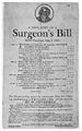 James Gillray, satirical broadside; Surgeons' Bill Wellcome M0010581.jpg 2,650 × 4,248; 3.2 MB
-
 John Condon Memorial -142707 (43764448901).jpg 7,952 × 5,304; 29.3 MB
-
 John Condon Memorial -142708 (43048728894).jpg 7,952 × 5,304; 27.67 MB
-
 John Condon Memorial in Waterford Ireland -142706 (42860548075).jpg 7,952 × 5,304; 34.39 MB
-
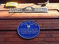
 John Moore Plaque - geograph.org.uk - 3579872.jpg 640 × 480; 68 KB
-
 John Roberts blue plaque.jpg 3,672 × 4,896; 6.15 MB
-
 John Roberts Square, Waterford. July 2016.jpg 5,184 × 3,888; 7.14 MB
-
 John Street, Waterford - geograph.org.uk - 3652178.jpg 640 × 480; 55 KB
-
 John's Bridge, Waterford - geograph.org.uk - 5821463.jpg 800 × 600; 711 KB
-
 John's Hill - geograph.org.uk - 3516758.jpg 640 × 640; 514 KB
-
 John's River, Waterford - geograph.org.uk - 5821422.jpg 800 × 600; 1,009 KB
-
 Johns River, Waterford - geograph.org.uk - 3652214.jpg 640 × 480; 52 KB
-
 Katiekim.jpg 579 × 878; 48 KB
-
 Kazbar Bar, Waterford - geograph.org.uk - 3652160.jpg 640 × 480; 57 KB
-
 Keyser sign, Waterford 2.jpg 1,200 × 900; 120 KB
-
 Keyser sign, Waterford.jpg 1,200 × 900; 91 KB
-
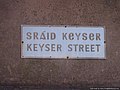
 Keyser Street sign.jpg 3,840 × 2,160; 1.3 MB
-
 Kilcohan Park Greyhound Stadium - geograph.org.uk - 1484067.jpg 621 × 640; 74 KB
-
 Kill St Lawrence, Waterford - geograph.org.uk - 1475667.jpg 640 × 480; 75 KB
-
 Kilmeadan Railway Station - geograph.org.uk - 264539.jpg 640 × 480; 115 KB
-
 Knitted Bicycle - geograph.org.uk - 5839605.jpg 800 × 600; 207 KB
-
 Lady Jane House, Waterford - geograph.org.uk - 3652263.jpg 640 × 480; 60 KB
-
 Lady Jane Street, Waterford - geograph.org.uk - 3652285.jpg 640 × 480; 52 KB
-
 Lady Lane, Waterford - geograph.org.uk - 4684369.jpg 640 × 427; 61 KB
-
 Lidl, off Dunmore Road, Ardkeen, Waterford - geograph.org.uk - 5449526.jpg 1,024 × 655; 106 KB
-
 Lidl, Tramore Road, Waterford - geograph.org.uk - 5449639.jpg 1,024 × 678; 153 KB
-
 Lime Kilns - geograph.org.uk - 5840402.jpg 800 × 600; 170 KB
-

-
 Lorry in Glenville. - commissioned by W. Power & Son, O'Connell Street, Waterford.jpg 2,000 × 1,541; 810 KB
-
 Low Tide - geograph.org.uk - 5839617.jpg 800 × 600; 89 KB
-
 Low Tide and Bridge - geograph.org.uk - 5839611.jpg 800 × 600; 73 KB
-

-

.jpg)


_-_geograph.org.uk_-_6091825.jpg)

.jpg)


.jpg)


.jpg)
.jpg)


.png)


.jpg)

_(Taranto).jpg)
.jpg)


.jpg)


.jpg)


.jpg)

_Murrill_794673.jpg)


.jpg)
.jpg)


.jpg)
.jpg)
.jpg)


