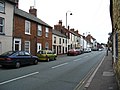
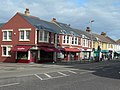
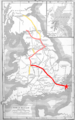
Category:Watling Street
Zur Navigation springen
Zur Suche springen

Altstraße in England _-_geograph.org.uk_-_373527.jpg)  | |||||
| Medium hochladen | |||||
| Ist ein(e) |
| ||||
|---|---|---|---|---|---|
| Ist Teil von | |||||
| Ort |
| ||||
| Länge |
| ||||
 | |||||
Unterkategorien
Es werden 11 von insgesamt 11 Unterkategorien in dieser Kategorie angezeigt:
In Klammern die Anzahl der enthaltenen Kategorien (K), Seiten (S), Dateien (D)
A
B
- Battle of Watling Street (8 D)
D
- Denbigh Hall railway bridge (8 D)
- Dow Bridge (6 D)
E
H
- High Cross, Leicestershire (5 D)
P
- Pear Tree Bridge, Oakengates (4 D)
S
- Stretton Aqueduct (13 D)
W
- Watling Street, Leintwardine (18 D)
Medien in der Kategorie „Watling Street“
Folgende 137 Dateien sind in dieser Kategorie, von 137 insgesamt.
-
 1911Watling Street.png 2.016 × 1.314; 169 KB
-
 A busy transport intersection - geograph.org.uk - 490131.jpg 640 × 477; 126 KB
-
 A lodge on Watling Street - geograph.org.uk - 723386.jpg 640 × 480; 92 KB
-
 A5 Watling Street - geograph.org.uk - 1219405.jpg 640 × 480; 194 KB
-
 A5 Watling Street - geograph.org.uk - 1264314.jpg 640 × 403; 51 KB
-
 A5 Watling Street - geograph.org.uk - 606684.jpg 640 × 458; 58 KB
-
 A5 Watling Street - geograph.org.uk - 670084.jpg 640 × 480; 76 KB
-
 A5 Watling Street and cycleway - geograph.org.uk - 672043.jpg 640 × 477; 82 KB
-
 A5 Watling Street at Hollow Farm - geograph.org.uk - 672008.jpg 640 × 506; 72 KB
-
 A5 Watling Street at Redgate - geograph.org.uk - 672062.jpg 640 × 538; 94 KB
-
 A5 Watling Street near Hinckley - geograph.org.uk - 670103.jpg 640 × 445; 72 KB
-
 A5 Watling Street near Mancetter - geograph.org.uk - 672067.jpg 640 × 452; 77 KB
-
 A5 Watling Street near Nuneaton - geograph.org.uk - 670122.jpg 640 × 466; 72 KB
-
 A5 Watling Street near Nuneaton - geograph.org.uk - 671997.jpg 640 × 493; 78 KB
-
 A5 Watling Street near Nuneaton - geograph.org.uk - 672012.jpg 640 × 437; 73 KB
-
 A5 Watling Street north of Markyate - geograph.org.uk - 657379.jpg 640 × 421; 45 KB
-
 A5 Watling Street towards Atherstone - geograph.org.uk - 672064.jpg 640 × 569; 93 KB
-

-
 A5 Watling Street, Nuneaton - geograph.org.uk - 670119.jpg 640 × 460; 70 KB
-
 Affetside Village Sign - panoramio.jpg 2.304 × 3.072; 2,95 MB
-
 Another bridge by Thomas Telford - geograph.org.uk - 857173.jpg 640 × 480; 65 KB
-
 Bittesby, Watling Street, A5 - geograph.org.uk - 1614348.jpg 640 × 480; 49 KB
-
 Bridleway, A5 Watling Street - geograph.org.uk - 1758344.jpg 1.024 × 768; 211 KB
-
 Colney Street, Watling Street - geograph.org.uk - 526626.jpg 640 × 480; 76 KB
-
 4-6, Watling Street.jpg 8.000 × 6.000; 10,49 MB
-
 Dartford, B2500 Watling Street - geograph.org.uk - 718702.jpg 640 × 480; 61 KB
-
 Dodford-Watling Street - geograph.org.uk - 118049.jpg 640 × 480; 82 KB
-
 Elstree, Watling Street - geograph.org.uk - 86008.jpg 640 × 480; 103 KB
-
 Frogmore - panoramio.jpg 3.008 × 2.000; 6,05 MB
-

-
 Hinckley, Leicestershire.jpg 1.280 × 1.000; 439 KB
-
 Houses, A5 Watling Street - geograph.org.uk - 1231572.jpg 640 × 428; 47 KB
-
 Houses, Watling Street, Thaxted - geograph.org.uk - 1363075.jpg 640 × 480; 105 KB
-

-

-

-
 Low bridge on Old Watling Street - geograph.org.uk - 1608982.jpg 640 × 480; 179 KB
-
 Markyate, The High Street - geograph.org.uk - 168511.jpg 640 × 480; 78 KB
-
 Markyate, The High Street - geograph.org.uk - 168514.jpg 640 × 480; 78 KB
-
 Midlands Watling Street.png 400 × 347; 94 KB
-
 Muckley Corner - geograph.org.uk - 771266.jpg 640 × 480; 78 KB
-

-
 Northwest along the A5 Watling Street - geograph.org.uk - 672055.jpg 640 × 450; 73 KB
-
 Ordnance Survey Sheet SP 74 Stony Stratford, Published 1955.jpg 7.435 × 7.853; 19,19 MB
-
 Ordnance Survey Sheet SP 83 Bletchley, Published 1956.jpg 7.404 × 7.536; 4,18 MB
-
 Radlett, The Oakway, Watling Street - geograph.org.uk - 1263065.jpg 640 × 480; 74 KB
-
 Radlett, Watling Street (1) - geograph.org.uk - 65195.jpg 640 × 425; 91 KB
-
 Radlett, Watling Street (2) - geograph.org.uk - 65199.jpg 640 × 425; 91 KB
-
 Radlett, Watling Street - geograph.org.uk - 89387.jpg 640 × 480; 120 KB
-
 Reconstruction of the London Gate, Verulamium, St Albans (16418078565).jpg 4.928 × 3.264; 6,9 MB
-
 Redway along Watling Street - geograph.org.uk - 2881513.jpg 1.600 × 1.066; 514 KB
-
 Remains of the London Gate, St Albans - geograph.org.uk - 4168495.jpg 1.024 × 680; 361 KB
-
 Scots Watling Street.png 1.000 × 882; 562 KB
-

-
-
 Shopping Parade, Watling Street, A2 - geograph.org.uk - 1146799.jpg 640 × 430; 56 KB
-
 Southeast along the A5 Watling Street - geograph.org.uk - 620643.jpg 640 × 415; 58 KB
-
 Southeast along the A5 Watling Street - geograph.org.uk - 672004.jpg 640 × 471; 66 KB
-
 Southeast along the A5 Watling Street - geograph.org.uk - 672057.jpg 640 × 426; 64 KB
-
 St. Paul's from Watling Street - geograph.org.uk - 525142.jpg 640 × 427; 79 KB
-
 Stretford.jpg 2.000 × 1.813; 3,43 MB
-

-
 The Bell Inn on Watling Street - geograph.org.uk - 857172.jpg 640 × 480; 61 KB
-
 The inscription on the Affetside cross. - panoramio.jpg 3.072 × 2.304; 3,08 MB
-
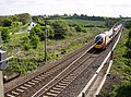
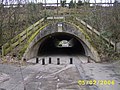
 The old A5 (Watling Street) - geograph.org.uk - 373527.jpg 640 × 480; 175 KB
-

-
 Watford Gap - geograph.org.uk - 86401.jpg 640 × 480; 63 KB
-
 Watling St (December 2007) - geograph.org.uk - 626972.jpg 640 × 480; 78 KB
-
 Watling Street (Roman Road), Affetside - geograph.org.uk - 2506354.jpg 1.280 × 960; 665 KB
-
 Watling street - geograph.org.uk - 117507.jpg 640 × 480; 137 KB
-
 Watling Street - geograph.org.uk - 200774.jpg 640 × 480; 147 KB
-
 Watling Street - geograph.org.uk - 200782.jpg 640 × 480; 114 KB
-
 Watling Street - geograph.org.uk - 421856.jpg 640 × 480; 147 KB
-
 Watling Street - geograph.org.uk - 746855.jpg 537 × 567; 146 KB
-
 Watling Street - geograph.org.uk - 774778.jpg 480 × 640; 66 KB
-
 Watling Street - geograph.org.uk - 846193.jpg 640 × 427; 67 KB
-
 Watling Street - geograph.org.uk - 847752.jpg 640 × 480; 74 KB
-
 Watling Street - geograph.org.uk - 857170.jpg 640 × 480; 58 KB
-
 Watling Street - geograph.org.uk - 938362.jpg 640 × 409; 71 KB
-
 Watling Street - the A5 - geograph.org.uk - 1072908.jpg 640 × 480; 61 KB
-

-
 Watling Street at Crackleybank - geograph.org.uk - 747963.jpg 640 × 480; 49 KB
-
 Watling Street at Richborough Castle.jpg 3.208 × 2.704; 3,34 MB
-

-
 Watling Street at Weston - geograph.org.uk - 748004.jpg 640 × 480; 81 KB
-
 Watling Street at Wroxeter (6995).jpg 4.288 × 2.848; 6,83 MB
-
 Watling Street at Wroxeter (7076).jpg 4.288 × 2.848; 6,42 MB
-
 Watling Street by The Horseshoe Inn - geograph.org.uk - 723385.jpg 640 × 480; 67 KB
-
 Watling Street goes beneath the A5 - geograph.org.uk - 787134.jpg 640 × 426; 55 KB
-
 Watling Street houses - geograph.org.uk - 846177.jpg 640 × 427; 69 KB
-
 Watling Street near Stoke Wood - geograph.org.uk - 1495939.jpg 640 × 427; 97 KB
-
 Watling Street near Stoke Wood - geograph.org.uk - 1495945.jpg 640 × 427; 77 KB
-
 Watling Street near Stoke Wood - geograph.org.uk - 1495957.jpg 640 × 427; 77 KB
-
 Watling Street near Wroxeter - geograph.org.uk - 723390.jpg 640 × 480; 50 KB
-
 Watling Street Northamptonshire.jpg 640 × 480; 109 KB
-
 Watling Street plaque Kilburn.jpg 1.936 × 1.288; 284 KB
-
 Watling Street Richborough.jpg 480 × 640; 76 KB
-
 Watling Street route.jpg 762 × 517; 300 KB
-
 Watling Street sign in Canterbury.jpg 2.926 × 2.310; 2,12 MB
-
 Watling Street Towcester 2008 05 18.jpg 3.958 × 2.138; 1,39 MB
-
 Watling Street View - geograph.org.uk - 1448850.jpg 480 × 640; 73 KB
-
 Watling Street West - geograph.org.uk - 245671.jpg 640 × 480; 99 KB
-
 Watling Street West, Towcester - geograph.org.uk - 454821.jpg 640 × 466; 78 KB
-
 Watling Street West, Towcester - geograph.org.uk - 473869.jpg 640 × 480; 84 KB
-
 Watling Street, Gillingham (1) - geograph.org.uk - 737161.jpg 640 × 480; 76 KB
-
 Watling Street, Gillingham (2) - geograph.org.uk - 737162.jpg 640 × 480; 76 KB
-
 Watling Street, Luton, Chatham - geograph.org.uk - 1572567.jpg 640 × 480; 53 KB
-
 Watling Street, Redbourn - geograph.org.uk - 956922.jpg 640 × 480; 78 KB
-
 Watling Street, Wall - geograph.org.uk - 1496890.jpg 640 × 480; 71 KB
-
 Watling Streets.png 854 × 1.364; 1,03 MB
-
 Welsh Watling Street.png 350 × 501; 110 KB
-
 West along Watling Street - geograph.org.uk - 747973.jpg 640 × 480; 62 KB
-
 White Gate Farm - geograph.org.uk - 622080.jpg 480 × 640; 70 KB
-

-
 A5 near Astcote - geograph.org.uk - 189181.jpg 640 × 480; 86 KB
-
 A5 Watling Street - geograph.org.uk - 616894.jpg 640 × 459; 49 KB
-
 A5 Watling Street - geograph.org.uk - 619279.jpg 640 × 433; 79 KB
-
 A5 Watling Street - geograph.org.uk - 619624.jpg 640 × 424; 69 KB
-
 A5 Watling Street - geograph.org.uk - 657813.jpg 640 × 504; 111 KB
-
 A5 Watling Street - geograph.org.uk - 657821.jpg 640 × 431; 94 KB
-
 A5 Watling Street - geograph.org.uk - 659624.jpg 640 × 449; 103 KB
-
 A5 Watling Street - geograph.org.uk - 659625.jpg 640 × 442; 87 KB
-
 A5 Watling Street - geograph.org.uk - 659632.jpg 640 × 552; 92 KB
-

-
 A5 Watling Street towards Wibtoft - geograph.org.uk - 619254.jpg 640 × 482; 93 KB
-
 B5061 (Watling Street) - geograph.org.uk - 809800.jpg 640 × 480; 52 KB
-
 Layby on the A5 Watling Street - geograph.org.uk - 657778.jpg 640 × 484; 81 KB
-
 Northwest along the A5 Watling Street - geograph.org.uk - 619547.jpg 640 × 480; 67 KB
-
 Old Watling Street, Strood - geograph.org.uk - 323102.jpg 640 × 480; 48 KB
-
 Roundabout on the A5 Watling Street - geograph.org.uk - 672017.jpg 640 × 502; 84 KB
-
 The A5 Watling Street - geograph.org.uk - 619248.jpg 640 × 423; 53 KB
-
 The A5 Watling Street towards Wibtoft - geograph.org.uk - 619269.jpg 640 × 403; 60 KB
-
 Watling Street - geograph.org.uk - 10100.jpg 480 × 640; 215 KB
-
 Watling Street - geograph.org.uk - 200788.jpg 640 × 480; 139 KB
-
 Watling Street - geograph.org.uk - 437770.jpg 640 × 480; 129 KB
-
 Watling Street at Dordon - geograph.org.uk - 210833.jpg 640 × 480; 37 KB
-


,_Kilsby_-_geograph.org.uk_-_1545145.jpg)


_-_geograph.org.uk_-_65195.jpg)
_-_geograph.org.uk_-_65199.jpg)

.jpg)


_-_geograph.org.uk_-_1146802.jpg)
_-_geograph.org.uk_-_1146807.jpg)


_Watling_Street_-_geograph.org.uk_-_1231580.jpg)

_-_geograph.org.uk_-_626972.jpg)
,_Affetside_-_geograph.org.uk_-_2506354.jpg)


.jpg)
.jpg)


_-_geograph.org.uk_-_737161.jpg)
_-_geograph.org.uk_-_737162.jpg)


_-_the_site_viewed_from_the_original_Watling_Street_-_geograph.org.uk_-_1935667.jpg)


_-_geograph.org.uk_-_809800.jpg)


