Category:Wattston
Aller à la navigation
Aller à la recherche
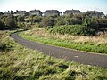
English: Wattston is a village adjoining Greengairs in North Lanarkshire, Scotland. It is around 4km south of Cumbernauld, and has a convenience store and a building merchants.
village britannique  | |||||
| Téléverser des médias | |||||
| Nature de l’élément | |||||
|---|---|---|---|---|---|
| Lieu |
| ||||
| Population |
| ||||
 | |||||
Sous-catégories
Cette catégorie comprend 4 sous-catégories, dont les 4 ci-dessous.
Média dans la catégorie « Wattston »
Cette catégorie comprend 15 fichiers, dont les 15 ci-dessous.
-
 Bridge over the Cameron Burn - geograph.org.uk - 1550034.jpg 640 × 480 ; 148 kio
-
 Cameron Road - geograph.org.uk - 1550027.jpg 640 × 480 ; 91 kio
-
 Colliery road, Meikle Drumgray - geograph.org.uk - 1501008.jpg 640 × 480 ; 123 kio
-
 Drumgray Lane, Wattston - geograph.org.uk - 990773.jpg 640 × 480 ; 62 kio
-
 Entrance to Wattston - geograph.org.uk - 3485050.jpg 640 × 468 ; 76 kio
-
 Greengairs Road - geograph.org.uk - 3638872.jpg 640 × 416 ; 306 kio
-
 Greengairs Road - geograph.org.uk - 3638875.jpg 640 × 427 ; 333 kio
-
 Housing at Wattson in North Lanarkshire - geograph.org.uk - 2801139.jpg 640 × 480 ; 48 kio
-
 Industrial Entrance - geograph.org.uk - 3638862.jpg 640 × 427 ; 349 kio
-
 Meikle Drumgray - geograph.org.uk - 3638879.jpg 640 × 427 ; 389 kio
-
 Meikle Drumgray Rd, Wattston - geograph.org.uk - 990774.jpg 640 × 480 ; 41 kio
-
 Meikle Drumgray Road - geograph.org.uk - 1772987.jpg 768 × 576 ; 97 kio
-
 Near Meikle Drumgray - geograph.org.uk - 3638884.jpg 640 × 427 ; 387 kio
-
 Wattson, bypass - geograph.org.uk - 2456947.jpg 1 024 × 768 ; 96 kio
-
 Wattston from Standrigg Memorial Park - geograph.org.uk - 1501751.jpg 640 × 480 ; 138 kio


