Category:Wayland, Massachusetts
Vai alla navigazione
Vai alla ricerca
comune statunitense del Massachusetts   | |||||
| Carica un file multimediale | |||||
| Istanza di | |||||
|---|---|---|---|---|---|
| Parte di | |||||
| Luogo | contea di Middlesex, Massachusetts, Stati Uniti d'America | ||||
| Data di fondazione o creazione |
| ||||
| Popolazione |
| ||||
| Superficie |
| ||||
| Altezza sul mare |
| ||||
| sito web ufficiale | |||||
 | |||||
Sottocategorie
Questa categoria contiene le 11 sottocategorie indicate di seguito, su un totale di 11.
File nella categoria "Wayland, Massachusetts"
Questa categoria contiene 44 file, indicati di seguito, su un totale di 44.
-

-
 86 old sudbury rd - panoramio.jpg 400 × 300; 40 KB
-

-
 B 16, MCRT Wayside, Wayland MA.jpg 4 032 × 3 024; 6,67 MB
-
 Broomstones Curling Club, Wayland MA.jpg 3 264 × 2 448; 1,74 MB
-
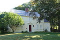
 Captain Edward Pousland House - Wayland, Massachusetts - DSC00219.JPG 4 320 × 3 240; 4,87 MB
-
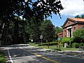
 Claypit Hill School, Wayland MA.jpg 3 264 × 2 448; 1,87 MB
-
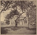
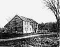 EdmundRiceHome1643.jpg 638 × 499; 147 KB
-
 Former Collins Market, Wayland MA.jpg 3 264 × 2 448; 2,77 MB
-
 Former site of Tower Hill station, August 2015.JPG 4 320 × 3 240; 3,64 MB
-
 Grout-Heard House, c. 1740 - Wayland, Massachusetts - DSC02227.JPG 5 472 × 3 648; 13,46 MB
-
 Hopestill Bent Tavern, Wayland MA.jpg 2 816 × 2 112; 2,24 MB
-
 Islamic Center of Boston - Wayland, MA - DSC00185.jpg 4 320 × 2 895; 3,37 MB
-
 KnoxTrailMarkerWayland.jpg 5 184 × 3 456; 11,32 MB
-
 Little Free Library, Russells Garden Center, Wayland MA.jpg 4 032 × 3 024; 4,55 MB
-
 MA Route 126 northbound in Wayland MA.jpg 2 272 × 1 704; 1,13 MB
-

-
 Old Connecticut Path, Wayland MA.jpg 3 072 × 2 304; 3,04 MB
-

-
-

-

-
 Seal of Wayland, Massachusetts.png 471 × 471; 389 KB
-

-
 View of Nobscot Hill in Framingham from Wayland MA.jpg 2 272 × 1 704; 1,42 MB
-
 Vokes Theatre, Wayland MA.jpg 3 072 × 2 304; 2,44 MB
-
 Wayland - Town Building.JPG 640 × 320; 78 KB
-
 Wayland ma highlight.png 788 × 466; 55 KB
-
 Wayland MA Town Center Aerial.jpg 6 000 × 4 000; 11,66 MB
-
 Wayland Public Library, Wayland MA.jpg 3 264 × 2 448; 2,74 MB
-
 Wayland Routes 20&27 Flooding, March 31, 2010 (4482131216).jpg 800 × 600; 99 KB
-
 Wayland, Burke's corner - DPLA - cd406e8fd9080deafdaff96e7d511f61.jpg 831 × 800; 194 KB
-

-

-

-

-
-
 WaylandMA NoyesParrisHouse.jpg 1 024 × 680; 232 KB
-

-
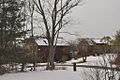
 WestonAqueduct HappyHollowEastSiphonHouse.jpg 1 024 × 680; 264 KB
-
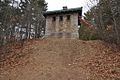
 WestonAqueduct HappyHollowWestSiphonHouse1.jpg 1 024 × 680; 267 KB
-
 WestonAqueduct HappyHollowWestSiphonHouse2.jpg 1 024 × 680; 306 KB
-
 WestonAqueduct SudburyRiverBridge.jpg 1 036 × 688; 183 KB
-
 WestonAqueduct WaylandMA.jpg 1 024 × 680; 247 KB


.jpg)


