Category:Weasenham All Saints
Aller à la navigation
Aller à la recherche
localité britannique du comté anglais de Norfolk  | |||||
| Téléverser des médias | |||||
| Nature de l’élément | |||||
|---|---|---|---|---|---|
| Lieu | Breckland, Norfolk, Angleterre de l'Est, Angleterre | ||||
| Superficie |
| ||||
 | |||||
Sous-catégories
Cette catégorie comprend 4 sous-catégories, dont les 4 ci-dessous.
Média dans la catégorie « Weasenham All Saints »
Cette catégorie comprend 101 fichiers, dont les 101 ci-dessous.
-
 A1065 road through Weasenham All Saints - geograph.org.uk - 4256765.jpg 560 × 640 ; 163 kio
-
 A1065 southbound in New Wood - geograph.org.uk - 3632150.jpg 640 × 482 ; 97 kio
-
 A1065 towards Swaffham - geograph.org.uk - 5556840.jpg 640 × 437 ; 72 kio
-
 A1065, Minque Wood - geograph.org.uk - 3830174.jpg 640 × 430 ; 105 kio
-
 A1065-Common End junction - geograph.org.uk - 3632143.jpg 640 × 480 ; 78 kio
-
 Autumn colours beside the A1065 road - geograph.org.uk - 4256782.jpg 640 × 582 ; 274 kio
-

-
 Bend in A1065 road to Weasenham All Saints - geograph.org.uk - 4256773.jpg 640 × 480 ; 209 kio
-
 Berries on hawthorn hedge - geograph.org.uk - 4228827.jpg 640 × 571 ; 345 kio
-
 Big lorry past Sawmill Wood - geograph.org.uk - 4256816.jpg 640 × 480 ; 227 kio
-

-
 Cereal crop north of Sawmill Wood - geograph.org.uk - 4256778.jpg 640 × 480 ; 144 kio
-
 Common End - geograph.org.uk - 4256808.jpg 640 × 480 ; 262 kio
-
 Cottages, Weasenham St Peter - geograph.org.uk - 5556832.jpg 640 × 480 ; 66 kio
-
 Crop field south of Tythe Farm - geograph.org.uk - 4228887.jpg 640 × 371 ; 113 kio
-
 Crop fields by Kipton Heath - geograph.org.uk - 4228830.jpg 640 × 480 ; 206 kio
-
 Crop fields south of Kipton Heath - geograph.org.uk - 4228824.jpg 640 × 480 ; 152 kio
-
 Crossroad, Weasenham St Peter - geograph.org.uk - 5586882.jpg 640 × 480 ; 86 kio
-
 Crossroads by Tythe Farm - geograph.org.uk - 4228888.jpg 640 × 480 ; 170 kio
-
 Crossroads near Tythe Farm - geograph.org.uk - 5556801.jpg 640 × 480 ; 92 kio
-
 Cultivated field by Tythe Farm - geograph.org.uk - 4228882.jpg 640 × 480 ; 192 kio
-
 Cultivated field north of All Saints' church - geograph.org.uk - 1869693.jpg 640 × 480 ; 147 kio
-
 Disused marlpit with Sly's Plantation beyond - geograph.org.uk - 532480.jpg 640 × 480 ; 89 kio
-
 Entering Weasenham, A1065 - geograph.org.uk - 3830176.jpg 640 × 430 ; 105 kio
-
 Extreeme Adventure centre - geograph.org.uk - 2282739.jpg 760 × 570 ; 355 kio
-
 Farm track east of Great Massingham, Norfolk - geograph.org.uk - 4272114.jpg 4 320 × 3 240 ; 5,46 Mio
-

-
 Farmland north of The Belt - geograph.org.uk - 4272364.jpg 4 320 × 3 240 ; 6,07 Mio
-
 Farmland track east of Great Massingham - geograph.org.uk - 4272205.jpg 4 320 × 3 240 ; 5,85 Mio
-
 Farmland track near High House, Weasenham All Saints. - geograph.org.uk - 4272405.jpg 4 320 × 3 240 ; 5,47 Mio
-
 Farmland west of Weasenham St Peter, Norfolk - geograph.org.uk - 4272309.jpg 4 320 × 3 240 ; 5,36 Mio
-
 Field and hedgerow near Tythe Farm - geograph.org.uk - 5556803.jpg 640 × 480 ; 85 kio
-
 Field near Tythe Farm - geograph.org.uk - 5556809.jpg 640 × 480 ; 59 kio
-
 Field, Weasenham - geograph.org.uk - 5556820.jpg 640 × 480 ; 63 kio
-
 Former Ostrich Inn, Weasenham All Saints, 2009-03-09.JPG 2 560 × 1 920 ; 3,43 Mio
-
 Green lane and emerging cereal crop - geograph.org.uk - 4272391.jpg 4 320 × 3 240 ; 5,51 Mio
-
 Hawthorn hedge beside Weasenham Road - geograph.org.uk - 4228828.jpg 640 × 480 ; 237 kio
-
 Houses on School Road, Weasenham St Peter - geograph.org.uk - 5556837.jpg 640 × 480 ; 94 kio
-
 Landscape NW of Weasenham All Saints, Norfolk - geograph.org.uk - 123804.jpg 640 × 480 ; 347 kio
-
 Lane through Minque Wood - geograph.org.uk - 4038866.jpg 4 320 × 3 240 ; 6,19 Mio
-
 Marl pit near High House, Weasenham All Saints - geograph.org.uk - 4272399.jpg 4 320 × 3 240 ; 5,8 Mio
-
 Massingham Road towards Weasenham St Peter - geograph.org.uk - 5556817.jpg 640 × 480 ; 73 kio
-
 Massingham Road, Weasenham - geograph.org.uk - 4561966.jpg 640 × 480 ; 126 kio
-
 Massingham Road, Weasenham St Peter - geograph.org.uk - 5556831.jpg 640 × 480 ; 73 kio
-
 Minor road past Sawmill Wood - geograph.org.uk - 4256813.jpg 640 × 480 ; 239 kio
-
 Minor road past Weasenham Lyngs - geograph.org.uk - 4256796.jpg 640 × 480 ; 169 kio
-
 Minor road towards Weasenham - geograph.org.uk - 5556792.jpg 640 × 480 ; 112 kio
-
 Minor roads crossing the A1065 road - geograph.org.uk - 4256791.jpg 640 × 480 ; 253 kio
-
 No more pints^ - geograph.org.uk - 542249.jpg 640 × 480 ; 94 kio
-
 Old wall of Weasenham Hall - geograph.org.uk - 4272426.jpg 4 320 × 3 240 ; 5,39 Mio
-
 On the edge of Sawmill Wood - geograph.org.uk - 4256786.jpg 640 × 480 ; 242 kio
-
 Ornate entrance gate at Roseberry House - geograph.org.uk - 4228923.jpg 640 × 480 ; 215 kio
-
 Ornate entrance gate at Roseberry House - geograph.org.uk - 4228926.jpg 640 × 602 ; 243 kio
-

-
 Road through Weasenham All Saints - geograph.org.uk - 4228927.jpg 640 × 480 ; 175 kio
-
 Rudham-Harpley roads junction - geograph.org.uk - 4228684.jpg 640 × 480 ; 189 kio
-
 Rural crossroads by Weasenham Lyngs - geograph.org.uk - 4256806.jpg 640 × 480 ; 174 kio
-
 Sawmill Wood next to Weasenham Lyngs Norfolk - geograph.org.uk - 4272353.jpg 4 320 × 3 240 ; 5,83 Mio
-
 School Road, Weasenham - geograph.org.uk - 5579717.jpg 640 × 480 ; 74 kio
-

-
 Sugar beet near Hall Farm, Weasenham All Saints - geograph.org.uk - 4272418.jpg 4 320 × 3 240 ; 5,59 Mio
-
 The A1065 road past Sawmill Wood - geograph.org.uk - 4256787.jpg 640 × 480 ; 241 kio
-
 The Great Barrow (Bronze Age bell barrow) - geograph.org.uk - 4256827.jpg 640 × 382 ; 107 kio
-
 The Great Barrow (Bronze Age bell barrow) - geograph.org.uk - 4256828.jpg 640 × 432 ; 142 kio
-
 The Great Barrow (Bronze Age bell barrow) - geograph.org.uk - 4256830.jpg 640 × 480 ; 240 kio
-
 The Great Barrow (Bronze Age bell barrow) - geograph.org.uk - 4256833.jpg 640 × 480 ; 263 kio
-
 The Great Barrow (Bronze Age bell barrow) - geograph.org.uk - 4256836.jpg 640 × 480 ; 206 kio
-
 The Great Barrow (Bronze Age bell barrow) - geograph.org.uk - 4256837.jpg 640 × 480 ; 177 kio
-
 The Ostrich (sign) - geograph.org.uk - 4256766.jpg 516 × 640 ; 165 kio
-
 The Ostrich Inn (detail) - geograph.org.uk - 4256760.jpg 640 × 516 ; 230 kio
-
 The Ostrich Inn - geograph.org.uk - 4256755.jpg 640 × 480 ; 161 kio
-
 The Ostrich Inn - geograph.org.uk - 4256756.jpg 640 × 480 ; 158 kio
-
 The Ostrich Inn - geograph.org.uk - 4256757.jpg 640 × 480 ; 146 kio
-
 The Ostrich Inn - geograph.org.uk - 4256758.jpg 640 × 480 ; 140 kio
-
 The southern edge of Sawmill Wood - geograph.org.uk - 4256799.jpg 640 × 480 ; 203 kio
-
 Track to Hall Farm - geograph.org.uk - 4228916.jpg 640 × 480 ; 216 kio
-
 Tractor on the A1065 at Weasenham All Saints - geograph.org.uk - 4634293.jpg 640 × 480 ; 388 kio
-
 Tumulus on Weasenham Lyngs - geograph.org.uk - 2282798.jpg 760 × 570 ; 204 kio
-
 Tumulus on Weasenham Lyngs in Norfolk - geograph.org.uk - 4272351.jpg 4 320 × 3 240 ; 5,7 Mio
-
 Tythe Farm west of Weasenham St Peter, Norfolk - geograph.org.uk - 4272320.jpg 4 320 × 3 240 ; 5,47 Mio
-
 Tythe Farm, at Weasenham St. Peter - geograph.org.uk - 4561950.jpg 640 × 480 ; 159 kio
-
 View across Weasenham Lyngs - geograph.org.uk - 4256794.jpg 640 × 480 ; 148 kio
-
 View along Weasenham Road - geograph.org.uk - 4228820.jpg 640 × 480 ; 253 kio
-
 View south along the A1065 road - geograph.org.uk - 4256764.jpg 631 × 640 ; 228 kio
-
 View towards Brereton's Covert - geograph.org.uk - 4256775.jpg 640 × 480 ; 162 kio
-
 Wall surrounding Roseberry House - geograph.org.uk - 4228920.jpg 640 × 595 ; 226 kio
-
 Weasenham Lyngs - geograph.org.uk - 4256801.jpg 640 × 480 ; 125 kio
-
 Weasenham village sign (detail) - geograph.org.uk - 4561990.jpg 3 456 × 2 592 ; 3,84 Mio
-
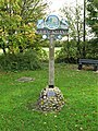
 Weasenham village sign - geograph.org.uk - 4561985.jpg 640 × 480 ; 229 kio
-
 Weasenham Village Sign - geograph.org.uk - 5586891.jpg 480 × 640 ; 143 kio
-
 Weasenham Woods - geograph.org.uk - 2282785.jpg 760 × 570 ; 381 kio
-

-
 Wood and crop field at Rougham End - geograph.org.uk - 4228918.jpg 640 × 480 ; 176 kio
-
 Wooded marl pit east of Great Massingham airfield - geograph.org.uk - 4272123.jpg 4 320 × 3 240 ; 5,96 Mio
-
 Farm track near Weasenham - geograph.org.uk - 504473.jpg 640 × 427 ; 64 kio
-
 Farm track near Weasenham - geograph.org.uk - 504474.jpg 427 × 640 ; 77 kio
-
 Farm track, Weasenham All Saints, Norfolk - geograph.org.uk - 123813.jpg 640 × 480 ; 304 kio
-
 Farmland NW of Weasenham All Saints, Norfolk - geograph.org.uk - 123800.jpg 640 × 480 ; 324 kio
-
 Overgrown marlpit, Weasenham All Saints, Norfolk - geograph.org.uk - 123811.jpg 640 × 480 ; 276 kio
-
 Overgrown marlpit, Weasenham All Saints, Norfolk - geograph.org.uk - 123820.jpg 640 × 480 ; 314 kio
-
 Subsoiler slits, Weasenham All Saints, Norfolk - geograph.org.uk - 123810.jpg 640 × 480 ; 410 kio


_-_geograph.org.uk_-_4256827.jpg)
_-_geograph.org.uk_-_4256828.jpg)
_-_geograph.org.uk_-_4256830.jpg)
_-_geograph.org.uk_-_4256833.jpg)
_-_geograph.org.uk_-_4256836.jpg)
_-_geograph.org.uk_-_4256837.jpg)
_-_geograph.org.uk_-_4256766.jpg)
_-_geograph.org.uk_-_4256760.jpg)


_-_geograph.org.uk_-_4561990.jpg)


