Category:Welshpool
Vai alla navigazione
Vai alla ricerca
comunità del Galles  | |||||
| Carica un file multimediale | |||||
| Istanza di | |||||
|---|---|---|---|---|---|
| Luogo | Powys, Galles | ||||
| Situato sul mare / lago / fiume | |||||
| Popolazione |
| ||||
 | |||||
Cymraeg: Mae'r Trallwng ( Saesneg: Welshpool) yn dref yng ngogledd-ddwyrain Powys, ger y ffin â Lloegr.
Deutsch: Welshpool (walisisch: Y Trallwng) ist eine Stadt in der walisischen Grafschaft Powys; sie liegt im Tal des Flusses Severn und besitzt seit 1263 Marktrecht.
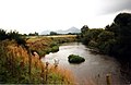
English: Welshpool (Welsh: Y Trallwng) is a town in the northeast of Powys, not far from the Wales-England border. The town is low-lying on the River Severn; the Welsh language name literally meaning 'the marshy or sinking land'.
Sottocategorie
Questa categoria contiene le 11 sottocategorie indicate di seguito, su un totale di 11.
*
B
- Beacon Ring (10 F)
- Belan, Powys (14 F)
L
- Welshpool livestock market (20 F)
- Llanerchydol (4 F)
P
S
T
W
File nella categoria "Welshpool"
Questa categoria contiene 200 file, indicati di seguito, su un totale di 991.
(pagina precedente) (pagina successiva)-
 "Anderson Shelter", Dingle Gardens - geograph.org.uk - 2605494.jpg 640 × 480; 121 KB
-
 "Fame" - geograph.org.uk - 4288094.jpg 800 × 531; 78 KB
-
 'Countess' at Welshpool - geograph.org.uk - 5881439.jpg 1 280 × 851; 488 KB
-
 'Countess' at Welshpool - geograph.org.uk - 5881442.jpg 1 280 × 851; 436 KB
-
 'Countess' at Welshpool - geograph.org.uk - 5881446.jpg 1 280 × 851; 445 KB
-
 Winifred Maxwell, Countess of Nithsdale.jpg 488 × 600; 56 KB
-
 7 and 8 Union Street, Welshpool - geograph.org.uk - 5658100.jpg 4 590 × 3 060; 2,86 MB
-
 9 Church Street, Welshpool - geograph.org.uk - 5658084.jpg 5 472 × 3 648; 6,47 MB
-
-
 A cock in the Cockpit - geograph.org.uk - 6009884.jpg 1 024 × 768; 206 KB
-

-
 A field of maize near Sarn-y-bryn-caled - geograph.org.uk - 3155722.jpg 3 872 × 2 592; 1,91 MB
-
 A Powis Peacock - geograph.org.uk - 5272514.jpg 3 675 × 2 440; 2,98 MB
-
 A. C. Roof Trusses - geograph.org.uk - 4633088.jpg 640 × 426; 52 KB
-
 A.C. Roof Trusses, Welshpool - geograph.org.uk - 4720869.jpg 800 × 493; 86 KB
-
 A458 Approaching Welshpool - geograph.org.uk - 5492655.jpg 640 × 480; 394 KB
-
 A458 at New Lane junction - geograph.org.uk - 4824951.jpg 640 × 458; 61 KB
-
 A458 near Coed-y-dinas - geograph.org.uk - 5492635.jpg 640 × 480; 415 KB
-
 A458 Salop Road at Waterloo Place - geograph.org.uk - 3959163.jpg 640 × 481; 56 KB
-
 A458 Welshpool bypass - geograph.org.uk - 4498361.jpg 1 600 × 1 200; 1,28 MB
-
 A483 - geograph.org.uk - 4437781.jpg 640 × 426; 58 KB
-
 A483 - geograph.org.uk - 4437787.jpg 640 × 426; 71 KB
-
 A483 - geograph.org.uk - 4437788.jpg 640 × 426; 58 KB
-
 A483 - geograph.org.uk - 4437789.jpg 640 × 426; 73 KB
-
 A483 - geograph.org.uk - 4437790.jpg 640 × 426; 65 KB
-
 A483 - geograph.org.uk - 4437805.jpg 640 × 426; 75 KB
-
 A483 - geograph.org.uk - 4437837.jpg 640 × 426; 67 KB
-
 A483 at Pool Quay village boundary - geograph.org.uk - 3289652.jpg 640 × 481; 43 KB
-
 A483 at Pool Quay, Powys - geograph.org.uk - 1921330.jpg 1 024 × 768; 236 KB
-
 A483 heading north - geograph.org.uk - 3289554.jpg 640 × 480; 44 KB
-
 A483 heading north - geograph.org.uk - 3959179.jpg 640 × 480; 45 KB
-
 A483 Leaving Welshpool - geograph.org.uk - 5498375.jpg 640 × 480; 311 KB
-
 A483 near Buttington - geograph.org.uk - 5498388.jpg 640 × 480; 409 KB
-
 A483 near Coed-Y-Dinas - geograph.org.uk - 5491741.jpg 640 × 427; 327 KB
-
 A483 near Court Farm - geograph.org.uk - 3289532.jpg 640 × 480; 64 KB
-
 A483 near Moors Farm - geograph.org.uk - 5498392.jpg 640 × 480; 393 KB
-
 A483 near The Moat Farm - geograph.org.uk - 3289549.jpg 640 × 480; 34 KB
-
 A483 near to Llwynderw - geograph.org.uk - 5491735.jpg 640 × 480; 416 KB
-
 A483 near to Pool Quay - geograph.org.uk - 5501285.jpg 640 × 480; 359 KB
-
 A483 near Weir End - geograph.org.uk - 3289650.jpg 640 × 481; 54 KB
-
 A483 near Welshpool - geograph.org.uk - 5498378.jpg 640 × 480; 380 KB
-
 A483 near Wernllwyd - geograph.org.uk - 3289517.jpg 640 × 480; 51 KB
-
 A483 north east of Welshpool - geograph.org.uk - 2227932.jpg 640 × 480; 50 KB
-
 A483 north of Pool Quay - geograph.org.uk - 3289654.jpg 640 × 480; 62 KB
-
 A483 north of Pool Quay - geograph.org.uk - 5501291.jpg 640 × 480; 356 KB
-
 A483 north of Welshpool - geograph.org.uk - 5498380.jpg 640 × 480; 302 KB
-
 A483 through the trees - geograph.org.uk - 4437838.jpg 640 × 426; 94 KB
-
 A483 Welshpool bypass looking north - geograph.org.uk - 2227927.jpg 640 × 480; 55 KB
-
 A483, Pool Quay - geograph.org.uk - 5501287.jpg 640 × 480; 394 KB
-
 A490 at entrance to Brookfield Hall - geograph.org.uk - 3133382.jpg 640 × 472; 111 KB
-
 A490 at Windmill Lane junction - geograph.org.uk - 3133386.jpg 640 × 452; 73 KB
-
 A490 flooded - geograph.org.uk - 3842704.jpg 1 280 × 851; 367 KB
-
 A490 flooded - geograph.org.uk - 3851982.jpg 1 280 × 851; 308 KB
-
 A490 lane junction near Groespluan - geograph.org.uk - 3953776.jpg 640 × 481; 28 KB
-
 A490 southbound near Homleigh - geograph.org.uk - 3953764.jpg 640 × 480; 51 KB
-
 Abbey Terrace on Salop Road - geograph.org.uk - 4589615.jpg 640 × 480; 75 KB
-

-
 Absolutely Fabulous in Welshpool - geograph.org.uk - 4722568.jpg 800 × 556; 123 KB
-
 Access road to Welshpool Police Station - geograph.org.uk - 4751957.jpg 800 × 719; 208 KB
-
-
-
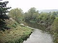
 Afon Hafren - geograph.org.uk - 691133.jpg 640 × 392; 66 KB
-
 Afon Hafren - Severn River - geograph.org.uk - 4522846.jpg 640 × 415; 54 KB
-
 Alleyway leading up to Broad Street - geograph.org.uk - 1560802.jpg 480 × 640; 97 KB
-
 Almshouses in Welshpool - geograph.org.uk - 4751989.jpg 800 × 663; 165 KB
-
 An Isolated tree - geograph.org.uk - 4633096.jpg 640 × 426; 44 KB
-
 An Ox Bow Lake - geograph.org.uk - 4633094.jpg 640 × 426; 47 KB
-
 Approaching a roundabout on the A483 in Welshpool - geograph.org.uk - 2084567.jpg 3 723 × 2 475; 1,94 MB
-
 Approaching the Bothy House - geograph.org.uk - 6225599.jpg 3 072 × 2 048; 360 KB
-
 Approaching Welshpool - geograph.org.uk - 1470719.jpg 640 × 480; 150 KB
-
 Approaching Welshpool on Glyndwr's Way - geograph.org.uk - 4672828.jpg 4 608 × 3 456; 4,01 MB
-

-
 Autumn along the canal - geograph.org.uk - 3183826.jpg 640 × 480; 117 KB
-

-
 Autumn scene near Cwm Lane - geograph.org.uk - 1560208.jpg 640 × 426; 66 KB
-
 B4381 direction signs, Welshpool - geograph.org.uk - 4755918.jpg 800 × 633; 160 KB
-

-
 Belan Bottom Lock, Montgomery Canal - geograph.org.uk - 4320407.jpg 800 × 534; 124 KB
-
 Belan Church in Wales church - geograph.org.uk - 6179988.jpg 640 × 480; 93 KB
-
 Belan Lock on the Montgomery Canal - geograph.org.uk - 6180009.jpg 640 × 480; 104 KB
-
 Belan Locks in a June rain storm - geograph.org.uk - 6180019.jpg 640 × 480; 62 KB
-
 Belan Top Lock, Montgomery Canal - geograph.org.uk - 4320442.jpg 800 × 534; 129 KB
-

-
 Bend near Golfa Farm - geograph.org.uk - 1560215.jpg 640 × 426; 112 KB
-
 Berriew Road, Welshpool - geograph.org.uk - 5492660.jpg 640 × 480; 425 KB
-
 Beside Lledan Brook - geograph.org.uk - 2192849.jpg 640 × 480; 142 KB
-
 Black and White - geograph.org.uk - 978015.jpg 640 × 457; 146 KB
-
 Blackpool Woods - geograph.org.uk - 5031046.jpg 1 024 × 768; 130 KB
-
 Boat hidden in greenery - geograph.org.uk - 4589593.jpg 640 × 480; 199 KB
-
 Bodhilin, Montgomeryshire. The Property of John Humphreys Esqr.jpeg 900 × 659; 420 KB
-
 Border Garage - geograph.org.uk - 3155792.jpg 3 872 × 2 592; 1,51 MB
-
 Border Garage near Welshpool - geograph.org.uk - 4738006.jpg 800 × 457; 73 KB
-
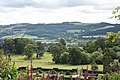
 Breddyn Mountains from Powis Castle Grounds.jpeg 900 × 754; 371 KB
-
 Bridge 116 over Montgomery Canal - geograph.org.uk - 4589575.jpg 640 × 480; 144 KB
-
 Bridge across stream at Cloddiau - geograph.org.uk - 1314910.jpg 640 × 480; 131 KB
-
 Bridge over Nant Rhyd-y-Moch - geograph.org.uk - 2241557.jpg 640 × 480; 110 KB
-
 British Homing World, Welshpool - geograph.org.uk - 4720820.jpg 800 × 545; 97 KB
-
 Brooks Cycles, Welshpool - geograph.org.uk - 4720181.jpg 800 × 713; 132 KB
-
 Builder's merchant, Welshpool - geograph.org.uk - 4437792.jpg 640 × 426; 72 KB
-
 Builder's merchant, Welshpool - geograph.org.uk - 4437793.jpg 640 × 426; 54 KB
-
 Bungalows by the canal - geograph.org.uk - 3183854.jpg 640 × 480; 85 KB
-
 Bus shelter by A458 south of Welshpool - geograph.org.uk - 4498415.jpg 1 600 × 1 200; 1,45 MB
-
 Bus Stop on the A458 near Coed-y-dinas - geograph.org.uk - 5492629.jpg 640 × 427; 375 KB
-
 Buttington Bridge - geograph.org.uk - 3845037.jpg 1 280 × 851; 261 KB
-
 Buttington Bridge over River Severn - geograph.org.uk - 4498350.jpg 1 600 × 1 068; 942 KB
-
 Buttington Bridge over the R Severn - geograph.org.uk - 4277179.jpg 1 024 × 768; 188 KB
-
 Buttington Roundabout - geograph.org.uk - 5508740.jpg 5 872 × 3 719; 6,16 MB
-

-
 Canal behind Clerk's Close - geograph.org.uk - 3184977.jpg 640 × 480; 106 KB
-

-

-
 Canal Boat on Montgomery Canal - geograph.org.uk - 3183412.jpg 640 × 480; 107 KB
-

-
 Canal looking towards Severn Street - geograph.org.uk - 4067260.jpg 640 × 480; 80 KB
-
 Canal narrows under old railway bridge - geograph.org.uk - 2469309.jpg 640 × 480; 123 KB
-
 Canal reflections - geograph.org.uk - 4589601.jpg 640 × 480; 149 KB
-
 Canal Reflections - geograph.org.uk - 791423.jpg 480 × 640; 66 KB
-

-
 Canal side sculpture - geograph.org.uk - 791437.jpg 480 × 640; 109 KB
-
 Canal towards Welshpool wharf - geograph.org.uk - 4589605.jpg 640 × 480; 110 KB
-

-
 Canal, road and sheep - geograph.org.uk - 3155835.jpg 3 872 × 2 592; 4,36 MB
-
 Canalside sculpture, Welshpool - geograph.org.uk - 1587584.jpg 480 × 640; 111 KB
-
 Car park and driveway, Powis Castle - geograph.org.uk - 4908608.jpg 2 048 × 1 536; 759 KB
-
 Car Park by Mill Lane bridge - geograph.org.uk - 4589607.jpg 640 × 480; 65 KB
-
 Cars parked in a turning area, Welshpool - geograph.org.uk - 4720893.jpg 800 × 544; 107 KB
-
 Castle courtyard, Powis Castle - geograph.org.uk - 5165564.jpg 2 500 × 1 875; 897 KB
-

-
 CEF premises and van, Welshpool - geograph.org.uk - 4720864.jpg 800 × 573; 101 KB
-
 Cefnyspin Lane, Near Welshpool - geograph.org.uk - 212496.jpg 640 × 480; 190 KB
-
 Ceunant Farm from A490 - geograph.org.uk - 3133388.jpg 640 × 418; 50 KB
-
 Check rail on the sharp curve - geograph.org.uk - 2560736.jpg 1 024 × 768; 210 KB
-
 Children warning sign, Welshpool - geograph.org.uk - 4719623.jpg 800 × 800; 199 KB
-
 Children's playground - geograph.org.uk - 613538.jpg 640 × 480; 123 KB
-

-
 Cleaning the lamps - geograph.org.uk - 494349.jpg 640 × 480; 122 KB
-
 Clerk's Court off Mill Lane - geograph.org.uk - 4589609.jpg 640 × 480; 84 KB
-
 Clivia miniata - geograph.org.uk - 2854114.jpg 426 × 640; 52 KB
-
 Cloddiau Farm entrance - geograph.org.uk - 1314906.jpg 640 × 447; 88 KB
-

-
 Coed Y Dinas Nature Reserve - geograph.org.uk - 3044623.jpg 2 592 × 1 944; 892 KB
-
 Coed y Dinas Nature Reserve - geograph.org.uk - 3155772.jpg 3 872 × 2 592; 2,73 MB
-
 Coed-y-dinas - geograph.org.uk - 661741.jpg 640 × 479; 66 KB
-
 Coed-Y-Dinas Country store - geograph.org.uk - 781946.jpg 640 × 480; 60 KB
-
 Coed-Y-Dinas from the air - geograph.org.uk - 892590.jpg 640 × 480; 95 KB
-
 Coed-y-Dinas garden centre - geograph.org.uk - 3556032.jpg 640 × 480; 79 KB
-
 Coed-y-dinas junction south of Welshpool - geograph.org.uk - 4738051.jpg 800 × 546; 110 KB
-
 Colours on Montgomery Canal - geograph.org.uk - 3183830.jpg 640 × 480; 114 KB
-
 Commemorative seat - geograph.org.uk - 791441.jpg 640 × 480; 68 KB
-
 Commemorative stone by Gorsedd stones - geograph.org.uk - 2003580.jpg 640 × 480; 113 KB
-
 Commemorative stone Heulwen Wharf - geograph.org.uk - 1350019.jpg 640 × 426; 108 KB
-
 Confluence of two streams near Raven Square - geograph.org.uk - 2286531.jpg 3 872 × 2 592; 5,34 MB
-
 Converted Chapel - Welshpool - geograph.org.uk - 2985862.jpg 3 216 × 4 288; 3,61 MB
-

-
 Countess arrives at Welshpool - geograph.org.uk - 2511446.jpg 2 112 × 2 816; 2,05 MB
-
 Countess at Welshpool - geograph.org.uk - 2511451.jpg 2 112 × 2 816; 2,14 MB
-
 Countess heads towards the summit - geograph.org.uk - 2433665.jpg 640 × 480; 128 KB
-

-
 Croquet lawn at Powis Castle - geograph.org.uk - 5535167.jpg 6 000 × 4 000; 4,55 MB
-
 Crown Hotel, Welshpool - geograph.org.uk - 2882894.jpg 3 488 × 2 616; 2,75 MB
-
 Cwm Lane and Beyond - geograph.org.uk - 1480401.jpg 640 × 426; 73 KB
-
 Cwm lane from railway - geograph.org.uk - 2437834.jpg 640 × 427; 83 KB
-
 Cwm Lane junction from A458 - geograph.org.uk - 4824962.jpg 640 × 502; 101 KB
-
 Dancing statues, Powis - geograph.org.uk - 4360172.jpg 1 600 × 1 067; 542 KB
-
 Deer Powis Park - geograph.org.uk - 4550079.jpg 2 048 × 1 536; 294 KB
-
 Derwas of Welshpool - geograph.org.uk - 4633108.jpg 640 × 426; 50 KB
-
 Detail of gateway, Powis Castle - geograph.org.uk - 6225606.jpg 2 048 × 3 072; 244 KB
-
 Diesel hauled works train at Golfa - geograph.org.uk - 3410648.jpg 640 × 480; 107 KB
-

-
 Distances from Welshpool - geograph.org.uk - 4719573.jpg 800 × 634; 143 KB
-

-
 Dominant oak south of Welshpool - geograph.org.uk - 4730850.jpg 800 × 600; 128 KB
-
 Down Cwm Lane from Level Crossing - geograph.org.uk - 1560192.jpg 640 × 426; 92 KB
-
 Drill Hall - Brook Street (1) - geograph.org.uk - 4210847.jpg 1 600 × 1 064; 386 KB
-
 Drill Hall - Brook Street (2) - geograph.org.uk - 4210851.jpg 1 600 × 1 064; 431 KB
-
 Drill Hall - Brook Street (3) - geograph.org.uk - 4210856.jpg 1 600 × 1 064; 346 KB
-
 Driveway at Bank - geograph.org.uk - 1510422.jpg 640 × 480; 121 KB
-
 Driveway into a private area, Powis Castle - geograph.org.uk - 4908596.jpg 2 048 × 1 536; 810 KB
-

-
 Duck Port. - geograph.org.uk - 791422.jpg 640 × 480; 94 KB
-
 Duck Race on the canal in Welshpool - geograph.org.uk - 4916797.jpg 640 × 480; 98 KB
-
 Ducks a plenty - geograph.org.uk - 2469317.jpg 640 × 480; 159 KB
-
 Ducks and Waterlilies - geograph.org.uk - 2469312.jpg 640 × 480; 100 KB
-
 Dyffyn Cafe - panoramio.jpg 4 608 × 3 456; 4,55 MB
-

-

-
 East side of the Old Station, Welshpool - geograph.org.uk - 4755984.jpg 800 × 643; 131 KB
-
 Edwardian buildings and Powis Castle, Wales - geograph.org.uk - 5167687.jpg 2 500 × 1 875; 849 KB
-
 Edwardian houses within the castle grounds, Powis Castle - geograph.org.uk - 5167230.jpg 2 500 × 1 875; 854 KB
-

-

-
 End of the line, Welshpool Station - geograph.org.uk - 4633101.jpg 640 × 426; 72 KB
-
 Entrance steps of Powis Castle (with peacock) - geograph.org.uk - 4498441.jpg 1 600 × 1 200; 1,61 MB
-
 Entrance to Charlies - geograph.org.uk - 781948.jpg 640 × 480; 79 KB
-
 Entrance to Derwen Caravan Site - geograph.org.uk - 651383.jpg 640 × 426; 104 KB
-

-

-

-
 Entrance to Powis Castle - geograph.org.uk - 4581244.jpg 640 × 427; 101 KB
-


_from_Maginnis_Bridge_-_geograph.org.uk_-_582593.jpg)


_-_geograph.org.uk_-_4210847.jpg)
_-_geograph.org.uk_-_4210851.jpg)
_-_geograph.org.uk_-_4210856.jpg)


_-_geograph.org.uk_-_4498441.jpg)


