Category:Wembworthy
Aller à la navigation
Aller à la recherche
village au Royaume-Uni  | |||||
| Téléverser des médias | |||||
| Nature de l’élément | |||||
|---|---|---|---|---|---|
| Lieu | Mid Devon, Devon, Angleterre du Sud-Ouest, Angleterre | ||||
 | |||||
Sous-catégories
Cette catégorie comprend 3 sous-catégories, dont les 3 ci-dessous.
Média dans la catégorie « Wembworthy »
Cette catégorie comprend 72 fichiers, dont les 72 ci-dessous.
-
 Access track at Pittford Bridge - geograph.org.uk - 5129731.jpg 1 600 × 1 200 ; 808 kio
-
 Barn north of Gosse's Farm - geograph.org.uk - 3701138.jpg 1 536 × 1 152 ; 1,09 Mio
-
 Bridge Reeve Cross signpost - geograph.org.uk - 3701147.jpg 1 536 × 1 152 ; 931 kio
-
 Bridle way, Flashdown Wood - geograph.org.uk - 3280661.jpg 640 × 480 ; 108 kio
-
 Bridleway in Flashdown Plantation - geograph.org.uk - 3700917.jpg 1 536 × 1 153 ; 1,33 Mio
-
 Cider Orchard - geograph.org.uk - 102090.jpg 640 × 480 ; 136 kio
-
 Countryside near Bridge Reeve - geograph.org.uk - 3423110.jpg 640 × 452 ; 80 kio
-
 Crossgate crossroads and phone mast - geograph.org.uk - 3700978.jpg 1 536 × 1 152 ; 1 014 kio
-
 Crossroads near Wembworthy - geograph.org.uk - 2281359.jpg 640 × 480 ; 47 kio
-
 Eggesford Bridge on the River Taw - geograph.org.uk - 1856616.jpg 1 024 × 768 ; 297 kio
-

-
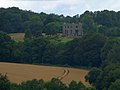 Eggesford House seen from Eggesford Church - geograph.org.uk - 3588569.jpg 1 024 × 768 ; 103 kio
-
 Entrance to Wembworthy - geograph.org.uk - 3280642.jpg 640 × 447 ; 68 kio
-
 Flashdown Plantation - geograph.org.uk - 102100.jpg 640 × 480 ; 99 kio
-
 Flashdown Plantation - geograph.org.uk - 3700909.jpg 768 × 1 024 ; 240 kio
-
 Flashdown Wood - geograph.org.uk - 3280655.jpg 640 × 480 ; 130 kio
-
 Footpath at Heywood - geograph.org.uk - 3422856.jpg 480 × 640 ; 104 kio
-
 Footpath into Labdon Brake - geograph.org.uk - 3700920.jpg 1 536 × 1 153 ; 1,44 Mio
-
 Footpath sign, North Down Plantation - geograph.org.uk - 3700961.jpg 600 × 800 ; 188 kio
-
 Gosse's Farm - geograph.org.uk - 3701135.jpg 1 536 × 1 152 ; 993 kio
-
 Gosse's Farm in the Taw valley - geograph.org.uk - 146025.jpg 640 × 426 ; 132 kio
-
 Heywood car park - geograph.org.uk - 3700969.jpg 1 536 × 1 152 ; 1,06 Mio
-
 Hollocombe Bridge - geograph.org.uk - 3701151.jpg 1 536 × 1 535 ; 1,63 Mio
-
 Houses backing on a field in Wembworthy - geograph.org.uk - 2281366.jpg 640 × 480 ; 57 kio
-
 Hunt Kennels - geograph.org.uk - 103046.jpg 640 × 480 ; 65 kio
-
 Kennels near Heywood Cross - geograph.org.uk - 3422803.jpg 640 × 480 ; 93 kio
-
 Labdon Lane - geograph.org.uk - 3423083.jpg 640 × 439 ; 81 kio
-
 Lady's smock, Heywood - geograph.org.uk - 3422949.jpg 473 × 640 ; 118 kio
-
 Lane at Saul's Bridge - geograph.org.uk - 3423021.jpg 640 × 466 ; 106 kio
-
 Lane near Kennydown Farm - geograph.org.uk - 3423311.jpg 492 × 640 ; 52 kio
-
 Lane to Bridge Reeve - geograph.org.uk - 3423051.jpg 640 × 480 ; 84 kio
-
 Little Dart Pool where the Little Dart River meets the River Taw - geograph.org.uk - 4367825.jpg 4 000 × 3 000 ; 4,6 Mio
-
 Looking upstream from Pittford Bridge - geograph.org.uk - 453744.jpg 640 × 480 ; 134 kio
-
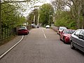
 Lymington Arms and its car park at Lama Cross - geograph.org.uk - 5129748.jpg 1 600 × 1 200 ; 731 kio
-
 Lymington Arms, Wembworthy - geograph.org.uk - 3280643.jpg 640 × 480 ; 53 kio
-
 Mid Devon , Countryside Scenery - geograph.org.uk - 4166391.jpg 4 288 × 2 848 ; 4,98 Mio
-
 Mid Devon , Grassy Field ^ Sheep - geograph.org.uk - 4166390.jpg 4 288 × 2 848 ; 6,25 Mio
-
 Mid Devon , Grassy Field ^ Sheep - geograph.org.uk - 4166393.jpg 4 288 × 2 848 ; 6,07 Mio
-
 Mid Devon , Grassy Field ^ Sheep - geograph.org.uk - 4166394.jpg 4 288 × 2 848 ; 5,27 Mio
-
 North Down Plantation - geograph.org.uk - 453652.jpg 640 × 480 ; 112 kio
-
 Old farm machinery at Labdon - geograph.org.uk - 146024.jpg 640 × 426 ; 126 kio
-
 Ordnance Survey Cut Mark - geograph.org.uk - 5024839.jpg 438 × 640 ; 114 kio
-
 Passing through Wembworthy - geograph.org.uk - 3915587.jpg 1 600 × 1 029 ; 276 kio
-
 Passing through Wembworthy - geograph.org.uk - 3915593.jpg 1 600 × 990 ; 352 kio
-
 Path to the kennels - geograph.org.uk - 3422896.jpg 525 × 640 ; 107 kio
-
 Postbox at Heywood Cottages - geograph.org.uk - 102093.jpg 640 × 480 ; 193 kio
-
 Rashleigh Lane - geograph.org.uk - 3423033.jpg 640 × 484 ; 68 kio
-
 Rashleigh Lane from Crossgate - geograph.org.uk - 3700993.jpg 1 536 × 1 152 ; 1,39 Mio
-
 Road drops to cross Pittford Bridge - geograph.org.uk - 2281372.jpg 640 × 480 ; 107 kio
-
 Road from Saul's Bridge to Saul's Farm - geograph.org.uk - 3700975.jpg 1 536 × 1 152 ; 1,21 Mio
-
 Road junction at Blackhorse Corner, Wembworthy - geograph.org.uk - 5129734.jpg 1 600 × 1 200 ; 788 kio
-
 Road passing Flashdown Plantation - geograph.org.uk - 3700905.jpg 683 × 1 024 ; 181 kio
-
 Road past Flashdown Plantation - geograph.org.uk - 3422810.jpg 640 × 460 ; 59 kio
-
 Road through Flashdown Plantation - geograph.org.uk - 3422832.jpg 530 × 640 ; 133 kio
-
 Rural lane west of Lama Cross - geograph.org.uk - 3923919.jpg 4 912 × 3 264 ; 5,16 Mio
-
 Saul's Bridge near Saul's Farm - geograph.org.uk - 3700971.jpg 1 536 × 1 536 ; 1,37 Mio
-
 Sheep near Kennydown Farm - geograph.org.uk - 3423297.jpg 640 × 415 ; 57 kio
-
 Sheep near Spekes Cross - geograph.org.uk - 3422797.jpg 640 × 456 ; 71 kio
-
 Sheep near Spekes Cross - geograph.org.uk - 3422800.jpg 640 × 443 ; 63 kio
-
 Signpost at Blackhorse Corner, Wembworthy - geograph.org.uk - 5129740.jpg 1 600 × 1 200 ; 757 kio
-
 Thatched building near Little Rashleigh - geograph.org.uk - 3701145.jpg 1 536 × 1 152 ; 918 kio
-
 The boundary of Wembworthy centre - geograph.org.uk - 3700939.jpg 1 536 × 1 152 ; 1,7 Mio
-
 The end of the Hayne valley at Eggesford - geograph.org.uk - 3588598.jpg 1 024 × 768 ; 190 kio
-
 The Lymington Arms at Lama Cross - geograph.org.uk - 5129742.jpg 1 600 × 1 066 ; 621 kio
-

-
 The River Taw at Little Dart Pool - geograph.org.uk - 4367851.jpg 4 000 × 3 000 ; 5,28 Mio
-
-
 Valley at Saul's Bridge - geograph.org.uk - 3422971.jpg 640 × 497 ; 86 kio
-
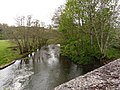
 View North over River Taw - geograph.org.uk - 103049.jpg 640 × 480 ; 110 kio
-
 Woodland footpath - geograph.org.uk - 102109.jpg 640 × 480 ; 195 kio
-
 Woodland in the Hayne Valley - geograph.org.uk - 103043.jpg 640 × 480 ; 146 kio
-
 Wow^ a bus shelter in rural Devon - geograph.org.uk - 3915597.jpg 1 600 × 1 012 ; 406 kio


