Category:Wennington, Lancashire
Zur Navigation springen
Zur Suche springen
Gemeinde in der englischen Grafschaft Lancashire  | |||||
| Medium hochladen | |||||
| Ist ein(e) | |||||
|---|---|---|---|---|---|
| Ort | City of Lancaster, Lancashire, North West England, England | ||||
 | |||||
English: Wennington is a village and civil parish in the City of Lancaster district in Lancashire, England. The parish of Wennington had a population of 102 recorded in the 2001 census,(→Wennington, Lancashire)
Nederlands: Wennington is een plaats en civil parish in het bestuurlijke gebied Lancaster, in het Engelse graafschap Lancashire met 102 inwoners. (→Wennington)
Polski: Wennington – wieś w Anglii, w hrabstwie Lancashire, w dystrykcie Lancaster. Leży 77 km na północ od miasta Manchester i 335 km na północny zachód od Londynu. W 2001 miejscowość liczyła 102 mieszkańców. (→Wennington (Lancashire))
Unterkategorien
Es werden 3 von insgesamt 3 Unterkategorien in dieser Kategorie angezeigt:
In Klammern die Anzahl der enthaltenen Kategorien (K), Seiten (S), Dateien (D)
W
- Wennington Pound (2 D)
- Wennington railway station (15 D)
Medien in der Kategorie „Wennington, Lancashire“
Folgende 80 Dateien sind in dieser Kategorie, von 80 insgesamt.
-
 "Stone Steps", Wennington - geograph.org.uk - 612003.jpg 640 × 480; 221 KB
-
 A glimpse of the River Wenning - geograph.org.uk - 5926614.jpg 480 × 640; 139 KB
-
 A hedge-lined Spout Lane heading towards Bull Bank - geograph.org.uk - 6307555.jpg 4.000 × 3.000; 4,47 MB
-
 Adlington, Blackburn, Cherry Tree, Chorley, Hincaster Ingleton & Wennington RJD 103.jpg 2.677 × 1.723; 680 KB
-
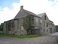
 Animal sheds - panoramio.jpg 3.072 × 1.728; 1,9 MB
-
 Apple Tree Wood - geograph.org.uk - 5926617.jpg 640 × 480; 114 KB
-
 B6480 towards Low Bentham - geograph.org.uk - 5926607.jpg 640 × 480; 52 KB
-
 B6480 towards Low Bentham - geograph.org.uk - 5926618.jpg 640 × 480; 122 KB
-
 Back Lane at Ringers Hill - geograph.org.uk - 6307557.jpg 4.000 × 3.000; 3,62 MB
-
 Back Lane crossing the border at Old Wennington - geograph.org.uk - 6307560.jpg 4.000 × 3.000; 5,16 MB
-
 Black pump - panoramio.jpg 3.072 × 1.728; 2,01 MB
-
 Bolt benchmark, Wennington Bridge - geograph.org.uk - 4662305.jpg 480 × 640; 112 KB
-
 Boundary stone near Wennington railway station.jpg 4.032 × 3.024; 3,73 MB
-
 Bridge 104 - panoramio.jpg 3.072 × 1.728; 1,98 MB
-
 Bridge 36 - panoramio.jpg 3.072 × 1.728; 2,56 MB
-
 Bridge at Wennington - geograph.org.uk - 611991.jpg 640 × 480; 205 KB
-
 Bull Bank - geograph.org.uk - 5156358.jpg 1.600 × 1.067; 571 KB
-

-

-
 Country looking South West from Bull Bank - geograph.org.uk - 5156363.jpg 1.600 × 1.067; 640 KB
-
 Country Road - geograph.org.uk - 135425.jpg 640 × 480; 124 KB
-
 Elizabeth II postbox on Lodge Lane, Wennington - geograph.org.uk - 5933958.jpg 1.303 × 2.328; 688 KB
-
 Farmland at Ringer's Hill - geograph.org.uk - 5024534.jpg 1.280 × 959; 911 KB
-
 Farmland School Hill - geograph.org.uk - 127339.jpg 640 × 480; 87 KB
-
 Field of gold - geograph.org.uk - 1910421.jpg 640 × 480; 112 KB
-
 Fingerpost - panoramio.jpg 1.728 × 3.072; 2,09 MB
-
 Fingerpost by the B6480, Wennington - geograph.org.uk - 6110984.jpg 1.198 × 1.600; 559 KB
-
 Fingerpost in Wennington and a water hydrant sign - geograph.org.uk - 6110990.jpg 1.200 × 1.600; 616 KB
-
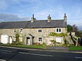
 Former mill, Wennington.jpg 4.000 × 3.000; 2,45 MB
-
 Garden ^ Oak Cottages - panoramio.jpg 3.072 × 1.728; 2,01 MB
-
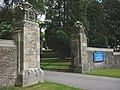 Gateway to Wennington Hall School - geograph.org.uk - 4071060.jpg 640 × 480; 208 KB
-

-
 Grazing of Lodge Lane - geograph.org.uk - 5926594.jpg 640 × 452; 80 KB
-
 Grazing, Ravens Close - geograph.org.uk - 5926606.jpg 640 × 480; 63 KB
-
 Green Lane on Ringers Hill - geograph.org.uk - 1908053.jpg 2.816 × 2.112; 2,05 MB
-
 House on Lodge Lane, Wennington - geograph.org.uk - 5926597.jpg 640 × 480; 58 KB
-
 Houses on Lodge Lane, Wennington - geograph.org.uk - 5933963.jpg 2.736 × 3.648; 2,04 MB
-
 Lodge Lane towards Wennington - geograph.org.uk - 5926592.jpg 640 × 480; 83 KB
-
 Lodge Lane, Wennington - geograph.org.uk - 5933967.jpg 3.648 × 2.736; 1,97 MB
-
 Metal Footbridge - panoramio.jpg 3.072 × 1.728; 2,14 MB
-
 Moss House - panoramio.jpg 3.072 × 1.728; 1,48 MB
-
 Muddy Track beside Cockshot Barn - geograph.org.uk - 4308245.jpg 5.184 × 3.456; 7,3 MB
-
 Narrows at Mill Farm - panoramio (1).jpg 3.072 × 1.728; 1,89 MB
-
 Narrows at Mill Farm - panoramio.jpg 3.072 × 1.728; 1,8 MB
-
 North Yorkshire county boundary - panoramio.jpg 3.072 × 1.728; 2,64 MB
-
 Old Saw Mill with chimney - panoramio.jpg 3.072 × 1.728; 1,77 MB
-
 Old Smithy - panoramio.jpg 1.728 × 3.072; 1,7 MB
-
 Old Wennington - panoramio.jpg 3.072 × 1.728; 2,35 MB
-
 Ordnance Survey Cut Mark - geograph.org.uk - 4090766.jpg 4.000 × 3.000; 4,39 MB
-
 Outside, Wennington - geograph.org.uk - 6065541.jpg 1.024 × 768; 352 KB
-
 Platform - panoramio (2).jpg 3.072 × 1.728; 2,41 MB
-
 Ravensclose Road - geograph.org.uk - 4307191.jpg 5.179 × 3.451; 5,2 MB
-
 River Wenning - geograph.org.uk - 135427.jpg 640 × 480; 137 KB
-
 River Wenning - geograph.org.uk - 612020.jpg 640 × 480; 162 KB
-
 River Wenning near Apple Tree Wood - geograph.org.uk - 5926615.jpg 640 × 480; 74 KB
-
 Sheep Hill Side farm - geograph.org.uk - 127340.jpg 640 × 480; 131 KB
-
-
 Site for new housing, Wennington - geograph.org.uk - 4666712.jpg 640 × 480; 87 KB
-
 Stile above Wennington - geograph.org.uk - 4070619.jpg 800 × 600; 160 KB
-
 Stone barn on Lodge Lane - geograph.org.uk - 5926563.jpg 640 × 480; 83 KB
-
 The B6480 passing through Wennington - geograph.org.uk - 6216512.jpg 2.592 × 1.944; 1,5 MB
-
 The River Wenning - geograph.org.uk - 3592520.jpg 3.825 × 2.631; 6,23 MB
-
 The River Wenning near Wennington - geograph.org.uk - 2295848.jpg 640 × 480; 176 KB
-
 The view from Ringers Hill - geograph.org.uk - 1910438.jpg 640 × 480; 88 KB
-
 Track East of Spout Lane - geograph.org.uk - 1908048.jpg 2.816 × 2.112; 1,94 MB
-
 Wennington Bridge - geograph.org.uk - 3113653.jpg 2.752 × 2.026; 2,7 MB
-
 Wennington Bridge - panoramio.jpg 3.072 × 1.728; 2,05 MB
-
 Wennington Bridge and the River Wenning - geograph.org.uk - 4664483.jpg 720 × 540; 134 KB
-
 Wennington crossroads - geograph.org.uk - 3113647.jpg 2.799 × 1.646; 1,68 MB
-
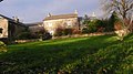
 Wennington Hall School (2) - geograph.org.uk - 4071049.jpg 480 × 640; 95 KB
-
 Wennington Hall School - geograph.org.uk - 4070668.jpg 480 × 640; 221 KB
-
 Wennington Hall School - geograph.org.uk - 4664459.jpg 663 × 480; 97 KB
-
 Wennington Hall School - geograph.org.uk - 5926566.jpg 640 × 480; 103 KB
-
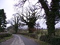
 Country Road - geograph.org.uk - 116833.jpg 480 × 640; 108 KB
-
 Lane Ashleys Farm - geograph.org.uk - 116834.jpg 640 × 480; 90 KB
-
 Mill Houses - geograph.org.uk - 50814.jpg 640 × 480; 149 KB
-
 On Trinket Lane - geograph.org.uk - 116831.jpg 480 × 640; 167 KB
-
 Railway - geograph.org.uk - 612017.jpg 640 × 480; 193 KB
-
 Roadside Trees - geograph.org.uk - 127341.jpg 640 × 480; 155 KB
-
 Wennington - geograph.org.uk - 49980.jpg 640 × 480; 122 KB


.jpg)


.jpg)


_-_geograph.org.uk_-_4071049.jpg)


