Category:Wentworth, South Yorkshire
Aller à la navigation
Aller à la recherche
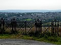
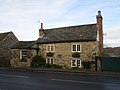
English: Wentworth is a village and civil parish in the Metropolitan Borough of Rotherham in South Yorkshire, England. It has a population of 1,223.
Nederlands: Wentworth is een dorp (village) en civil parish in het bestuurlijke gebied Rotherham, in het Engelse graafschap South Yorkshire. De civil parish telt

village britannique du Yorkshire du Sud  | |||||
| Téléverser des médias | |||||
| Nature de l’élément | |||||
|---|---|---|---|---|---|
| Lieu | district métropolitain de Rotherham, Yorkshire du Sud, Yorkshire-et-Humber, Angleterre | ||||
| Population |
| ||||
| À ne pas confondre avec | |||||
 | |||||
Sous-catégories
Cette catégorie comprend 16 sous-catégories, dont les 16 ci-dessous.
B
- The Round House, Barrow (6 F)
- Wentworth Hospital (2 F)
- Barrowfield Gate (2 F)
D
H
- Harley, South Yorkshire (21 F)
- Hoober Hall (4 F)
- Hoober Observatory (4 F)
- Hoober Stand (25 F)
I
R
- Rockingham Arms, Wentworth (13 F)
W
Média dans la catégorie « Wentworth, South Yorkshire »
Cette catégorie comprend 632 fichiers, dont les 200 ci-dessous.
(page précédente) (page suivante)-
 'Bird Estate' at Thorpe Hesley, from Hague Lane, Wentworth - geograph.org.uk - 3303064.jpg 2 990 × 2 228 ; 2,32 Mio
-

-
 'Job done' on Clayfield Lane, Wentworth, near Rotherham - geograph.org.uk - 3305250.jpg 3 527 × 2 645 ; 3,39 Mio
-
 'See Right Thru' Window' on Main Street, Wentworth, near Rotherham - geograph.org.uk - 3308604.jpg 2 680 × 3 574 ; 3,98 Mio
-
 'Trim from the Tractor' on Clayfield Lane, Wentworth, near Rotherham - geograph.org.uk - 3305246.jpg 3 648 × 2 736 ; 1,99 Mio
-
 4 lanes junction - geograph.org.uk - 550504.jpg 640 × 512 ; 88 kio
-
 60-62 Main Street, Wentworth.jpg 1 024 × 768 ; 138 kio
-
 A busy day at the garden centre, Wentworth - 1 - geograph.org.uk - 1755115.jpg 2 576 × 1 932 ; 1,24 Mio
-
 A busy day at the garden centre, Wentworth - 2 - geograph.org.uk - 1755122.jpg 2 576 × 1 932 ; 1,84 Mio
-
 A good day for walking^ - geograph.org.uk - 3776332.jpg 1 024 × 540 ; 142 kio
-
 A view over Wentworth Park - geograph.org.uk - 2489310.jpg 2 848 × 2 144 ; 2,87 Mio
-
 A Wentworth Camera - geograph.org.uk - 5139748.jpg 3 308 × 1 566 ; 1,35 Mio
-
 Acacia Lodge Cattery, Main Street, Wentworth, near Rotherham - geograph.org.uk - 3308594.jpg 3 213 × 2 417 ; 2,74 Mio
-
 Acacia Lodge, Main Street, Wentworth - geograph.org.uk - 4200157.jpg 1 600 × 1 200 ; 675 kio
-
 Angel Lane (B6090) - geograph.org.uk - 2810371.jpg 640 × 480 ; 111 kio
-
 Approaching Nether Haugh - geograph.org.uk - 2747379.jpg 640 × 461 ; 44 kio
-
 At Church Field near Wentworth - geograph.org.uk - 3806462.jpg 4 948 × 3 535 ; 5,45 Mio
-
 Autumn sown crop and Dog Kennel Pond - geograph.org.uk - 5628659.jpg 1 024 × 768 ; 195 kio
-

-
 B6090 towards Wentworth - geograph.org.uk - 2808920.jpg 640 × 480 ; 93 kio
-
 Barley Field on Middle Common - geograph.org.uk - 2455177.jpg 3 296 × 2 472 ; 980 kio
-

-
 Barnsley Road (B6086) - geograph.org.uk - 2808902.jpg 640 × 480 ; 68 kio
-
 Barrow Field Gate, on Barrow Field Lane - geograph.org.uk - 6238258.jpg 1 600 × 1 200 ; 353 kio
-

-
 BBQs at Wentworth, Clayfield Lane, Wentworth, near Rotherham - geograph.org.uk - 3305745.jpg 3 543 × 2 658 ; 2,65 Mio
-
 Bessy Gill Lake, Wentworth Woodhouse - geograph.org.uk - 5458181.jpg 1 200 × 799 ; 369 kio
-

-
 Between Scholes and Wentworth - geograph.org.uk - 3738145.jpg 1 600 × 1 200 ; 333 kio
-
 Bigger Wentworth Cows, from Church Drive, Wentworth, near Rotherham - geograph.org.uk - 3322012.jpg 3 648 × 2 736 ; 1,68 Mio
-
 Broadcarr Road - geograph.org.uk - 2435891.jpg 1 024 × 681 ; 180 kio
-
 Brook flowing towards Morley Pond - geograph.org.uk - 4198450.jpg 1 600 × 1 064 ; 881 kio
-
 Buildings at Fox Farm - geograph.org.uk - 4199427.jpg 1 600 × 1 200 ; 616 kio
-
 Buildings at Linthwaite Farm - geograph.org.uk - 6238045.jpg 1 600 × 1 200 ; 450 kio
-
 Buildings at Mabel College - geograph.org.uk - 4198977.jpg 1 600 × 1 064 ; 743 kio
-

-

-
 Car Park, Church Field Lane, Wentworth, near Rotherham - geograph.org.uk - 3322695.jpg 3 636 × 2 727 ; 4,44 Mio
-
 Car Park, Main Street, Wentworth, near Rotherham - geograph.org.uk - 3308470.jpg 3 181 × 2 311 ; 2,46 Mio
-
 Car park, Wentworth Garden Centre - geograph.org.uk - 2809066.jpg 640 × 480 ; 121 kio
-

-

-
 Church Field Lane, Wentworth Estate - geograph.org.uk - 4200193.jpg 1 600 × 1 200 ; 501 kio
-
 Church Field Lane, Wentworth, near Rotherham - geograph.org.uk - 3311387.jpg 3 648 × 2 736 ; 1,88 Mio
-
 Clayfield Lane Houses from Main Street, Wentworth, near Rotherham - geograph.org.uk - 3308374.jpg 2 843 × 1 822 ; 2,45 Mio
-
 Clayfield Lane Houses, Wentworth, near Rotherham - geograph.org.uk - 3308375.jpg 2 343 × 1 553 ; 1,21 Mio
-
 Clayfield Lane, off Cortworth Lane, Wentworth, near Rotherham - 1 - geograph.org.uk - 3307693.jpg 3 393 × 2 344 ; 2,88 Mio
-
 Clayfield Lane, off Main Street, Wentworth, near Rotherham - geograph.org.uk - 3308563.jpg 3 441 × 2 518 ; 2,84 Mio
-
 Clayfield Lane, Wentworth - geograph.org.uk - 1821053.jpg 1 600 × 1 200 ; 595 kio
-
 Clayfield Lane, Wentworth, near Rotherham - 2 - geograph.org.uk - 3307703.jpg 3 648 × 2 736 ; 1,83 Mio
-
 Coach Road at Spittal Houses - geograph.org.uk - 4200502.jpg 1 600 × 1 200 ; 600 kio
-
 Coach Road near Harley - geograph.org.uk - 2454981.jpg 3 296 × 2 472 ; 1,05 Mio
-
 Coach Road towards Harley - geograph.org.uk - 4200510.jpg 1 600 × 1 200 ; 625 kio
-
 Coach Road towards Harley - geograph.org.uk - 4200516.jpg 1 600 × 1 200 ; 370 kio
-
 Coach Road towards Spittal Houses - geograph.org.uk - 4200498.jpg 1 600 × 1 200 ; 655 kio
-
 Coaley Lane Farm - geograph.org.uk - 1124624.jpg 640 × 427 ; 84 kio
-
 Coaley Lane near Wentworth - geograph.org.uk - 4837955.jpg 549 × 640 ; 212 kio
-
 Coley Lane at Linthwaite Lane - geograph.org.uk - 4199437.jpg 1 600 × 1 200 ; 540 kio
-
 Coley Lane near Wentworth - geograph.org.uk - 4837946.jpg 640 × 473 ; 141 kio
-
 Corthworth Lane, Wentworth, near Rotherham - geograph.org.uk - 3307688.jpg 3 648 × 2 736 ; 1,82 Mio
-
 Cortworth Lane (B6090) - geograph.org.uk - 2809055.jpg 640 × 480 ; 70 kio
-
 Cortworth Lane at Hague Lane, Wentworth - geograph.org.uk - 4199863.jpg 1 600 × 1 200 ; 643 kio
-
 Cortworth Lane near Hoober - geograph.org.uk - 4837648.jpg 640 × 474 ; 169 kio
-
 Cortworth Lane towards Wentworth - geograph.org.uk - 2810360.jpg 640 × 480 ; 30 kio
-

-
 Cortworth Lane, Wentworth - geograph.org.uk - 4837964.jpg 480 × 640 ; 202 kio
-
 Cottage at the southern end of Coley Lane - geograph.org.uk - 3261131.jpg 4 320 × 2 432 ; 659 kio
-
 Cottages at Barrow - geograph.org.uk - 1505667.jpg 640 × 477 ; 127 kio
-
 Cottages in Nether Haugh - geograph.org.uk - 3171860.jpg 4 351 × 2 901 ; 3,04 Mio
-
 Cottages in Nether Haugh - geograph.org.uk - 5628637.jpg 1 024 × 768 ; 138 kio
-
 Cottages in Street - geograph.org.uk - 2712908.jpg 1 024 × 768 ; 268 kio
-
 Cottages in Street - geograph.org.uk - 5630654.jpg 1 024 × 768 ; 158 kio
-
 Cottages in the hamlet of Street - geograph.org.uk - 3171764.jpg 4 295 × 2 864 ; 3,37 Mio
-
 Cottages in Wentworth - geograph.org.uk - 1223532.jpg 640 × 427 ; 69 kio
-
 Cottages just west of Wentworth village - geograph.org.uk - 1225150.jpg 640 × 427 ; 58 kio
-
 Cottages on Cortworth Lane - geograph.org.uk - 2712884.jpg 1 024 × 768 ; 301 kio
-
 Cottages on Main Street - geograph.org.uk - 2712970.jpg 1 024 × 768 ; 177 kio
-
 Cottages, Wentworth, Rotherham - geograph.org.uk - 1968038.jpg 1 024 × 768 ; 182 kio
-
 Cover Close, Harley - geograph.org.uk - 4200564.jpg 1 600 × 1 200 ; 506 kio
-
 Cows in a huddle, Church Drive, Wentworth, near Rotherham - 1 - geograph.org.uk - 3321661.jpg 2 616 × 1 741 ; 1,52 Mio
-
 Cows in a huddle, Church Drive, Wentworth, near Rotherham - 2 - geograph.org.uk - 3321664.jpg 3 648 × 2 736 ; 1,73 Mio
-
 Cows in the field, Church Drive, Wentworth, near Rotherham - 1 - geograph.org.uk - 3321670.jpg 3 571 × 2 678 ; 2,57 Mio
-
 Cows in the field, Church Drive, Wentworth, near Rotherham - 2 - geograph.org.uk - 3321969.jpg 3 648 × 2 736 ; 3,29 Mio
-
 Cricket View Road, Harley - geograph.org.uk - 4200615.jpg 1 600 × 1 200 ; 574 kio
-
 Crop Field near Abdy Farm - geograph.org.uk - 4747318.jpg 4 608 × 3 456 ; 3,91 Mio
-
 Crops by Cortworth Lane - geograph.org.uk - 1984981.jpg 2 848 × 2 144 ; 1,52 Mio
-
 Crops by Hauge Lane - geograph.org.uk - 1986475.jpg 2 848 × 2 144 ; 1,51 Mio
-
 Crops near Barley Hall Cottage - geograph.org.uk - 1984380.jpg 2 848 × 2 144 ; 1,51 Mio
-
 Cyclist at the top of Hague Lane Hill, Wentworth, near Rotherham - geograph.org.uk - 3303355.jpg 2 210 × 3 119 ; 2,23 Mio
-
 Cyclist on Hague Lane Hill, Wentworth, near Rotherham - geograph.org.uk - 3303348.jpg 1 850 × 2 590 ; 1,18 Mio
-
 Deer Park, Wentworth Woodhouse - geograph.org.uk - 6114169.jpg 1 024 × 768 ; 141 kio
-
 Detail of mausoleum, Wentworth - geograph.org.uk - 4840395.jpg 481 × 640 ; 109 kio
-
 Detail of Wentworth Woodhouse, Wentworth - geograph.org.uk - 4843950.jpg 475 × 640 ; 184 kio
-
 Diamond Jubilee - Wentworth Beacon - geograph.org.uk - 2979517.jpg 3 648 × 2 736 ; 3,21 Mio
-
 Dike Hill at Harley - geograph.org.uk - 1942701.jpg 2 560 × 1 920 ; 1,31 Mio
-

-
 Dog Kennel Pond, Wentworth Woodhouse - geograph.org.uk - 5458188.jpg 1 200 × 799 ; 403 kio
-
 Down the Lane - geograph.org.uk - 1133905.jpg 640 × 427 ; 112 kio
-

-
 Driveway to Holy Trinity Church, Wentworth - geograph.org.uk - 5458170.jpg 1 200 × 799 ; 468 kio
-
 Elsecar View - geograph.org.uk - 5285943.jpg 4 608 × 3 456 ; 3,71 Mio
-
 Entering Hood Hill on Kirby Lane - geograph.org.uk - 2808908.jpg 640 × 480 ; 99 kio
-
 Entrance to the Deer Park, Wentworth - geograph.org.uk - 5628674.jpg 1 024 × 768 ; 243 kio
-
 Entrance to the Walled Garden Wentworth - geograph.org.uk - 1817821.jpg 1 024 × 738 ; 247 kio
-
 Evening sunlight at Nether Haugh - geograph.org.uk - 799610.jpg 640 × 480 ; 113 kio
-
 Fading light over an abandoned field - geograph.org.uk - 5630678.jpg 1 024 × 768 ; 220 kio
-
 Farm track off Cortworth Lane - geograph.org.uk - 2810352.jpg 640 × 480 ; 84 kio
-
 Farmer's Market, Garden Centre. Wentworth, near Rotherham - 1 - geograph.org.uk - 2104910.jpg 2 576 × 1 932 ; 1,63 Mio
-
 Farmer's Market, Garden Centre. Wentworth, near Rotherham - 2 - geograph.org.uk - 2104915.jpg 2 576 × 1 932 ; 933 kio
-
 Farmland and Footpath near King's Wood - geograph.org.uk - 5285951.jpg 4 608 × 3 456 ; 3,89 Mio
-
 Farmland east of Linthwaite Lane - geograph.org.uk - 4318995.jpg 640 × 480 ; 92 kio
-
 Farmland near Coley Lane Farm - geograph.org.uk - 5285960.jpg 4 608 × 3 456 ; 3,72 Mio
-
 Farmland near to Low Stubbin - geograph.org.uk - 1209339.jpg 640 × 480 ; 57 kio
-
 Farmland near Wentworth (1) - geograph.org.uk - 4837931.jpg 539 × 640 ; 254 kio
-
 Farmland near Wentworth (2) - geograph.org.uk - 4837952.jpg 640 × 430 ; 126 kio
-
 Farmland south of Linthwaite Farm - geograph.org.uk - 6238052.jpg 1 600 × 1 200 ; 489 kio
-
 Farmland towards Low Wood - geograph.org.uk - 2808934.jpg 640 × 480 ; 95 kio
-
 Farmland, Cortworth Field - geograph.org.uk - 2810357.jpg 640 × 480 ; 69 kio
-
 Farmland, Nether Haugh - geograph.org.uk - 2810333.jpg 640 × 480 ; 57 kio
-
 Fence or No Fence, Church Drive, Wentworth, near Rotherham - geograph.org.uk - 3322021.jpg 3 231 × 2 359 ; 2,16 Mio
-
 Field beside Packman Road - geograph.org.uk - 4319945.jpg 640 × 480 ; 66 kio
-
 Field of barley, near Barrow Field - geograph.org.uk - 6238261.jpg 1 703 × 1 277 ; 1,11 Mio
-
 Field of wheat and Lee cottage - geograph.org.uk - 5803842.jpg 800 × 600 ; 124 kio
-
 Fields near Bramptom Bierlow - geograph.org.uk - 5285964.jpg 4 608 × 3 456 ; 3,86 Mio
-
 Fields near Hoober Stand - geograph.org.uk - 2012290.jpg 3 072 × 2 048 ; 289 kio
-

-
 Fly tipping on Back Lane - geograph.org.uk - 5707772.jpg 600 × 800 ; 104 kio
-
 Football pitch in Thorpe Hesley - geograph.org.uk - 3947870.jpg 2 590 × 1 850 ; 1,43 Mio
-
 Footpath at Wentworth - geograph.org.uk - 2596635.jpg 3 264 × 2 448 ; 2,18 Mio
-
 Footpath beside Cortworth Lane - geograph.org.uk - 2809061.jpg 640 × 480 ; 92 kio
-
 Footpath between Elsecar and Wentworth - geograph.org.uk - 2712820.jpg 768 × 1 024 ; 264 kio
-
 Footpath leading to Hoober Stand - geograph.org.uk - 4199152.jpg 1 600 × 1 064 ; 538 kio
-
 Footpath leading to Hoober Stand - geograph.org.uk - 4199154.jpg 1 600 × 1 064 ; 399 kio
-
 Footpath leading to Hoober Stand - geograph.org.uk - 4199160.jpg 1 600 × 1 064 ; 924 kio
-
 Footpath leading to Hoober Stand - geograph.org.uk - 4199166.jpg 1 064 × 1 600 ; 898 kio
-
 Footpath near Hoober House - geograph.org.uk - 2597049.jpg 3 235 × 1 632 ; 1,25 Mio
-
 Footpath near Scholes - geograph.org.uk - 2712959.jpg 1 024 × 768 ; 196 kio
-
 Footpath off Barrow Field Lane - geograph.org.uk - 2808940.jpg 640 × 480 ; 94 kio
-
 Footpath off Clayfield Lane - geograph.org.uk - 5630231.jpg 1 024 × 768 ; 191 kio
-
 Footpath off Kirby Lane - geograph.org.uk - 2808906.jpg 640 × 480 ; 133 kio
-
 Footpath over disused colliery spoil heap near Hemingfield - geograph.org.uk - 3312200.jpg 4 320 × 2 432 ; 871 kio
-
 Footpath through the Deer Park, Wentworth Woodhouse - geograph.org.uk - 5629189.jpg 1 024 × 768 ; 228 kio
-

-
 Footpath to Cortworth Lane - geograph.org.uk - 5630658.jpg 1 024 × 768 ; 194 kio
-
 Footpath to Hoober - geograph.org.uk - 5628459.jpg 1 024 × 768 ; 183 kio
-
 Footpath to Hoober - geograph.org.uk - 5628583.jpg 1 024 × 768 ; 136 kio
-
 Footpath to Hoober Stand - geograph.org.uk - 5628461.jpg 1 024 × 768 ; 238 kio
-
 Footpath to Hoober Stand - geograph.org.uk - 5630664.jpg 1 024 × 768 ; 148 kio
-
 Footpath to Nether Haugh - geograph.org.uk - 5628640.jpg 1 024 × 768 ; 179 kio
-
 Footpath to Scholes - geograph.org.uk - 5628571.jpg 1 024 × 768 ; 112 kio
-
 Footpath to the Church, off Hague Lane, Wentworth, near Rotherham - geograph.org.uk - 3321958.jpg 3 580 × 2 685 ; 4,22 Mio
-
 Footpath towards Simon Wood - geograph.org.uk - 6175354.jpg 1 600 × 1 200 ; 353 kio
-
 Forlorn horse at Hood Hill - geograph.org.uk - 3806445.jpg 5 182 × 3 702 ; 4,92 Mio
-
 Former car park at Barley Hall - geograph.org.uk - 3007575.jpg 800 × 600 ; 219 kio
-
 Former Mechanics' Institute, Wentworth.jpg 4 032 × 3 024 ; 2,83 Mio
-
 Former Methodist Church, Wentworth - geograph.org.uk - 5628544.jpg 1 024 × 768 ; 188 kio
-
 Former tower mill on Clayfield Lane in Wentworth - geograph.org.uk - 5722723.jpg 4 032 × 3 024 ; 2,58 Mio
-
 Former tower mill, Wentworth - geograph.org.uk - 5628471.jpg 1 024 × 768 ; 153 kio
-
 Former Wentworth Mill and Newly Sown Field - geograph.org.uk - 2634471.jpg 3 296 × 2 472 ; 974 kio
-
 Fox Farm - geograph.org.uk - 2712839.jpg 1 024 × 768 ; 191 kio
-
 Fox Farm on Coley Lane - geograph.org.uk - 4199428.jpg 1 600 × 1 200 ; 417 kio
-
 Fox Farm on Coley Lane - geograph.org.uk - 5285953.jpg 4 397 × 3 101 ; 3,51 Mio
-
 Fox Farm, northeast of Wentworth - geograph.org.uk - 6175350.jpg 1 600 × 1 200 ; 332 kio
-
 Friar's House Gate, Church Drive, Wentworth, near Rotherham - geograph.org.uk - 3322068.jpg 3 579 × 2 684 ; 4,44 Mio
-

-
 Friar's House, from Church Drive, Wentworth, near Rotherham - 2 - geograph.org.uk - 3322061.jpg 3 599 × 2 699 ; 2,55 Mio
-

-
 Gate and Two Bins, Church Drive, Wentworth, near Rotherham - geograph.org.uk - 3321960.jpg 2 663 × 3 550 ; 5,1 Mio
-
 Gate in the wall, Hague Lane, Wentworth, near Rotherham - geograph.org.uk - 3303369.jpg 3 648 × 2 736 ; 3 Mio
-
 George & Dragon, Main Street, Wentworth, near Rotherham - 1 - geograph.org.uk - 3311208.jpg 1 742 × 1 432 ; 912 kio
-
 George & Dragon, Wentworth - geograph.org.uk - 3058229.jpg 1 024 × 684 ; 633 kio
-
 George and Dragon 85 Main Street Wentworth - geograph.org.uk - 4959742.jpg 7 824 × 3 344 ; 6,58 Mio
-
 George and Dragon, Wentworth.jpg 1 600 × 1 200 ; 510 kio
-
 George ^ Dragon - geograph.org.uk - 5458167.jpg 1 200 × 799 ; 339 kio
-
 George ^ Dragon Sign, Main Street, Wentworth, near Rotherham - geograph.org.uk - 3311236.jpg 2 106 × 2 887 ; 1,37 Mio
-
 George ^ Dragon, Main Street, Wentworth, near Rotherham - 2 - geograph.org.uk - 3311222.jpg 3 216 × 2 344 ; 2,32 Mio
-
 Grassland above the Wentworth Ponds - geograph.org.uk - 5074209.jpg 4 608 × 3 456 ; 4,41 Mio
-
 Grazing and stables - geograph.org.uk - 4319944.jpg 640 × 480 ; 58 kio
-
 Grazing land off Cortworth Lane - geograph.org.uk - 2809052.jpg 640 × 480 ; 77 kio
-
 Grazing land, Low Harley - geograph.org.uk - 2808917.jpg 640 × 480 ; 86 kio
-
 Grazing near Hoober Hall Farm - geograph.org.uk - 4319012.jpg 640 × 480 ; 57 kio
-
 Grazing towards Giles Wood - geograph.org.uk - 4319004.jpg 640 × 480 ; 54 kio
-
 Gun Park Buildings, Cortworth Lane, Wentworth, near Rotherham - geograph.org.uk - 3305232.jpg 3 580 × 2 685 ; 2,62 Mio
-
 Hague Lane heading south - geograph.org.uk - 2809073.jpg 640 × 480 ; 82 kio
-
 Hague Lane, Wentworth - geograph.org.uk - 6114173.jpg 1 024 × 768 ; 222 kio
-
 Harley Road (B6090) heading east - geograph.org.uk - 2808910.jpg 640 × 480 ; 46 kio
-
 Harvested field near Elsecar - geograph.org.uk - 2004264.jpg 3 072 × 2 048 ; 306 kio
-
 Harvested Field off Coaley Lane near Brampton Bierlow - geograph.org.uk - 2004272.jpg 3 072 × 2 048 ; 274 kio
-
 Hesley Wood from Little Lane - geograph.org.uk - 3947872.jpg 2 590 × 1 850 ; 1,38 Mio
-
 Hillside grazing off Linthwaite Lane - geograph.org.uk - 4318999.jpg 640 × 480 ; 65 kio
-
 Hollin Hall - geograph.org.uk - 5628648.jpg 1 024 × 768 ; 128 kio
-
 Holy Trinity (old church) Wentworth - geograph.org.uk - 5630184.jpg 1 024 × 768 ; 256 kio
-
 Holy Trinity (old church) Wentworth, chancel - geograph.org.uk - 5630189.jpg 1 024 × 721 ; 173 kio
-

-
 Holy Trinity Church - geograph.org.uk - 5784955.jpg 600 × 800 ; 164 kio
-
 Holy Trinity Church, Wentworth - geograph.org.uk - 5457219.jpg 913 × 1 200 ; 509 kio
-
 Holy Trinity Church, Wentworth - geograph.org.uk - 5457226.jpg 694 × 1 200 ; 371 kio
-
 Holy Trinity Church, Wentworth - geograph.org.uk - 5457233.jpg 689 × 1 200 ; 330 kio
-
 Holy Trinity Church, Wentworth - geograph.org.uk - 5457238.jpg 680 × 1 200 ; 329 kio
-
 Holy Trinity Church, Wentworth - geograph.org.uk - 5457240.jpg 677 × 1 200 ; 307 kio


_-_geograph.org.uk_-_2810371.jpg)


_-_geograph.org.uk_-_2808902.jpg)


_-_geograph.org.uk_-_2809055.jpg)


_-_geograph.org.uk_-_4837931.jpg)
_-_geograph.org.uk_-_4837952.jpg)


_heading_east_-_geograph.org.uk_-_2808910.jpg)


_Wentworth_-_geograph.org.uk_-_5630184.jpg)
_Wentworth,_chancel_-_geograph.org.uk_-_5630189.jpg)
_Wentworth,_painted_glass_in_north_chapel_-_geograph.org.uk_-_5630193.jpg)


