Category:West Camel
Aller à la navigation
Aller à la recherche
English: West Camel is a village and civil parish in south Somerset, England, about north of the town of Yeovil. Situated either side of the River Cam it lies just south of the A303 and has a population of approximately 400. The parish includes the hamlet of Urgashay.
localité britannique du comté anglais de Somerset  | |||||
| Téléverser des médias | |||||
| Nature de l’élément | |||||
|---|---|---|---|---|---|
| Lieu | South Somerset, Somerset, Angleterre du Sud-Ouest, Angleterre | ||||
| Réputé identique à | West Camel (page en doublon, paroisse civile) | ||||
 | |||||
Sous-catégories
Cette catégorie comprend 2 sous-catégories, dont les 2 ci-dessous.
A
W
- The Walnut Tree, West Camel (3 F)
Média dans la catégorie « West Camel »
Cette catégorie comprend 103 fichiers, dont les 103 ci-dessous.
-
 'The Cottage', Keep Street - geograph.org.uk - 5696038.jpg 1 024 × 768 ; 176 kio
-
 A303 approaching Canegore Corner - geograph.org.uk - 3763057.jpg 1 754 × 1 079 ; 1 002 kio
-
 A303 approaching Canegore Corner - geograph.org.uk - 5301445.jpg 640 × 388 ; 52 kio
-
 A303 east of Canegore Corner - geograph.org.uk - 3847002.jpg 3 648 × 2 736 ; 1,21 Mio
-
 A303 east of Podimore - geograph.org.uk - 3761208.jpg 1 691 × 1 119 ; 1,04 Mio
-
 A303 east of Podimore - geograph.org.uk - 3847005.jpg 3 648 × 2 736 ; 912 kio
-
 A303 eastbound - geograph.org.uk - 3761219.jpg 1 600 × 1 090 ; 343 kio
-
 A303 heading west - geograph.org.uk - 6261004.jpg 1 024 × 684 ; 165 kio
-
 A303 heading west - geograph.org.uk - 6261016.jpg 1 024 × 684 ; 227 kio
-
 A303 heading west - geograph.org.uk - 6261027.jpg 1 024 × 684 ; 196 kio
-
 A303 in Fog - geograph.org.uk - 4753513.jpg 640 × 387 ; 42 kio
-
 A303 near West Camel - geograph.org.uk - 2515331.jpg 640 × 480 ; 71 kio
-
 A303 north of Slow Court Farm - geograph.org.uk - 3847003.jpg 3 648 × 2 736 ; 1,49 Mio
-
 A303 passes The Hawk House - geograph.org.uk - 3847004.jpg 3 648 × 2 736 ; 1,47 Mio
-
 A303 westbound - geograph.org.uk - 3279317.jpg 640 × 480 ; 37 kio
-
 A303 westbound - geograph.org.uk - 3279323.jpg 640 × 460 ; 30 kio
-
 A303, Canegore Corner - geograph.org.uk - 5301446.jpg 640 × 380 ; 57 kio
-
 A303, Hawk House - geograph.org.uk - 4779867.jpg 640 × 343 ; 34 kio
-
 A303, single carriageway - geograph.org.uk - 3023664.jpg 640 × 397 ; 45 kio
-
 A303, westbound - geograph.org.uk - 5301450.jpg 640 × 426 ; 53 kio
-
 Agricultural machinery business, Urgashay - geograph.org.uk - 5696050.jpg 1 024 × 768 ; 177 kio
-
 All Saints Church, West Camel - geograph.org.uk - 5695758.jpg 1 024 × 768 ; 193 kio
-
 Annis Hill House - geograph.org.uk - 5727497.jpg 1 024 × 768 ; 226 kio
-
 Canegore Corner on A303 - geograph.org.uk - 3538303.jpg 800 × 320 ; 36 kio
-
 Canegore crossroads from A303 - geograph.org.uk - 4044580.jpg 640 × 370 ; 72 kio
-
 Church on the A303, West Camel - geograph.org.uk - 5764077.jpg 2 304 × 1 728 ; 1,58 Mio
-

-

-
 Downhead Lane - geograph.org.uk - 5301457.jpg 640 × 426 ; 68 kio
-
 Downhead Manor Farm - geograph.org.uk - 5727042.jpg 1 024 × 791 ; 182 kio
-
 Downhead Manor Farm from Mead Lane - geograph.org.uk - 5636102.jpg 640 × 427 ; 179 kio
-
 Early daffodils, West Camel - geograph.org.uk - 5696018.jpg 1 024 × 787 ; 310 kio
-
 Earth Bund - geograph.org.uk - 5261263.jpg 640 × 480 ; 88 kio
-
 Eastmead Lane - geograph.org.uk - 5727034.jpg 1 024 × 768 ; 268 kio
-
 Farthings, West Camel - geograph.org.uk - 5696031.jpg 1 024 × 817 ; 231 kio
-
 Field, Camel Cross - geograph.org.uk - 5301463.jpg 640 × 426 ; 38 kio
-
 Fields near Canegore Corner - geograph.org.uk - 2890529.jpg 640 × 480 ; 72 kio
-
 Frozen pond, West Camel - geograph.org.uk - 5696005.jpg 1 024 × 768 ; 337 kio
-
 Garage and junction at Camel Cross - geograph.org.uk - 4046299.jpg 640 × 339 ; 52 kio
-
 Garage at Canegore Corner - geograph.org.uk - 5727053.jpg 1 024 × 768 ; 125 kio
-
 Hawk House - geograph.org.uk - 3023665.jpg 640 × 390 ; 33 kio
-
 Hawk House - geograph.org.uk - 3538301.jpg 800 × 533 ; 51 kio
-
 Hawk House Hotel - geograph.org.uk - 5366857.jpg 640 × 426 ; 35 kio
-
 Hawk House, A303 - geograph.org.uk - 5301462.jpg 640 × 362 ; 45 kio
-
 Hedge, West Camel Hill - geograph.org.uk - 5301454.jpg 640 × 426 ; 31 kio
-
 House near West Camel Methodist Church - geograph.org.uk - 5366860.jpg 640 × 426 ; 56 kio
-
 House, West Camel - geograph.org.uk - 5695995.jpg 1 024 × 768 ; 162 kio
-
 Howell Hill - geograph.org.uk - 5366861.jpg 640 × 426 ; 46 kio
-
 Howell Hill, West Camel - geograph.org.uk - 785227.jpg 640 × 450 ; 76 kio
-
 Interior, All Saints Church, West Camel - geograph.org.uk - 5695761.jpg 1 024 × 768 ; 137 kio
-
 Little Marston Cottages - geograph.org.uk - 5728178.jpg 1 024 × 768 ; 110 kio
-
 Looking down Steart Hill - geograph.org.uk - 5727461.jpg 1 024 × 753 ; 308 kio
-
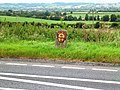 Milestone at Canegore Corner - geograph.org.uk - 543046.jpg 640 × 480 ; 120 kio
-
 New building at Steart Farm - geograph.org.uk - 5727477.jpg 1 024 × 817 ; 118 kio
-
 Old shed on Parsonage Road - geograph.org.uk - 5696014.jpg 1 024 × 797 ; 165 kio
-
 Outbuildings at Higher Farm - geograph.org.uk - 5696027.jpg 1 024 × 768 ; 164 kio
-
 Outbuildings at Steart Farm - geograph.org.uk - 5727472.jpg 1 024 × 762 ; 176 kio
-
 Podmore turning, A303 - geograph.org.uk - 5301464.jpg 640 × 426 ; 64 kio
-
 Rear Entrance to Downhead Manor Farm - geograph.org.uk - 5636132.jpg 640 × 427 ; 178 kio
-
 Redundant Postbox at Back Street West Camel - geograph.org.uk - 442130.jpg 640 × 480 ; 137 kio
-
 Sharp bend in Urgashay - geograph.org.uk - 5696170.jpg 1 024 × 838 ; 236 kio
-
 Slate Lane - geograph.org.uk - 5727047.jpg 1 024 × 818 ; 205 kio
-
 Small Orchard Near Spring Farm - geograph.org.uk - 5288837.jpg 640 × 480 ; 66 kio
-
 Solar Farm at Southfield Farm - geograph.org.uk - 5393162.jpg 640 × 432 ; 64 kio
-
 Solar Panels - geograph.org.uk - 5393165.jpg 640 × 427 ; 87 kio
-
 South Somerset , Grassy Countryside - geograph.org.uk - 3127016.jpg 4 288 × 2 848 ; 4,83 Mio
-
 South Somerset , Grassy Field - geograph.org.uk - 3127027.jpg 4 288 × 2 848 ; 5,68 Mio
-
 South Somerset , The A303 - geograph.org.uk - 3104426.jpg 4 288 × 2 848 ; 4,76 Mio
-
 South Somerset , The A303 Road - geograph.org.uk - 3127020.jpg 4 288 × 2 848 ; 5,54 Mio
-
 South Somerset , The A303 ^ Hawk House - geograph.org.uk - 3127022.jpg 4 288 × 2 848 ; 5,73 Mio
-
 Steart Bridge - geograph.org.uk - 2890470.jpg 640 × 480 ; 164 kio
-
 Steart Bridge - geograph.org.uk - 2890476.jpg 480 × 640 ; 151 kio
-
 Steart Bridge - geograph.org.uk - 5727466.jpg 1 024 × 768 ; 313 kio
-
 Steart Lane - geograph.org.uk - 5727483.jpg 1 024 × 806 ; 258 kio
-
 Stream near Spring Farm - geograph.org.uk - 5288573.jpg 640 × 427 ; 79 kio
-
 The Manor House - West Camel - geograph.org.uk - 442127.jpg 640 × 480 ; 197 kio
-
 Turning for Podimore - geograph.org.uk - 5728396.jpg 1 024 × 765 ; 147 kio
-
 Water Supply tank - geograph.org.uk - 708891.jpg 640 × 480 ; 67 kio
-
 West Camel - geograph.org.uk - 785214.jpg 640 × 357 ; 57 kio
-
 West Camel Hill - geograph.org.uk - 5727049.jpg 1 024 × 788 ; 167 kio
-
 West Camel Methodist Church - geograph.org.uk - 5366859.jpg 640 × 426 ; 61 kio
-
 West Camel, All Saints church - geograph.org.uk - 3047992.jpg 640 × 427 ; 215 kio
-
 West Camel, All Saints church - geograph.org.uk - 3047995.jpg 640 × 427 ; 175 kio
-

-
 West Camel, the river Cam - geograph.org.uk - 3048002.jpg 640 × 427 ; 237 kio
-
 Annis Hill from A303 - geograph.org.uk - 542971.jpg 640 × 480 ; 55 kio
-
 Bill's Lane - geograph.org.uk - 543533.jpg 640 × 480 ; 70 kio
-
 Bridge over Dyke Brook on Steart Lane - geograph.org.uk - 543034.jpg 640 × 480 ; 155 kio
-
 Buttercups - West Camel - geograph.org.uk - 442121.jpg 640 × 468 ; 149 kio
-
 Cottages at Downhead - geograph.org.uk - 442146.jpg 640 × 480 ; 138 kio
-
 Courtry Farmhouse - Bridgehampton - geograph.org.uk - 442152.jpg 640 × 480 ; 167 kio
-
 Dyke Brook - geograph.org.uk - 543014.jpg 640 × 480 ; 186 kio
-
 Dyke Brook view - geograph.org.uk - 543022.jpg 640 × 480 ; 82 kio
-
 Entrance to Courtry Farm - Bridgehampton - geograph.org.uk - 442148.jpg 640 × 480 ; 182 kio
-
 Farm track and barn near Sparkford - geograph.org.uk - 708866.jpg 640 × 480 ; 82 kio
-
 Lane at Spring farm - geograph.org.uk - 560963.jpg 640 × 425 ; 76 kio
-
 Lane towards Chantry farm - geograph.org.uk - 560965.jpg 640 × 425 ; 67 kio
-
 Lean Bean Pole - geograph.org.uk - 708874.jpg 640 × 480 ; 113 kio
-
 Naish's Farmhouse - West Camel - geograph.org.uk - 442117.jpg 640 × 480 ; 166 kio
-
 RNAS Yeovilton aerial farm - geograph.org.uk - 543051.jpg 640 × 480 ; 67 kio
-
 Slate Lane - geograph.org.uk - 543041.jpg 640 × 480 ; 118 kio
-
 The Old Mill on the River Cam, West Camel - geograph.org.uk - 693898.jpg 640 × 480 ; 247 kio
-
 The Old Rectory - West Camel - geograph.org.uk - 442125.jpg 640 × 480 ; 182 kio


