Category:West Clandon
Zur Navigation springen
Zur Suche springen
English: West Clandon is a village in Surrey, England. It is within 2 miles (3 km) of the M25 and the A3. Nearby villages include: Send, Ripley, Ockham, East and West Horsley. Local towns are Woking and Guildford.
Gemeinde in der englischen Grafschaft Surrey  | |||||
| Medium hochladen | |||||
| Ist ein(e) | |||||
|---|---|---|---|---|---|
| Ort | Borough of Guildford, Surrey, Südostengland, England | ||||
| Fläche |
| ||||
 | |||||
Unterkategorien
Es werden 5 von insgesamt 5 Unterkategorien in dieser Kategorie angezeigt:
In Klammern die Anzahl der enthaltenen Kategorien (K), Seiten (S), Dateien (D)
Medien in der Kategorie „West Clandon“
Folgende 200 Dateien sind in dieser Kategorie, von 287 insgesamt.
(vorherige Seite) (nächste Seite)-
 2016, a year on Geograph (Day 307) - geograph.org.uk - 5177927.jpg 640 × 480; 50 KB
-
 A 246, Epsom Road - geograph.org.uk - 4137080.jpg 2.048 × 1.536; 1,14 MB
-
 A shapely tree - geograph.org.uk - 5888580.jpg 1.024 × 768; 310 KB
-
 A247 at St Peter And St Paul - geograph.org.uk - 2857692.jpg 640 × 428; 100 KB
-
 A247 closed at A25 junction - geograph.org.uk - 5888526.jpg 1.024 × 768; 382 KB
-
 A25, Shere Road - geograph.org.uk - 4137186.jpg 2.048 × 1.536; 1,31 MB
-
 A3 - 1-2 mile to Burpham interchange - geograph.org.uk - 2686972.jpg 640 × 428; 80 KB
-
 A3 - 3 miles to Guildford - geograph.org.uk - 2686926.jpg 640 × 428; 58 KB
-
 A3 approaching A247 bridge - geograph.org.uk - 2686922.jpg 640 × 428; 68 KB
-
 A3 near Burnt Common - geograph.org.uk - 4261492.jpg 640 × 425; 56 KB
-
 A3 towards Guildford - geograph.org.uk - 2686912.jpg 640 × 428; 74 KB
-
 A3, Burnt Common - geograph.org.uk - 4261495.jpg 640 × 379; 37 KB
-
 Access Road off the A25 - geograph.org.uk - 4137217.jpg 2.048 × 1.536; 1,71 MB
-
 Access road off the Shere Road - geograph.org.uk - 4137180.jpg 2.048 × 1.536; 1,54 MB
-
 Access Road to Nuthill Farm - geograph.org.uk - 6022934.jpg 1.440 × 1.080; 1,15 MB
-
 Access Road to Wellhouse Farm - geograph.org.uk - 6023140.jpg 3.648 × 2.736; 4,92 MB
-
 An empty car park at Clandon Park - geograph.org.uk - 5918017.jpg 640 × 480; 102 KB
-
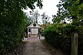
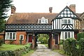
 Arch by The Street, West Clandon - geograph.org.uk - 5362302.jpg 1.728 × 2.304; 1,47 MB
-
 Autumn on Merrow Lane - geograph.org.uk - 1030954.jpg 640 × 480; 125 KB
-
 Avenue to West Clandon Church - geograph.org.uk - 1085789.jpg 480 × 640; 125 KB
-
 Barn at Tythebarns - geograph.org.uk - 1001421.jpg 640 × 480; 69 KB
-
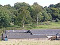 Barns at Old Scotland Farm - geograph.org.uk - 992368.jpg 640 × 480; 110 KB
-
 Barriers and Barriers - geograph.org.uk - 2731065.jpg 2.560 × 1.920; 1,68 MB
-
 Benches, Clandon Park - geograph.org.uk - 3626077.jpg 1.600 × 1.200; 856 KB
-
 Berry Bower - geograph.org.uk - 2729133.jpg 2.560 × 1.920; 1,65 MB
-
 Bones of a tree - geograph.org.uk - 5888549.jpg 1.024 × 768; 322 KB
-
 Bridlebridge on Green Lane - geograph.org.uk - 3839465.jpg 800 × 600; 193 KB
-
 Brown and Yellow Butterfly - geograph.org.uk - 3056535.jpg 1.753 × 1.409; 868 KB
-
 Bull's Head - geograph.org.uk - 2731031.jpg 1.920 × 2.560; 1,87 MB
-

-
 Bus stop on A3 - geograph.org.uk - 2686948.jpg 640 × 428; 70 KB
-
 Bus stop on Epsom Road south of Clandon Park - geograph.org.uk - 2810591.jpg 1.024 × 768; 255 KB
-
 By Old Scotland Farm - geograph.org.uk - 974826.jpg 640 × 480; 94 KB
-
 Carefree Pedestrians - geograph.org.uk - 3056382.jpg 4.288 × 3.216; 2,71 MB
-
 Central reservation on Epsom Road, East Clandon - geograph.org.uk - 4827835.jpg 2.048 × 1.536; 1,51 MB
-

-
 Clandon Downs - geograph.org.uk - 4137346.jpg 2.048 × 1.536; 1,33 MB
-
 Clandon Downs - geograph.org.uk - 992295.jpg 640 × 480; 97 KB
-
 Clandon Downs - geograph.org.uk - 992309.jpg 640 × 480; 89 KB
-
 Clandon Park - Angling Pond - geograph.org.uk - 5254086.jpg 2.560 × 1.920; 3,31 MB
-
 Clandon Park - geograph.org.uk - 3625279.jpg 1.600 × 1.200; 344 KB
-
 Clandon Park - geograph.org.uk - 3944476.jpg 2.048 × 1.536; 1,4 MB
-
 Clandon Park - geograph.org.uk - 6023139.jpg 3.648 × 2.736; 3,41 MB
-
 Clandon Park - WW1 Display - geograph.org.uk - 5251467.jpg 2.560 × 1.920; 2,4 MB
-
 Clandon Park estate - geograph.org.uk - 3868595.jpg 2.048 × 1.536; 1,29 MB
-
 Clandon Park in 1981 - geograph.org.uk - 5470658.jpg 1.024 × 651; 210 KB
-
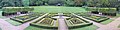 Clandon Park, Parterre - geograph.org.uk - 3660055.jpg 7.779 × 1.924; 3,09 MB
-
 Clandon Park, path to Garden Centre - geograph.org.uk - 3625392.jpg 1.600 × 1.200; 435 KB
-
-
 Clandon railway station, Surrey - geograph.org.uk - 3775291.jpg 1.024 × 768; 201 KB
-
 Clandon Regis - geograph.org.uk - 1085918.jpg 640 × 480; 128 KB
-
 Clandon Regis - geograph.org.uk - 281316.jpg 480 × 640; 187 KB
-
 Clandon Regis Golf Club - geograph.org.uk - 1085923.jpg 640 × 480; 126 KB
-
 Clandon Regis Golf Club - geograph.org.uk - 1085930.jpg 640 × 480; 122 KB
-
 Clandon Regis golf club entrance - geograph.org.uk - 4136689.jpg 2.048 × 1.536; 1,27 MB
-
 Clandon Regis Golf Course - geograph.org.uk - 1085936.jpg 640 × 480; 119 KB
-
 Clandon Regis Golf Course - geograph.org.uk - 1494864.jpg 640 × 428; 65 KB
-
 Clandon Road going north - geograph.org.uk - 3838857.jpg 800 × 600; 177 KB
-
 Clandon School - geograph.org.uk - 2729137.jpg 2.560 × 1.920; 1,82 MB
-
 Clandon Station - geograph.org.uk - 4362139.jpg 1.024 × 768; 203 KB
-

-
 Club House at Clandon Regis Golf Course - geograph.org.uk - 6023137.jpg 3.648 × 2.736; 2,42 MB
-
 Cones and Cones - geograph.org.uk - 2731071.jpg 2.560 × 1.920; 1,74 MB
-
 Coppiced area in Merrow Downs woodland - geograph.org.uk - 2999565.jpg 640 × 480; 207 KB
-
 Cottages in West Clandon - geograph.org.uk - 1085902.jpg 480 × 640; 117 KB
-
 Covered reservoir - geograph.org.uk - 4137202.jpg 2.048 × 1.536; 1,35 MB
-
 Covered reservoir - geograph.org.uk - 4137351.jpg 2.048 × 1.536; 1,38 MB
-

-
 Dean Bottom - geograph.org.uk - 993383.jpg 640 × 480; 95 KB
-
 Dedswell Manor Farm - geograph.org.uk - 2880926.jpg 2.048 × 1.536; 1,39 MB
-
 Dedswell Manor Farm House - geograph.org.uk - 2880910.jpg 2.025 × 1.517; 404 KB
-
 Dedswell Manor Farmhouse - geograph.org.uk - 3838873.jpg 800 × 600; 154 KB
-
 Difficult driving conditions - geograph.org.uk - 1167824.jpg 640 × 425; 92 KB
-
 Downland by Cotts Wood - geograph.org.uk - 1086573.jpg 640 × 480; 56 KB
-
 Downland Landscape by West Clandon - geograph.org.uk - 1086491.jpg 640 × 480; 86 KB
-
 Downland Landscape, West Clandon - geograph.org.uk - 1086493.jpg 640 × 480; 83 KB
-
 Drawing the Line - geograph.org.uk - 826715.jpg 640 × 480; 140 KB
-
 Dutch Garden, Clandon Park - geograph.org.uk - 3625877.jpg 1.600 × 1.200; 675 KB
-
 Dutch Garden, Clandon Park - geograph.org.uk - 3625897.jpg 1.600 × 1.200; 686 KB
-
 Electricity sub-station, The Street - geograph.org.uk - 1760913.jpg 800 × 600; 131 KB
-
 End of Lime Grove and Junction with Woodstock - geograph.org.uk - 6022783.jpg 3.648 × 2.736; 4 MB
-
 Epsom Road at the junction of The Street - geograph.org.uk - 4827821.jpg 1.974 × 1.430; 739 KB
-
 Epsom Road, West Clandon - geograph.org.uk - 2582782.jpg 4.320 × 3.240; 5,02 MB
-
 Ewbank's Auction Rooms - geograph.org.uk - 5950904.jpg 3.809 × 1.601; 408 KB
-
 Exit to Potters Lane on the A3 - geograph.org.uk - 2576088.jpg 1.600 × 1.200; 574 KB
-
 Farm buildings at Dedswell Manor Farm - geograph.org.uk - 3838888.jpg 800 × 600; 142 KB
-
 Farm track near West Clandon - geograph.org.uk - 3838034.jpg 800 × 600; 221 KB
-
 Farm track under railway bridge - geograph.org.uk - 3838892.jpg 800 × 600; 160 KB
-
 Farmland, Clandon Downs - geograph.org.uk - 4137716.jpg 2.048 × 1.536; 1,45 MB
-
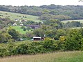
 Farmland, West Clandon - geograph.org.uk - 2877835.jpg 2.048 × 1.536; 1,43 MB
-
 Field by Clandon Road - geograph.org.uk - 4286010.jpg 4.608 × 3.456; 5,01 MB
-
 Field by Tithebarns Lane, Burntcommon - geograph.org.uk - 4285237.jpg 4.608 × 3.456; 4,97 MB
-
 Field on chalk downland - geograph.org.uk - 4137668.jpg 2.048 × 1.536; 962 KB
-
 Field with a view - geograph.org.uk - 4137411.jpg 2.048 × 1.536; 1,33 MB
-
 Flooded footpaths by the golf course - geograph.org.uk - 3839046.jpg 800 × 600; 254 KB
-
 Flowerbed near Clandon Park House - geograph.org.uk - 3626106.jpg 1.600 × 1.118; 796 KB
-
 Folly and Horse - geograph.org.uk - 3944496.jpg 2.048 × 1.536; 1,58 MB
-
 Footbridge in Clandon Park (1) - geograph.org.uk - 3839021.jpg 800 × 600; 235 KB
-
 Footbridge in Clandon Park (2) - geograph.org.uk - 3839024.jpg 800 × 600; 233 KB
-
 Footbridge, Green Lane - geograph.org.uk - 2881030.jpg 2.048 × 1.536; 1,07 MB
-
 Footbridge, West Clandon - geograph.org.uk - 2881050.jpg 2.048 × 1.536; 1,44 MB
-
 Footpath above Wellhouse Farm - geograph.org.uk - 4137417.jpg 2.048 × 1.536; 1,79 MB
-
 Footpath along the hedge - geograph.org.uk - 4138161.jpg 2.048 × 1.536; 1,46 MB
-
 Footpath approaching Clandon Park - geograph.org.uk - 4135220.jpg 1.024 × 768; 169 KB
-
 Footpath at Clandon Park - geograph.org.uk - 6023130.jpg 3.648 × 2.736; 5,8 MB
-
 Footpath at West Clandon, Surrey - geograph.org.uk - 1494786.jpg 640 × 428; 90 KB
-

-
 Footpath emerging from woodland, Merrow Common - geograph.org.uk - 4134605.jpg 749 × 1.024; 171 KB
-

-
 Footpath going south from Highcotts Lane - geograph.org.uk - 3838867.jpg 800 × 600; 149 KB
-
 Footpath near Oldlands Copse - geograph.org.uk - 4189686.jpg 2.048 × 1.536; 2,77 MB
-
 Footpath reaches Shere Road - geograph.org.uk - 2810600.jpg 1.024 × 768; 305 KB
-
 Footpath through the grass - geograph.org.uk - 4137210.jpg 2.048 × 1.536; 1,29 MB
-
 Footpath to West Clandon Church - geograph.org.uk - 992288.jpg 640 × 480; 137 KB
-
 Footpath, West Clandon - geograph.org.uk - 2880947.jpg 2.048 × 1.536; 1,43 MB
-
 Glebe Cottages access road - geograph.org.uk - 4136687.jpg 1.957 × 1.467; 784 KB
-
 Gosden Hill Farm - geograph.org.uk - 2877805.jpg 2.048 × 1.536; 1,41 MB
-
 Gosden Hill Farm - geograph.org.uk - 2877807.jpg 2.048 × 1.536; 1,37 MB
-
 Gosden Hill farm - geograph.org.uk - 2877814.jpg 2.048 × 1.536; 1,41 MB
-
 Gosden Hill Farm - geograph.org.uk - 2877827.jpg 2.048 × 1.536; 1,39 MB
-
 Gosden Hill Farms - geograph.org.uk - 2877818.jpg 2.048 × 1.536; 1,41 MB
-
 Grazing by Merrow - geograph.org.uk - 2731076.jpg 2.560 × 1.920; 1,7 MB
-
 Green Lane - geograph.org.uk - 2880999.jpg 2.048 × 1.536; 1,35 MB
-
 Green Lane - geograph.org.uk - 2881011.jpg 2.048 × 1.536; 1,43 MB
-
 Green Lane - geograph.org.uk - 2881022.jpg 2.048 × 1.536; 1,45 MB
-
 Green Lane - geograph.org.uk - 6073402.jpg 768 × 1.024; 335 KB
-

-
 Grotto - Clandon Park - geograph.org.uk - 3625716.jpg 1.600 × 1.200; 836 KB
-
 Grotto at Clandon Park - geograph.org.uk - 5470879.jpg 1.024 × 641; 272 KB
-
 Guildford Manor Hotel - geograph.org.uk - 5950796.jpg 2.373 × 1.476; 434 KB
-
 Ha-ha, Clandon Park - geograph.org.uk - 3944485.jpg 2.048 × 1.536; 1,6 MB
-
 Hay There^ - geograph.org.uk - 1086488.jpg 640 × 480; 85 KB
-
 Hazlehurst Cottage - geograph.org.uk - 2881007.jpg 2.048 × 1.536; 1,45 MB
-
 High Clandon Farm - geograph.org.uk - 907595.jpg 640 × 480; 101 KB
-
 Highcotts Lane looking north - geograph.org.uk - 3838863.jpg 800 × 600; 221 KB
-
 Hinemihi, Maori Meeting House - geograph.org.uk - 5686328.jpg 640 × 481; 141 KB
-
 Horse Jumps - geograph.org.uk - 5254081.jpg 2.560 × 1.920; 3,13 MB
-
 House at West Clandon, Surrey - geograph.org.uk - 1494586.jpg 640 × 428; 97 KB
-
 House on Clandon Road, West Clandon - geograph.org.uk - 4285973.jpg 4.608 × 3.456; 5,11 MB
-

-
 Junction on Tithebarns Lane, Burntcommon - geograph.org.uk - 4285192.jpg 4.608 × 3.456; 4,79 MB
-
 L'auberge at the Onslow Arms, The Street - geograph.org.uk - 1760846.jpg 1.024 × 702; 238 KB
-

-
 Lime Avenue, Clandon Park - geograph.org.uk - 3625803.jpg 1.600 × 1.200; 678 KB
-
 Lime Avenue, Clandon Park - geograph.org.uk - 3625814.jpg 1.600 × 1.200; 818 KB
-
 Lime Grove - geograph.org.uk - 2880954.jpg 2.048 × 1.536; 1,34 MB
-
 Lime Grove, West Clandon - geograph.org.uk - 5362344.jpg 2.304 × 1.728; 855 KB
-
 Lodge at West Clandon, Surrey - geograph.org.uk - 1494630.jpg 640 × 428; 101 KB
-
 Lych Gate, West Clandon - geograph.org.uk - 2731041.jpg 2.560 × 1.920; 1,81 MB
-
 Major crossroads on the A25 - geograph.org.uk - 2810595.jpg 1.024 × 768; 229 KB
-
 Manor House Hotel near Newlands Corner - geograph.org.uk - 4855205.jpg 4.000 × 3.000; 3,48 MB
-
 Maori Carvings, Clandon Park - geograph.org.uk - 3660061.jpg 2.082 × 2.810; 1,31 MB
-
 Meadowlands, West Clandon - geograph.org.uk - 5950802.jpg 1.878 × 936; 193 KB
-
 Merrow Common - geograph.org.uk - 2843950.jpg 2.048 × 1.536; 1,42 MB
-
 Merrow Marker - geograph.org.uk - 826697.jpg 640 × 480; 148 KB
-
 Merrow Meadow - geograph.org.uk - 3056554.jpg 4.288 × 3.216; 3,53 MB
-
 Mistletoe - geograph.org.uk - 1085912.jpg 640 × 480; 168 KB
-
 Narrow Bridleway on the Clandon Downs - geograph.org.uk - 6023141.jpg 3.648 × 2.736; 4,47 MB
-
 Nearly dead tree, Merrow Common - geograph.org.uk - 2986918.jpg 640 × 480; 111 KB
-
 New Trees - geograph.org.uk - 147994.jpg 640 × 480; 83 KB
-
 New Zealand hut in Surrey - geograph.org.uk - 3604321.jpg 1.713 × 891; 431 KB
-
 Nuthill Farm - geograph.org.uk - 6023129.jpg 1.440 × 1.080; 1,06 MB
-
 NW corner of Clandon Park - geograph.org.uk - 5888571.jpg 1.024 × 768; 275 KB
-
 Oak Ride Farm - geograph.org.uk - 4189690.jpg 2.048 × 1.536; 2,74 MB
-
 Old Ford by West Clandon - geograph.org.uk - 1086502.jpg 640 × 480; 147 KB
-
 Old Milestone by the A246, Epsom Road, Clandon Park (geograph 5583702).jpg 740 × 1.024; 277 KB
-
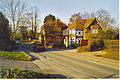 Onslow Arms, West Clandon. - geograph.org.uk - 140730.jpg 640 × 429; 137 KB
-
 Ornamental stands, Clandon Park - geograph.org.uk - 3944473.jpg 1.946 × 1.459; 957 KB
-
 Out of the woods, Clandon Downs - geograph.org.uk - 4137701.jpg 2.048 × 1.536; 1,23 MB
-
 Parterre, Clandon Park - geograph.org.uk - 3626096.jpg 1.600 × 1.200; 872 KB
-
 Path along Oldlands Copse - geograph.org.uk - 4189697.jpg 2.048 × 1.536; 2,87 MB
-
 Path entrance on The Street, West Clandon - geograph.org.uk - 5362317.jpg 2.304 × 1.728; 811 KB
-
 Path off The Street, West Clandon - geograph.org.uk - 5362304.jpg 2.304 × 1.728; 779 KB
-
 Poplars, West Clandon - geograph.org.uk - 2880986.jpg 2.048 × 1.536; 1,26 MB
-
 Pre-Worboys road number on Epsom Road, Clandon - geograph.org.uk - 3925424.jpg 2.560 × 1.920; 1,92 MB
-
 Pylon in the woods - geograph.org.uk - 2877823.jpg 2.048 × 1.536; 1,41 MB
-
 Pylon, West Clandon - geograph.org.uk - 2877843.jpg 1.965 × 1.474; 399 KB
-
 Railway Bridge - geograph.org.uk - 148009.jpg 640 × 480; 100 KB
-
 Red Brick and Orange Pyracantha - geograph.org.uk - 1494648.jpg 640 × 428; 72 KB
-
 Red phone box on The Street, Clandon - geograph.org.uk - 2680186.jpg 1.600 × 1.200; 587 KB
-
 Retail premises - geograph.org.uk - 3966753.jpg 2.048 × 1.536; 1,47 MB
-
 ROAD AHEAD CLOSED - geograph.org.uk - 3056364.jpg 4.288 × 3.216; 3,66 MB
-
 Road junction, West Clandon, Surrey - geograph.org.uk - 3340595.jpg 1.600 × 1.152; 410 KB
-

-
 Road works on A247 - geograph.org.uk - 2857717.jpg 640 × 428; 128 KB
-
 Roadworks, West Clandon - geograph.org.uk - 2731058.jpg 1.920 × 2.560; 1,56 MB
-
 Rustic Bark - geograph.org.uk - 1085801.jpg 480 × 640; 116 KB
-
 Snowy Clandon House - geograph.org.uk - 2917356.jpg 2.520 × 1.680; 402 KB
-

-
 Southbound A3 near Burpham Exit - geograph.org.uk - 4480426.jpg 640 × 480; 251 KB
-
 Southbound A3, Burntcommon - geograph.org.uk - 4480417.jpg 640 × 480; 230 KB
-
 Storm clouds near East Clandon - geograph.org.uk - 4137692.jpg 1.995 × 1.495; 869 KB
-
 Stream, Clandon Park - geograph.org.uk - 2729118.jpg 2.560 × 1.920; 1,66 MB
-
 Stubble field, Clandon Downs - geograph.org.uk - 4136705.jpg 1.937 × 1.452; 1,08 MB
-
 Stubble field, Clandon Downs - geograph.org.uk - 4137075.jpg 2.048 × 1.536; 1,41 MB
-
 Sun Valley - geograph.org.uk - 993398.jpg 640 × 480; 89 KB
-
 Sundial, West Clandon - geograph.org.uk - 2731047.jpg 2.560 × 1.920; 1,58 MB
-
 Telephone Exchange, West Clandon - geograph.org.uk - 2310901.jpg 3.072 × 2.304; 1,79 MB
-
 Temple Court - geograph.org.uk - 1085753.jpg 640 × 480; 69 KB
-
 Temple Court - geograph.org.uk - 3868373.jpg 2.048 × 1.536; 1,4 MB
_-_geograph.org.uk_-_5177927.jpg)


_-_geograph.org.uk_-_3839021.jpg)
_-_geograph.org.uk_-_3839024.jpg)


_Ltd,_Clandon_Station,_Surrey_-_geograph.org.uk_-_1494558.jpg)


.jpg)


