Category:West Stafford
Vai alla navigazione
Vai alla ricerca
English: West Stafford is a village in south west Dorset, England, situated in the Frome valley two miles east of Dorchester. The village has a population of 270 . It contains 'The Wise Man Inn' which is the village pub and St Andrew's Church. The river Winterbourne runs beside the village and 2 miles south lies the village of West Knighton.
village and civil parish in Dorset, United Kingdom  | |||||
| Carica un file multimediale | |||||
| Istanza di | |||||
|---|---|---|---|---|---|
| Luogo | Dorset, Sud Ovest dell'Inghilterra, Inghilterra | ||||
 | |||||
Sottocategorie
Questa categoria contiene le 3 sottocategorie indicate di seguito, su un totale di 3.
+
S
- Stafford House, Dorset (1 F)
File nella categoria "West Stafford"
Questa categoria contiene 40 file, indicati di seguito, su un totale di 40.
-
 1967 Morris Minor 1000 - geograph.org.uk - 6211545.jpg 2 592 × 1 936; 548 KB
-
 Barrow just east of Dorchester - geograph.org.uk - 707187.jpg 640 × 480; 118 KB
-
 Big brother, little brother - geograph.org.uk - 707189.jpg 640 × 480; 78 KB
-

-

-

-

-

-
 Dorset Bridge notice - geograph.org.uk - 3562638.jpg 3 072 × 2 304; 3,55 MB
-
 Entrance to West Safford - geograph.org.uk - 2789289.jpg 640 × 451; 93 KB
-

-

-
 Frome Hill Cottage - geograph.org.uk - 554845.jpg 640 × 480; 168 KB
-
 Hardy Way near Frome Farm - geograph.org.uk - 5891116.jpg 640 × 427; 62 KB
-
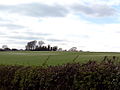 Mount Pleasant Henge - April 2015.jpg 1 200 × 900; 265 KB
-
 Pyramidal Orchid, West Stafford - geograph.org.uk - 3602270.jpg 3 456 × 4 608; 1,41 MB
-
 Railway Bridge at Frome Hill - geograph.org.uk - 554842.jpg 640 × 480; 187 KB
-
 Re-Thatching of Lower Lewell Farm Barn - geograph.org.uk - 797480.jpg 426 × 640; 106 KB
-
 River Frome Lower Bockhampton. - geograph.org.uk - 2885514.jpg 640 × 480; 90 KB
-
 Road into West Stafford - geograph.org.uk - 5891181.jpg 640 × 427; 101 KB
-
 Stafford Farm - geograph.org.uk - 5070736.jpg 640 × 480; 48 KB
-
 Stafford House - geograph.org.uk - 5642942.jpg 1 024 × 768; 201 KB
-
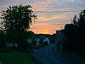 Summer Sunset Over West Stafford - geograph.org.uk - 143260.jpg 640 × 480; 58 KB
-
 Talbothays Cottages - geograph.org.uk - 5070745.jpg 640 × 480; 49 KB
-
 The Frome looking west towards Dorchester - geograph.org.uk - 554810.jpg 640 × 480; 130 KB
-
 The Wise Man, West Stafford - geograph.org.uk - 2789294.jpg 640 × 465; 51 KB
-
 Traveller's Site on Frome Hill - geograph.org.uk - 2697390.jpg 640 × 480; 132 KB
-
 View towards Stafford Farm - geograph.org.uk - 554834.jpg 640 × 480; 161 KB
-
 West Stafford - geograph.org.uk - 5070748.jpg 640 × 480; 91 KB
-
 West Stafford Village Hall - geograph.org.uk - 5642894.jpg 1 024 × 768; 192 KB
-
 West Stafford, Barton Road - geograph.org.uk - 1365047.jpg 640 × 480; 74 KB
-
 West Stafford, burial ground - geograph.org.uk - 5642959.jpg 1 024 × 768; 218 KB
-
 West Stafford, bus shelter - geograph.org.uk - 5642908.jpg 1 024 × 768; 157 KB
-
 West Stafford, postbox No. DT2 55 - geograph.org.uk - 1365042.jpg 640 × 480; 102 KB
-
 West Stafford, red telephone box - geograph.org.uk - 4722958.jpg 480 × 640; 69 KB
-

-
 West Stafford, South Winterborne - geograph.org.uk - 5642920.jpg 1 024 × 768; 284 KB
-
 West Stafford, Wise Man - geograph.org.uk - 5642905.jpg 1 024 × 751; 140 KB
-
 West Stafford, Wise Man Cottage - geograph.org.uk - 5642953.jpg 1 024 × 768; 189 KB
-
 Cyclists at the Wise Man - geograph.org.uk - 20421.jpg 640 × 480; 232 KB


_-_geograph.org.uk_-_4842319.jpg)
_-_geograph.org.uk_-_4842324.jpg)
_-_geograph.org.uk_-_4842330.jpg)
_-_geograph.org.uk_-_4842335.jpg)
_-_geograph.org.uk_-_4842337.jpg)


