Category:Weston-on-the-Green
Aller à la navigation
Aller à la recherche
localité britannique du comté anglais d'Oxfordshire  | |||||
| Téléverser des médias | |||||
| Nature de l’élément | |||||
|---|---|---|---|---|---|
| Lieu | Cherwell, Oxfordshire, Angleterre du Sud-Est, Angleterre | ||||
| Population |
| ||||
| Superficie |
| ||||
| site officiel | |||||
 | |||||
Sous-catégories
Cette catégorie comprend 2 sous-catégories, dont les 2 ci-dessous.
Média dans la catégorie « Weston-on-the-Green »
Cette catégorie comprend 139 fichiers, dont les 139 ci-dessous.
-
 "Crash gate" - geograph.org.uk - 345185.jpg 640 × 480 ; 218 kio
-
 1 mile to junction 9 M40 - geograph.org.uk - 1833880.jpg 640 × 480 ; 57 kio
-

-
 A34 approaching Wendlebury Interchange - geograph.org.uk - 5648488.jpg 640 × 426 ; 63 kio
-
 A34 at B430 turning - geograph.org.uk - 5648472.jpg 640 × 395 ; 47 kio
-
 A34 Family Farm Services - geograph.org.uk - 2534935.jpg 3 648 × 2 736 ; 1,38 Mio
-
 A34 near Family Farm Services - geograph.org.uk - 3102906.jpg 640 × 479 ; 36 kio
-
 A34 near Weston Park Farm - geograph.org.uk - 2836162.jpg 640 × 480 ; 39 kio
-
 A34 near Weston-on-the-Green - geograph.org.uk - 3181408.jpg 3 036 × 2 010 ; 3,63 Mio
-
 A34 northbound - geograph.org.uk - 5637961.jpg 640 × 428 ; 74 kio
-
 A34 northbound - geograph.org.uk - 5637965.jpg 640 × 428 ; 80 kio
-
 A34 northbound - geograph.org.uk - 5637970.jpg 640 × 428 ; 69 kio
-
 A34, Family Farm Service Area - geograph.org.uk - 5648470.jpg 640 × 406 ; 51 kio
-
 A34, Layby near Wendlebury Junction - geograph.org.uk - 3296865.jpg 640 × 427 ; 376 kio
-
 A34, northbound - geograph.org.uk - 5648491.jpg 640 × 389 ; 43 kio
-
 A34, Weston-on-The-Green - geograph.org.uk - 3296849.jpg 640 × 427 ; 343 kio
-
 Akeman Street - geograph.org.uk - 1045268.jpg 640 × 552 ; 124 kio
-
 Akeman Street crosses the B430 - geograph.org.uk - 4752673.jpg 1 500 × 1 125 ; 186 kio
-
 Akeman Street heading east - geograph.org.uk - 4752669.jpg 1 500 × 1 125 ; 178 kio
-
 Akeman Street, Roman Road - geograph.org.uk - 4354618.jpg 640 × 480 ; 71 kio
-
 Approaching Family Farm Services on the A34 - geograph.org.uk - 2325102.jpg 640 × 480 ; 86 kio
-
 B430 bridge over A34 - geograph.org.uk - 5528829.jpg 1 600 × 798 ; 505 kio
-
 B430 Northampton Road - geograph.org.uk - 2836233.jpg 640 × 481 ; 36 kio
-
 B430 Turning off the A34 - geograph.org.uk - 6260337.jpg 640 × 444 ; 40 kio
-
 Black Leys wood, near Weston on the Green - geograph.org.uk - 384429.jpg 640 × 480 ; 230 kio
-
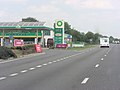
 BP Filling Station at the Family Farm Services - geograph.org.uk - 1743779.jpg 1 500 × 985 ; 130 kio
-
 BP Filling station off A34 - geograph.org.uk - 1826030.jpg 640 × 480 ; 77 kio
-
 BP fuel at the A34 services, near Weston-on-The -Green - geograph.org.uk - 6190629.jpg 1 024 × 747 ; 157 kio
-
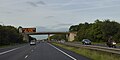
 Bridge carrying B430 over A34 - geograph.org.uk - 6371418.jpg 1 024 × 768 ; 71 kio
-
 Cherwell , BP Petrol Station - geograph.org.uk - 6113514.jpg 6 000 × 4 000 ; 6,65 Mio
-
 Cherwell , Northampton Road - geograph.org.uk - 6113518.jpg 6 000 × 4 000 ; 7,37 Mio
-
 Cherwell , The A34 - geograph.org.uk - 6113516.jpg 6 000 × 4 000 ; 6,4 Mio
-
 Cherwell , The A34 - geograph.org.uk - 6113519.jpg 6 000 × 4 000 ; 6,66 Mio
-
 Cherwell , The A34 - geograph.org.uk - 6113520.jpg 6 000 × 4 000 ; 6,69 Mio
-
 Cherwell , The A34 - geograph.org.uk - 6113521.jpg 6 000 × 4 000 ; 6,31 Mio
-
 Cherwell , The M40 Northbound - geograph.org.uk - 6113524.jpg 6 000 × 4 000 ; 7,77 Mio
-
 Cherwell , The M40 Northbound - geograph.org.uk - 6113525.jpg 6 000 × 4 000 ; 7,04 Mio
-
 Church Lane, Weston-on-the-Green - geograph.org.uk - 1967773.jpg 640 × 405 ; 79 kio
-
 Cottages - geograph.org.uk - 357712.jpg 640 × 479 ; 233 kio
-

-
 Family Farm service area by A34 - geograph.org.uk - 5528821.jpg 1 600 × 965 ; 577 kio
-
 Family Farm Service Area, Northbound A34 - geograph.org.uk - 3296839.jpg 640 × 480 ; 422 kio
-
 Family Farm services, A34 - geograph.org.uk - 1803144.jpg 2 000 × 1 498 ; 141 kio
-
-

-

-
 Footpath across the fields - geograph.org.uk - 4487699.jpg 4 320 × 3 240 ; 5,59 Mio
-
 Footpath closure warning - geograph.org.uk - 4487700.jpg 4 320 × 3 240 ; 6,11 Mio
-
 Footpath to Gaerleon - geograph.org.uk - 2769847.jpg 640 × 480 ; 80 kio
-
 Gate into field near Chesterton - geograph.org.uk - 1917004.jpg 640 × 480 ; 95 kio
-
 Half mile from Wendlebury Interchange, A34 - geograph.org.uk - 5648489.jpg 640 × 426 ; 78 kio
-
 Half-mile warning sign for junction of A34 and M40 - geograph.org.uk - 5528840.jpg 1 600 × 1 599 ; 754 kio
-

-
 Lady Georgiana Bertie and her son Charles 1835.jpg 1 025 × 1 315 ; 158 kio
-
 Lady Olive Grace Greville.jpg 1 197 × 1 594 ; 230 kio
-
 Livestock Lorry - geograph.org.uk - 4487673.jpg 4 320 × 3 240 ; 5,47 Mio
-
 Lord Charles Greville 1924.jpg 1 000 × 1 284 ; 157 kio
-
 M40 heading north near Chesterton - geograph.org.uk - 2987571.jpg 640 × 480 ; 50 kio
-
 M40 motorway curving north of junction 9 - geograph.org.uk - 3022668.jpg 640 × 480 ; 44 kio
-
 M40 motorway near Greystone Court - geograph.org.uk - 3022669.jpg 640 × 480 ; 63 kio
-
 M40 northbound - geograph.org.uk - 6191609.jpg 1 024 × 684 ; 250 kio
-
 M40, Junction 9 - geograph.org.uk - 2687435.jpg 640 × 335 ; 35 kio
-
 New Barn Farm, Weston on the Green - geograph.org.uk - 379312.jpg 640 × 480 ; 80 kio
-
 Northampton Road at The Ben Johnson Inn - geograph.org.uk - 2836202.jpg 640 × 481 ; 43 kio
-
 Northampton Road heading south - geograph.org.uk - 4752676.jpg 1 500 × 1 125 ; 123 kio
-
 Northampton Road near Weston-on-The-Green - geograph.org.uk - 2836189.jpg 640 × 481 ; 50 kio
-
 Northbound A34 - geograph.org.uk - 3296878.jpg 640 × 480 ; 397 kio
-
 Northbound A34 near Wendlebury Junction - geograph.org.uk - 3296854.jpg 640 × 480 ; 458 kio
-
 Paddock and house in Weston-on-the-Green - geograph.org.uk - 387619.jpg 640 × 480 ; 226 kio
-
 Parachutists on Airfield next to B430 - geograph.org.uk - 6001977.jpg 4 160 × 3 120 ; 2,69 Mio
-
 Parachutists transport at Skydive Weston - geograph.org.uk - 1882262.jpg 3 648 × 2 736 ; 2,04 Mio
-
 Pasture, by Stonehouse Farm, Weston on the Green - geograph.org.uk - 386554.jpg 640 × 480 ; 201 kio
-
 Peregrine Francis Bertie.jpg 1 000 × 1 408 ; 130 kio
-
 Pumping station and Gallos Brook - geograph.org.uk - 5363714.jpg 1 024 × 768 ; 325 kio
-
 Rev Frederick Bertie and his daughter Agnes.jpg 1 200 × 1 327 ; 225 kio
-
 Services on the A34 southbound - geograph.org.uk - 6377906.jpg 1 024 × 768 ; 166 kio
-
 Sewer works at Weston-on-the-Green - geograph.org.uk - 357711.jpg 640 × 480 ; 234 kio
-
 Shell filling station at eastern side of the A34 - geograph.org.uk - 3400704.jpg 3 648 × 2 736 ; 2,3 Mio
-
 Signage on M40 approaching A34 junction - geograph.org.uk - 6371419.jpg 1 024 × 768 ; 88 kio
-
 Slip Road to M40 at Junction 9 - geograph.org.uk - 3296893.jpg 640 × 480 ; 365 kio
-
 Southbound M40 approaching Junction 9 - geograph.org.uk - 3296758.jpg 640 × 404 ; 195 kio
-
 St Mary's Church in Weston on the Green - geograph.org.uk - 4735519.jpg 1 500 × 1 125 ; 182 kio
-
 Starbucks at the A34 services, near Weston-on-The -Green - geograph.org.uk - 6190616.jpg 1 024 × 746 ; 160 kio
-
 Starbucks on the A34 - geograph.org.uk - 5904847.jpg 1 024 × 683 ; 169 kio
-
 Stile by a wet field, near Weston on the Green. - geograph.org.uk - 386578.jpg 480 × 640 ; 129 kio
-
 Stocks at Weston on the Green - geograph.org.uk - 2856713.jpg 2 816 × 2 112 ; 2,22 Mio
-
 Stocks at Weston on the Green - geograph.org.uk - 357718.jpg 640 × 479 ; 161 kio
-
 Stocks on the green in Weston-on-the-Green - geograph.org.uk - 1916686.jpg 640 × 480 ; 136 kio
-
 Stocks, Weston-on-the-Green - geograph.org.uk - 1046454.jpg 640 × 480 ; 153 kio
-

-

-

-

-

-
 Thatched Pub - geograph.org.uk - 4481671.jpg 4 320 × 3 240 ; 5,21 Mio
-
 The A34 near Weston-on-the-Green - geograph.org.uk - 4310110.jpg 1 500 × 999 ; 104 kio
-
 The A34 near Weston-on-the-Green - geograph.org.uk - 4310113.jpg 1 500 × 999 ; 104 kio
-
 The A34 near Weston-on-The-Green - geograph.org.uk - 5576570.jpg 6 000 × 4 000 ; 5,25 Mio
-
 The B430 heading south - geograph.org.uk - 4752675.jpg 1 500 × 1 125 ; 162 kio
-
 The B430 to Weston on the Green - geograph.org.uk - 2655303.jpg 800 × 600 ; 206 kio
-
 The Bar at the Black Sheep - geograph.org.uk - 4481660.jpg 4 320 × 3 240 ; 5,19 Mio
-
 The Black Sheep - geograph.org.uk - 4481652.jpg 4 320 × 3 240 ; 5,78 Mio
-
 The Chequers - geograph.org.uk - 3342326.jpg 3 311 × 2 645 ; 1,28 Mio
-
 The church of St. Mary the Virgin, Weston on the Green - geograph.org.uk - 5365717.jpg 1 024 × 768 ; 193 kio
-

-
 The churchyard, Weston on the Green - geograph.org.uk - 5363769.jpg 1 024 × 768 ; 288 kio
-
 The gate to St Mary's Church - geograph.org.uk - 4735518.jpg 1 500 × 1 119 ; 268 kio
-
 The lamp at Weston Manor Hotel - geograph.org.uk - 4735521.jpg 1 091 × 1 500 ; 212 kio
-
 The Little Chef at Family Farm Services - geograph.org.uk - 1743775.jpg 1 500 × 992 ; 236 kio
-
 The M40 heading southbound - geograph.org.uk - 4977179.jpg 1 500 × 1 125 ; 122 kio
-
 The Oxfordshire Way in Weston on the Green (2) - geograph.org.uk - 5363720.jpg 1 024 × 768 ; 187 kio
-
 The Oxfordshire Way in Weston on the Green (3) - geograph.org.uk - 5363729.jpg 1 024 × 730 ; 148 kio
-
 The Oxfordshire Way in Weston on the Green - geograph.org.uk - 5363717.jpg 1 024 × 768 ; 220 kio
-
 The path - geograph.org.uk - 4487702.jpg 4 320 × 3 240 ; 5,39 Mio
-
 The path through the churchyard, Weston on the Green - geograph.org.uk - 5359814.jpg 1 024 × 768 ; 296 kio
-
 The southbound carriageway of the A34 - geograph.org.uk - 5576573.jpg 6 000 × 4 000 ; 4,69 Mio
-
 The Village Hall, Weston on the Green - geograph.org.uk - 5363765.jpg 1 024 × 768 ; 157 kio
-
 Track - geograph.org.uk - 4354621.jpg 640 × 480 ; 101 kio
-
 Village green, Weston-on-the-Green - geograph.org.uk - 1046439.jpg 640 × 480 ; 85 kio
-
 Westlands Avenue, Weston-on-the-Green - geograph.org.uk - 1967765.jpg 640 × 427 ; 83 kio
-
 About to Land - geograph.org.uk - 1394204.jpg 640 × 520 ; 14 kio
-
 Nutter^ - geograph.org.uk - 1394201.jpg 640 × 503 ; 11 kio
-
 Parachutist - geograph.org.uk - 1394189.jpg 367 × 640 ; 16 kio
-
 Parachutists - geograph.org.uk - 1394195.jpg 640 × 497 ; 11 kio
-
 Weston BenJonson.JPG 2 850 × 1 710 ; 2,03 Mio
-
 Weston Chequers.JPG 3 000 × 1 800 ; 1,9 Mio
-
 Weston DovecoteCottage.JPG 2 950 × 1 770 ; 2 Mio
-
 Weston Manor Hotel - geograph.org.uk - 4735520.jpg 1 500 × 1 122 ; 227 kio
-
 Bungalow in Weston-on-the-Green - geograph.org.uk - 387566.jpg 640 × 480 ; 93 kio
-
 Heather flowerbeds at the Family Farm Services - geograph.org.uk - 1743777.jpg 1 500 × 928 ; 348 kio
-
 Old Milestone by the B430, Weston-on-the-Green Parish (geograph 6044473).jpg 1 257 × 1 704 ; 396 kio
-
 Weston-on-the-Green Airfield - geograph.org.uk - 3552139.jpg 2 000 × 1 328 ; 504 kio
-
-
 Weston-on-the-Green, Black Sheep - geograph.org.uk - 4944354.jpg 1 024 × 768 ; 149 kio
-
 Weston-on-the-Green, service area - geograph.org.uk - 3887064.jpg 1 024 × 768 ; 141 kio
-
 Weston-on-the-Green, The Chequers - geograph.org.uk - 3172825.jpg 1 024 × 803 ; 129 kio
-
 WestonGreen.JPG 869 × 629 ; 121 kio
-
 Wheat field north of Weston on the Green - geograph.org.uk - 379354.jpg 640 × 480 ; 209 kio
-
 Church Close, Weston on the Green - geograph.org.uk - 357715.jpg 640 × 480 ; 89 kio


.jpg)
.jpg)
.jpg)
.jpg)
.jpg)


_-_geograph.org.uk_-_5363720.jpg)
_-_geograph.org.uk_-_5363729.jpg)


.jpg)


