Category:Weston by Welland
Aller à la navigation
Aller à la recherche
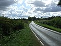
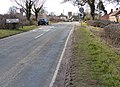
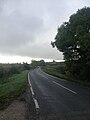
English: Weston by Welland is a village in the north of the English county of Northamptonshire administered as part of the borough of Kettering. As its name suggests it is near to the River Welland that, thereabouts, forms the boundary with the county of Leicestershire.
village britannique  | |||||
| Téléverser des médias | |||||
| Nature de l’élément | |||||
|---|---|---|---|---|---|
| Lieu | North Northamptonshire, Northamptonshire, Midlands de l'Est, Angleterre | ||||
 | |||||
Sous-catégories
Cette catégorie comprend seulement la sous-catégorie ci-dessous.
S
Média dans la catégorie « Weston by Welland »
Cette catégorie comprend 96 fichiers, dont les 96 ci-dessous.
-
 A minor relic - geograph.org.uk - 4912467.jpg 5 500 × 3 667 ; 7,25 Mio
-
 All directions - newly painted - geograph.org.uk - 4646720.jpg 480 × 640 ; 56 kio
-
 Approaching Slawston on Green Lane - geograph.org.uk - 5278915.jpg 480 × 640 ; 49 kio
-
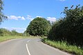
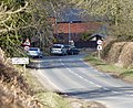
 Ashley Road (B664) - geograph.org.uk - 4134709.jpg 640 × 480 ; 76 kio
-
 Ashley Road in Weston by Welland - geograph.org.uk - 3411740.jpg 3 687 × 2 664 ; 2,94 Mio
-
 Ashley Road, Weston by Welland - geograph.org.uk - 5552243.jpg 480 × 640 ; 48 kio
-
 Ashley Road, Weston by Welland - geograph.org.uk - 6249995.jpg 1 906 × 1 260 ; 1,49 Mio
-
 Bend on Welham Road, Weston by Welland - geograph.org.uk - 6225002.jpg 1 920 × 1 280 ; 1,39 Mio
-
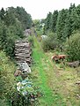 Dismantled railway - geograph.org.uk - 569541.jpg 484 × 640 ; 146 kio
-
 Disused railway embankment - geograph.org.uk - 5886348.jpg 4 000 × 3 000 ; 3,3 Mio
-
 Driving east along Ashley Road - geograph.org.uk - 3411728.jpg 3 719 × 2 303 ; 2,64 Mio
-
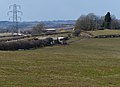
 Electricity pylon overlooking the Welland Valley - geograph.org.uk - 3411029.jpg 3 856 × 2 696 ; 2,69 Mio
-
 Entering Northamptonshire on Welham Road - geograph.org.uk - 6224173.jpg 1 920 × 1 280 ; 1,46 Mio
-
 Ewe and lamb near Mill House - geograph.org.uk - 3411053.jpg 2 376 × 1 800 ; 1,4 Mio
-
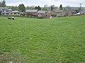
 Farm buildings and sheep pasture - geograph.org.uk - 3410043.jpg 3 068 × 2 220 ; 2,26 Mio
-
 Farm track off Ashley Road - geograph.org.uk - 4134708.jpg 640 × 480 ; 85 kio
-
 Farmland - geograph.org.uk - 1273254.jpg 640 × 480 ; 50 kio
-
 Farmland east of Weston by Welland - geograph.org.uk - 4134707.jpg 640 × 480 ; 76 kio
-
 Farmland near Weston by Welland - geograph.org.uk - 3411591.jpg 3 206 × 2 321 ; 2,29 Mio
-
 Farmyard gate - geograph.org.uk - 4912474.jpg 5 500 × 3 667 ; 7,69 Mio
-
 Fence and hedge descending into the Welland Valley - geograph.org.uk - 3411046.jpg 2 979 × 3 624 ; 3,18 Mio
-
 Field by the River Welland, Welham - geograph.org.uk - 6351015.jpg 1 920 × 1 280 ; 1,36 Mio
-
 Footpath in the Welland Valley - geograph.org.uk - 2643359.jpg 1 280 × 856 ; 215 kio
-
 Gate along the Macmillan Way - geograph.org.uk - 3411044.jpg 3 548 × 2 611 ; 2,95 Mio
-
 Gates near Mill House - geograph.org.uk - 3411456.jpg 3 644 × 2 561 ; 2,57 Mio
-
 House on the junction, Weston by Welland - geograph.org.uk - 4134702.jpg 640 × 480 ; 79 kio
-
 House on Valley Road, Weston by Welland - geograph.org.uk - 6202026.jpg 2 034 × 1 526 ; 2,72 Mio
-
 Inquisitive bullocks - geograph.org.uk - 444681.jpg 640 × 477 ; 102 kio
-
 Inside the derelict Mill House - geograph.org.uk - 3411065.jpg 4 000 × 3 000 ; 3,55 Mio
-
 Logging yard on Welham Road - geograph.org.uk - 6224998.jpg 1 920 × 1 280 ; 1,51 Mio
-
 Looking east along Ashley Road - geograph.org.uk - 3411756.jpg 3 188 × 2 549 ; 2,24 Mio
-
 Lych Gate - geograph.org.uk - 1273122.jpg 640 × 480 ; 108 kio
-
 Macmillan Way heading towards Brampton Ash - geograph.org.uk - 3411020.jpg 2 998 × 2 380 ; 1,82 Mio
-
 Macmillan Way heading towards Weston by Welland - geograph.org.uk - 3410045.jpg 4 000 × 3 000 ; 3,64 Mio
-
 Mickleborough Close, Weston by Welland - geograph.org.uk - 6225007.jpg 1 920 × 1 280 ; 1,85 Mio
-
 Mill House - geograph.org.uk - 3411128.jpg 3 560 × 2 831 ; 3,83 Mio
-
 Modern house - geograph.org.uk - 4912470.jpg 5 500 × 3 667 ; 7,45 Mio
-
 New housing near the church - geograph.org.uk - 4912460.jpg 5 500 × 3 667 ; 7,25 Mio
-

-

-

-
 Pasture and pylon along the Macmillan Way - geograph.org.uk - 3410041.jpg 3 437 × 2 369 ; 2,74 Mio
-

-
 Ploughed field along Ashley Road - geograph.org.uk - 3411777.jpg 3 193 × 2 686 ; 2,48 Mio
-
 Ploughing a field along Ashley Road - geograph.org.uk - 3411769.jpg 2 434 × 2 244 ; 1,72 Mio
-
 Ploughing a field north of Ashley Road - geograph.org.uk - 3411798.jpg 3 158 × 2 504 ; 2,56 Mio
-
 Public 'phone box - geograph.org.uk - 1273564.jpg 640 × 480 ; 132 kio
-
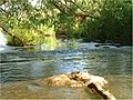
 River Welland looking east - geograph.org.uk - 441748.jpg 640 × 477 ; 136 kio
-
 Running Water - geograph.org.uk - 1273131.jpg 640 × 480 ; 112 kio
-
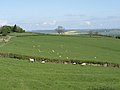
 Sheep pasture overlooking the Welland Valley - geograph.org.uk - 3411035.jpg 4 000 × 3 000 ; 3,34 Mio
-
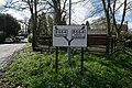
 Signpost at Weston by Welland - geograph.org.uk - 569529.jpg 589 × 640 ; 167 kio
-
 Sutton Road towards Weston by Welland - geograph.org.uk - 3411616.jpg 3 215 × 2 480 ; 2,63 Mio
-
 The Green in Weston by Welland - geograph.org.uk - 3411684.jpg 2 436 × 1 830 ; 1,26 Mio
-
 The Green, Weston by Welland - geograph.org.uk - 569537.jpg 640 × 458 ; 103 kio
-
 The Old School in Weston by Welland - geograph.org.uk - 3411696.jpg 3 541 × 2 194 ; 2,31 Mio
-
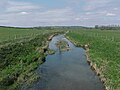
 The River Welland - geograph.org.uk - 2470791.jpg 1 139 × 855 ; 188 kio
-
 The River Welland - geograph.org.uk - 5234752.jpg 640 × 480 ; 37 kio
-
 The River Welland near Welham - geograph.org.uk - 6379608.jpg 3 776 × 2 520 ; 3,24 Mio
-
 The Welland Valley - geograph.org.uk - 2470785.jpg 1 280 × 960 ; 277 kio
-
 The Wheel and Compass, Weston by Welland - geograph.org.uk - 441752.jpg 640 × 477 ; 93 kio
-
 Towards Ashley - geograph.org.uk - 3487485.jpg 640 × 478 ; 40 kio
-
 Towards Weston by Welland - geograph.org.uk - 3487484.jpg 640 × 547 ; 64 kio
-
 Towards Weston-by-Welland - geograph.org.uk - 3487483.jpg 640 × 456 ; 33 kio
-
 Track and bridleway to Mill House - geograph.org.uk - 3411502.jpg 2 667 × 2 114 ; 1,78 Mio
-
 Track and bridleway to Weston Road - geograph.org.uk - 3411135.jpg 4 000 × 3 000 ; 3,54 Mio
-
 Track and footpath to the River Welland - geograph.org.uk - 3411762.jpg 3 225 × 2 427 ; 2,58 Mio
-
 Track towards River Welland - geograph.org.uk - 3487486.jpg 640 × 472 ; 43 kio
-
 Tree on Valley Road, Weston by Welland - geograph.org.uk - 6202029.jpg 1 526 × 2 034 ; 1,16 Mio
-
 Valley Road in Weston by Welland - geograph.org.uk - 569532.jpg 640 × 455 ; 96 kio
-
 Valley Road, Weston by Welland - geograph.org.uk - 6200125.jpg 2 034 × 1 526 ; 2,75 Mio
-
 Valley Road, Weston by Welland - geograph.org.uk - 6202032.jpg 2 034 × 1 526 ; 2,34 Mio
-
 View north across the Welland Valley - geograph.org.uk - 3411483.jpg 4 000 × 3 000 ; 3,35 Mio
-
 View of Sutton Bassett - geograph.org.uk - 6200130.jpg 2 034 × 1 526 ; 1,61 Mio
-
 View of Sutton Bassett - geograph.org.uk - 6200131.jpg 2 034 × 1 526 ; 1,58 Mio
-
 Welham Road at the junction of Valley Road - geograph.org.uk - 6202030.jpg 2 034 × 1 526 ; 2,4 Mio
-
 Welham Road, Weston by Welland - geograph.org.uk - 6225005.jpg 1 892 × 1 236 ; 1,39 Mio
-
 Weston by Welland - geograph.org.uk - 1275022.jpg 640 × 480 ; 96 kio
-
 Weston by Welland - geograph.org.uk - 4134704.jpg 640 × 480 ; 107 kio
-
 Weston by Welland - geograph.org.uk - 4421422.jpg 640 × 480 ; 102 kio
-
 Weston by Welland - geograph.org.uk - 4646717.jpg 640 × 480 ; 61 kio
-
 Weston by Welland, Northamptonshire - geograph.org.uk - 569534.jpg 640 × 452 ; 98 kio
-
 Weston by Welland, Sutton Road - geograph.org.uk - 3411606.jpg 3 121 × 2 542 ; 2,35 Mio
-
 Weston by Welland, The Green - geograph.org.uk - 3411672.jpg 3 110 × 2 233 ; 2,24 Mio
-
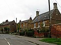 Weston by Welland-Stone Houses - geograph.org.uk - 6299110.jpg 1 600 × 1 200 ; 475 kio
-
 Weston from the Macmillan Way - geograph.org.uk - 4646721.jpg 640 × 480 ; 54 kio
-
 Barn near Mill House - geograph.org.uk - 444683.jpg 640 × 477 ; 95 kio
-
 Disused railway bridge - geograph.org.uk - 569542.jpg 640 × 428 ; 98 kio
-
 Evidence of ridge and furrow - geograph.org.uk - 444684.jpg 640 × 477 ; 73 kio
-
 Green Lane in Northamptonshire - geograph.org.uk - 569526.jpg 640 × 419 ; 102 kio
-
 Green Lane towards Weston by Welland - geograph.org.uk - 230259.jpg 640 × 480 ; 88 kio
-
 Green Lane towards Weston by Welland - geograph.org.uk - 569509.jpg 640 × 573 ; 101 kio
-
 Looking down on Weston by Welland - geograph.org.uk - 444679.jpg 640 × 477 ; 95 kio
-
 Meeting of the Ways. - geograph.org.uk - 383036.jpg 640 × 480 ; 117 kio
-
 Pond - geograph.org.uk - 444687.jpg 640 × 477 ; 121 kio
-
 Six paths - geograph.org.uk - 444690.jpg 640 × 477 ; 128 kio
-
 Weston by Welland - geograph.org.uk - 230260.jpg 640 × 429 ; 103 kio


_-_geograph.org.uk_-_4134709.jpg)


