Category:Whitrope Burn
Zur Navigation springen
Zur Suche springen
natürliches Fließgewässer im Vereinigten Königreich  | |||||
| Medium hochladen | |||||
| Ist ein(e) | |||||
|---|---|---|---|---|---|
| Ort | Scottish Borders, Schottland | ||||
| Mündet in |
| ||||
| Nebenfluss |
| ||||
 | |||||
Medien in der Kategorie „Whitrope Burn“
Folgende 17 Dateien sind in dieser Kategorie, von 17 insgesamt.
-
 A sheepfold at Riskinhope Hope - geograph.org.uk - 1313032.jpg 640 × 427; 129 KB
-
 Bridge at Whitrope Burn - geograph.org.uk - 1738377.jpg 800 × 507; 103 KB
-
 Bridge on the Whitrope Burn, Midlothian - geograph-4773849.jpg 4.000 × 3.000; 4,73 MB
-
 Fern covered banking by Sundhope Burn - geograph.org.uk - 521157.jpg 480 × 640; 132 KB
-

-
 Road bridge over the Whitrope Burn - geograph.org.uk - 378402.jpg 640 × 467; 100 KB
-
-
 The B6399 crosses the Whitrope burn - geograph.org.uk - 828390.jpg 640 × 480; 76 KB
-
 Valley of the Whitrope Burn - geograph.org.uk - 1430028.jpg 640 × 480; 111 KB
-
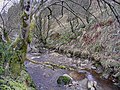
 Whitrope Burn - geograph.org.uk - 1430030.jpg 640 × 480; 84 KB
-
 Whitrope Burn - geograph.org.uk - 1430033.jpg 640 × 480; 82 KB
-
 Whitrope Burn - geograph.org.uk - 1430043.jpg 640 × 480; 94 KB
-
 Whitrope Burn - geograph.org.uk - 1430046.jpg 480 × 640; 129 KB
-
 Whitrope Burn - geograph.org.uk - 1430062.jpg 480 × 640; 133 KB
-
 Whitrope Burn - geograph.org.uk - 351385.jpg 640 × 480; 171 KB
-
 Whitrope Burn - geograph.org.uk - 818270.jpg 427 × 640; 134 KB
-
 Whitropefoot Farm - geograph.org.uk - 1430044.jpg 640 × 480; 122 KB


