Category:Whorlton, County Durham
Aller à la navigation
Aller à la recherche
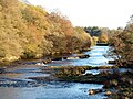
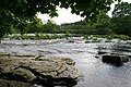
English: Whorlton is a village in County Durham, in England. It is situated to the east of Barnard Castle,Whorlton is situated near the River Tees. It has a pub called the 'Bridge Inn' due to the 19th century suspension bridge situated just outside the village.
village britannique  Eglwys y Santes Fair, Whorlton | |||||
| Téléverser des médias | |||||
| Nature de l’élément | |||||
|---|---|---|---|---|---|
| Lieu | comté de Durham, Durham, Angleterre du Nord-Est, Angleterre | ||||
 | |||||
Sous-catégories
Cette catégorie comprend 2 sous-catégories, dont les 2 ci-dessous.
M
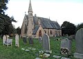
- St Mary's Church, Whorlton (3 F)
W
- Whorlton Bridge (11 F)
Média dans la catégorie « Whorlton, County Durham »
Cette catégorie comprend 74 fichiers, dont les 74 ci-dessous.
-
 "The Meeting of the Waters" - geograph.org.uk - 1413888.jpg 640 × 427 ; 91 kio
-
 A67 towards Barnard Castle - geograph.org.uk - 4731661.jpg 640 × 480 ; 109 kio
-
 A67, Whorley Hill - geograph.org.uk - 4731655.jpg 640 × 480 ; 73 kio
-
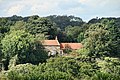
 Church of St Mary, Whorlton - geograph.org.uk - 5615961.jpg 4 320 × 3 068 ; 2,36 Mio
-
 Cottages on the south bank of the Tees - geograph.org.uk - 5616169.jpg 4 320 × 2 681 ; 1,98 Mio
-
 Countryside view near Low Barn - geograph.org.uk - 5631504.jpg 4 320 × 2 525 ; 2,11 Mio
-
 Disused Pump, Whorlton - geograph.org.uk - 343102.jpg 640 × 426 ; 73 kio
-
 Downstream from Whorlton Bridge - geograph.org.uk - 5604194.jpg 4 320 × 3 240 ; 5,02 Mio
-
 Drinking fountain, Whorlton - geograph.org.uk - 5763334.jpg 768 × 1 024 ; 202 kio
-
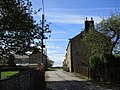
 Entry to Whorlton Village from the south (1971) - geograph.org.uk - 5906933.jpg 4 211 × 2 642 ; 3,93 Mio
-
 Estate cottages, Whorlton (geograph 5763318).jpg 1 024 × 768 ; 200 kio
-
 Farmland towards Etherley House Farm - geograph.org.uk - 4731653.jpg 640 × 480 ; 51 kio
-
 Fernaville's Rest, Whorlton - geograph.org.uk - 5616182.jpg 4 320 × 2 635 ; 1,98 Mio
-
 Footpath above Whorlton Banks - geograph.org.uk - 5763263.jpg 1 024 × 768 ; 379 kio
-
 Footpath heading towards Whorlton - geograph.org.uk - 3238728.jpg 1 125 × 1 500 ; 2,12 Mio
-
 Footpath to Whorlton Bridge from Whorlton - geograph.org.uk - 5763409.jpg 1 024 × 768 ; 408 kio
-
 Footpath to Whorlton from Whorlton Bridge - geograph.org.uk - 5763401.jpg 1 024 × 768 ; 426 kio
-
 Former school in Whorlton - geograph.org.uk - 5616183.jpg 3 661 × 2 592 ; 1,97 Mio
-
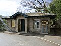 Former Toll House, Whorlton Bridge - geograph.org.uk - 5762343.jpg 1 024 × 768 ; 253 kio
-
 Graft's Farm - geograph.org.uk - 2583375.jpg 3 564 × 2 364 ; 1,71 Mio
-
 Grazing south of the A67 - geograph.org.uk - 4731659.jpg 640 × 480 ; 59 kio
-
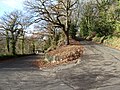 Hairpin bend at Whorlton - geograph.org.uk - 5615965.jpg 4 320 × 3 240 ; 6,32 Mio
-
 Houses of Whorlton from the west - geograph.org.uk - 3238688.jpg 1 500 × 666 ; 887 kio
-
 Is it a path^ - geograph.org.uk - 1738145.jpg 640 × 512 ; 125 kio
-
 Lilac Cottage (geograph 5763472).jpg 1 024 × 768 ; 380 kio
-
 Minor road towards Whorlton - geograph.org.uk - 4731658.jpg 640 × 480 ; 82 kio
-
 Oilseed rape near Sledwich - geograph.org.uk - 5762353.jpg 1 024 × 768 ; 228 kio
-
 Old Direction Sign - Signpost in Whorlton - geograph.org.uk - 6072845.jpg 720 × 960 ; 120 kio
-
 Path above the river - geograph.org.uk - 5631505.jpg 4 320 × 3 240 ; 4,71 Mio
-
 Rainbow over Whorlton Village Green - geograph.org.uk - 1410391.jpg 640 × 427 ; 36 kio
-
 Red House - geograph.org.uk - 2583347.jpg 3 888 × 2 592 ; 1,83 Mio
-
 River Greta, Rokeby - geograph.org.uk - 121870.jpg 313 × 472 ; 40 kio
-
 River Tees at Whorlton, aerial 2018 - geograph.org.uk - 5906612.jpg 800 × 533 ; 102 kio
-
 River Tees From Mortham - geograph.org.uk - 343101.jpg 640 × 426 ; 72 kio
-
 Riverside Cottages at Wycliffe - geograph.org.uk - 3616625.jpg 3 502 × 2 528 ; 2,13 Mio
-
 Road and path to Whorlton Bridge - geograph.org.uk - 5763456.jpg 1 024 × 768 ; 370 kio
-
 Ruin in the woods - geograph.org.uk - 5615992.jpg 3 239 × 4 319 ; 5,24 Mio
-
 Sledwich track - geograph.org.uk - 1566255.jpg 640 × 480 ; 104 kio
-
 St. Mary's Whorlton - geograph.org.uk - 5763512.jpg 1 024 × 768 ; 244 kio
-
 Stepping stones across Whorlton Beck - geograph.org.uk - 5615972.jpg 3 240 × 4 319 ; 4,76 Mio
-
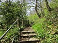
 Steps and stepping stones for path to cross Whorlton Beck - geograph.org.uk - 3616619.jpg 3 648 × 2 736 ; 2,96 Mio
-
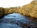
 Tees above Whorlton - geograph.org.uk - 1280673.jpg 640 × 480 ; 96 kio
-
 Tees Valley from Mortham - geograph.org.uk - 1570112.jpg 640 × 480 ; 84 kio
-
 The churchyard and rear of the Village Hall, Whorlton - geograph.org.uk - 5763347.jpg 1 024 × 768 ; 297 kio
-
 The entrance to Grange Farm, Whorlton - geograph.org.uk - 5762347.jpg 1 024 × 768 ; 228 kio
-
 The entrance to Whorlton Grange - geograph.org.uk - 5763310.jpg 1 024 × 768 ; 384 kio
-
 The gated 'road' to Humbleton - geograph.org.uk - 481945.jpg 640 × 480 ; 99 kio
-
 The Green, Whorlton village (1971) - geograph.org.uk - 5907489.jpg 4 015 × 2 567 ; 1,49 Mio
-
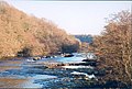
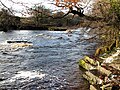
 The River Tees at Whorlton - geograph.org.uk - 75693.jpg 640 × 427 ; 132 kio
-
 The River Tees below Whorlton Banks - geograph.org.uk - 5763366.jpg 1 024 × 768 ; 342 kio
-
 The road to Sledwich near Whorlton - geograph.org.uk - 5771362.jpg 1 024 × 768 ; 285 kio
-
 The road to Whorlton near Sledwich - geograph.org.uk - 5771360.jpg 1 024 × 768 ; 345 kio
-
 The Tees at Whorlton - geograph.org.uk - 134126.jpg 476 × 321 ; 38 kio
-
 Track at Whorlton - geograph.org.uk - 5763297.jpg 1 024 × 768 ; 281 kio
-
 Track from West Whorley Hill - geograph.org.uk - 1704487.jpg 512 × 640 ; 114 kio
-
 Track in crop field - geograph.org.uk - 4731657.jpg 640 × 480 ; 48 kio
-
 Trig pillar at East Whorley Hill - geograph.org.uk - 1946479.jpg 1 024 × 552 ; 96 kio
-
 Upstream from Whorlton Bridge - geograph.org.uk - 5604195.jpg 4 320 × 3 240 ; 4,97 Mio
-
 View across River Tees, Whorlton Bridge (1971) - geograph.org.uk - 5906859.jpg 4 318 × 2 729 ; 2,19 Mio
-

-
 Village hall - geograph.org.uk - 252491.jpg 488 × 349 ; 39 kio
-
 Water worn rock slabs by the Tees - geograph.org.uk - 5616159.jpg 4 320 × 3 240 ; 4,13 Mio
-
 Where waters combine - geograph.org.uk - 5631527.jpg 4 203 × 3 153 ; 4,04 Mio
-
 Whorlton - geograph.org.uk - 2583353.jpg 3 888 × 2 592 ; 2,34 Mio
-
 Whorlton - geograph.org.uk - 2583357.jpg 3 869 × 2 563 ; 2,24 Mio
-
 Whorlton Bridge - geograph.org.uk - 5641300.jpg 2 587 × 920 ; 347 kio
-
 Whorlton Bridge - geograph.org.uk - 5763390.jpg 1 024 × 768 ; 211 kio
-
 Whorlton Bridge and Toll House seen through the trees - geograph.org.uk - 5763382.jpg 1 024 × 768 ; 438 kio
-
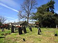
 Whorlton Parish Church and graveyard (1971) - geograph.org.uk - 5907690.jpg 4 260 × 2 456 ; 1,92 Mio
-
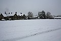 Winter scene on Whorlton Village Green - geograph.org.uk - 1410669.jpg 640 × 427 ; 35 kio
-
 'Meeting of the Waters' - geograph.org.uk - 241175.jpg 640 × 287 ; 84 kio
-
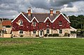
 The Bridge Inn, Whorlton - geograph.org.uk - 252493.jpg 640 × 480 ; 113 kio
-
 Village Green, Whorlton - geograph.org.uk - 252436.jpg 640 × 480 ; 105 kio
-
 Whorlton Lido - geograph.org.uk - 247980.jpg 624 × 415 ; 71 kio


_-_geograph.org.uk_-_5906933.jpg)
.jpg)


.jpg)


_-_geograph.org.uk_-_5907489.jpg)


_-_geograph.org.uk_-_5906859.jpg)


_-_geograph.org.uk_-_5907690.jpg)


