Category:Wick, Caithness
Zur Navigation springen
Zur Suche springen
English: Wick is an estuary town and a royal burgh in the north of the Highland council area of Scotland.
Kleinstadt in Schottland  | |||||
| Medium hochladen | |||||
| Ist ein(e) |
| ||||
|---|---|---|---|---|---|
| Ort | |||||
| Einwohnerzahl |
| ||||
| Fläche |
| ||||
 | |||||
Unterkategorien
Es werden 15 von insgesamt 15 Unterkategorien in dieser Kategorie angezeigt:
In Klammern die Anzahl der enthaltenen Kategorien (K), Seiten (S), Dateien (D)
*
C
- Castle of Old Wick (4 D)
- Churches in Wick, Caithness (8 D)
- County Offices, Wick (1 D)
E
- Ebenezer Place, Wick (3 D)
H
- Harmsworth Park (2 D)
W
- Wick Heritage Centre (3 D)
- Wick railway station (30 D)
- Wick Sheriff Court (3 D)
- Wick South Pier light (3 D)
- Wick Town Hall (4 D)
Medien in der Kategorie „Wick, Caithness“
Folgende 177 Dateien sind in dieser Kategorie, von 177 insgesamt.
-
 10 Dempster Street, Wick.jpg 6.000 × 8.000; 13,11 MB
-
 11 Malcolm Street, Wick.jpg 6.000 × 8.000; 11,59 MB
-
 3 Dempster Street, Wick.jpg 6.000 × 8.000; 14,4 MB
-
 5 Dempster Street, Wick.jpg 6.000 × 8.000; 13,57 MB
-
 7-9 Malcolm Street, Wick.jpg 8.000 × 6.000; 10,3 MB
-
 8 Dempster Street, Wick.jpg 6.000 × 8.000; 11,33 MB
-
 Admiralty Chart No 1462 Harbours on the (North and) East Coasts of Scotland, Published 1962.jpg 6.818 × 9.842; 21,33 MB
-

-
 Admiralty Chart No 2550 Wick, Published 1857.jpg 9.954 × 6.741; 19,79 MB
-
 Robert Anderson - Wick's Black Saturday (1885).jpg 1.200 × 701; 133 KB
-
 Approach to Wick - geograph.org.uk - 487312.jpg 565 × 384; 54 KB
-
 Ash Tree, Wick Rocks. - panoramio.jpg 2.062 × 2.496; 1,96 MB
-
 Beech copse on Lansdown - geograph.org.uk - 717903.jpg 640 × 488; 137 KB
-
 Big fields at Hempriggs - geograph.org.uk - 582920.jpg 640 × 425; 153 KB
-
 Bignold Court - geograph.org.uk - 479222.jpg 585 × 421; 70 KB
-
 Bistro a la Wick - geograph.org.uk - 479221.jpg 592 × 440; 78 KB
-
 Black-headed Gull - geograph.org.uk - 479216.jpg 640 × 480; 113 KB
-
 BlackStepsPaintedByLowry.jpg 4.320 × 3.240; 2,62 MB
-
 BlackStepsPaintedByLowryPlaque.jpg 4.320 × 3.240; 3,09 MB
-
 Bridge at Wick - geograph.org.uk - 3996506.jpg 640 × 480; 70 KB
-
 Bridge of Wick - geograph.org.uk - 252159.jpg 640 × 480; 97 KB
-
 Bridge of Wick - geograph.org.uk - 3281490.jpg 4.528 × 3.015; 5,59 MB
-
 Bridge of Wick - geograph.org.uk - 5106635.jpg 640 × 480; 75 KB
-
 Bridge Street, Wick (A99) - geograph.org.uk - 4017140.jpg 640 × 421; 77 KB
-
 Bridge Street, Wick - geograph.org.uk - 6445589.jpg 1.797 × 1.198; 328 KB
-
 Caithness arable land - geograph.org.uk - 781968.jpg 640 × 303; 54 KB
-
 Cast Iron Direction Sign, Wick. - panoramio.jpg 1.059 × 1.249; 472 KB
-
 Cemetery just outside Wick - geograph.org.uk - 820439.jpg 640 × 480; 89 KB
-
 Coastguard Lookout - geograph.org.uk - 479186.jpg 640 × 480; 118 KB
-
 Coghill Bridge - geograph.org.uk - 4226654.jpg 640 × 407; 55 KB
-
 Coldharbour Farm in the distance - geograph.org.uk - 254924.jpg 640 × 480; 67 KB
-
 Commemorative plaque on Harbour Bridge - geograph.org.uk - 1703736.jpg 640 × 480; 257 KB
-
 Cotswold Stone Wall, Wick Rocks. - panoramio.jpg 2.112 × 2.816; 4 MB
-
 Ex-Hotel beside the Wick River - geograph.org.uk - 951672.jpg 480 × 640; 168 KB
-
 Ex-Hotel building - geograph.org.uk - 951683.jpg 640 × 480; 181 KB
-
 SaintFergus.jpg 1.097 × 3.264; 476 KB
-
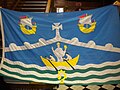 Flag of Wick, at the Townhouse.JPG 3.648 × 2.736; 4,23 MB
-
 Flag of Wick.png 2.000 × 1.401; 340 KB
-
 FMIB 43636 Wick Harbour During the Fishing-Season.jpeg 646 × 569; 154 KB
-
 Foot bridge on the River Wick - geograph.org.uk - 5711802.jpg 1.800 × 1.012; 1,11 MB
-
 Footbridge over the River Wick - geograph.org.uk - 4164893.jpg 4.608 × 3.456; 3,32 MB
-
 Footbridge over Wick River - geograph.org.uk - 31794.jpg 640 × 427; 64 KB
-
 Footbridge over Wick River - geograph.org.uk - 5538632.jpg 1.024 × 682; 138 KB
-
 Former Station Hotel, Wick - geograph.org.uk - 5106641.jpg 640 × 480; 68 KB
-
 Fountain by the river, Wick - geograph.org.uk - 1703726.jpg 480 × 640; 234 KB
-
 Gazebo and chimney - geograph.org.uk - 479195.jpg 452 × 423; 44 KB
-
 George V postbox - geograph.org.uk - 951678.jpg 480 × 640; 235 KB
-
 Harbour Bridge, Wick - geograph.org.uk - 479213.jpg 640 × 480; 116 KB
-
 Harbour entrance, Wick - geograph.org.uk - 5106605.jpg 640 × 480; 61 KB
-
 HMS Jervis Bay Plaque.jpg 3.280 × 2.460; 1,51 MB
-
 House on The Shore, Wick - geograph.org.uk - 5113239.jpg 640 × 480; 66 KB
-
 Houston, we have fish and chips... - panoramio.jpg 1.280 × 960; 630 KB
-

-
 Inner Harbour, Wick - geograph.org.uk - 4017121.jpg 640 × 480; 43 KB
-
 Island in the River, Wick - geograph.org.uk - 574417.jpg 640 × 480; 69 KB
-
 Island in Wick River - geograph.org.uk - 2047133.jpg 640 × 480; 80 KB
-
 James Bremner Monument.jpg 3.480 × 4.640; 4,03 MB
-
 Kenneth Street, Wick - geograph.org.uk - 5106579.jpg 640 × 480; 67 KB
-
 Klimadiagramm-deutsch-Wick (Schottland)-Großbritannien.png 1.024 × 710; 126 KB
-
 Mackay's Hotel, Wick - geograph.org.uk - 3281498.jpg 4.541 × 2.724; 2,91 MB
-
 Memorial statue of Dr. John Alexander - geograph.org.uk - 1703732.jpg 480 × 640; 245 KB
-
 Miller Street Wick - geograph.org.uk - 2303751.jpg 3.648 × 2.736; 2,39 MB
-
 Navigation Buoy - geograph.org.uk - 3044232.jpg 2.560 × 1.920; 2,28 MB
-
 North Baths, Wick - geograph.org.uk - 2318677.jpg 3.087 × 1.855; 3,31 MB
-
 Northhead - geograph.org.uk - 233342.jpg 640 × 480; 80 KB
-
 Northhead - geograph.org.uk - 233345.jpg 640 × 480; 72 KB
-
 Nucleus, Caithness.jpg 835 × 558; 79 KB
-
 Old Pulteney Distillery - panoramio.jpg 3.264 × 2.448; 3,15 MB
-
 Old Pultney Distillery - panoramio.jpg 3.264 × 2.448; 2,18 MB
-
 Ordnance Survey One-Inch Sheet 12 Wick, Published 1947.jpg 8.808 × 12.871; 10 MB
-
 Ordnance Survey One-Inch Sheet 16 Wick, Published 1959.jpg 8.276 × 9.893; 7,01 MB
-
 Outdoor Bathing Pool - geograph.org.uk - 4224962.jpg 640 × 431; 82 KB
-
 Over wintered at Wick Harbour - geograph.org.uk - 2311011.jpg 3.648 × 2.736; 2,05 MB
-
 Pathway to Wick - geograph.org.uk - 230747.jpg 640 × 480; 107 KB
-

-
 River Basin View - geograph.org.uk - 4224957.jpg 640 × 358; 51 KB
-
 River Basin ^ view towards Wick Harbour Bridge - geograph.org.uk - 6445594.jpg 1.802 × 1.201; 459 KB
-
 River Basin, Wick (1980) - geograph.org.uk - 863118.jpg 440 × 640; 85 KB
-
 River Basin, Wick - geograph.org.uk - 4017143.jpg 640 × 480; 68 KB
-
 River Basin, Wick - geograph.org.uk - 5106610.jpg 640 × 480; 86 KB
-
 River Boyd near Wick Court. - panoramio.jpg 2.816 × 2.112; 3,7 MB
-
 Road - panoramio (131).jpg 2.592 × 1.936; 1,04 MB
-
 RobertLouisStevensonHouse.jpg 640 × 480; 97 KB
-
 RobertLouisStevensonPlaque.jpg 640 × 480; 108 KB
-
 RobertLouisStevensonPlaqueMedium.jpg 640 × 480; 89 KB
-
 Roman Catholic Convent, 1 -3 Malcolm Street, Wick.jpg 6.000 × 8.000; 10,04 MB
-
 School - geograph.org.uk - 233349.jpg 640 × 480; 90 KB
-
 Scouting centenary flower bed in Scotland.jpg 1.067 × 800; 169 KB
-
 Secluded glade - geograph.org.uk - 951675.jpg 640 × 480; 312 KB
-
 Service Bridge, Wick - geograph.org.uk - 3281508.jpg 4.585 × 3.070; 7 MB
-
 Sheepfold near the Allt-nan-Scaraig - geograph.org.uk - 944814.jpg 640 × 480; 74 KB
-
 Sinclair Terrace, Wick - geograph.org.uk - 5113242.jpg 640 × 480; 97 KB
-
 Small flag of Wick.png 240 × 160; 28 KB
-

-
 Stack O' Brough - geograph.org.uk - 236773.jpg 640 × 480; 81 KB
-
 Storm at Wick harbour - geograph.org.uk - 2255953.jpg 1.600 × 1.200; 333 KB
-
 Storm at Wick Harbour - geograph.org.uk - 3275762.jpg 959 × 639; 330 KB
-
 Stormy day in Wick - geograph.org.uk - 2094232.jpg 3.888 × 2.592; 2,6 MB
-
 Subsea 7 towheads in Wick (15024729770).jpg 3.264 × 2.448; 3,18 MB
-
 Subsea 7 towheads in Wick (15024738570).jpg 3.076 × 1.730; 2,29 MB
-
 Subsea 7 towheads in Wick (15211460325).jpg 3.164 × 1.484; 2,15 MB
-
 Summer house, Wick Court. - panoramio.jpg 2.112 × 2.679; 3,36 MB
-
 Telford Street, Wick - geograph.org.uk - 2303952.jpg 3.648 × 2.736; 2,37 MB
-
 Tesco Store, Wick - geograph.org.uk - 536378.jpg 640 × 480; 65 KB
-

-
 The Bridge of Wick - geograph.org.uk - 951725.jpg 640 × 480; 172 KB
-
 The Bridge of Wick, Wick - geograph.org.uk - 6331047.jpg 640 × 480; 122 KB
-
 The Crown Bar, Market Place, Wick - geograph.org.uk - 574420.jpg 640 × 480; 71 KB
-
 The main road bridge, Wick - geograph.org.uk - 574414.jpg 640 × 480; 78 KB
-
 The Old Parish Church, Wick - geograph.org.uk - 245232.jpg 370 × 432; 21 KB
-
 The Old Post Office, Wick town centre - geograph.org.uk - 607559.jpg 426 × 640; 62 KB
-
 The quarry on Warth Hill - geograph.org.uk - 480326.jpg 640 × 480; 122 KB
-
 The Seamans Mission, Wick - geograph.org.uk - 574524.jpg 640 × 480; 57 KB
-
 The Shore, Wick - geograph.org.uk - 2802032.jpg 640 × 419; 37 KB
-
 The Wick River - geograph.org.uk - 200515.jpg 640 × 480; 180 KB
-
 The Wick River - geograph.org.uk - 4454739.jpg 640 × 480; 177 KB
-
 The Wick River - geograph.org.uk - 951715.jpg 640 × 480; 169 KB
-
 Town Centre, Wick - geograph.org.uk - 607564.jpg 426 × 640; 73 KB
-
 Town Centre, Wick - geograph.org.uk - 607565.jpg 426 × 640; 73 KB
-
 Trinkie outdoor swimming pool. - geograph.org.uk - 1110748.jpg 431 × 640; 65 KB
-
 Tunnel Entrance, Wick Quarry. - panoramio.jpg 2.816 × 2.112; 1,95 MB
-
 Up stream River Wick - geograph.org.uk - 479211.jpg 640 × 480; 115 KB
-
 Victoria Place, Wick - geograph.org.uk - 479209.jpg 640 × 480; 114 KB
-
 View over Wick Bay - geograph.org.uk - 479189.jpg 640 × 480; 117 KB
-
 War Memorial, Wick (geograph 5086149).jpg 480 × 640; 76 KB
-
 Wick - Bridge Street - geograph.org.uk - 5200187.jpg 4.608 × 3.456; 6,22 MB
-
 Wick - geograph.org.uk - 566045.jpg 640 × 560; 95 KB
-
 Wick - Pedestrianised End of the High Street - geograph.org.uk - 5200168.jpg 4.608 × 3.456; 6,7 MB
-
 Wick - Provost's fountain.JPG 4.606 × 3.452; 7,08 MB
-
 Wick - VIP Visitor List.JPG 2.111 × 2.794; 3,34 MB
-
 Wick and East Caithness.png 885 × 1.300; 241 KB
-
 Wick Bay View - geograph.org.uk - 4224964.jpg 640 × 438; 84 KB
-
 Wick Caithness Scottish Highlands.jpg 3.840 × 2.160; 3,01 MB
-
 Wick Carnegie Public Library - geograph.org.uk - 5106586.jpg 640 × 480; 80 KB
-
 Wick Court. - panoramio - Robert Powell.jpg 2.051 × 2.407; 3,29 MB
-
 Wick Fire Station - geograph.org.uk - 4017144.jpg 640 × 480; 76 KB
-
 Wick From The North Head Path - geograph.org.uk - 4224965.jpg 640 × 422; 80 KB
-
 Wick Harbour Bridge - geograph.org.uk - 2379194.jpg 2.816 × 1.880; 2,91 MB
-
 Wick Harbour Bridge - geograph.org.uk - 4017127.jpg 640 × 480; 61 KB
-
 Wick Harbour Bridge - geograph.org.uk - 5513803.jpg 1.024 × 682; 128 KB
-
 Wick Harbour entrance.JPG 4.311 × 2.247; 2,78 MB
-
 Wick Herring Mart - geograph.org.uk - 882932.jpg 640 × 480; 70 KB
-
 Wick Quarry - panoramio.jpg 2.560 × 1.920; 2,21 MB
-
 Wick Quarry. - panoramio - Bob&Anne Powell.jpg 2.112 × 2.816; 1.015 KB
-
 Wick Quarry. - panoramio.jpg 2.816 × 2.112; 2,67 MB
-
 Wick River , Wick - geograph.org.uk - 3680431.jpg 1.024 × 768; 170 KB
-
 Wick River - geograph.org.uk - 2047143.jpg 640 × 480; 48 KB
-
 Wick River - geograph.org.uk - 3796704.jpg 640 × 426; 73 KB
-
 Wick River - geograph.org.uk - 4017129.jpg 640 × 480; 82 KB
-
 Wick River - geograph.org.uk - 5106616.jpg 640 × 480; 78 KB
-
 Wick River - geograph.org.uk - 5113240.jpg 640 × 480; 60 KB
-
 Wick River - geograph.org.uk - 5797874.jpg 640 × 480; 144 KB
-
 Wick River and River Basin, Wick - geograph.org.uk - 6331027.jpg 1.600 × 1.200; 233 KB
-
 Wick River at very low water - geograph.org.uk - 5855774.jpg 640 × 370; 76 KB
-
 Wick River at Wick - geograph.org.uk - 3584415.jpg 3.872 × 2.592; 4,39 MB
-
 Wick River Basin - geograph.org.uk - 3584417.jpg 3.872 × 2.592; 2,62 MB
-
 Wick River below Wick Railway Station - geograph.org.uk - 2758999.jpg 1.200 × 900; 448 KB
-
 Wick River Island - geograph.org.uk - 4226642.jpg 640 × 457; 93 KB
-
 Wick River Nature Reserve - geograph.org.uk - 4226675.jpg 640 × 418; 99 KB
-
 Wick River Wildlife Reserve - geograph.org.uk - 4226667.jpg 640 × 417; 79 KB
-
 Wick River, Wick, Caithness - geograph.org.uk - 6331031.jpg 1.600 × 1.200; 372 KB
-
 Wick Road Bridge on the River Wick - geograph.org.uk - 200513.jpg 640 × 480; 162 KB
-
-
 Wick town and bridge.JPG 4.439 × 2.699; 4,79 MB
-
 Wick Town Centre - geograph.org.uk - 4226591.jpg 640 × 507; 98 KB
-
 Wick town centre - geograph.org.uk - 619265.jpg 640 × 443; 92 KB
-
 Wick War Memorial (geograph 5106630).jpg 640 × 477; 117 KB
-
 Wick, Bridge Street - geograph.org.uk - 245228.jpg 285 × 432; 16 KB
-
 Wick, Bridge Street - geograph.org.uk - 3076941.jpg 4.320 × 3.240; 7,32 MB
-
 Wick, Bridge Street.jpg 424 × 640; 73 KB
-
 Wick, from Lodge Road - panoramio.jpg 3.175 × 2.251; 2,61 MB
-
 Wick, harbour bridge - geograph.org.uk - 596890.jpg 640 × 480; 82 KB
-
 Wick, Highland 01.jpg 4.111 × 2.668; 1,41 MB
-
 Wick, Highland 02.jpg 4.272 × 2.848; 1,83 MB
-
 WickCaithness.jpg 2.832 × 2.128; 1,03 MB
-
 Woodland - geograph.org.uk - 232378.jpg 640 × 480; 129 KB
-
 Southhead - geograph.org.uk - 227085.jpg 640 × 480; 62 KB


_East_Coasts_of_Scotland,_Published_1962.jpg)


.jpg)


_-_geograph.org.uk_-_4017140.jpg)


-Gro%C3%9Fbritannien.png)


_-_geograph.org.uk_-_863118.jpg)


.jpg)


.jpg)
.jpg)
.jpg)


.jpg)


.jpg)


