Category:Wick, Vale of Glamorgan
Aller à la navigation
Aller à la recherche
village au Royaume-Uni   | |||||
| Téléverser des médias | |||||
| Nature de l’élément | |||||
|---|---|---|---|---|---|
| Lieu | Vale of Glamorgan, pays de Galles | ||||
| Population |
| ||||
| Superficie |
| ||||
 | |||||
Cymraeg: Pentref ym Mro Morgannwg ydy Y Wig (Saesneg: Wick. Mae tua dwy filltir o'r arfordir, y trefi agosaf yw Llanilltud Fawr, Y Bont-faen a Pen-y-bont ar Ogwr.
English: Wick is a small village in the Vale of Glamorgan in Wales, situated about two miles from the coast. The closest towns are Llantwit Major, Cowbridge and Bridgend.
Norsk bokmål: Wick er en liten landsby i Vale of Glamorgan i det sørlige Wales, omkring 3 km fra kysten.
Sous-catégories
Cette catégorie comprend seulement la sous-catégorie ci-dessous.
S
- St James's Church, Wick (7 F)
Média dans la catégorie « Wick, Vale of Glamorgan »
Cette catégorie comprend 188 fichiers, dont les 188 ci-dessous.
-
 Animal feeder, near Wick. - geograph.org.uk - 375619.jpg 640 × 456 ; 127 kio
-
 B4265 beyond Wick - geograph.org.uk - 6250288.jpg 1 600 × 1 433 ; 440 kio
-
 Big sky - Wick - geograph.org.uk - 1929702.jpg 1 500 × 978 ; 988 kio
-
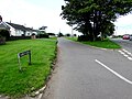
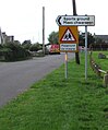
 Bilingual direction sign in Wick, Vale of Glamorgan - geograph.org.uk - 6250053.jpg 801 × 1 024 ; 150 kio
-
 Bridge at Ffynnon Shwlac - geograph.org.uk - 4809970.jpg 5 472 × 3 648 ; 5,39 Mio
-
 Brooklands Farm buildings in Wick, Vale of Glamorgan - geograph.org.uk - 6251927.jpg 1 600 × 926 ; 241 kio
-

-
 Broughton Road bungalows, Wick, Vale of Glamorgan - geograph.org.uk - 6252286.jpg 1 600 × 1 475 ; 434 kio
-
 Broughton Road bus stop and shelter, Wick, Vale of Glamorgan - geograph.org.uk - 6249757.jpg 1 600 × 1 390 ; 390 kio
-
 Broughton Sewage Pumping Station in the Vale of Glamorgan - geograph.org.uk - 6253388.jpg 1 600 × 1 147 ; 670 kio
-
 Chapel Road bus shelter, Broughton, Vale of Glamorgan - geograph.org.uk - 6252601.jpg 1 600 × 1 307 ; 678 kio
-
 Chapel Road houses, Broughton, Vale of Glamorgan - geograph.org.uk - 6252629.jpg 1 206 × 1 600 ; 343 kio
-
 Chapel Road, Broughton, Vale of Glamorgan - geograph.org.uk - 6252598.jpg 1 600 × 1 317 ; 531 kio
-
 Chapel Road, Wick, Vale of Glamorgan - geograph.org.uk - 6252279.jpg 1 600 × 1 039 ; 381 kio
-
 Children's play area in Wick, Vale of Glamorgan - geograph.org.uk - 6252243.jpg 1 600 × 1 292 ; 435 kio
-
 Children's swings in Wick, Vale of Glamorgan - geograph.org.uk - 6252246.jpg 1 600 × 935 ; 367 kio
-
 Church and churchyard, Wick, Vale of Glamorgan - geograph.org.uk - 6250533.jpg 1 600 × 1 079 ; 380 kio
-
 Church Farm - geograph.org.uk - 4778022.jpg 3 264 × 2 448 ; 2,17 Mio
-
 Church of St James, Wick, Vale of Glamorgan - geograph.org.uk - 6250623.jpg 1 600 × 1 283 ; 511 kio
-
 Church Road bungalows, Wick, Vale of Glamorgan - geograph.org.uk - 6249721.jpg 1 600 × 983 ; 357 kio
-
 Church Road, Wick, Vale of Glamorgan - geograph.org.uk - 6252239.jpg 1 600 × 1 200 ; 534 kio
-
 Church Street bus stop, Wick, Vale of Glamorgan - geograph.org.uk - 6250488.jpg 1 600 × 1 307 ; 442 kio
-
 Church Street semis, Wick, Vale of Glamorgan - geograph.org.uk - 6249804.jpg 800 × 642 ; 129 kio
-
 Church Street side of the Lamb & Flag, Wick, Vale of Glamorgan (geograph 6250293).jpg 1 600 × 1 237 ; 366 kio
-
 Clear Hill - geograph.org.uk - 5143409.jpg 3 264 × 2 448 ; 2,42 Mio
-
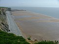
 Cliffs at Traeth Bach - geograph.org.uk - 2774487.jpg 4 000 × 3 000 ; 3,01 Mio
-
 Cliffs at Traeth Bach - geograph.org.uk - 2774494.jpg 4 000 × 3 000 ; 4,14 Mio
-
 Cliffs at Traeth Bach - geograph.org.uk - 2774503.jpg 4 000 × 3 000 ; 3,18 Mio
-
 Colourful primary school building, Wick - geograph.org.uk - 6250476.jpg 1 600 × 1 541 ; 458 kio
-
 Croes-Cwtta, Valeof Glamorgan. - geograph.org.uk - 375589.jpg 640 × 461 ; 85 kio
-
 Cwm Bach - geograph.org.uk - 4631591.jpg 640 × 480 ; 111 kio
-
 Cwrt-y-felin, Wick, Vale of Glamorgan - geograph.org.uk - 6252241.jpg 1 600 × 1 359 ; 378 kio
-

-
 Dark green and red near St Brides Road, Wick, Vale of Glamorgan - geograph.org.uk - 6250062.jpg 1 312 × 1 600 ; 478 kio
-
 David Street, Wick, Vale of Glamorgan - geograph.org.uk - 6249654.jpg 1 600 × 1 039 ; 464 kio
-
 Derelict Outbuildings - geograph.org.uk - 5143341.jpg 3 264 × 2 448 ; 3,4 Mio
-
 Double gates at a field entrance in Wick, Vale of Glamorgan - geograph.org.uk - 6252340.jpg 1 600 × 1 200 ; 583 kio
-
 Early signs of autumn on a Wick corner in the Vale of Glamorgan - geograph.org.uk - 6249751.jpg 1 600 × 1 208 ; 584 kio
-
 East along Church Street, Wick, Vale of Glamorgan - geograph.org.uk - 6249774.jpg 1 543 × 1 600 ; 401 kio
-
-
 End of the 30 zone beyond Wick in the Vale of Glamorgan - geograph.org.uk - 6251683.jpg 1 600 × 1 362 ; 398 kio
-
 End of the pavement alongside the B4265 St Brides Road, Wick - geograph.org.uk - 6250287.jpg 1 600 × 1 445 ; 604 kio
-
-
 Entrance path to St James Church, Wick, Vale of Glamorgan - geograph.org.uk - 6250529.jpg 1 504 × 1 600 ; 669 kio
-
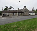
 Ewenny Road side of the Star Inn, Wick, Vale of Glamorgan - geograph.org.uk - 6251564.jpg 1 600 × 1 173 ; 294 kio
-
 Ewenny Road, Wick, Vale of Glamorgan - geograph.org.uk - 6250016.jpg 1 024 × 750 ; 128 kio
-
 Field boundary near Tre-pit - geograph.org.uk - 2774479.jpg 4 000 × 3 000 ; 3,28 Mio
-
 Fields near Wick - geograph.org.uk - 2774462.jpg 4 000 × 3 000 ; 2,55 Mio
-
 Flooded Road - geograph.org.uk - 4809193.jpg 3 648 × 5 472 ; 5,7 Mio
-
 Footpath and Stile - geograph.org.uk - 2759701.jpg 2 000 × 1 304 ; 2,23 Mio
-
 Footpath ladders at Traeth Bach - geograph.org.uk - 2774498.jpg 3 000 × 4 000 ; 4,43 Mio
-
 Footpath near Lower Monkton - geograph.org.uk - 2774439.jpg 4 000 × 3 000 ; 3,67 Mio
-
 Footpath near Lower Monkton - geograph.org.uk - 2774444.jpg 4 000 × 3 000 ; 3,32 Mio
-

-
 Gate across the entrance to Clawdd y Mynach Farm, Monknash - geograph.org.uk - 6253421.jpg 1 600 × 1 317 ; 411 kio
-
 Glacial Valley - Cwm Bach - geograph.org.uk - 5143392.jpg 3 264 × 2 448 ; 2,54 Mio
-
 Glan y Mor - geograph.org.uk - 5143327.jpg 3 264 × 2 448 ; 3,22 Mio
-
 Glan-y-Mor Lane - geograph.org.uk - 3049078.jpg 640 × 480 ; 45 kio
-
 Grazing sheep in a field near Clawdd y Mynach Farm, Monknash - geograph.org.uk - 6253455.jpg 1 600 × 1 498 ; 508 kio
-
 Green Isaf, Wick, Vale of Glamorgan - geograph.org.uk - 6251712.jpg 1 600 × 910 ; 410 kio
-
 Green Isha Farm - geograph.org.uk - 4778031.jpg 2 894 × 1 944 ; 1,55 Mio
-
 Green Uchaf, Wick, Vale of Glamorgan - geograph.org.uk - 6249862.jpg 1 600 × 883 ; 355 kio
-
 Hedge-lined part of Chapel Road, Broughton, Vale of Glamorgan - geograph.org.uk - 6253192.jpg 1 600 × 1 131 ; 382 kio
-
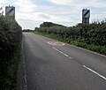
 Hedge-lined road from Wick towards Llantwit Major - geograph.org.uk - 6251680.jpg 1 600 × 1 275 ; 414 kio
-
 Hen Felin Wynt Y Wig (Wick Old Windmill) - geograph.org.uk - 4632313.jpg 640 × 480 ; 105 kio
-
 Heol Las looking south - geograph.org.uk - 3049080.jpg 640 × 481 ; 61 kio
-
 Heol Las towards Water Street, Monknash, Vale of Glamorgan - geograph.org.uk - 6253400.jpg 1 600 × 1 506 ; 466 kio
-
 Horse riders in Wick, Vale of Glamorgan - geograph.org.uk - 6252237.jpg 1 024 × 995 ; 233 kio
-
 Horses in Paddock - geograph.org.uk - 5249679.jpg 3 264 × 2 448 ; 3,63 Mio
-

-

-
 Houses on a Wick corner in the Vale of Glamorgan - geograph.org.uk - 6252242.jpg 1 600 × 1 323 ; 336 kio
-
 Housing variety, Church Street, Wick, Vale of Glamorgan - geograph.org.uk - 6250481.jpg 1 600 × 1 022 ; 388 kio
-
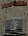
 Information board, St James Church, Wick, Vale of Glamorgan - geograph.org.uk - 6250527.jpg 1 079 × 1 600 ; 428 kio
-
 Inquisitive horses - geograph.org.uk - 4778044.jpg 2 448 × 3 264 ; 859 kio
-
 Into Wick - geograph.org.uk - 6250289.jpg 1 322 × 1 266 ; 328 kio
-
 Iron Age Hill Fort - geograph.org.uk - 5143379.jpg 3 264 × 2 448 ; 3,52 Mio
-
 Iron Age Hill Fort - geograph.org.uk - 5143384.jpg 3 209 × 2 407 ; 2,24 Mio
-

-

-

-
 Junction of the B4265 and Church Street, Wick, Vale of Glamorgan - geograph.org.uk - 6250692.jpg 1 600 × 1 000 ; 239 kio
-

-

-

-

-
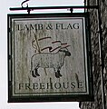
 Lamb ^ Flag in Wick, Vale of Glamorgan - geograph.org.uk - 6250680.jpg 1 600 × 1 333 ; 392 kio
-
-
 Lane off the B4265 near Wick - geograph.org.uk - 1158346.jpg 640 × 480 ; 117 kio
-
 Layered Hedge - geograph.org.uk - 5249690.jpg 3 241 × 2 440 ; 2,23 Mio
-
 Little West Barn, Broughton Road, Wick, Vale of Glamorgan - geograph.org.uk - 6252329.jpg 1 600 × 1 200 ; 497 kio
-
 Llantwit Road semis, Wick, Vale of Glamorgan - geograph.org.uk - 6250347.jpg 1 600 × 1 062 ; 307 kio
-
 Llantwit Road towards the centre of Wick, Vale of Glamorgan - geograph.org.uk - 6251949.jpg 1 600 × 1 200 ; 408 kio
-
 Lower Monkton - geograph.org.uk - 4869810.jpg 5 472 × 3 648 ; 4,94 Mio
-

-
 Maes Isaf - geograph.org.uk - 5143407.jpg 3 264 × 2 448 ; 1,9 Mio
-
 Mill Lodge, Wick, Vale of Glamorgan - geograph.org.uk - 6251625.jpg 1 600 × 1 496 ; 450 kio
-
 Muddy track - geograph.org.uk - 4778039.jpg 2 448 × 3 264 ; 3,02 Mio
-
-
 N.A.T. Group driver training bus in Wick, Vale of Glamorgan - geograph.org.uk - 6249660.jpg 1 600 × 1 084 ; 350 kio
-
 New houses, St Brides Road, Wick, Vale of Glamorgan - geograph.org.uk - 6250291.jpg 1 600 × 1 380 ; 379 kio
-
 North along David Street, Wick, Vale of Glamorgan - geograph.org.uk - 6249788.jpg 1 499 × 1 600 ; 496 kio
-
 North along Ewenny Road, Wick, Vale of Glamorgan - geograph.org.uk - 6251540.jpg 1 600 × 1 043 ; 344 kio
-
 North side of St James Church, Wick, Vale of Glamorgan - geograph.org.uk - 6250502.jpg 1 600 × 1 200 ; 417 kio
-
 North side of the Lamb ^ Flag, Wick, Vale of Glamorgan - geograph.org.uk - 6250297.jpg 1 600 × 1 254 ; 314 kio
-
 Old Barn, Near Llantwit Major, Vale of Glamorgan. - geograph.org.uk - 376262.jpg 640 × 480 ; 102 kio
-
 Ordnance Survey Cut Mark - geograph.org.uk - 4858774.jpg 480 × 640 ; 118 kio
-
 Path and road junction near Tre-pit - geograph.org.uk - 2774471.jpg 4 000 × 3 000 ; 2,75 Mio
-
 Planted fields near Cwm Bach - geograph.org.uk - 2774485.jpg 4 000 × 3 000 ; 2,71 Mio
-
 Queen Elizabeth II pillarbox in Wick, Vale of Glamorgan - geograph.org.uk - 6250073.jpg 1 350 × 1 600 ; 430 kio
-

-
 Recently-built house, St James Road, Wick, Vale of Glamorgan - geograph.org.uk - 6250023.jpg 1 600 × 1 299 ; 407 kio
-
 Redundant sign - Monk's Wood, Wick - geograph.org.uk - 1929632.jpg 1 500 × 998 ; 1,52 Mio
-
 Remains of a medieval preaching cross, Wick, Vale of Glamorgan - geograph.org.uk - 6250530.jpg 1 600 × 1 276 ; 486 kio
-

-
 Road into Wick in the Vale of Glamorgan - geograph.org.uk - 6251749.jpg 1 536 × 1 600 ; 460 kio
-
 Roadside weather station in Wick, Vale of Glamorgan - geograph.org.uk - 6251905.jpg 1 600 × 1 200 ; 319 kio
-
 Rockfall at Traeth Mawr - geograph.org.uk - 2774521.jpg 4 000 × 3 000 ; 4,3 Mio
-
 Rooftop solar panels, St Brides Road, Wick - geograph.org.uk - 6250286.jpg 1 600 × 1 198 ; 270 kio
-
 Royal Mail van, Broughton Road, Wick, Vale of Glamorgan - geograph.org.uk - 6252318.jpg 1 600 × 1 282 ; 470 kio
-
 Rustic road and rusty roof - Wick - geograph.org.uk - 1929682.jpg 1 500 × 996 ; 1,9 Mio
-

-

-
 Sheep in a field at the southern edge of Wick, Vale of Glamorgan - geograph.org.uk - 6252342.jpg 1 600 × 1 102 ; 412 kio
-

-
 SLOW-ARAF on Heol Las north of Monknash - geograph.org.uk - 6253462.jpg 1 386 × 1 600 ; 534 kio
-
 South along Broughton Road, Wick, Vale of Glamorgan - geograph.org.uk - 6249843.jpg 1 600 × 1 393 ; 485 kio
-
 South along West Street, Broughton, Vale of Glamorgan - geograph.org.uk - 6252433.jpg 1 600 × 1 587 ; 544 kio
-
 Southern boundary of Wick in the Vale of Glamorgan - geograph.org.uk - 6252337.jpg 1 600 × 902 ; 490 kio
-
 Springs and streams - geograph.org.uk - 4778052.jpg 2 448 × 3 264 ; 2,36 Mio
-
 St Brides Road bus stop and shelter, Wick, Vale of Glamorgan - geograph.org.uk - 6250292.jpg 1 600 × 1 360 ; 475 kio
-
 St.James Church, Wick - geograph.org.uk - 4778028.jpg 3 024 × 2 266 ; 1,68 Mio
-
 Star Inn, Wick, Vale of Glamorgan (geograph 6250020).jpg 1 600 × 1 194 ; 386 kio
-

-
 Start of the pavement alongside the B4265, Wick - geograph.org.uk - 6250290.jpg 1 600 × 1 425 ; 626 kio
-
 Stile and Footpath near Wick village - geograph.org.uk - 2759716.jpg 2 000 × 1 500 ; 3,38 Mio
-
 Stone houses, Chapel Road, Broughton, Vale of Glamorgan - geograph.org.uk - 6253173.jpg 1 600 × 1 599 ; 592 kio
-
 Stone Stile - geograph.org.uk - 5143334.jpg 3 264 × 2 448 ; 3,51 Mio
-

-
 The Old Shop, Broughton - geograph.org.uk - 6252430.jpg 1 600 × 1 423 ; 532 kio
-
 The Star Inn, Wick - geograph.org.uk - 4780893.jpg 2 759 × 1 988 ; 916 kio
-
 The Star Inn, Wick, Vale of Glamorgan - geograph.org.uk - 374926.jpg 640 × 412 ; 57 kio
-
 Tractor and trailer in Wick, Vale of Glamorgan - geograph.org.uk - 6252304.jpg 1 600 × 1 589 ; 482 kio
-
 Traeth Bach and cliffs - geograph.org.uk - 2774507.jpg 4 000 × 3 000 ; 3,79 Mio
-
 Traeth Mawr - geograph.org.uk - 2774515.jpg 4 000 × 3 000 ; 2,31 Mio
-
 Traeth Mawr at low tide - geograph.org.uk - 161864.jpg 640 × 480 ; 65 kio
-
 Ty Shwlac - geograph.org.uk - 4809956.jpg 5 472 × 3 648 ; 3,82 Mio
-
 Vale of Glamorgan Real Ale Trail advert, Wick - geograph.org.uk - 6250712.jpg 1 600 × 1 285 ; 400 kio
-
 Village hall detail, Wick, Vale of Glamorgan (geograph 6250660).jpg 497 × 640 ; 90 kio
-

-
 Wales Vale of Glamorgan Community Wick map.svg 512 × 322 ; 401 kio
-
 Warning sign - concealed entrance on the approach to Wick - geograph.org.uk - 6251722.jpg 2 120 × 2 928 ; 1,16 Mio
-
 Warning sign - minor road junction ahead, Heol Las, Monknash - geograph.org.uk - 6253415.jpg 1 600 × 1 192 ; 383 kio
-
 Warning signs, Church Street, Wick, Vale of Glamorgan - geograph.org.uk - 6250296.jpg 1 334 × 1 600 ; 511 kio
-
 Welcome to Wick in the Vale of Glamorgan - geograph.org.uk - 6251735.jpg 1 319 × 1 317 ; 423 kio
-
 West along Church Street, Wick, Vale of Glamorgan - geograph.org.uk - 6250294.jpg 1 600 × 1 306 ; 453 kio
-
 West Farm, Wick, Vale of Glamorgan - geograph.org.uk - 6252320.jpg 1 600 × 917 ; 339 kio
-
 West side of Ewenny Road, Wick, Vale of Glamorgan - geograph.org.uk - 6251548.jpg 1 600 × 1 026 ; 318 kio
-
 Western boundary of Monknash, Vale of Glamorgan - geograph.org.uk - 6253395.jpg 1 600 × 1 204 ; 520 kio
-
 Westwood Cottage access road, Wick, Vale of Glamorgan - geograph.org.uk - 6252324.jpg 1 600 × 1 200 ; 773 kio
-
 Wet and dry track - geograph.org.uk - 4778036.jpg 2 448 × 3 264 ; 2,35 Mio
-
 Wetlands and springs - geograph.org.uk - 4778045.jpg 3 264 × 2 448 ; 4,38 Mio
-
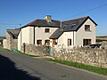
 White houses, Chapel Road, Broughton, Vale of Glamorgan - geograph.org.uk - 6252647.jpg 1 600 × 1 541 ; 396 kio
-
 Whitmore Stairs - geograph.org.uk - 5143369.jpg 3 113 × 2 335 ; 2,14 Mio
-
 Whitmore Stairs - geograph.org.uk - 5143413.jpg 3 264 × 2 448 ; 2,59 Mio
-
 Whitmore Stairs and Traeth Bach - geograph.org.uk - 2774510.jpg 4 000 × 3 000 ; 3,41 Mio
-
 Whitmore Stairs, Vale of Glamorgan coast - geograph.org.uk - 2774511.jpg 4 000 × 3 000 ; 3,36 Mio
-
 Wick & Monknash Village hall in the Vale of Glamorgan (geograph 6250646).jpg 1 600 × 1 167 ; 352 kio
-
 Wick and Marcross Church in Wales Primary School - geograph.org.uk - 6250473.jpg 1 600 × 1 245 ; 504 kio
-
 Wick Exchange in the Vale of Glamorgan - geograph.org.uk - 6251578.jpg 1 600 × 1 490 ; 428 kio
-
 Wick field - geograph.org.uk - 6250349.jpg 1 600 × 859 ; 343 kio
-
 Wick field and trees - geograph.org.uk - 6250351.jpg 1 600 × 923 ; 354 kio
-
 Wick Village Shop & Post Office (geograph 6249643).jpg 1 600 × 1 000 ; 275 kio
-
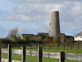 Wick Windmill.jpg 640 × 480 ; 61 kio
-
 Wick, UK - panoramio (3).jpg 4 176 × 2 784 ; 3,98 Mio
-
 Wick, UK - panoramio (4).jpg 4 176 × 2 784 ; 4,42 Mio
-
 Wick, UK - panoramio (5).jpg 4 176 × 2 784 ; 4,7 Mio
-
 Wick, UK - panoramio (6).jpg 4 176 × 2 784 ; 3,41 Mio
-
 Wick, UK - panoramio.jpg 2 592 × 1 936 ; 2,17 Mio
-
 Wick, windmill - geograph.org.uk - 5042625.jpg 1 024 × 768 ; 225 kio
-
 Windmill Close, Wick, Vale of Glamorgan - geograph.org.uk - 6251614.jpg 1 600 × 1 434 ; 409 kio
-
-

-
 Zebra crossing on the main road through Wick, Vale of Glamorgan - geograph.org.uk - 6249647.jpg 1 600 × 1 247 ; 344 kio
-
 Ewenny Road, near Wick, Vale of Glamorgan - geograph.org.uk - 375606.jpg 640 × 480 ; 80 kio
-
 Stone Stile and Gate. Vale of Glamorgan. - geograph.org.uk - 374762.jpg 640 × 486 ; 133 kio
-
 Wick Village Shop - geograph.org.uk - 272846.jpg 640 × 480 ; 112 kio
-
 Wick, Vale of Glamorgan - geograph.org.uk - 374934.jpg 640 × 480 ; 117 kio


.jpg)


_-_geograph.org.uk_-_4632313.jpg)


.jpg)


.jpg)


.jpg)


.jpg)


.jpg)
.jpg)
.jpg)
.jpg)
.jpg)


