Category:Wicken, Northamptonshire
Vai alla navigazione
Vai alla ricerca
Città britannica  | |||||
| Carica un file multimediale | |||||
| Istanza di | |||||
|---|---|---|---|---|---|
| Luogo | West Northamptonshire, Northamptonshire, Midlands Orientali, Inghilterra | ||||
| Popolazione |
| ||||
| Superficie |
| ||||
 | |||||
Sottocategorie
Questa categoria contiene un'unica sottocategoria, indicata di seguito.
W
File nella categoria "Wicken, Northamptonshire"
Questa categoria contiene 62 file, indicati di seguito, su un totale di 62.
-
 Neale(1818) p3.184 - Wicken Park, Northamptonshire.jpg 1 856 × 1 252; 619 KB
-

-
 A422 eastbound near Bedlam Copse - geograph.org.uk - 4873163.jpg 640 × 479; 39 KB
-
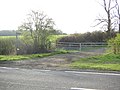
 A422 junction with Wicken Park Road - geograph.org.uk - 3910370.jpg 640 × 463; 57 KB
-
 A422 passes entrance to Mount Mill Farm - geograph.org.uk - 3911618.jpg 4 000 × 3 000; 1,36 MB
-
 A422 passes the Murco filling station - geograph.org.uk - 3911656.jpg 3 854 × 2 851; 1,21 MB
-
 A422 Wicken Road Junction - geograph.org.uk - 2114187.jpg 1 600 × 1 200; 307 KB
-
 Bedlam Copse - geograph.org.uk - 3189801.jpg 1 600 × 1 067; 363 KB
-
 Bridleway from the Wicken road - geograph.org.uk - 2980004.jpg 1 600 × 1 067; 388 KB
-
 Bridleway in Wicken Woods - geograph.org.uk - 3018958.jpg 1 200 × 1 600; 823 KB
-
 Bridleway through Wicken Wood - geograph.org.uk - 2980005.jpg 1 200 × 1 600; 564 KB
-
 Bridleway to Wicken - geograph.org.uk - 2951730.jpg 640 × 427; 87 KB
-
 Brook meandering across a field - geograph.org.uk - 3189893.jpg 1 600 × 1 067; 516 KB
-
 Buckingham Road - geograph.org.uk - 1934104.jpg 640 × 480; 58 KB
-
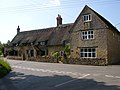
 Chimneys, Wicken - geograph.org.uk - 1011430.jpg 640 × 474; 73 KB
-
 Descriptive Plaque, Old Pound, Wicken - geograph.org.uk - 1011390.jpg 640 × 480; 108 KB
-
 Disused Car Park - geograph.org.uk - 2114278.jpg 1 600 × 1 200; 331 KB
-
 Driveway to Akeley Wood School - geograph.org.uk - 256897.jpg 640 × 480; 115 KB
-
 Electricity Substation - geograph.org.uk - 2114236.jpg 1 600 × 1 200; 341 KB
-

-
 Entrance to Hurst Farm, Wicken - geograph.org.uk - 6242725.jpg 5 184 × 3 888; 4,61 MB
-
 Entrance to Mount Mill Farm - geograph.org.uk - 3189849.jpg 1 600 × 1 070; 380 KB
-
 Farm track toward Akeley Wood school - geograph.org.uk - 3189834.jpg 1 600 × 1 069; 526 KB
-
 Field margin north of Little Hill Farm - geograph.org.uk - 256898.jpg 640 × 480; 128 KB
-
 Footbridge on bridleway to Wicken - geograph.org.uk - 2951729.jpg 640 × 430; 95 KB
-

-
 Footpath to Wicken - geograph.org.uk - 1929609.jpg 640 × 480; 98 KB
-
 Footpath to Wicken - geograph.org.uk - 1934053.jpg 640 × 480; 65 KB
-
 Footpath toward Sparrow Lodge and Wicken - geograph.org.uk - 3189838.jpg 1 600 × 1 068; 457 KB
-
 Footpath towards Wicken - geograph.org.uk - 2951721.jpg 640 × 427; 83 KB
-
 Great Ouse by Mount Mill - geograph.org.uk - 3189914.jpg 1 600 × 1 068; 407 KB
-
 House at Mount Mill - geograph.org.uk - 3189918.jpg 1 600 × 1 067; 387 KB
-
 Houses on the corner of Wicken Park Road - geograph.org.uk - 3189836.jpg 1 600 × 1 066; 432 KB
-
 Hurst Farm - geograph.org.uk - 6242638.jpg 800 × 512; 78 KB
-
 Jack's Copse - geograph.org.uk - 3189798.jpg 1 600 × 1 069; 441 KB
-
 Lane to Wicken - geograph.org.uk - 1934093.jpg 640 × 480; 72 KB
-
 Long stone wall, Wicken - geograph.org.uk - 1011457.jpg 640 × 480; 104 KB
-
 Looking to Akeley Wood School - geograph.org.uk - 1934088.jpg 640 × 480; 68 KB
-
 Looking towards Wicken Wood - geograph.org.uk - 1047376.jpg 640 × 480; 41 KB
-
 Part of the old route of the A422 - geograph.org.uk - 3189803.jpg 1 600 × 1 069; 773 KB
-

-
 Public Footpath - geograph.org.uk - 2114212.jpg 1 200 × 1 600; 388 KB
-
 Rabbit Wood - geograph.org.uk - 3189826.jpg 1 600 × 1 067; 604 KB
-
 South Northamptonshire , Mount Mill Solar Park - geograph.org.uk - 6113610.jpg 6 000 × 4 000; 7,22 MB
-
 South Northamptonshire , The A422 - geograph.org.uk - 6113608.jpg 6 000 × 4 000; 7,25 MB
-
 South Northamptonshire , The A422 - geograph.org.uk - 6113609.jpg 6 000 × 4 000; 7,64 MB
-
 South Northamptonshire , The A422 - geograph.org.uk - 6113611.jpg 6 000 × 4 000; 2,96 MB
-
 Stubble field beside East Ashalls Copse - geograph.org.uk - 6242628.jpg 800 × 600; 147 KB
-
 Stubble field near Forest Farm - geograph.org.uk - 6242632.jpg 800 × 600; 98 KB
-
 Stubble field with pigeons - geograph.org.uk - 3189823.jpg 1 600 × 1 068; 378 KB
-
 The A422 north of Thornton - geograph.org.uk - 256899.jpg 640 × 480; 147 KB
-
 Track toward Bedlam Copse - geograph.org.uk - 3189831.jpg 1 600 × 1 067; 610 KB
-
 Wicken - geograph.org.uk - 454303.jpg 640 × 480; 112 KB
-
 Wicken - geograph.org.uk - 454311.jpg 640 × 480; 105 KB
-
 Wicken Park Road - geograph.org.uk - 3189808.jpg 1 600 × 1 067; 457 KB
-
 Wicken Park, Wicken - geograph.org.uk - 3402252.jpg 640 × 389; 168 KB
-
 Deanshanger - geograph.org.uk - 454343.jpg 640 × 480; 131 KB
-
 Public Footpath - geograph.org.uk - 392146.jpg 640 × 480; 136 KB
-

-
 Road junction with A422 at Cranley Oak - geograph.org.uk - 256900.jpg 640 × 480; 132 KB
-
 Wicken - geograph.org.uk - 452819.jpg 640 × 480; 150 KB
-
 Wicken - geograph.org.uk - 454333.jpg 640 × 480; 109 KB
_p3.184_-_Wicken_Park,_Northamptonshire.jpg)


