Category:Wicklewood
Aller à la navigation
Aller à la recherche
English: Wicklewood is a village and civil parish in the South Norfolk district of Norfolk, England. It is located 11 miles west of Norwichnear to the Market town of Wymondham, neighbouring the Villages of Deopham, Hackford and Kimberely. It covers an area of and had a population of 886 in 345 households as of the 2001 census.
localité britannique du comté anglais de Norfolk  | |||||
| Téléverser des médias | |||||
| Nature de l’élément | |||||
|---|---|---|---|---|---|
| Lieu | South Norfolk, Norfolk, Angleterre de l'Est, Angleterre | ||||
| Population |
| ||||
| Superficie |
| ||||
 | |||||
Sous-catégories
Cette catégorie comprend 3 sous-catégories, dont les 3 ci-dessous.
A
S
Média dans la catégorie « Wicklewood »
Cette catégorie comprend 191 fichiers, dont les 191 ci-dessous.
-
 'The Cherry Tree' at Wicklewood - geograph.org.uk - 5365798.jpg 3 456 × 2 592 ; 3,94 Mio
-
 Agricultural shed, west of Whitehall Farm - geograph.org.uk - 5819161.jpg 1 024 × 768 ; 130 kio
-
 Approaching High Oak crossroads, Morley - geograph.org.uk - 6193549.jpg 3 456 × 2 592 ; 3,74 Mio
-
 B1135 - geograph.org.uk - 4491401.jpg 640 × 426 ; 34 kio
-
 B1135, Crownthorpe Rd - geograph.org.uk - 4491396.jpg 640 × 426 ; 33 kio
-
 B1135, Crownthorpe Rd - geograph.org.uk - 4491473.jpg 640 × 426 ; 39 kio
-
 B1135, Crownthorpe Rd - geograph.org.uk - 4491494.jpg 640 × 426 ; 50 kio
-
 B1135, Crownthorpe Rd - geograph.org.uk - 4496359.jpg 640 × 426 ; 80 kio
-

-
 Barn, Wood Farm - geograph.org.uk - 5434339.jpg 640 × 480 ; 49 kio
-
 Barns, Old Hall - geograph.org.uk - 4481418.jpg 640 × 426 ; 75 kio
-
 Barrier on a private road to Whitehall Farm - geograph.org.uk - 5819150.jpg 1 024 × 768 ; 225 kio
-
 Birch in Winter - geograph.org.uk - 2202733.jpg 1 504 × 2 128 ; 945 kio
-
 Bridge And Road Junction - geograph.org.uk - 1944211.jpg 1 600 × 1 200 ; 458 kio
-
 Buck's Lane, Morley St Botolph - geograph.org.uk - 4407791.jpg 2 592 × 1 944 ; 1,28 Mio
-
 Buck's Lane, Morley St. Botolph - geograph.org.uk - 5394461.jpg 640 × 480 ; 39 kio
-
 By the B1135 - geograph.org.uk - 4491425.jpg 640 × 426 ; 45 kio
-
 Cereal crop off Hospital Road - geograph.org.uk - 5434340.jpg 640 × 480 ; 94 kio
-

-
 Church Lane - geograph.org.uk - 4481260.jpg 640 × 426 ; 84 kio
-
 Church of St James - geograph.org.uk - 4489363.jpg 426 × 640 ; 56 kio
-
 Church of St James - geograph.org.uk - 4489369.jpg 426 × 640 ; 65 kio
-
 Church of St James - geograph.org.uk - 4489371.jpg 640 × 426 ; 76 kio
-
 Church of St James - geograph.org.uk - 4489532.jpg 640 × 377 ; 32 kio
-
 Cottages, Low St - geograph.org.uk - 4481406.jpg 640 × 426 ; 69 kio
-
 Crop field off Top Road - geograph.org.uk - 5434310.jpg 640 × 480 ; 95 kio
-
 Crop field off Wymondham Road - geograph.org.uk - 5434347.jpg 640 × 480 ; 89 kio
-
 Crop field towards woodland, Wicklewood - geograph.org.uk - 5434335.jpg 640 × 480 ; 71 kio
-
 Crop field, Morley St. Botolph - geograph.org.uk - 5394458.jpg 640 × 480 ; 49 kio
-
 Crownthorpe Carr, on the west bank of the River Tiffey - geograph.org.uk - 5819173.jpg 1 024 × 768 ; 190 kio
-
 Crownthorpe Cottage - geograph.org.uk - 4496358.jpg 640 × 426 ; 110 kio
-
 Crownthorpe from the Mid Norfolk Railway - geograph.org.uk - 2369010.jpg 3 888 × 2 592 ; 2,81 Mio
-
 Crownthorpe from the railway - geograph.org.uk - 2615869.jpg 640 × 425 ; 94 kio
-
 Crownthorpe Rd - geograph.org.uk - 4489542.jpg 640 × 426 ; 45 kio
-
 Crownthorpe Rd, B1135 - geograph.org.uk - 4489572.jpg 640 × 426 ; 27 kio
-
 Crownthorpe Rd, B1135 - geograph.org.uk - 4491482.jpg 640 × 426 ; 45 kio
-
 Crownthorpe Road (B1135) to Wymondham - geograph.org.uk - 2202727.jpg 700 × 525 ; 127 kio
-
 Crownthorpe Road (B1135), from the railway - geograph.org.uk - 5822122.jpg 1 024 × 768 ; 138 kio
-
 Crownthorpe War Memorial - geograph.org.uk - 4518303.jpg 3 456 × 2 592 ; 3,29 Mio
-
 Ditch by Low St - geograph.org.uk - 4481430.jpg 640 × 426 ; 50 kio
-
 Drain near Low Farm - geograph.org.uk - 5394482.jpg 640 × 480 ; 75 kio
-

-
 Exit from St. George's onto Hospital Road - geograph.org.uk - 6174598.jpg 3 456 × 2 592 ; 3,85 Mio
-
 Fallow field - geograph.org.uk - 4491386.jpg 640 × 426 ; 44 kio
-
 Farmland by Low St - geograph.org.uk - 4481386.jpg 640 × 426 ; 38 kio
-
 Farmland by Low St - geograph.org.uk - 4481440.jpg 640 × 426 ; 48 kio
-
 Farmland Development - geograph.org.uk - 5471171.jpg 640 × 423 ; 93 kio
-
 Farmland east of Crownthorpe Bridge - geograph.org.uk - 5822093.jpg 1 024 × 576 ; 111 kio
-
 Farmland off Wymondham Road - geograph.org.uk - 5437484.jpg 640 × 480 ; 68 kio
-
 Farmland south of Crownthorpe Carr - geograph.org.uk - 5819179.jpg 1 024 × 768 ; 174 kio
-
 Farmland south of Falstoff's Wood - geograph.org.uk - 5819156.jpg 1 024 × 768 ; 130 kio
-
 Farmland south of Low St - geograph.org.uk - 4481427.jpg 640 × 426 ; 35 kio
-
 Farmland, Crownthorpe - geograph.org.uk - 4489565.jpg 640 × 426 ; 58 kio
-
 Farmland, Crownthorpe - geograph.org.uk - 4491419.jpg 640 × 426 ; 48 kio
-
 Field boundary - geograph.org.uk - 4491414.jpg 640 × 426 ; 43 kio
-
 Field by B1135 - geograph.org.uk - 4491487.jpg 640 × 426 ; 61 kio
-
 Field by B1135 - geograph.org.uk - 4491489.jpg 640 × 426 ; 39 kio
-
 Field by Crownthorpe Rd - geograph.org.uk - 4491503.jpg 640 × 426 ; 49 kio
-
 Field by Low St - geograph.org.uk - 4481442.jpg 640 × 426 ; 53 kio
-
 Field, Crownthorpe - geograph.org.uk - 4489375.jpg 640 × 426 ; 46 kio
-
 Flint house on Low St - geograph.org.uk - 4481377.jpg 640 × 426 ; 97 kio
-
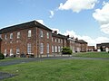
 Former workhouse, Wicklewood - geograph.org.uk - 5307313.jpg 640 × 442 ; 152 kio
-
 Garage on Low Road - geograph.org.uk - 5394479.jpg 640 × 480 ; 49 kio
-
 Grassland by Crownthorpe Rd - geograph.org.uk - 4496361.jpg 640 × 426 ; 98 kio
-
 Grassland, Crownthorpe - geograph.org.uk - 4489560.jpg 640 × 426 ; 41 kio
-
 Grassland, Crownthorpe - geograph.org.uk - 4491384.jpg 640 × 426 ; 41 kio
-
 Green Lane - geograph.org.uk - 4489342.jpg 640 × 426 ; 83 kio
-
 Green Lane - geograph.org.uk - 4489357.jpg 640 × 426 ; 68 kio
-
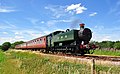 GWR 9466 at Crownthorpe - geograph.org.uk - 2000008.jpg 800 × 494 ; 107 kio
-
 GWR Pannier Tank 9466 - geograph.org.uk - 1955844.jpg 800 × 531 ; 118 kio
-
 Hanging sign of 'The Cherry Tree' at Wicklewood - geograph.org.uk - 5365794.jpg 2 592 × 3 456 ; 2,89 Mio
-
 Hanging sign of 'The Cherry Tree' at Wicklewood - geograph.org.uk - 5365796.jpg 2 592 × 3 456 ; 2,75 Mio
-
 Hill House - geograph.org.uk - 4489502.jpg 640 × 426 ; 51 kio
-
 Hillside Crescent - geograph.org.uk - 4481346.jpg 640 × 426 ; 54 kio
-
 Hospital Road - geograph.org.uk - 5434341.jpg 640 × 480 ; 81 kio
-
 Hospital Road, Wicklewood - geograph.org.uk - 5305078.jpg 640 × 406 ; 168 kio
-
 House at the top end of Low Road, Morley - geograph.org.uk - 6174606.jpg 3 456 × 2 592 ; 3,97 Mio
-
 House on Crownthorpe Road - geograph.org.uk - 5822113.jpg 1 024 × 768 ; 159 kio
-
 House, Low St - geograph.org.uk - 4481397.jpg 640 × 426 ; 56 kio
-
 If only dogs could read^ - geograph.org.uk - 4518185.jpg 640 × 480 ; 160 kio
-
 In the Tiffey Valley - geograph.org.uk - 4481215.jpg 640 × 426 ; 46 kio
-

-

-

-

-
 Kimberley House - geograph.org.uk - 4481249.jpg 640 × 426 ; 64 kio
-
 Leaving Wicklewood - geograph.org.uk - 5434332.jpg 640 × 480 ; 70 kio
-
 Looking towards Wymondham - geograph.org.uk - 1435489.jpg 640 × 480 ; 38 kio
-
 Low Road near Low Farm - geograph.org.uk - 5394484.jpg 640 × 480 ; 58 kio
-
 Low St - geograph.org.uk - 4481256.jpg 640 × 426 ; 57 kio
-
 Low St - geograph.org.uk - 4481362.jpg 640 × 426 ; 77 kio
-
 Low St - geograph.org.uk - 4481389.jpg 640 × 426 ; 60 kio
-
 Low St - geograph.org.uk - 4481393.jpg 640 × 426 ; 62 kio
-
 Low St - geograph.org.uk - 4481445.jpg 640 × 426 ; 86 kio
-
 Low St - geograph.org.uk - 4489275.jpg 640 × 426 ; 66 kio
-
 Low Street - geograph.org.uk - 4489483.jpg 640 × 426 ; 53 kio
-
 Low Street - geograph.org.uk - 4489551.jpg 640 × 426 ; 84 kio
-
 Low Street Farm - geograph.org.uk - 4489282.jpg 640 × 426 ; 67 kio
-
 Low Street, Crownthorpe Rd junction - geograph.org.uk - 4489496.jpg 640 × 426 ; 46 kio
-
 Many cars - geograph.org.uk - 4481243.jpg 640 × 426 ; 65 kio
-
 Memorial at Wicklewood Workhouse marking the burial ground - geograph.org.uk - 6174581.jpg 2 592 × 3 456 ; 3,27 Mio
-
 Mid Norfolk Railway - geograph.org.uk - 4489336.jpg 640 × 426 ; 43 kio
-
 Mid Norfolk Railway - geograph.org.uk - 4489374.jpg 640 × 426 ; 42 kio
-
 Mid Norfolk Railway nr Crownthorpe cutting - geograph.org.uk - 2630783.jpg 640 × 482 ; 102 kio
-
 Mill Cottage - geograph.org.uk - 4481283.jpg 640 × 426 ; 58 kio
-
 Mown field margin, south of Crownthorpe Carr - geograph.org.uk - 5819178.jpg 1 024 × 768 ; 192 kio
-
 Muddy Field - geograph.org.uk - 4491478.jpg 640 × 426 ; 52 kio
-
 Norfolk countryside - geograph.org.uk - 4491500.jpg 640 × 426 ; 45 kio
-
 Norfolk farmland - geograph.org.uk - 4481448.jpg 640 × 426 ; 37 kio
-
 Oakdene - geograph.org.uk - 4481257.jpg 640 × 426 ; 52 kio
-
 Old British Railway container - geograph.org.uk - 1762732.jpg 800 × 531 ; 211 kio
-
 Old Hall - geograph.org.uk - 4481424.jpg 640 × 426 ; 72 kio
-
 On Low St - geograph.org.uk - 4481412.jpg 640 × 426 ; 66 kio
-
 Pink Cottage - geograph.org.uk - 4481382.jpg 640 × 426 ; 54 kio
-
 Potatoes, Wicklewood - geograph.org.uk - 5434333.jpg 640 × 480 ; 94 kio
-
 Railway Bridge, B1135 - geograph.org.uk - 4489490.jpg 640 × 426 ; 45 kio
-
 Rattle Row House - geograph.org.uk - 4481357.jpg 640 × 426 ; 92 kio
-
 River Tiffey - geograph.org.uk - 4481175.jpg 640 × 426 ; 118 kio
-
 Row of houses - geograph.org.uk - 4481271.jpg 640 × 426 ; 56 kio
-
 Row of Houses, Crownthorpe - geograph.org.uk - 4489344.jpg 640 × 426 ; 60 kio
-
 Sign for the Cherry Tree, Wicklewood - geograph.org.uk - 5434331.jpg 524 × 640 ; 57 kio
-
 St Andrew ^ All Saints Church, Wicklewood - geograph.org.uk - 5434321.jpg 640 × 480 ; 79 kio
-

-
-

-

-
 St Andrew ^ All Saints, Wicklewood, font - geograph.org.uk - 5547068.jpg 480 × 640 ; 57 kio
-

-

-

-

-

-

-
 Steam Train at Crownthorpe - geograph.org.uk - 1955839.jpg 800 × 516 ; 131 kio
-
 Thatched house, Low St - geograph.org.uk - 4481375.jpg 640 × 426 ; 91 kio
-
 The Cherry Tree, Wicklewood - geograph.org.uk - 5434329.jpg 640 × 480 ; 76 kio
-
 The old Wicklewood Workhouse in Hospital Road (2) - geograph.org.uk - 6174564.jpg 3 456 × 2 592 ; 3,81 Mio
-
 The old Wicklewood Workhouse in Hospital Road - geograph.org.uk - 6174562.jpg 3 456 × 2 592 ; 3,91 Mio
-
 The River Tiffey, looking downstream (north) - geograph.org.uk - 5819184.jpg 1 024 × 768 ; 251 kio
-
 The Village Hall - geograph.org.uk - 295729.jpg 640 × 480 ; 93 kio
-
 Tiffey Valley Farmland - geograph.org.uk - 5471169.jpg 640 × 420 ; 106 kio
-
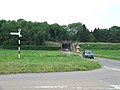
 Top Road at the High Oak Lane junction - geograph.org.uk - 4518166.jpg 1 024 × 768 ; 410 kio
-
 Top Road towards The Green - geograph.org.uk - 5434311.jpg 640 × 480 ; 69 kio
-
 Top Road, Wicklewood - geograph.org.uk - 4518162.jpg 1 024 × 768 ; 215 kio
-
 Track to Whitehall Farm - geograph.org.uk - 4491443.jpg 640 × 426 ; 48 kio
-
 Triangle of woodland, east of Crownthorpe Bridge - geograph.org.uk - 5822109.jpg 1 024 × 768 ; 224 kio
-
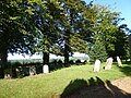
 Turnstile at the gates of Wicklewood church - geograph.org.uk - 4518295.jpg 768 × 1 024 ; 270 kio
-

-
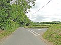
 View east along Morley Lane - geograph.org.uk - 1610754.jpg 640 × 443 ; 74 kio
-
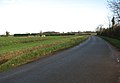
 View north-east along Low Road - geograph.org.uk - 1610752.jpg 640 × 460 ; 90 kio
-
 View southwest - geograph.org.uk - 675414.jpg 480 × 640 ; 187 kio
-
 Village sign, Crownthorpe - geograph.org.uk - 4489519.jpg 640 × 426 ; 63 kio
-
 War Memorial in Wicklewood church - geograph.org.uk - 4518312.jpg 2 048 × 2 730 ; 1,54 Mio
-
 Water (Sewage) works on High Oak Road, Morley - geograph.org.uk - 6193547.jpg 3 456 × 2 592 ; 3,93 Mio
-
 Whitehouse Lane, Wicklewood - geograph.org.uk - 6174602.jpg 3 456 × 2 592 ; 3,75 Mio
-
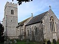 Wicklewood All Saints church - geograph.org.uk - 2253762.jpg 640 × 480 ; 111 kio
-
 Wicklewood Mill - Bin Floor - geograph.org.uk - 3512654.jpg 640 × 424 ; 244 kio
-
 Wicklewood Mill - Brake Wheel - geograph.org.uk - 3512650.jpg 640 × 424 ; 246 kio
-
 Wicklewood Mill - Dust Floor - geograph.org.uk - 3512645.jpg 640 × 424 ; 230 kio
-
 Wicklewood Mill - geograph.org.uk - 3512628.jpg 467 × 640 ; 170 kio
-
 Wicklewood Mill - geograph.org.uk - 3512634.jpg 424 × 640 ; 191 kio
-
 Wicklewood Mill - geograph.org.uk - 4481307.jpg 640 × 426 ; 66 kio
-
 Wicklewood Mill - geograph.org.uk - 4481309.jpg 640 × 426 ; 94 kio
-
 Wicklewood Mill - geograph.org.uk - 4481313.jpg 640 × 426 ; 48 kio
-
 Wicklewood Mill - geograph.org.uk - 4481343.jpg 426 × 640 ; 53 kio
-
 Wicklewood Mill - geograph.org.uk - 4481350.jpg 426 × 640 ; 40 kio
-
 Wicklewood Mill - Governor remains - geograph.org.uk - 3512690.jpg 640 × 424 ; 280 kio
-
 Wicklewood Mill - Meal Floor - geograph.org.uk - 3512702.jpg 640 × 424 ; 257 kio
-
 Wicklewood Mill - Stone Floor - geograph.org.uk - 3512668.jpg 640 × 424 ; 241 kio
-
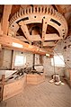 Wicklewood Mill - Stone Floor - geograph.org.uk - 3512687.jpg 424 × 640 ; 199 kio
-
 Wicklewood Mill from Green Lane - geograph.org.uk - 4518180.jpg 1 024 × 768 ; 251 kio
-
 Wicklewood Primary School and Nursery - geograph.org.uk - 5434323.jpg 640 × 408 ; 54 kio
-
 Wicklewood Rd - geograph.org.uk - 4481227.jpg 640 × 426 ; 73 kio
-
 Wicklewood Rd - geograph.org.uk - 4481247.jpg 640 × 426 ; 53 kio
-
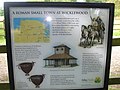 Wicklewood Roman Town - geograph.org.uk - 1449082.jpg 640 × 480 ; 79 kio
-
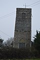
 Wicklewood Tower Mill - geograph.org.uk - 4704876.jpg 480 × 640 ; 57 kio
-
 Wicklewood War Memorial - geograph.org.uk - 4518288.jpg 2 592 × 3 456 ; 3,24 Mio
-
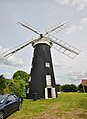
 Wicklewood Windmill (geograph 3064973).jpg 424 × 640 ; 264 kio
-
 Wicklewood Windmill - first floor - geograph.org.uk - 4012180.jpg 640 × 414 ; 84 kio
-
 Wicklewood Windmill - geograph.org.uk - 3973590.jpg 420 × 640 ; 70 kio
-
 Wicklewood Windmill - geograph.org.uk - 4012086.jpg 427 × 640 ; 82 kio
-
 Wicklewood windmill - geograph.org.uk - 4518188.jpg 576 × 768 ; 204 kio
-
 Wicklewood windmill - geograph.org.uk - 5365804.jpg 3 456 × 2 592 ; 3,71 Mio
-

-
 Wicklewood Windmill - sack hoist - geograph.org.uk - 3989991.jpg 640 × 427 ; 69 kio
-
 Wicklewood Windmill - sack hoist drive - geograph.org.uk - 4012105.jpg 640 × 427 ; 78 kio
-
 Wicklewood Windmill - stone floor - geograph.org.uk - 4012125.jpg 427 × 640 ; 86 kio
-
 Wicklewood Windmill - stone floor - geograph.org.uk - 4012131.jpg 640 × 427 ; 75 kio
-
 Woodland by Crownthorpe Rd - geograph.org.uk - 4496354.jpg 640 × 426 ; 70 kio
-
 Wymondham Road - geograph.org.uk - 5434336.jpg 640 × 480 ; 65 kio
-
 Wymondham Road - geograph.org.uk - 5434348.jpg 640 × 480 ; 65 kio


_to_Wymondham_-_geograph.org.uk_-_2202727.jpg)
,_from_the_railway_-_geograph.org.uk_-_5822122.jpg)


_-_geograph.org.uk_-_5548618.jpg)
_-_geograph.org.uk_-_5548619.jpg)
_-_geograph.org.uk_-_5548621.jpg)
_-_geograph.org.uk_-_5548623.jpg)


_-_geograph.org.uk_-_5545047.jpg)
_-_geograph.org.uk_-_5545051.jpg)
_-_geograph.org.uk_-_5545062.jpg)
_-_geograph.org.uk_-_5545063.jpg)

_-_geograph.org.uk_-_5547070.jpg)
_-_geograph.org.uk_-_5547071.jpg)
_-_geograph.org.uk_-_5546334.jpg)
_-_geograph.org.uk_-_5546339.jpg)
_-_geograph.org.uk_-_5546355.jpg)


_-_geograph.org.uk_-_6174564.jpg)

_-_geograph.org.uk_-_5819184.jpg)


,_south_of_Crownthorpe_Carr_-_geograph.org.uk_-_5822070.jpg)


_works_on_High_Oak_Road,_Morley_-_geograph.org.uk_-_6193547.jpg)


.jpg)


