Category:Widecombe in the Moor
Zur Navigation springen
Zur Suche springen
Deutsch: Widecombe in the Moor ist ein englisches Dorf im Herzen des Dartmoor National Parks in der südwestenglischen Grafschaft Devon. Der Name des Ortes leitet sich von „Withy-combe“ (deutsch „Weidental“) ab.
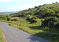
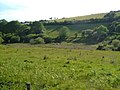
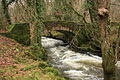
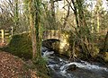
English: Widecombe in the Moor is a small village located within the heart of the Dartmoor National Park in Devon, England. . The name is thought to derive from 'Withy-combe' which means Willow Valley.
Français : Widecombe in the Moor est un petit village anglais situé dans le Dartmoor, comté du Devon.
village and civil parish in Devon, United Kingdom  | |||||
| Medium hochladen | |||||
| Ist ein(e) | |||||
|---|---|---|---|---|---|
| Liegt in Schutzgebiet | |||||
| Ort | Teignbridge, Devon, Südwestengland, England | ||||
| Betreut durch | |||||
| Einwohnerzahl |
| ||||
| offizielle Website | |||||
 | |||||
Unterkategorien
Es werden 23 von insgesamt 23 Unterkategorien in dieser Kategorie angezeigt:
In Klammern die Anzahl der enthaltenen Kategorien (K), Seiten (S), Dateien (D)
B
- Bel Tor, Dartmoor (19 D)
- Bonehill Rocks (26 D)
C
- Corndon Tor (8 D)
E
H
- Higher Uppacott (3 D)
- Honeybag Tor (13 D)
L
M
- Mel Tor (12 D)
N
- Newbridge, River Dart (3 D)
O
P
- Pil Tor (5 D)
R
- Rowden Farm, Teignbridge (3 D)
T
- Tunhill Rocks (8 D)
W
- Wind Tor (6 D)
Y
- Yar Tor (12 D)
Medien in der Kategorie „Widecombe in the Moor“
Folgende 200 Dateien sind in dieser Kategorie, von 1.598 insgesamt.
(vorherige Seite) (nächste Seite)-
 'Widecombe Fair' model in the Parish Church - geograph.org.uk - 3147518.jpg 1.785 × 1.195; 951 KB
-
 A burial cist on Blackslade Down - geograph.org.uk - 3976809.jpg 1.152 × 1.536; 1,22 MB
-
 A cattle grid at Ephraim's Pinch - geograph.org.uk - 3486753.jpg 800 × 580; 145 KB
-
 A cattle grid near Grendon Cottage - geograph.org.uk - 3486767.jpg 800 × 600; 145 KB
-
 A chink of light, Bell Tor, Dartmoor - geograph.org.uk - 5892936.jpg 1.600 × 1.200; 670 KB
-
 A marshy field near Lower Town - geograph.org.uk - 4738002.jpg 1.600 × 1.200; 1,29 MB
-
 A minor road at Langworthy Farm - geograph.org.uk - 3484057.jpg 800 × 600; 188 KB
-
 A minor road near Lower Blackaton - geograph.org.uk - 3486782.jpg 800 × 568; 144 KB
-
 A minor road near Lower Blackaton - geograph.org.uk - 3486792.jpg 800 × 600; 155 KB
-
 A minor road towards Grendon Cottage - geograph.org.uk - 3486773.jpg 800 × 600; 175 KB
-
 A minor road towards Higher Dunstone - geograph.org.uk - 3483966.jpg 800 × 600; 171 KB
-
 A minor road towards Wind Tor - geograph.org.uk - 3484001.jpg 800 × 602; 143 KB
-
 A minor road towards Windwhistle - geograph.org.uk - 3483982.jpg 800 × 527; 169 KB
-
 A Moor Otter at the Rugglestone - geograph.org.uk - 5475827.jpg 2.048 × 3.072; 1,1 MB
-
 A planned gap in a granite wall - geograph.org.uk - 5304185.jpg 1.600 × 1.200; 907 KB
-
 A prehistoric burial chamber at Hemsworthy Gate - geograph.org.uk - 3976969.jpg 1.536 × 1.152; 1,22 MB
-
 A quiet Dartmoor road - geograph.org.uk - 164826.jpg 640 × 480; 158 KB
-
 A section of Dr Blackall's Drive - geograph.org.uk - 2523293.jpg 3.872 × 2.592; 5,44 MB
-

-
 About as near as you can get to Bel Tor - geograph.org.uk - 2523350.jpg 3.872 × 2.592; 4,64 MB
-
 Above Southcombe - geograph.org.uk - 680800.jpg 640 × 480; 82 KB
-
 Above the East Webburn - geograph.org.uk - 3163600.jpg 640 × 427; 214 KB
-
 Above Widecombe - geograph.org.uk - 3163618.jpg 640 × 640; 299 KB
-
 Access land below Blackadon Tor - geograph.org.uk - 2773223.jpg 640 × 480; 127 KB
-
 Access land below Blackadon Tor - geograph.org.uk - 2773444.jpg 640 × 480; 100 KB
-
 Access land beside Blackadon Tor - geograph.org.uk - 2773528.jpg 640 × 468; 115 KB
-
 Access to the open ground at Spitchwick - geograph.org.uk - 3739264.jpg 2.560 × 1.920; 2,98 MB
-
 Across the East Webburn - geograph.org.uk - 4138393.jpg 1.910 × 1.303; 745 KB
-
 Across to Honeybag Tor - geograph.org.uk - 3163596.jpg 640 × 427; 202 KB
-
 Aish Tor - geograph.org.uk - 1593488.jpg 640 × 427; 71 KB
-
 Almost on the moor - geograph.org.uk - 3899616.jpg 1.024 × 768; 203 KB
-
-
 Approaching Hameldown Beacon on the Two Moors Way (geograph 6134263).jpg 4.608 × 3.456; 6,77 MB
-

-
 Approaching Mel Tor - geograph.org.uk - 6337653.jpg 768 × 1.024; 157 KB
-
 Approaching Pil Tor - geograph.org.uk - 4239841.jpg 800 × 532; 146 KB
-
 Approaching Sherwell - geograph.org.uk - 4596563.jpg 800 × 532; 145 KB
-
 Approaching Southcombe Cross - geograph.org.uk - 680781.jpg 473 × 640; 143 KB
-
 Approaching the Potato Field - geograph.org.uk - 2358011.jpg 480 × 640; 120 KB
-
 Approaching Two Barrows, Hamel Down - geograph.org.uk - 6134245.jpg 4.608 × 3.456; 6,38 MB
-

-

-
 Approaching Widecombe-in-the-Moor - geograph.org.uk - 6137096.jpg 640 × 387; 53 KB
-
 Approaching Woodland - geograph.org.uk - 3435771.jpg 1.024 × 768; 345 KB
-
 Artificial pool near New Bridge on the River Dart - geograph.org.uk - 4738339.jpg 1.600 × 1.200; 2,06 MB
-
 Autumn colours, Dartmeet, Devon - geograph.org.uk - 4674323.jpg 4.034 × 2.811; 5,52 MB
-
 Autumn scene near Spitchwick - geograph.org.uk - 3739239.jpg 2.560 × 1.920; 2,99 MB
-
 Autumn trees by New Bridge - geograph.org.uk - 3739184.jpg 2.525 × 1.755; 1,75 MB
-
 Avenue of Trees - geograph.org.uk - 3435735.jpg 1.024 × 768; 280 KB
-
 B3357 at Uppacott - geograph.org.uk - 4034772.jpg 640 × 431; 67 KB
-
 B3387 above Widecombe - geograph.org.uk - 3707590.jpg 3.373 × 2.267; 690 KB
-
 B3387 east of Widecombe in the Moor - geograph.org.uk - 4012516.jpg 1.535 × 1.536; 1,38 MB
-
 Ba ba bath time - geograph.org.uk - 1047722.jpg 480 × 640; 116 KB
-
-
-
 Badgers Holt at Dartmeet - geograph.org.uk - 4034314.jpg 640 × 471; 82 KB
-
 Barn at West Shallowford - geograph.org.uk - 3036056.jpg 640 × 480; 133 KB
-
 Barn at West Shallowford - geograph.org.uk - 3566715.jpg 640 × 480; 98 KB
-
 Behind the church - geograph.org.uk - 3163639.jpg 640 × 428; 198 KB
-
 Bell Tor - geograph.org.uk - 3162021.jpg 640 × 427; 226 KB
-
 Bell Tor - geograph.org.uk - 3978343.jpg 1.536 × 1.152; 1,05 MB
-
 Bell Tor - geograph.org.uk - 4138495.jpg 1.920 × 1.350; 913 KB
-
 Bell Tor - geograph.org.uk - 4394615.jpg 800 × 532; 167 KB
-
 Belltor Corner - geograph.org.uk - 2331088.jpg 1.024 × 768; 146 KB
-
 Belted Galloways above Widecombe - geograph.org.uk - 3526059.jpg 640 × 374; 46 KB
-
 Belted Galloways near Rowden - geograph.org.uk - 3034738.jpg 640 × 492; 125 KB
-
 Beltor Corner - geograph.org.uk - 3737837.jpg 2.048 × 1.536; 1,21 MB
-
 Bend at Great Dunstone - geograph.org.uk - 4035100.jpg 640 × 306; 66 KB
-
 Bend in road near Lower Blackaton - geograph.org.uk - 6136236.jpg 1.925 × 1.444; 2,36 MB
-
 Bend into Ponsworthy - geograph.org.uk - 4034988.jpg 640 × 369; 73 KB
-
 Beneath the Rugglestone - geograph.org.uk - 6005081.jpg 2.848 × 4.288; 1,49 MB
-
 Berry Pound on Hameldown - geograph.org.uk - 5894081.jpg 1.600 × 1.200; 897 KB
-
 Bittleford Down - geograph.org.uk - 1229182.jpg 640 × 480; 112 KB
-
 Blackadon Down - geograph.org.uk - 2773764.jpg 640 × 438; 83 KB
-
 Blackadon Down - geograph.org.uk - 3739364.jpg 1.920 × 1.440; 810 KB
-
 Blackadon Tor - geograph.org.uk - 1607647.jpg 640 × 427; 84 KB
-
 Blackadon Tor - geograph.org.uk - 2773469.jpg 640 × 428; 116 KB
-
 Blackadon Tor - geograph.org.uk - 3739385.jpg 1.920 × 1.292; 700 KB
-
 Blackaton Cross - geograph.org.uk - 3034534.jpg 640 × 483; 121 KB
-
 Blackaton Down - geograph.org.uk - 3034450.jpg 640 × 480; 107 KB
-
 Blackaton Manor - geograph.org.uk - 1780652.jpg 1.024 × 683; 179 KB
-
 Blackslade (geograph 6727879).jpg 4.288 × 2.848; 1,94 MB
-
 Blackslade Down - geograph.org.uk - 1005310.jpg 640 × 408; 85 KB
-
 Blackslade Ford - geograph.org.uk - 1164846.jpg 640 × 427; 114 KB
-
 Blackslade longhouse - geograph.org.uk - 3418614.jpg 640 × 427; 207 KB
-
 Bluebells in woodland on Chinkwell Tor - geograph.org.uk - 3979756.jpg 1.536 × 1.152; 1,65 MB
-
 Bog Asphodel near Corndon Ford - geograph.org.uk - 3567026.jpg 480 × 640; 77 KB
-
 Bog Pimpernel near Corndon Ford - geograph.org.uk - 3566925.jpg 451 × 640; 69 KB
-
 Bonehill - geograph.org.uk - 3161963.jpg 640 × 427; 217 KB
-
 Bonehill - geograph.org.uk - 4394640.jpg 800 × 532; 192 KB
-
 Bonehill and Bonehill Rocks - geograph.org.uk - 3527329.jpg 640 × 416; 58 KB
-
 Bonehill Down - geograph.org.uk - 4145027.jpg 1.920 × 1.310; 1,02 MB
-
 Bonehill Down - geograph.org.uk - 4145784.jpg 1.920 × 1.298; 758 KB
-
 Bonehill Down - geograph.org.uk - 4777956.jpg 1.600 × 900; 369 KB
-
 Bonehill Rocks - geograph.org.uk - 3978321.jpg 1.024 × 768; 142 KB
-
 Bonehill Rocks - geograph.org.uk - 4145885.jpg 1.768 × 1.276; 546 KB
-
 Bonehill Rocks from the slope of Bell Tor - geograph.org.uk - 3978348.jpg 1.024 × 768; 145 KB
-
 Bonehill Rocks on a sunny Christmas Eve - geograph.org.uk - 4289875.jpg 2.560 × 1.920; 2,09 MB
-
 Bonehill Rocks, Dartmoor - geograph.org.uk - 5892935.jpg 1.600 × 1.200; 741 KB
-
 Bonehill to Chinkwell st hug.jpg 8.000 × 1.739; 7,72 MB
-
 Boulders by the Dart - geograph.org.uk - 2360578.jpg 640 × 480; 150 KB
-
-
 Boundary marker stones by the road - geograph.org.uk - 1003724.jpg 640 × 480; 50 KB
-
 Boundary Marker, Dunstone Down - geograph.org.uk - 6276929.jpg 1.600 × 1.200; 664 KB
-
 Boundary of farmland and moorland, Cator Court - geograph.org.uk - 4011731.jpg 1.536 × 1.024; 763 KB
-
 Boundary stone - geograph.org.uk - 3163500.jpg 640 × 427; 200 KB
-
 Boundary stone - geograph.org.uk - 3163508.jpg 640 × 427; 215 KB
-
 Boundary Stone - geograph.org.uk - 4403028.jpg 1.600 × 1.067; 821 KB
-
 Boundary stone at Hemsworthy Gate - geograph.org.uk - 3976967.jpg 1.151 × 1.536; 1,21 MB
-
 Boundary stone near Natsworthy Manor - geograph.org.uk - 5893522.jpg 1.200 × 1.600; 801 KB
-
 Boundary stone on Broad Barrow - geograph.org.uk - 5894126.jpg 1.600 × 1.200; 859 KB
-
 Boundary stone on Single Barrow - geograph.org.uk - 5894129.jpg 1.600 × 1.200; 747 KB
-
 Boundary wall - geograph.org.uk - 4392673.jpg 800 × 532; 163 KB
-
 Boundary wall and Two Barrows on Hamel Down - geograph.org.uk - 5894305.jpg 1.600 × 1.200; 868 KB
-
 Boundary wall between farmland and moorland - geograph.org.uk - 5895101.jpg 1.200 × 1.600; 823 KB
-
 Boundary Wall, Hamel Down - geograph.org.uk - 6277205.jpg 1.600 × 1.200; 579 KB
-
 Boundary wall, south of Hameldown - geograph.org.uk - 5895096.jpg 1.600 × 1.200; 828 KB
-
 Bowden Barn and Widecombe - geograph.org.uk - 1237879.jpg 640 × 480; 81 KB
-
 Boys will be boys - geograph.org.uk - 3163657.jpg 640 × 443; 205 KB
-
 Bracken near Blackadon Tor - geograph.org.uk - 2773415.jpg 640 × 445; 84 KB
-
 Branches across the Dart - geograph.org.uk - 2360299.jpg 640 × 480; 136 KB
-
 Bridge and Belted Galloways - geograph.org.uk - 183890.jpg 640 × 480; 118 KB
-
 Bridge at a bend in the road below Coronation Plantation - geograph.org.uk - 4737807.jpg 1.600 × 1.200; 1,49 MB
-
 Bridge at West Shallowford - geograph.org.uk - 1165011.jpg 640 × 427; 122 KB
-
 Bridge at West Shallowford - geograph.org.uk - 3036037.jpg 640 × 480; 131 KB
-
 Bridge over Broadaford Brook - geograph.org.uk - 3034760.jpg 640 × 480; 115 KB
-
 Bridge over East Dart River - geograph.org.uk - 4875025.jpg 3.200 × 1.800; 2,05 MB
-
 Bridge over the East Dart River - geograph.org.uk - 1498684.jpg 640 × 427; 126 KB
-
 Bridge over West Webburn - geograph.org.uk - 4425676.jpg 1.920 × 1.440; 884 KB
-
 Bridge over West Webburn River - geograph.org.uk - 6136244.jpg 1.925 × 1.444; 3,22 MB
-

-
 Bridleway - geograph.org.uk - 6337651.jpg 768 × 1.024; 226 KB
-
 Bridleway from Cator Gate - geograph.org.uk - 4596558.jpg 800 × 532; 185 KB
-
 Bridleway Meets Road - geograph.org.uk - 3652894.jpg 1.024 × 768; 446 KB
-
 Bridleway near Jordan - geograph.org.uk - 3566456.jpg 480 × 640; 141 KB
-
 Bridleway to East Shallowford - geograph.org.uk - 4593927.jpg 800 × 461; 165 KB
-
 Bridleway to Hameldown Tor - geograph.org.uk - 3163491.jpg 640 × 427; 173 KB
-
 Bridleway to Jordan - geograph.org.uk - 1165020.jpg 640 × 427; 135 KB
-
 Bridleway to Jordan - geograph.org.uk - 3566462.jpg 640 × 480; 115 KB
-
 Bridleway to Shallowford - geograph.org.uk - 3566466.jpg 640 × 446; 88 KB
-
 Bridleway to Shallowford - geograph.org.uk - 3566485.jpg 640 × 451; 100 KB
-
 Bridleway to Shallowford - geograph.org.uk - 3566610.jpg 640 × 487; 94 KB
-
 Bridleway, lower slopes of Cordon Down - geograph.org.uk - 4594032.jpg 800 × 532; 150 KB
-
 Bridleway, lower slopes of Cordon Down - geograph.org.uk - 4594046.jpg 800 × 543; 157 KB
-
 Bridleway, West Webburn valley - geograph.org.uk - 3566481.jpg 640 × 480; 81 KB
-
 Broad barrow & stakes.jpg 2.048 × 1.536; 1,41 MB
-
 Broad Barrow on Hamel Down in 1989 - geograph.org.uk - 3948738.jpg 1.024 × 674; 181 KB
-
 Broad Barrow, Dartmoor - geograph.org.uk - 1046931.jpg 640 × 480; 90 KB
-
 Broad Barrow, Hamel Down - geograph.org.uk - 6134254.jpg 4.608 × 3.456; 7,2 MB
-
 Broadaford - geograph.org.uk - 4593951.jpg 800 × 532; 126 KB
-
 Broadaford Brook - geograph.org.uk - 3034571.jpg 640 × 480; 131 KB
-
 Broadaford Brook valley - geograph.org.uk - 3034459.jpg 640 × 455; 81 KB
-
 Broadaford Brook valley - geograph.org.uk - 3034466.jpg 640 × 480; 92 KB
-
 Broadaford Brook valley - geograph.org.uk - 3034493.jpg 640 × 418; 92 KB
-
 Broadaford Brook valley - geograph.org.uk - 3034546.jpg 640 × 480; 102 KB
-
 Broadaford Brook valley - geograph.org.uk - 3034734.jpg 640 × 480; 85 KB
-
 Broadaford Brook valley - geograph.org.uk - 3034749.jpg 640 × 480; 80 KB
-
 Broadaford Brook valley - geograph.org.uk - 3034776.jpg 640 × 480; 87 KB
-
 Brook Lane Cottages - geograph.org.uk - 3163626.jpg 640 × 638; 313 KB
-
 Buckland Bridge - geograph.org.uk - 1147609.jpg 640 × 427; 125 KB
-
 Buckland Bridge - geograph.org.uk - 2773874.jpg 640 × 464; 129 KB
-
 Buckland Bridge - geograph.org.uk - 3454522.jpg 640 × 480; 150 KB
-
 Build-up of trees, West Webburn River - geograph.org.uk - 2773638.jpg 640 × 480; 134 KB
-
 Buildings at Sherril - geograph.org.uk - 3046574.jpg 640 × 464; 84 KB
-
 By Northway Bridge, Widecombe in the Moor - geograph.org.uk - 3258493.jpg 2.560 × 1.920; 2,81 MB
-
 By the Dart - geograph.org.uk - 2360307.jpg 640 × 480; 134 KB
-
 By the River Dart - geograph.org.uk - 840944.jpg 640 × 480; 148 KB
-
 By the Rugglestone - geograph.org.uk - 6005092.jpg 4.288 × 2.848; 2,69 MB
-
 By the West Webburn - geograph.org.uk - 3566666.jpg 640 × 495; 124 KB
-
 Cairn and boundary stone on Hameldown Beacon - geograph.org.uk - 5895068.jpg 1.600 × 1.200; 790 KB
-
 Cairn on Chinkwell Tor - geograph.org.uk - 3978366.jpg 1.536 × 1.152; 962 KB
-
 Cairn on Hameldown Beacon - geograph.org.uk - 6277209.jpg 1.600 × 1.200; 501 KB
-
 Cairn, Corndon Down - geograph.org.uk - 4655206.jpg 1.600 × 1.200; 354 KB
-
 Cairn, Yar Tor - geograph.org.uk - 4655228.jpg 1.600 × 1.200; 540 KB
-
 Cairns on Chinkwell.jpg 4.112 × 2.696; 3,35 MB
-
 Cairns on Corndon Down summits - geograph.org.uk - 1543008.jpg 640 × 480; 63 KB
-
 Car park at Spitchwick - geograph.org.uk - 3899611.jpg 1.024 × 768; 359 KB
-
 Car park for the Old Inn, Widecombe in The Moor - geograph.org.uk - 5895116.jpg 1.600 × 1.200; 767 KB
-
 Car park on Dunstone Down, Dartmoor - geograph.org.uk - 164820.jpg 640 × 480; 114 KB
-
 Car park, Holne New Bridge - geograph.org.uk - 2357752.jpg 640 × 480; 105 KB
-
 Car Park, Widecombe in the Moor - geograph.org.uk - 4541028.jpg 2.200 × 1.467; 2,98 MB
-
 Carriage drive below Bell Tor - geograph.org.uk - 3979779.jpg 1.536 × 1.152; 1,16 MB
-
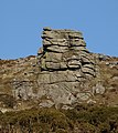
 Cathanger Rock (1) - geograph.org.uk - 1426285.jpg 640 × 480; 118 KB
-
 Cathanger Rock (2) - geograph.org.uk - 1426294.jpg 640 × 480; 150 KB
-
 Cathanger Rock - geograph.org.uk - 2195961.jpg 1.024 × 683; 157 KB
-
 Cator Cross - geograph.org.uk - 4483604.jpg 640 × 480; 71 KB
-
 Cattle drinking at Ponsworthy - geograph.org.uk - 4034997.jpg 640 × 428; 72 KB
-

-
 Cattle Grid - geograph.org.uk - 4394566.jpg 800 × 532; 149 KB
-
 Cattle grid south of Isaford - geograph.org.uk - 5893497.jpg 1.600 × 1.200; 774 KB
-
 Cattle on Corndon Down - geograph.org.uk - 3035760.jpg 640 × 478; 92 KB
-
 Celtic cross, Widecombe - geograph.org.uk - 4540608.jpg 2.200 × 1.467; 2,62 MB
-
 Centre of Widecombe - geograph.org.uk - 3163630.jpg 525 × 640; 236 KB
-
 Centre of Widecombe - geograph.org.uk - 3527581.jpg 640 × 480; 58 KB
-
 Change of road status - geograph.org.uk - 2829453.jpg 640 × 480; 84 KB
-
 Chickens at Sherril - geograph.org.uk - 3046625.jpg 480 × 640; 115 KB
-
 Children's playground, Widecombe in The Moor - geograph.org.uk - 5895113.jpg 1.600 × 1.200; 830 KB
-
 Chinkwell Tor - geograph.org.uk - 1237603.jpg 571 × 640; 100 KB
-
 Chinkwell Tor - geograph.org.uk - 935860.jpg 640 × 480; 81 KB
-
 Chinkwell Tor from Honeybag Tor - geograph.org.uk - 3978399.jpg 1.536 × 1.152; 1 MB


.jpg)


_-_geograph.org.uk_-_1426285.jpg)
_-_geograph.org.uk_-_1426294.jpg)


.jpg)