Category:Wigan
Zur Navigation springen
Zur Suche springen
englische Stadt  | |||||
| Medium hochladen | |||||
| Ist ein(e) | |||||
|---|---|---|---|---|---|
| Ort | Metropolitan Borough of Wigan, Greater Manchester, North West England, England | ||||
| Liegt am oder im Gewässer | |||||
| Einwohnerzahl |
| ||||
| Fläche |
| ||||
| Verschieden von | |||||
 | |||||
Unterkategorien
Es werden 19 von insgesamt 19 Unterkategorien in dieser Kategorie angezeigt:
In Klammern die Anzahl der enthaltenen Kategorien (K), Seiten (S), Dateien (D)
- Plaques in Wigan (5 D)
A
- Alexandra Park, Wigan (3 D)
G
H
K
L
M
- Marus Bridge, Wigan (13 D)
S
- Scholes, Greater Manchester (27 D)
T
W
- Wigan Market (10 D)
Medien in der Kategorie „Wigan“
Folgende 153 Dateien sind in dieser Kategorie, von 153 insgesamt.
-
 1953 Graffiti - geograph.org.uk - 930058.jpg 640 × 429; 199 KB
-

-
 A rooftop view of Wigan - geograph.org.uk - 1614943.jpg 640 × 426; 67 KB
-
 Amusements in Wigan town centre - geograph.org.uk - 4212732.jpg 800 × 600; 109 KB
-
 An eco carpark light - geograph.org.uk - 1030773.jpg 480 × 640; 90 KB
-
 An old railway bridge, Wigan - panoramio.jpg 2.048 × 1.536; 368 KB
-

-
 At the rear of Kwik Fit garage - geograph.org.uk - 2258068.jpg 1.200 × 803; 203 KB
-
 Beresford St bridge - geograph.org.uk - 2273263.jpg 1.200 × 803; 127 KB
-
 Best buds - geograph.org.uk - 3605624.jpg 1.000 × 750; 876 KB
-

-
 Bomb Shelter ^ - geograph.org.uk - 1764073.jpg 600 × 400; 76 KB
-
 Bonnet MET 1977.67 label.jpg 2.712 × 1.584; 1,12 MB
-

-
 Burned out car at Parson's Meadow - geograph.org.uk - 3574018.jpg 800 × 566; 167 KB
-
 Car Park in Wigan Town Centre - geograph.org.uk - 4609115.jpg 1.024 × 768; 216 KB
-
 Chapel Lane Car Park entrance, Wigan - geograph.org.uk - 5550651.jpg 800 × 564; 99 KB
-
 Chemistry lab mock-up in a Wigan e-cig shop.JPG 4.320 × 3.240; 2,71 MB
-
 Church Gardens, Wigan - geograph.org.uk - 3578326.jpg 640 × 480; 88 KB
-
 Close Brook and culvert - geograph.org.uk - 1737617.jpg 2.816 × 2.112; 1,86 MB
-
 Compass Rose - geograph.org.uk - 2273377.jpg 1.200 × 803; 329 KB
-
 Convergence - geograph.org.uk - 97069.jpg 640 × 426; 101 KB
-
 Curtis Stigers - Wigan Jazz Festival 2010.jpg 5.184 × 3.456; 2,24 MB
-

-
 Derelict Warehouse, Pottery Lane, Wigan - geograph.org.uk - 3574940.jpg 800 × 566; 473 KB
-

-
 Double postbox (WN1 223) - geograph.org.uk - 5370219.jpg 1.024 × 1.413; 909 KB
-
 Drumcroon Gallery - geograph.org.uk - 930713.jpg 425 × 640; 164 KB
-
 End of Olympic dreams-03 - geograph.org.uk - 1542839.jpg 640 × 426; 52 KB
-
 Entrance to Bridleway off Acacia Crescent - geograph.org.uk - 2080993.jpg 1.600 × 1.198; 638 KB
-
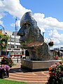
 Face of Wigan - geograph.org.uk - 2715720.jpg 1.600 × 1.200; 380 KB
-
 Face of Wigan sculpture, Wigan.jpg 2.796 × 4.172; 1,29 MB
-
 Field Street, Wigan.jpg 2.310 × 1.731; 932 KB
-
 Fields, Brimelow Farm, Beech Hill - geograph.org.uk - 1171926.jpg 640 × 426; 42 KB
-
 Footpaths under viaduct - geograph.org.uk - 2258040.jpg 1.200 × 800; 219 KB
-
 Gidlow Cemetery, Wigan - geograph.org.uk - 5302847.jpg 1.024 × 820; 257 KB
-
 Ground Maintenance - geograph.org.uk - 55603.jpg 640 × 480; 65 KB
-
 Haigh Foundry gateposts - geograph.org.uk - 1034741.jpg 640 × 479; 88 KB
-

-
 Hole - geograph.org.uk - 3574939.jpg 800 × 566; 616 KB
-
 Home of Rugby League sculpture - geograph.org.uk - 3755977.jpg 480 × 640; 114 KB
-
 Homeless in Wigan - geograph.org.uk - 4631043.jpg 1.024 × 767; 304 KB
-
 Independence Night Club - geograph.org.uk - 3573300.jpg 800 × 567; 171 KB
-
 Jennets Lane Bridge - geograph.org.uk - 1769533.jpg 4.224 × 3.168; 3,26 MB
-

-
 Market Place and the Grand Arcade Wigan.jpg 640 × 480; 105 KB
-
 Mesnes Terrace Car Park, Wigan - geograph.org.uk - 3230834.jpg 4.000 × 2.248; 1,34 MB
-
 Mine Shaft Cap South West of Gidlow Cemetery - geograph.org.uk - 5302838.jpg 1.024 × 820; 535 KB
-
 Narrow Boats at Red Rock Moorings - geograph.org.uk - 469511.jpg 479 × 640; 83 KB
-
 No Change Given - geograph.org.uk - 1814735.jpg 2.048 × 1.536; 588 KB
-
-
-

-
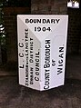
 Old Boundary Marker in Elnup Wood (geograph 6711234).jpg 480 × 640; 127 KB
-
 Old Lane - geograph.org.uk - 5223582.jpg 1.024 × 683; 427 KB
-

-

-
 Old Sign on bridge - geograph.org.uk - 2273268.jpg 1.200 × 803; 225 KB
-
 Old sign on bridge - geograph.org.uk - 2273274.jpg 1.200 × 803; 218 KB
-
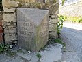
 Old Wayside Cross (geograph 6499389).jpg 720 × 960; 108 KB
-
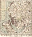 Ordnance Survey One-Inch Sheet 100 Liverpool, Published 1947.jpg 10.933 × 12.775; 16,46 MB
-
 Ordnance Survey One-Inch Sheet 100 Liverpool, Published 1966.jpg 8.244 × 9.891; 11,11 MB
-
 Orrell Street businesses, Wigan - geograph.org.uk - 5550430.jpg 800 × 585; 117 KB
-
 Orwellian Wigan - geograph.org.uk - 3567554.jpg 800 × 524; 175 KB
-
 Parson's Meadow - geograph.org.uk - 937477.jpg 640 × 426; 188 KB
-
 Parson's Meadow - geograph.org.uk - 937478.jpg 640 × 426; 200 KB
-
 Parson's Meadow - geograph.org.uk - 937480.jpg 640 × 426; 158 KB
-
 Parson's Meadow - geograph.org.uk - 937485.jpg 640 × 426; 203 KB
-
 Playing fields - geograph.org.uk - 3507068.jpg 640 × 480; 52 KB
-
 Parson's Meadow - geograph.org.uk - 937482.jpg 640 × 426; 173 KB
-

-

-
 Railway Bridge over Frog Lane - geograph.org.uk - 3335284.jpg 640 × 480; 97 KB
-
 Razor wire - geograph.org.uk - 3583394.jpg 800 × 533; 141 KB
-
 River Douglas at Wigan (1).JPG 4.320 × 3.240; 4,4 MB
-
 River Douglas at Wigan (2).JPG 4.320 × 3.240; 4,59 MB
-
 RiverDouglas.JPG 1.600 × 1.200; 424 KB
-
 Road to Orrell - geograph.org.uk - 504836.jpg 640 × 480; 115 KB
-
 Saddle Junction commemorative stone, Wigan.jpg 4.320 × 3.240; 4,4 MB
-
 Sculpture on a Wigan corner - geograph.org.uk - 5559318.jpg 800 × 600; 145 KB
-

-
 Sicklefield - geograph.org.uk - 2115331.jpg 4.344 × 2.891; 5,39 MB
-
 Sign - Douglas Valley Way - geograph.org.uk - 928036.jpg 640 × 425; 251 KB
-
 Site for new fishery - geograph.org.uk - 2273349.jpg 1.200 × 803; 142 KB
-
 Site Investigation - geograph.org.uk - 1595600.jpg 640 × 427; 74 KB
-
 Sovereign Road Car Park, Wigan - geograph.org.uk - 5559338.jpg 800 × 575; 131 KB
-
 Steps between Walnut Avenue and Woodland Grove - geograph.org.uk - 5725041.jpg 1.024 × 768; 402 KB
-
 Tagged - geograph.org.uk - 3578161.jpg 800 × 533; 123 KB
-
 Taylor Gallery at the Museum of Wigan Life.jpg 836 × 626; 147 KB
-
 The Dinner Hour, Wigan - detail.jpg 2.560 × 1.920; 594 KB
-
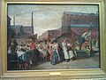
 The Dinner Hour, Wigan - Eyre Crowe.jpg 800 × 570; 77 KB
-
 The Dinner Hour, Wigan.jpg 2.560 × 1.920; 988 KB
-
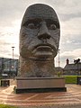
 The Face of Wigan (18995811475).jpg 3.456 × 4.608; 3,01 MB
-
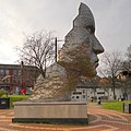
 The Face of Wigan - geograph.org.uk - 3297171.jpg 480 × 640; 424 KB
-
 The Face of Wigan - geograph.org.uk - 3297317.jpg 640 × 640; 613 KB
-
 The Face of Wigan and Civic Centre - geograph.org.uk - 3297156.jpg 512 × 640; 499 KB
-
 The Grand Arcade - geograph.org.uk - 1099332.jpg 640 × 480; 59 KB
-
 The History of the Church & Manor of Wigan part 1.djvu 1.115 × 1.367, 192 Seiten; 4,33 MB
-
 The History of the Church & Manor of Wigan part 2.djvu 3.684 × 4.848, 282 Seiten; 8,1 MB
-
 The Powell Statue - panoramio.jpg 3.072 × 2.304; 2,62 MB
-
 The Wheel at Wigan and Leigh College (1).JPG 4.608 × 3.456; 3,44 MB
-
 They weren't here yesterday.... - geograph.org.uk - 931562.jpg 640 × 426; 81 KB
-
 Town Centre Parking in Wigan - geograph.org.uk - 4630925.jpg 1.024 × 683; 160 KB
-
 Tree on King Street West, Wigan.JPG 3.240 × 4.320; 5,02 MB
-
 Tyldesley monument, Wigan.jpg 1.200 × 1.600; 1,31 MB
-
 Unfinished - geograph.org.uk - 4146125.jpg 640 × 480; 73 KB
-
 View from the top deck-04 - geograph.org.uk - 851464.jpg 640 × 426; 50 KB
-
 View from the top deck-12 - geograph.org.uk - 851495.jpg 640 × 426; 49 KB
-
 View from the top deck-13 - geograph.org.uk - 851497.jpg 640 × 426; 56 KB
-
 View from the top deck-21 - geograph.org.uk - 851707.jpg 640 × 426; 51 KB
-
 View from the top deck-22 - geograph.org.uk - 851716.jpg 640 × 426; 53 KB
-
 VR Postbox - geograph.org.uk - 66288.jpg 588 × 640; 127 KB
-
 West Coast Main Line Express - geograph.org.uk - 49026.jpg 640 × 480; 204 KB
-
-

-
 Wigan - geograph.org.uk - 1534130.jpg 640 × 428; 82 KB
-
 Wigan - Northway - geograph.org.uk - 1630837.jpg 640 × 480; 187 KB
-
 Wigan - panoramio (1).jpg 2.304 × 1.728; 797 KB
-
 Wigan - panoramio.jpg 2.304 × 1.728; 717 KB
-
 Wigan 2.62999W 53.54564N.jpg 1.280 × 958; 168 KB
-
 Wigan aerial view.jpg 4.267 × 3.195; 11,27 MB
-
 Wigan banner Pier.jpg 3.527 × 504; 1,15 MB
-
 Wigan Borough 1923-1924.jpg 800 × 484; 360 KB
-
 Wigan CR P1010019.JPG 3.072 × 2.304; 2,97 MB
-
 Wigan History Shop And Careers Office.jpg 3.024 × 4.032; 3,08 MB
-
 Wigan Investment Centre.jpg 640 × 425; 147 KB
-
 WIGAN KOŚCIÓL - panoramio.jpg 2.592 × 1.944; 774 KB
-
 Wigan Metropolitan Borough Council 2024.svg 360 × 185; 5 KB
-
 Wigan Skyline - geograph.org.uk - 1531800.jpg 640 × 364; 50 KB
-
 Wigan skyline 2008.jpg 640 × 418; 90 KB
-
 Wigan UK ward map 2023.svg 636 × 550; 391 KB
-
 Wigan UK ward map 2024.svg 679 × 586; 378 KB
-
 Wigan, 1881.jpg 1.540 × 2.562; 1,27 MB
-
 Wigan, Sherwood Dr - panoramio.jpg 2.304 × 1.728; 781 KB
-
 Wigan, UK - panoramio (1).jpg 4.288 × 3.216; 2,97 MB
-
 Wigan, UK - panoramio (2).jpg 3.216 × 4.288; 3,07 MB
-
 Wigan, UK - panoramio (3).jpg 1.520 × 2.688; 1,07 MB
-
 Wigan, UK - panoramio (4).jpg 2.688 × 1.520; 1,88 MB
-
 Wigan, UK - panoramio (5).jpg 2.688 × 1.520; 1,92 MB
-
 Wigan, UK - panoramio (6).jpg 2.688 × 1.520; 1,81 MB
-
 Wigan, UK - panoramio.jpg 4.288 × 3.216; 2,83 MB
-
 Wilton Street Car Park entrance, Wigan - geograph.org.uk - 5559330.jpg 800 × 729; 207 KB
-
 Worthington - Worthington Lakes.jpg 640 × 426; 280 KB
-
 Worthington Lakes - geograph.org.uk - 921715.jpg 640 × 426; 173 KB
-
 A Closed Victoria Hotel - geograph.org.uk - 1427287.jpg 640 × 480; 75 KB
-
 Crankwood - the end of the road - geograph.org.uk - 1419583.jpg 640 × 426; 47 KB
-
 Footbridge near Speakman House - geograph.org.uk - 485941.jpg 480 × 640; 137 KB
-
-

-
 Little Scotland - geograph.org.uk - 50405.jpg 640 × 480; 143 KB
-
 New Park Wood - geograph.org.uk - 584754.jpg 479 × 640; 139 KB
-
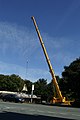 Reaching new heights - geograph.org.uk - 378041.jpg 426 × 640; 74 KB
-
 Shaft cap in New Park Wood - geograph.org.uk - 584760.jpg 479 × 640; 161 KB

.jpg)


_-_geograph.org.uk_-_5370219.jpg)


.jpg)
.jpg)
.jpg)

.jpg)
.jpg)


.jpg)


.JPG)
.JPG)


.jpg)


.JPG)


.jpg)


.jpg)
.jpg)
.jpg)
.jpg)
.jpg)
.jpg)


