Category:Wildsworth
Aller à la navigation
Aller à la recherche
English: Wildsworth is a village and civil parish in Lincolnshire, England. In 1870-72 it was described as being a hamlet within the parish of Laughton, with a population of 150 in 27 houses.

localité britannique du comté anglais de Lincolnshire  | |||||
| Téléverser des médias | |||||
| Nature de l’élément | |||||
|---|---|---|---|---|---|
| Lieu | West Lindsey, Lincolnshire, Midlands de l'Est, Angleterre | ||||
 | |||||
Sous-catégories
Cette catégorie comprend 2 sous-catégories, dont les 2 ci-dessous.
J
- St John's Church, Wildsworth (7 F)
W
- Wildsworth War Memorial (1 F)
Média dans la catégorie « Wildsworth »
Cette catégorie comprend 56 fichiers, dont les 56 ci-dessous.
-
 Carr Lane - geograph.org.uk - 4178006.jpg 640 × 480 ; 61 kio
-
 East Ferry Road - geograph.org.uk - 1060725.jpg 640 × 427 ; 64 kio
-
 East Ferry Road, Wildsworth - geograph.org.uk - 4177112.jpg 640 × 480 ; 64 kio
-
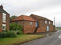
 Farm building, Wildsworth - geograph.org.uk - 4177108.jpg 640 × 480 ; 62 kio
-
 Farm buildings, Ravensfleet - geograph.org.uk - 2010096.jpg 1 024 × 768 ; 167 kio
-
 Farm buildings, Wildsworth - geograph.org.uk - 4177110.jpg 640 × 480 ; 59 kio
-
 Farm Track off Carr Lane - geograph.org.uk - 5783408.jpg 1 600 × 1 065 ; 513 kio
-
 Farmland near Ravensfleet Farm - geograph.org.uk - 4178018.jpg 640 × 480 ; 72 kio
-
 Flat farmland east of Wildsworth - geograph.org.uk - 4177114.jpg 640 × 480 ; 80 kio
-
 Flat farmland near drain - geograph.org.uk - 4177098.jpg 640 × 480 ; 71 kio
-
 High Street - geograph.org.uk - 4177105.jpg 640 × 480 ; 69 kio
-
 Houses at Gunthorpe and the River Trent - geograph.org.uk - 5431332.jpg 800 × 470 ; 117 kio
-
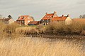
 Houses at Wildsworth - geograph.org.uk - 5783402.jpg 1 600 × 1 025 ; 573 kio
-
 Jenny Hurn Drain near the River Trent - geograph.org.uk - 5429678.jpg 800 × 748 ; 176 kio
-
 Jenny Hurne Pumping Station - geograph.org.uk - 3272849.jpg 2 256 × 1 504 ; 965 kio
-
-
 Minor road towards Wildsworth - geograph.org.uk - 4177100.jpg 640 × 480 ; 56 kio
-
 Potato field near Wildsworth - geograph.org.uk - 4177103.jpg 640 × 480 ; 111 kio
-
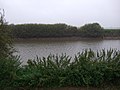
 Ravensfleet - geograph.org.uk - 1060720.jpg 640 × 427 ; 55 kio
-
 Ravensfleet Farm and road along the River Trent - geograph.org.uk - 5402138.jpg 800 × 553 ; 120 kio
-
 Ravensfleet Road - geograph.org.uk - 4178020.jpg 640 × 480 ; 54 kio
-
 Ravensfleet Road next to the River Trent - geograph.org.uk - 5431373.jpg 800 × 597 ; 121 kio
-
 Ravensfleet Road, Wildsworth - geograph.org.uk - 4178016.jpg 640 × 480 ; 63 kio
-
 River Bank - geograph.org.uk - 293538.jpg 640 × 480 ; 107 kio
-
 River Trent at Ravensfleet - geograph.org.uk - 5431427.jpg 800 × 662 ; 152 kio
-
 River Trent flood bank - geograph.org.uk - 4178023.jpg 640 × 480 ; 79 kio
-
 River Trent flood bank, Wildsworth - geograph.org.uk - 4178012.jpg 640 × 480 ; 94 kio
-
 The High Street in Wildsworth - geograph.org.uk - 5429684.jpg 800 × 581 ; 139 kio
-
 The River Trent near Gunthorpe - geograph.org.uk - 5431325.jpg 800 × 600 ; 145 kio
-
 Trent Bank - geograph.org.uk - 947884.jpg 640 × 427 ; 79 kio
-
 Trent bank at Wildsworth - geograph.org.uk - 2610626.jpg 1 024 × 768 ; 205 kio
-
 Trent reach near Jenny Hurn - geograph.org.uk - 2311048.jpg 1 280 × 959 ; 633 kio
-
 View across the carrs towards Wildsworth - geograph.org.uk - 2445745.jpg 1 024 × 768 ; 157 kio
-
 View across the Trent - geograph.org.uk - 2678506.jpg 1 024 × 768 ; 228 kio
-
 View Across the Trent to Wildsworth - geograph.org.uk - 4861357.jpg 4 608 × 3 456 ; 4,32 Mio
-

-
 View from the end of Whoofer Lane towards Wildsworth - geograph.org.uk - 2610644.jpg 1 024 × 768 ; 186 kio
-
 View from Whoofer Lane - geograph.org.uk - 4020177.jpg 1 024 × 714 ; 129 kio
-
 View from Wildsworth churchyard - geograph.org.uk - 2610637.jpg 1 024 × 768 ; 176 kio
-
 Whoofer Lane (2) - geograph.org.uk - 4020304.jpg 1 024 × 768 ; 116 kio
-
 Whoofer Lane - geograph.org.uk - 2610602.jpg 1 024 × 768 ; 165 kio
-
 Whoofer Lane - geograph.org.uk - 3272744.jpg 2 256 × 1 504 ; 949 kio
-
 Whoofer Lane - geograph.org.uk - 4020300.jpg 1 024 × 768 ; 146 kio
-
 Whoofer Lane and Drain - geograph.org.uk - 1291070.jpg 640 × 480 ; 224 kio
-
 Whoofer Lane and drain - geograph.org.uk - 4872117.jpg 3 696 × 2 448 ; 2,27 Mio
-
 Wildsworth - geograph.org.uk - 2810885.jpg 640 × 427 ; 104 kio
-
 Wildsworth - geograph.org.uk - 2810888.jpg 640 × 427 ; 87 kio
-
 Wildsworth - geograph.org.uk - 947875.jpg 640 × 427 ; 87 kio
-
 Wildsworth Carrs - geograph.org.uk - 1291075.jpg 640 × 480 ; 220 kio
-
 Bunker's Hill Farm - geograph.org.uk - 142718.jpg 640 × 480 ; 112 kio
-
 Bunker's Hill Farm - geograph.org.uk - 337409.jpg 640 × 480 ; 83 kio
-
 Mantree Cross Junction - geograph.org.uk - 142750.jpg 640 × 478 ; 147 kio
-
 Near Bunker's Hill Farm - geograph.org.uk - 142721.jpg 640 × 426 ; 126 kio
-
 Near Laughton - geograph.org.uk - 142726.jpg 640 × 426 ; 94 kio
-
 Wildsworth - geograph.org.uk - 58455.jpg 640 × 427 ; 132 kio
-
 Wildsworth Churchyard - geograph.org.uk - 142866.jpg 640 × 426 ; 144 kio


_-_geograph.org.uk_-_4020304.jpg)


