Category:Willerby, North Yorkshire
Aller à la navigation
Aller à la recherche
localité britannique du comté anglais de North Yorkshire  | |||||
| Téléverser des médias | |||||
| Nature de l’élément | |||||
|---|---|---|---|---|---|
| Lieu | Ryedale, Yorkshire du Nord, Yorkshire-et-Humber, Angleterre | ||||
| Population |
| ||||
 | |||||
English: Willerby is a small village and civil parish in the Ryedale district of North Yorkshire, England. It is contiguous with neighbouring Staxton.
Sous-catégories
Cette catégorie comprend 3 sous-catégories, dont les 3 ci-dessous.
Média dans la catégorie « Willerby, North Yorkshire »
Cette catégorie comprend 179 fichiers, dont les 179 ci-dessous.
-
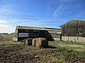
 A farm track on Staxton Wold - geograph.org.uk - 2115449.jpg 800 × 600 ; 285 kio
-

-
 A sporting practice area in North Dale (geograph 6649759).jpg 4 608 × 3 456 ; 3,51 Mio
-
 A1039 towards Filey - geograph.org.uk - 4803954.jpg 640 × 480 ; 61 kio
-
 A64 and entrance to Willerby Pig Farm - geograph.org.uk - 5333816.jpg 2 858 × 1 590 ; 1 000 kio
-
 A64 near Ganton - geograph.org.uk - 5333832.jpg 2 864 × 1 646 ; 891 kio
-
 A64 near Staxton - geograph.org.uk - 5333789.jpg 2 960 × 1 968 ; 1,28 Mio
-
 A64 near Willerby - geograph.org.uk - 5333808.jpg 2 800 × 1 826 ; 1,26 Mio
-
 A64 Spital Road northbound - geograph.org.uk - 5333847.jpg 2 892 × 1 708 ; 1,05 Mio
-
 Arable land across Prior Moor, Willerby Wold - geograph.org.uk - 394873.jpg 640 × 480 ; 95 kio
-
 B1249 on north side of Ganton Dale - geograph.org.uk - 4612634.jpg 1 600 × 1 067 ; 1,21 Mio
-
 B1249 on Prior Moor - geograph.org.uk - 4612643.jpg 1 600 × 1 069 ; 1,05 Mio
-
 Bean field and Long Plantation - geograph.org.uk - 5520294.jpg 1 024 × 768 ; 237 kio
-
 Bean field and Staxton Wold - geograph.org.uk - 5520298.jpg 1 024 × 768 ; 266 kio
-

-
 Binnington Carr - geograph.org.uk - 6695625.jpg 1 024 × 767 ; 178 kio
-
 Binnington Carr Lane - geograph.org.uk - 3559922.jpg 3 825 × 2 213 ; 2,75 Mio
-
 Bridleway, Robin's Bottom Plantation - geograph.org.uk - 3559881.jpg 4 212 × 2 884 ; 3,54 Mio
-
 Bus stop beside Spital Road (A64) - geograph.org.uk - 4803941.jpg 640 × 480 ; 81 kio
-
 Bus stop on the A64 near Staxton - geograph.org.uk - 4803952.jpg 640 × 434 ; 48 kio
-
 Campervan on the lay-by off the A64 - geograph.org.uk - 4803021.jpg 640 × 480 ; 64 kio
-
 Carr House Farm - geograph.org.uk - 4803059.jpg 640 × 480 ; 47 kio
-
 Centenary Way-Yorkshire Wolds Way near Staxton Wold Farm - geograph.org.uk - 5515332.jpg 1 024 × 768 ; 207 kio
-
 Centenary Way-Yorkshire Wolds Way near Staxton Wold Farm - geograph.org.uk - 5515348.jpg 1 024 × 768 ; 247 kio
-
 Chalk Track to Willerby - geograph.org.uk - 1331027.jpg 640 × 480 ; 97 kio
-
 Cottage in Staxton built 1649 - geograph.org.uk - 5028117.jpg 4 608 × 3 456 ; 3,14 Mio
-
 Cotton Dale Slack Staxton Wold - geograph.org.uk - 5027895.jpg 3 456 × 4 608 ; 5,58 Mio
-
 Crop Field, Prior Moor - geograph.org.uk - 1330329.jpg 640 × 480 ; 53 kio
-
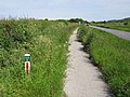
 Cycle path beside Spital Road (A64) - geograph.org.uk - 4803917.jpg 640 × 480 ; 59 kio
-
 Cycle path beside Spital Road (A64) - geograph.org.uk - 4803918.jpg 640 × 480 ; 61 kio
-
 Cycle path beside Spital Road (A64) - geograph.org.uk - 4803924.jpg 640 × 480 ; 60 kio
-
 Cycle path beside Spital Road (A64) - geograph.org.uk - 4803929.jpg 640 × 480 ; 66 kio
-
 Cycle path beside Spital Road (A64) - geograph.org.uk - 4803931.jpg 640 × 480 ; 78 kio
-
 Dated gatepost at Willerby church - geograph.org.uk - 3004469.jpg 480 × 640 ; 216 kio
-
 Drain off Spital Road (A64) - geograph.org.uk - 4803930.jpg 640 × 480 ; 60 kio
-
 Dual use path beside Spital Road (A64) - geograph.org.uk - 4803053.jpg 640 × 480 ; 55 kio
-
 Entrance to Spring Willows Caravan Park - geograph.org.uk - 4803953.jpg 640 × 480 ; 73 kio
-
 Entrance to Willerby Grange - geograph.org.uk - 2701000.jpg 1 024 × 768 ; 128 kio
-
 Farm at Willerby Wold - geograph.org.uk - 4612645.jpg 1 600 × 1 067 ; 1,09 Mio
-
 Farm buildings, Carr House Farm - geograph.org.uk - 4803056.jpg 640 × 408 ; 41 kio
-
 Farm track and field of beans, Willerby Wold - geograph.org.uk - 5520290.jpg 1 024 × 768 ; 203 kio
-
 Farm track and wheat waiting to be harvested - geograph.org.uk - 5520285.jpg 1 024 × 768 ; 257 kio
-
 Farm track beside the A64 - geograph.org.uk - 4803050.jpg 640 × 480 ; 74 kio
-
 Farm track beside the River Hertford - geograph.org.uk - 4803028.jpg 640 × 480 ; 75 kio
-
 Farm Track, Hertford Dale - geograph.org.uk - 1331039.jpg 640 × 480 ; 81 kio
-
 Farm Track, Staxton Brow - geograph.org.uk - 1330470.jpg 640 × 480 ; 77 kio
-
 Farmland and a milestone at Willerby - geograph.org.uk - 3004859.jpg 640 × 480 ; 185 kio
-
 Farmland and track alongside the A64 - geograph.org.uk - 3004888.jpg 640 × 480 ; 124 kio
-
 Farmland near R.A.F. Staxton Wold - geograph.org.uk - 1330457.jpg 640 × 458 ; 111 kio
-
 Farmland near Spital House Farm - geograph.org.uk - 4803933.jpg 640 × 480 ; 43 kio
-
 Farmland near Staxton - geograph.org.uk - 1331056.jpg 640 × 480 ; 68 kio
-
 Farmland South of Willerby - geograph.org.uk - 1331029.jpg 640 × 480 ; 87 kio
-
 Farmland west of Spital Road (A64) - geograph.org.uk - 4803932.jpg 640 × 480 ; 41 kio
-
 Farmland West of Staxton Wold Farm - geograph.org.uk - 1330406.jpg 640 × 480 ; 89 kio
-
 Farmland, Staxton Carr - geograph.org.uk - 4803044.jpg 640 × 480 ; 43 kio
-
 Field Boundary - geograph.org.uk - 1330320.jpg 640 × 480 ; 79 kio
-
 Field boundary west of Spital Road (A64) - geograph.org.uk - 4803923.jpg 640 × 480 ; 57 kio
-
 Field entrance near Merry Lees Farm - geograph.org.uk - 4803927.jpg 640 × 480 ; 68 kio
-
 Field entrance near Staxton Wold Farm - geograph.org.uk - 5520340.jpg 1 024 × 768 ; 173 kio
-
 Field entrance off Spital Road (A64) - geograph.org.uk - 4803925.jpg 640 × 480 ; 59 kio
-
 Field entrance off Spital Road - geograph.org.uk - 4803061.jpg 640 × 480 ; 72 kio
-
 Field on Staxton Wold - geograph.org.uk - 202048.jpg 640 × 480 ; 92 kio
-
 Flooded farmland east of Spital Road (A64) - geograph.org.uk - 4803919.jpg 640 × 480 ; 41 kio
-
 Gallery and Tearoom at Willerby Wold Farm - geograph.org.uk - 2896306.jpg 3 264 × 2 448 ; 1,71 Mio
-
 Gated Level Crossing, near Willerby - geograph.org.uk - 1331043.jpg 640 × 480 ; 93 kio
-
 Grass track on northern side of River Hertford - geograph.org.uk - 5027938.jpg 4 608 × 3 456 ; 4,05 Mio
-
 Grassy fields beside the railway - geograph.org.uk - 5786045.jpg 800 × 600 ; 78 kio
-
 Harvested field on Willerby Wold - geograph.org.uk - 5515361.jpg 1 024 × 768 ; 269 kio
-
 Harvested field with Staxton Brow beyond - geograph.org.uk - 3115085.jpg 2 560 × 1 920 ; 1,8 Mio
-
 Harvested fields at Binnington Carr - geograph.org.uk - 520912.jpg 640 × 480 ; 135 kio
-
 Hedgerow near Starr Carr Farm - geograph.org.uk - 4803018.jpg 480 × 640 ; 108 kio
-
 Hertford Plantation - geograph.org.uk - 3559853.jpg 4 608 × 3 456 ; 6,05 Mio
-
 High Farm Staxton Wold - geograph.org.uk - 5027875.jpg 4 608 × 3 456 ; 3,54 Mio
-
 Horse riders on a 'route with public access' - geograph.org.uk - 2700997.jpg 1 024 × 768 ; 129 kio
-
 Inside the disabled toilet at Staxton Hill - geograph.org.uk - 5710577.jpg 6 000 × 4 000 ; 6,28 Mio
-
 Inside the men's toilet at Staxton Hill - geograph.org.uk - 5710485.jpg 6 000 × 4 000 ; 6,61 Mio
-
 Inside the women's toilet at Staxton Hill - geograph.org.uk - 5710523.jpg 6 000 × 4 000 ; 6,34 Mio
-
 Lane to the west of Willerby Grange Farm - geograph.org.uk - 3115035.jpg 2 560 × 1 920 ; 1,98 Mio
-
 Layby off Spital Road - geograph.org.uk - 3801716.jpg 1 200 × 798 ; 474 kio
-

-
 Looking across towards the North York Moors - geograph.org.uk - 2319209.jpg 800 × 600 ; 270 kio
-
 Looking towards the edge - geograph.org.uk - 5520351.jpg 1 024 × 768 ; 213 kio
-
 Main Gate RAF Staxton Wold - geograph.org.uk - 5027864.jpg 640 × 480 ; 44 kio
-
 Main Street, Staxton - geograph.org.uk - 2115416.jpg 800 × 600 ; 336 kio
-
 Minor road towards Forden (geograph 2115461).jpg 800 × 600 ; 252 kio
-
 Minor Road Towards Fordon - geograph.org.uk - 1283110.jpg 640 × 480 ; 86 kio
-
 Minor Road Towards Willerby Wold - geograph.org.uk - 1330374.jpg 640 × 480 ; 65 kio
-
 Not a well defined footpath - geograph.org.uk - 1423761.jpg 640 × 480 ; 102 kio
-
 Old stone milestone alongside the A64 - geograph.org.uk - 3004845.jpg 480 × 640 ; 259 kio
-
 On the Wolds Way near Grange Farm above Staxton - geograph.org.uk - 120260.jpg 640 × 480 ; 140 kio
-
 Once a petrol filling station now derelict site on A64(T) - geograph.org.uk - 5054045.jpg 2 947 × 2 126 ; 1,79 Mio
-
 Once a School - geograph.org.uk - 3115070.jpg 2 560 × 1 920 ; 1,85 Mio
-
 Orange Hibiscus Glow-1.jpg 5 000 × 3 312 ; 9,59 Mio
-
 Panoramic view from Staxton Hill - geograph.org.uk - 1357562.jpg 640 × 480 ; 111 kio
-
 Path to go down through Staxton Wold Plantation - geograph.org.uk - 5028114.jpg 4 608 × 3 456 ; 5,5 Mio
-
 Poppies (3592084151).jpg 2 952 × 1 184 ; 2,45 Mio
-
 Poppy-lined cycleway - geograph.org.uk - 4059477.jpg 1 600 × 1 101 ; 663 kio
-
 Public toilets at Staxton Hill - geograph.org.uk - 5710640.jpg 1 600 × 1 067 ; 542 kio
-

-
 River Hertford at Spital Road bridge - geograph.org.uk - 3801715.jpg 1 200 × 798 ; 473 kio
-
 River Hertford flowing west - geograph.org.uk - 5027954.jpg 4 608 × 3 456 ; 4,88 Mio
-
 River Hertford looking east from footbridge - geograph.org.uk - 5027941.jpg 4 608 × 3 456 ; 4,33 Mio
-
 Roundabout on the A64 - geograph.org.uk - 4803950.jpg 640 × 480 ; 53 kio
-
 Roundabout on the A64 near Staxton - geograph.org.uk - 4803948.jpg 640 × 480 ; 49 kio
-
 Shell Service Station A64(T) Staxton - geograph.org.uk - 3166904.jpg 4 000 × 3 000 ; 2,21 Mio
-
 Shop Farm, on Staxton's main street - geograph.org.uk - 2700955.jpg 1 024 × 768 ; 116 kio
-
 Sign for the Spital Inn - geograph.org.uk - 4803936.jpg 640 × 583 ; 91 kio
-
 Sign for the Spital Inn - geograph.org.uk - 4803944.jpg 640 × 622 ; 81 kio
-
 Small wood, Staxton Carr - geograph.org.uk - 3803617.jpg 640 × 436 ; 307 kio
-
 Spital Craft Centre ^ Christmas Village, Staxton - geograph.org.uk - 3803751.jpg 1 200 × 798 ; 460 kio
-
 Spital House Farm - geograph.org.uk - 4803949.jpg 640 × 480 ; 61 kio
-
 Spital Inn and Restaurant - geograph.org.uk - 3801719.jpg 1 200 × 798 ; 382 kio
-
 Spital Inn and Restaurant - geograph.org.uk - 3803760.jpg 798 × 1 200 ; 338 kio
-
 Spital Road (A64) - geograph.org.uk - 4803025.jpg 640 × 480 ; 48 kio
-
 Spital Road (A64) - geograph.org.uk - 4803935.jpg 640 × 480 ; 83 kio
-
 Staxton (or Willerby) Primitive Methodist Chapel - geograph.org.uk - 2700946.jpg 1 024 × 768 ; 112 kio
-
 Staxton Wold Farm - geograph.org.uk - 5520344.jpg 1 024 × 768 ; 205 kio
-
 Stile, Wolds Way Footpath - geograph.org.uk - 1331026.jpg 640 × 480 ; 102 kio
-
 Straw figures at Staxton - geograph.org.uk - 5421217.jpg 1 200 × 799 ; 427 kio
-
 Straw Stacks - geograph.org.uk - 512723.jpg 640 × 480 ; 123 kio
-
 Stubble fields on Binnington Ness - geograph.org.uk - 4159578.jpg 4 608 × 3 456 ; 4,23 Mio
-
 The A64 in Willerby - geograph.org.uk - 3004874.jpg 640 × 481 ; 194 kio
-
 The A64(T) and the Vale of Pickering - geograph.org.uk - 3166897.jpg 4 000 × 3 000 ; 1,99 Mio
-
 The Belt Plantation - geograph.org.uk - 3559944.jpg 3 628 × 2 533 ; 2,88 Mio
-
 The Hare and Hounds inn, Staxton - geograph.org.uk - 4612652.jpg 1 600 × 1 067 ; 1,13 Mio
-
 The Hare and Hounds, Staxton - geograph.org.uk - 5421246.jpg 1 200 × 799 ; 297 kio
-
 The Hare and Hounds, Staxton - geograph.org.uk - 5421248.jpg 807 × 1 200 ; 282 kio
-
 The north side of St Peter's Willerby - geograph.org.uk - 3115016.jpg 2 560 × 1 920 ; 2,05 Mio
-
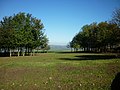 The picnic area at the top of Staxton Hill - geograph.org.uk - 2115427.jpg 800 × 600 ; 305 kio
-
 The River Hertford - geograph.org.uk - 4803023.jpg 640 × 480 ; 59 kio
-
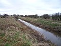 The River Hertford - geograph.org.uk - 4803029.jpg 640 × 480 ; 77 kio
-
 The Spital Inn - geograph.org.uk - 4803947.jpg 640 × 480 ; 62 kio
-
 The Yorkshire Wolds Gallery - geograph.org.uk - 2115438.jpg 800 × 600 ; 263 kio
-

-
 Track down Staxton Brow to A64(T) - geograph.org.uk - 5028111.jpg 4 608 × 3 456 ; 6,29 Mio
-
 Track in Willerby - geograph.org.uk - 520916.jpg 640 × 480 ; 131 kio
-
 Track on Staxton Brow - geograph.org.uk - 5028109.jpg 4 608 × 3 456 ; 5,77 Mio
-
 Track to Binnington Wold Farm - geograph.org.uk - 1330387.jpg 640 × 480 ; 130 kio
-
 Track to Cotton Dale Shooting School - geograph.org.uk - 1330365.jpg 640 × 480 ; 67 kio
-
 Track to Ganton Dale Farm - geograph.org.uk - 1283115.jpg 640 × 480 ; 75 kio
-
 Track to Ings Farm - geograph.org.uk - 1501733.jpg 640 × 480 ; 90 kio
-
 Track to R.A.F Staxton Wold - geograph.org.uk - 1330425.jpg 640 × 480 ; 127 kio
-
 Track to Willerby - geograph.org.uk - 1331028.jpg 640 × 480 ; 98 kio
-
 Track towards Level Crossing, Willerby Carr - geograph.org.uk - 1331033.jpg 640 × 480 ; 144 kio
-
 Tracks in an empty stubble field - geograph.org.uk - 4159600.jpg 4 608 × 3 456 ; 4,85 Mio
-
 Traffic free Willerby - geograph.org.uk - 3115048.jpg 2 560 × 1 920 ; 2 Mio
-
 View along Cotton Dale - geograph.org.uk - 1402511.jpg 640 × 480 ; 85 kio
-
 View towards Staxton Wold (geograph 5515379).jpg 1 024 × 768 ; 175 kio
-
 Wain's Lane level crossing - geograph.org.uk - 3559909.jpg 4 160 × 2 692 ; 3,3 Mio
-
 Wain's Lane, Willerby - geograph.org.uk - 2701008.jpg 1 024 × 768 ; 105 kio
-
 Wains Lane, Staxton - geograph.org.uk - 1331052.jpg 640 × 480 ; 66 kio
-
 Wains Lane, Willerby - geograph.org.uk - 1331031.jpg 640 × 480 ; 73 kio
-
 Watching the trains go by - geograph.org.uk - 5786049.jpg 800 × 600 ; 103 kio
-
 Whitewashed cottage with solar panels - geograph.org.uk - 2700934.jpg 1 024 × 768 ; 101 kio
-
 Willerby School, Staxton - geograph.org.uk - 2700971.jpg 1 024 × 768 ; 144 kio
-
 Willerby Wold Farm - geograph.org.uk - 1283108.jpg 640 × 480 ; 73 kio
-
 Wolds Way Footpath, Staxton Wold - geograph.org.uk - 1331023.jpg 640 × 480 ; 164 kio
-
 Wolds Way towards Flixton Wold - geograph.org.uk - 1331024.jpg 640 × 480 ; 111 kio
-
 Wolds Way, Flixton Wold - geograph.org.uk - 120269.jpg 640 × 480 ; 119 kio
-
 Woodland East of Staxton Wold Farm - geograph.org.uk - 1330433.jpg 640 × 480 ; 78 kio
-
 Yorkshire Wolds Way - geograph.org.uk - 1330399.jpg 640 × 480 ; 84 kio
-
 Young crop field near the River Hertford - geograph.org.uk - 4803048.jpg 640 × 480 ; 54 kio
-
 Young crop field west of Spital Road (A64) - geograph.org.uk - 4803922.jpg 640 × 480 ; 53 kio
-
 A64 looking towards Staxton Brow - geograph.org.uk - 1462163.jpg 640 × 480 ; 54 kio
-
 A64 towards Scarborough - geograph.org.uk - 1354200.jpg 640 × 480 ; 68 kio
-
 Beech Wood - geograph.org.uk - 325280.jpg 640 × 480 ; 166 kio
-

-
 Cornfield Flixton Wold - geograph.org.uk - 1423749.jpg 640 × 480 ; 86 kio
-
 Dry Valley, Flixton Wold - geograph.org.uk - 202060.jpg 640 × 480 ; 73 kio
-
 East over Flixton Wold - geograph.org.uk - 1423754.jpg 640 × 480 ; 76 kio
-
 Gated level crossing on the York-Scarborough line - geograph.org.uk - 520906.jpg 640 × 480 ; 132 kio
-
 Grange Farm Buildings - geograph.org.uk - 1423768.jpg 640 × 480 ; 67 kio
-
 On Staxton Brow - geograph.org.uk - 201824.jpg 640 × 480 ; 76 kio
-
 Picnic area at the top of Staxton Hill - geograph.org.uk - 260108.jpg 640 × 468 ; 127 kio
-
 Prior Moor - geograph.org.uk - 256951.jpg 640 × 480 ; 106 kio
-
 Road to Fordon - geograph.org.uk - 256952.jpg 640 × 480 ; 151 kio
-

-
 Track above Staxton Brow - geograph.org.uk - 202025.jpg 640 × 480 ; 92 kio
-
 View From Staxton Hill - geograph.org.uk - 281741.jpg 640 × 480 ; 116 kio


.jpg)


_-_geograph.org.uk_-_4803941.jpg)


_-_geograph.org.uk_-_4803917.jpg)
_-_geograph.org.uk_-_4803918.jpg)
_-_geograph.org.uk_-_4803924.jpg)
_-_geograph.org.uk_-_4803929.jpg)
_-_geograph.org.uk_-_4803931.jpg)

_-_geograph.org.uk_-_4803930.jpg)
_-_geograph.org.uk_-_4803053.jpg)


_-_geograph.org.uk_-_4803932.jpg)


_-_geograph.org.uk_-_4803923.jpg)


_-_geograph.org.uk_-_4803925.jpg)


_-_geograph.org.uk_-_4803919.jpg)


.jpg)


_-_geograph.org.uk_-_5054045.jpg)


_-_geograph.org.uk_-_4803939.jpg)


_Staxton_-_geograph.org.uk_-_3166904.jpg)


_-_geograph.org.uk_-_4803025.jpg)
_-_geograph.org.uk_-_4803935.jpg)
_Primitive_Methodist_Chapel_-_geograph.org.uk_-_2700946.jpg)


_and_the_Vale_of_Pickering_-_geograph.org.uk_-_3166897.jpg)


_-_geograph.org.uk_-_5028111.jpg)


.jpg)


_-_geograph.org.uk_-_4803922.jpg)


.jpg)