Category:Wilpshire
Aller à la navigation
Aller à la recherche
English: Wilpshire is a village and civil parish in the county of Lancashire, England. It is north of Blackburn, and forms part of the town's urban area, although it is in the Ribble Valley local government district. (→Wilpshire)
Nederlands: Wilpshire is een plaats en civil parish in het bestuurlijke gebied Ribble Valley, in het Engelse graafschap Lancashire. (→Wilpshire)
Polski: Wilpshire – wieś w Anglii, w hrabstwie Lancashire, w dystrykcie Ribble Valley. Leży 39 km na północny zachód od miasta Manchester i 298 km na północny zachód od Londynu. (→Wilpshire)
localité britannique du comté anglais de Lancashire  | |||||
| Téléverser des médias | |||||
| Nature de l’élément | |||||
|---|---|---|---|---|---|
| Lieu | Ribble Valley, Lancashire, Angleterre du Nord-Ouest, Angleterre | ||||
 | |||||
Sous-catégories
Cette catégorie comprend 2 sous-catégories, dont les 2 ci-dessous.
W
- Wilpshire railway station (3 F)
Média dans la catégorie « Wilpshire »
Cette catégorie comprend 110 fichiers, dont les 110 ci-dessous.
-
 A Canada goose "hove to" on Parsonage Reservoir - geograph.org.uk - 3891937.jpg 3 590 × 2 458 ; 6,67 Mio
-
 A discreet footpath sign - geograph.org.uk - 3876799.jpg 4 592 × 2 912 ; 7,75 Mio
-
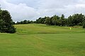
 A Green on Wilpshire Golf Course - geograph.org.uk - 5470479.jpg 5 184 × 3 456 ; 7,16 Mio
-
 A View North East from Wilpshire Moor - geograph.org.uk - 5470502.jpg 5 184 × 3 456 ; 7,38 Mio
-
 A666 towards Whalley - geograph.org.uk - 5038808.jpg 640 × 480 ; 46 kio
-
 Access Bridge across the Blackburn-Clitheroe Line, Wilpshire - geograph.org.uk - 5475182.jpg 5 184 × 3 456 ; 6,39 Mio
-
 Access Lane from Tipping's Farm - geograph.org.uk - 5475184.jpg 5 184 × 3 456 ; 4,21 Mio
-
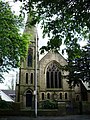
 All Souls R.C. Church - geograph.org.uk - 4150881.jpg 4 000 × 3 000 ; 6,34 Mio
-
 Anderton House Farm - geograph.org.uk - 5038804.jpg 640 × 480 ; 67 kio
-
 Blackburn Cemetery - geograph.org.uk - 35557.jpg 640 × 429 ; 102 kio
-

-
 Bolton Hall, Copster Green - geograph.org.uk - 97816.jpg 640 × 427 ; 143 kio
-
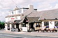
 Bull's Head and Rising Sun, Wilpshire - geograph.org.uk - 33496.jpg 640 × 474 ; 70 kio
-
 Bull's Head public house, Wilpshire - geograph.org.uk - 5038775.jpg 640 × 480 ; 64 kio
-

-
 Busy junction in Wilpshire - geograph.org.uk - 2247223.jpg 3 872 × 2 592 ; 4,65 Mio
-
 Clayton Manor - geograph.org.uk - 3877263.jpg 3 056 × 3 056 ; 5,34 Mio
-
 Culvert outlet - geograph.org.uk - 1101186.jpg 640 × 480 ; 140 kio
-
 Durham Road, Wilpshire - geograph.org.uk - 1865081.jpg 640 × 480 ; 141 kio
-
 Durham Road, Wilpshire - geograph.org.uk - 5038796.jpg 640 × 480 ; 58 kio
-
 Elizabeth II postbox and phonebox on Whalley New Road, Wilpshire - geograph.org.uk - 5039589.jpg 3 262 × 2 388 ; 1,77 Mio
-

-
 Elizabeth II postbox on Whalley Road, Wilpshire - geograph.org.uk - 5039638.jpg 1 895 × 3 423 ; 1,09 Mio
-
 Elizabeth II postbox, former Wilpshire Post Office - geograph.org.uk - 5039654.jpg 1 679 × 2 352 ; 755 kio
-
 Ely Close, Wilpshire - geograph.org.uk - 5038800.jpg 640 × 425 ; 64 kio
-
 Entering Langho - geograph.org.uk - 5038819.jpg 640 × 480 ; 71 kio
-
 Entrance to Carr Hall - geograph.org.uk - 1865077.jpg 640 × 480 ; 124 kio
-
 Entrance to Carr Hall - geograph.org.uk - 5038817.jpg 640 × 404 ; 38 kio
-
 Evening light on Wilpshire Golf Course - geograph.org.uk - 2249438.jpg 3 872 × 2 592 ; 1,15 Mio
-
 Former Blackburn Orphanage - geograph.org.uk - 1865080.jpg 640 × 480 ; 241 kio
-
 Green and Fairway on Wilpshire Golf Course - geograph.org.uk - 5470495.jpg 5 184 × 3 456 ; 6,95 Mio
-
 Hollowhead Lane - geograph.org.uk - 2249455.jpg 3 872 × 2 592 ; 1,51 Mio
-
 Houses on Durham Road, Wilpshire - geograph.org.uk - 5038795.jpg 640 × 480 ; 54 kio
-
 Houses on Whalley Road, Wilpshire - geograph.org.uk - 5038792.jpg 640 × 480 ; 96 kio
-
 Houses on Whalley Road, Wilpshire - geograph.org.uk - 5038802.jpg 640 × 480 ; 63 kio
-
 January morning snow - geograph.org.uk - 6031186.jpg 640 × 640 ; 193 kio
-
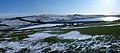
 January Snowy View, Wilpshire - geograph.org.uk - 6031830.jpg 640 × 640 ; 548 kio
-
 Lovely Hall, Lovely Hall Lane - geograph.org.uk - 97782.jpg 640 × 480 ; 149 kio
-
 New Inn, Wilpshire - geograph.org.uk - 35590.jpg 640 × 429 ; 99 kio
-
 No sight of the reservoir from this path - geograph.org.uk - 3876826.jpg 4 592 × 3 056 ; 7,15 Mio
-
 Old Milestone by the A666, Whalley Road, Wilpshire Parish (geograph 6044174).jpg 480 × 640 ; 460 kio
-
 Outflow at Parsonage Reservoir - geograph.org.uk - 4150870.jpg 2 668 × 1 997 ; 2,85 Mio
-
 Parsonage Farm - geograph.org.uk - 1179213.jpg 640 × 461 ; 88 kio
-
 Parsonage Reservoir - geograph.org.uk - 1179178.jpg 640 × 285 ; 52 kio
-
 Parsonage Reservoir - geograph.org.uk - 1179200.jpg 640 × 480 ; 86 kio
-
 Parsonage Reservoir - geograph.org.uk - 2249500.jpg 3 872 × 2 592 ; 1,45 Mio
-
 Parsonage Reservoir - geograph.org.uk - 3876311.jpg 4 592 × 2 853 ; 7,72 Mio
-
 Parsonage Reservoir - geograph.org.uk - 3884833.jpg 4 592 × 3 056 ; 6,82 Mio
-
 Parsonage reservoir above the road causeway - geograph.org.uk - 3876842.jpg 4 341 × 2 636 ; 5,64 Mio
-
 Pump house at Parsonage Reservoir - geograph.org.uk - 4150866.jpg 4 000 × 3 000 ; 6,23 Mio
-
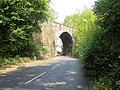 Railway bridge - geograph.org.uk - 4150888.jpg 2 668 × 1 998 ; 3,91 Mio
-
 Railway Bridge. - geograph.org.uk - 1101171.jpg 640 × 480 ; 113 kio
-
 Railway Line heading North East from Wilpshire - geograph.org.uk - 5475179.jpg 5 184 × 3 456 ; 7,05 Mio
-
 Railway line, Wilpshire. - geograph.org.uk - 1101715.jpg 640 × 423 ; 108 kio
-
 Railway tunnel - geograph.org.uk - 1101148.jpg 640 × 480 ; 84 kio
-
 Road junction on the A666, Wilpshire - geograph.org.uk - 5038784.jpg 640 × 480 ; 94 kio
-
 Road to Anderton House - geograph.org.uk - 1865079.jpg 640 × 480 ; 111 kio
-
 Roe Lee Mill, Blackburn - geograph.org.uk - 35556.jpg 640 × 429 ; 105 kio
-
 Row of shops in Wilpshire - geograph.org.uk - 2244249.jpg 3 872 × 2 592 ; 3,57 Mio
-
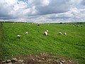 Sheep at the end of Hollowbank Avenue - geograph.org.uk - 433761.jpg 640 × 480 ; 100 kio
-
 Sheep pasture off Hollowhead Lane - geograph.org.uk - 4150876.jpg 4 000 × 3 000 ; 6,47 Mio
-

-

-
 Sign for the Wilpshire Hotel - geograph.org.uk - 5038789.jpg 513 × 640 ; 59 kio
-
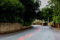
 The A666 at Wilpshire - geograph.org.uk - 4150878.jpg 2 668 × 1 998 ; 3,16 Mio
-
 The Dam holding back Parsonage Reservoir - geograph.org.uk - 5470512.jpg 5 184 × 3 456 ; 6,26 Mio
-
 The dam of Parsonage Reservoir - geograph.org.uk - 2243228.jpg 3 872 × 2 592 ; 1,29 Mio
-
 The entrance to Carr Hall Home and Garden Centre - geograph.org.uk - 3878335.jpg 4 335 × 2 885 ; 5,11 Mio
-
 The Rising Sun public house, Wilpshire - geograph.org.uk - 5038777.jpg 640 × 420 ; 51 kio
-
 The Rising Sun, Wilpshire - geograph.org.uk - 2243252.jpg 3 872 × 2 592 ; 1,52 Mio
-
 The Wilpshire Hotel - geograph.org.uk - 5038787.jpg 640 × 635 ; 95 kio
-
 Vapour trails over Parsonage Reservoir - geograph.org.uk - 2249476.jpg 3 872 × 2 592 ; 876 kio
-
 Water tower - geograph.org.uk - 1101651.jpg 640 × 424 ; 80 kio
-
 Whalley Road (A666) - geograph.org.uk - 5038807.jpg 640 × 480 ; 59 kio
-
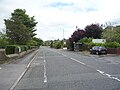 Whalley Road (A666), Wilpshire - geograph.org.uk - 5038801.jpg 640 × 480 ; 71 kio
-
 Whalley Road (A666), Wilpshire - geograph.org.uk - 5039643.jpg 640 × 480 ; 74 kio
-
 Whalley Road (A666), Wilpshire - geograph.org.uk - 5039656.jpg 640 × 480 ; 72 kio
-
 Whalley Road, Langho - geograph.org.uk - 1865078.jpg 640 × 480 ; 118 kio
-
 Whalley Road, Wilpshire - geograph.org.uk - 5038793.jpg 640 × 480 ; 74 kio
-
 Whalley Road, Wilpshire - geograph.org.uk - 5470461.jpg 5 184 × 3 456 ; 5,81 Mio
-
 Wilpshire Hotel - geograph.org.uk - 1101691.jpg 640 × 402 ; 61 kio
-
 Wilpshire Methodist Church - geograph.org.uk - 3902853.jpg 2 930 × 3 840 ; 6,56 Mio
-
 Wilpshire Methodist Church - geograph.org.uk - 413178.jpg 480 × 640 ; 126 kio
-
 Wilpshire moor manicured into a golf course - geograph.org.uk - 3876888.jpg 4 425 × 2 945 ; 6,25 Mio
-

-

-
 Copster Green - geograph.org.uk - 83580.jpg 640 × 480 ; 143 kio
-
 Copster Green - geograph.org.uk - 97800.jpg 640 × 427 ; 120 kio
-
 Entering Blackburn (Parsonage Road) - geograph.org.uk - 670128.jpg 640 × 480 ; 196 kio
-
 Footpath - geograph.org.uk - 413129.jpg 640 × 480 ; 149 kio
-
 Footpath at the end of Hollowbank Avenue - geograph.org.uk - 433756.jpg 640 × 480 ; 101 kio
-
 Footpath^ - geograph.org.uk - 97710.jpg 640 × 427 ; 147 kio
-
 Gate north west of Lovely Hall - geograph.org.uk - 413123.jpg 640 × 480 ; 160 kio
-
 Jersey Croft, Wilpshire - geograph.org.uk - 526529.jpg 566 × 424 ; 228 kio
-
 Lammack Road and Barker Lane - geograph.org.uk - 42609.jpg 640 × 480 ; 64 kio
-
 Lovely Hall, Lovely Hall Lane - geograph.org.uk - 97787.jpg 427 × 640 ; 160 kio
-
 Man in a Tree - Wilpshire - geograph.org.uk - 353101.jpg 432 × 579 ; 263 kio
-
 Millstone at Ramsgreave Hall Farm - geograph.org.uk - 42498.jpg 640 × 563 ; 211 kio
-
 Poultry Houses, Parsonage Rd - geograph.org.uk - 97686.jpg 640 × 427 ; 128 kio
-
 Railway Bridge, Wilpshire Lane - geograph.org.uk - 97695.jpg 640 × 427 ; 123 kio
-
 Ramsgreave Hall - geograph.org.uk - 42495.jpg 640 × 427 ; 130 kio
-
 Rear of cottages, Lammack Road, Lammack - geograph.org.uk - 42916.jpg 640 × 427 ; 107 kio
-
 Rising Sun, Whalley New Road, Blackburn - geograph.org.uk - 670114.jpg 640 × 480 ; 152 kio
-
 Stonehill Garden Centre - geograph.org.uk - 503181.jpg 640 × 480 ; 90 kio
-
 Sugarcroft - geograph.org.uk - 97701.jpg 640 × 427 ; 151 kio
-
 The Bulls Head, Whalley New Road, Blackburn - geograph.org.uk - 670112.jpg 640 × 480 ; 163 kio
-
 The Spread Eagle - geograph.org.uk - 42500.jpg 640 × 427 ; 124 kio
-
 Tippings Farm - geograph.org.uk - 97706.jpg 640 × 427 ; 155 kio
-
 View from the Spread Eagle. - geograph.org.uk - 42501.jpg 640 × 427 ; 111 kio
-
 Wilpshire golf course (founded 1890) - geograph.org.uk - 35601.jpg 640 × 429 ; 84 kio


.jpg)


_-_geograph.org.uk_-_5038807.jpg)
,_Wilpshire_-_geograph.org.uk_-_5038801.jpg)
,_Wilpshire_-_geograph.org.uk_-_5039643.jpg)
,_Wilpshire_-_geograph.org.uk_-_5039656.jpg)


_-_geograph.org.uk_-_670128.jpg)


_-_geograph.org.uk_-_35601.jpg)