Category:Wimbotsham
Vai alla navigazione
Vai alla ricerca
English: Wimbotsham is a village and civil parish in the English county of Norfolk. It is situated close to the River Great Ouse, west of the city of Norwich.
Voce principale su Wikipedia: Wimbotsham.

village and civil parish in Norfolk, UK  | |||||
| Carica un file multimediale | |||||
| Istanza di | |||||
|---|---|---|---|---|---|
| Luogo | King's Lynn and West Norfolk, Norfolk, Est dell'Inghilterra, Inghilterra | ||||
| Superficie |
| ||||
 | |||||
Sottocategorie
Questa categoria contiene le 2 sottocategorie indicate di seguito, su un totale di 2.
M
File nella categoria "Wimbotsham"
Questa categoria contiene 112 file, indicati di seguito, su un totale di 112.
-
 A robin - geograph.org.uk - 4416278.jpg 5 184 × 3 888; 3,92 MB
-
 A10 heading north - geograph.org.uk - 5684767.jpg 640 × 428; 69 KB
-
 Arable landscape - geograph.org.uk - 5036051.jpg 640 × 426; 44 KB
-
 Barroway Drove, aerial 2017 - geograph.org.uk - 5537069.jpg 640 × 427; 61 KB
-
 Bushes, Floodway embankment - geograph.org.uk - 5838444.jpg 1 024 × 681; 126 KB
-

-
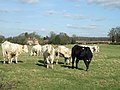 Church Farm cows in field - geograph.org.uk - 714426.jpg 640 × 480; 100 KB
-
 Concrete hardstanding beside New Road - geograph.org.uk - 4076002.jpg 640 × 480; 134 KB
-
 Cottages in Church Road, Wimbotsham - geograph.org.uk - 1737211.jpg 640 × 480; 144 KB
-
 Crop field towards Upper Farm - geograph.org.uk - 5431938.jpg 640 × 480; 53 KB
-
 Crop field Wimbotsham - geograph.org.uk - 5431956.jpg 640 × 480; 70 KB
-
 Ditch beside New Road - geograph.org.uk - 4075968.jpg 640 × 480; 156 KB
-
 Drain running south from Lake Drove, Wimbotsham - geograph.org.uk - 5110376.jpg 4 320 × 3 240; 5,42 MB
-
 Drainage ditch - geograph.org.uk - 4416238.jpg 5 184 × 3 888; 6,3 MB
-
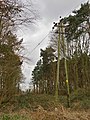
 Electricity poles along New Road - geograph.org.uk - 4076011.jpg 640 × 439; 124 KB
-
 Electricity poles beside New Road - geograph.org.uk - 4075966.jpg 640 × 480; 137 KB
-
 Electricity pylon - geograph.org.uk - 4416310.jpg 3 888 × 5 184; 5,98 MB
-
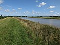
 Embankment of the Great Ouse - geograph.org.uk - 5024659.jpg 640 × 426; 47 KB
-
 Embankment of the Great Ouse - geograph.org.uk - 5024663.jpg 640 × 426; 44 KB
-
 Embankment, River Ouse floodway - geograph.org.uk - 5838434.jpg 1 024 × 681; 106 KB
-
 Fallen tree - geograph.org.uk - 4416270.jpg 4 960 × 3 720; 7,48 MB
-
 Farmland and buildings - geograph.org.uk - 6053763.jpg 5 202 × 3 465; 4,03 MB
-
 Farmland and Gravelpit Plantation near Wimbotsham - geograph.org.uk - 5110324.jpg 4 320 × 3 240; 3,68 MB
-
 Farmland, Wimbotsham - geograph.org.uk - 5540803.jpg 640 × 374; 32 KB
-
 Fen Rivers Way looking southward - geograph.org.uk - 6053777.jpg 5 202 × 3 465; 2,49 MB
-
 Fields by Bexwell - geograph.org.uk - 4075970.jpg 640 × 480; 193 KB
-
 Fields to the East of Church Farm - geograph.org.uk - 2576214.jpg 640 × 481; 55 KB
-

-
 Flat field towards Wimbotsham - geograph.org.uk - 5540806.jpg 640 × 400; 38 KB
-
 Flooded farmland from Fen Rivers Way - geograph.org.uk - 6053773.jpg 5 202 × 3 465; 4,21 MB
-
 Footpath next to Gravel Pit Plantation, Wimbotsham, Norfolk - geograph.org.uk - 5110318.jpg 4 320 × 3 240; 5,22 MB
-
 Footpath to Bexwell Road - geograph.org.uk - 4076001.jpg 640 × 480; 212 KB
-
 Gate on New Road - geograph.org.uk - 4075997.jpg 640 × 480; 145 KB
-
 Great tit - geograph.org.uk - 4416294.jpg 5 184 × 3 888; 7,48 MB
-
 Hedge and wooded pond - geograph.org.uk - 5036049.jpg 640 × 426; 48 KB
-
 Horses grazing - geograph.org.uk - 4416250.jpg 5 184 × 3 888; 2,9 MB
-
 House in Wimbotsham - geograph.org.uk - 524231.jpg 640 × 426; 128 KB
-
 Karoo Close, Bexwell - geograph.org.uk - 5983826.jpg 1 600 × 1 143; 715 KB
-
 Kings Lynn to Kings Cross train - geograph.org.uk - 4416227.jpg 5 184 × 3 888; 3,45 MB
-
 Kissing gate on footpath - geograph.org.uk - 1737209.jpg 640 × 480; 116 KB
-
 Lake Drove - geograph.org.uk - 886372.jpg 3 008 × 2 000; 4,07 MB
-
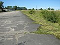
 Last remains of a runway - geograph.org.uk - 4076022.jpg 640 × 480; 206 KB
-
 Lower Farm, Wimbotsham, Norfolk - geograph.org.uk - 5110855.jpg 4 320 × 3 240; 3,43 MB
-
 Lynn Road near Broomhill Farm - geograph.org.uk - 5431941.jpg 640 × 480; 45 KB
-
 National Cycle Route 11 - geograph.org.uk - 5431947.jpg 640 × 480; 51 KB
-
 National Cycle Route 11, Wimbotsham - geograph.org.uk - 5431961.jpg 640 × 480; 53 KB
-

-
 New housing at Broomhill - geograph.org.uk - 4073963.jpg 640 × 480; 177 KB
-
 New housing at Broomhill - geograph.org.uk - 4073968.jpg 640 × 480; 170 KB
-
 New housing at Broomhill - geograph.org.uk - 4073970.jpg 640 × 480; 169 KB
-
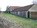
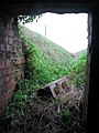
 Old airfield building - detail - geograph.org.uk - 4075985.jpg 640 × 480; 257 KB
-
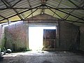
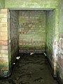
 Old airfield building - interior - geograph.org.uk - 4075990.jpg 640 × 480; 176 KB
-
 Old airfield building - interior - geograph.org.uk - 4075992.jpg 640 × 480; 151 KB
-

-
 Old Milestone - geograph.org.uk - 1714826.jpg 1 600 × 1 200; 723 KB
-
 Old Milestone - geograph.org.uk - 1714836.jpg 1 200 × 1 600; 634 KB
-
 Part of former RAF Downham Market ^^ - geograph.org.uk - 5112889.jpg 4 297 × 3 223; 3,6 MB
-
 Public footpath to the B1507 road - geograph.org.uk - 1737206.jpg 640 × 480; 136 KB
-
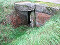
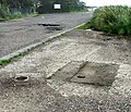 Remains of a FIDO installation - geograph.org.uk - 5033710.jpg 640 × 552; 197 KB
-
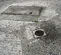 Remains of a FIDO installation - geograph.org.uk - 5033714.jpg 640 × 589; 241 KB
-

-
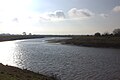
 River Great Ouse - geograph.org.uk - 4583998.jpg 2 560 × 1 920; 1,77 MB
-
 River Great Ouse bend - geograph.org.uk - 6053765.jpg 5 202 × 3 465; 2,31 MB
-
 River Great Ouse, looking northwards - geograph.org.uk - 6053768.jpg 5 202 × 3 465; 3,61 MB
-
 River Great Ouse, west bank - geograph.org.uk - 6053771.jpg 5 202 × 3 465; 3,23 MB
-
 Snow clouds approaching over Fen Rivers Way - geograph.org.uk - 6053779.jpg 5 202 × 3 465; 2,04 MB
-
 St Mary the Virgin, Wimbotsham - geograph.org.uk - 4616155.jpg 1 600 × 1 067; 549 KB
-
 St Mary the Virgin, Wimbotsham - geograph.org.uk - 4616160.jpg 1 600 × 1 067; 540 KB
-

-
 Sugar beet crop field beside New Road - geograph.org.uk - 4075973.jpg 640 × 480; 218 KB
-
 The southern edge of Oak Wood - geograph.org.uk - 4076006.jpg 640 × 480; 188 KB
-
 Trees by Fen Rivers Way - geograph.org.uk - 6053767.jpg 5 202 × 3 465; 3,21 MB
-
 Two bushes - geograph.org.uk - 5024661.jpg 640 × 426; 48 KB
-
 Upper Farm north of Downham Market - geograph.org.uk - 5112859.jpg 4 291 × 3 219; 3,08 MB
-
 View across field towards Lower Farm - geograph.org.uk - 525179.jpg 640 × 426; 125 KB
-
 View down road - geograph.org.uk - 524238.jpg 640 × 426; 112 KB
-
 View north along the A10 road - geograph.org.uk - 4073961.jpg 640 × 480; 155 KB
-
 View west along New Road - geograph.org.uk - 4076000.jpg 640 × 480; 144 KB
-
 View west along New Road - geograph.org.uk - 4076007.jpg 640 × 586; 169 KB
-
 Wheat crop field by Oak Wood - geograph.org.uk - 4076014.jpg 640 × 480; 166 KB
-
 Whinclose Covert - geograph.org.uk - 5036053.jpg 640 × 329; 42 KB
-
 Whinclose Covert - geograph.org.uk - 5036056.jpg 640 × 300; 41 KB
-
 Whinclose Covert near Wimbotsham - geograph.org.uk - 5110365.jpg 4 320 × 3 240; 5,03 MB
-
 Whincourt Kennels - geograph.org.uk - 886377.jpg 3 008 × 2 000; 3,17 MB
-
 Wild flowers beside New Road - geograph.org.uk - 4075978.jpg 640 × 600; 330 KB
-
 Willow Farm (farmhouse) - geograph.org.uk - 5309164.jpg 640 × 480; 363 KB
-
 Wimbotsham Plantation - geograph.org.uk - 551549.jpg 640 × 480; 101 KB
-
 Wimbotsham post office - geograph.org.uk - 524230.jpg 640 × 426; 121 KB
-
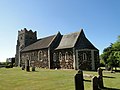 Wimbotsham St. Mary's church - geograph.org.uk - 4353748.jpg 1 024 × 768; 300 KB
-
 Wimbotsham Village Hall - geograph.org.uk - 5431949.jpg 640 × 420; 43 KB
-
 Wimbotsham village sign (detail) - geograph.org.uk - 4521884.jpg 1 024 × 972; 265 KB
-
 Wimbotsham village sign - geograph.org.uk - 4521881.jpg 768 × 1 024; 386 KB
-
 Wimbotsham village sign - geograph.org.uk - 524241.jpg 426 × 640; 119 KB
-
 WW2 airfield near Downham Market - geograph.org.uk - 4075681.jpg 640 × 480; 179 KB
-
 WW2 airfield near Downham Market - geograph.org.uk - 4075686.jpg 640 × 480; 170 KB
-
 WW2 airfield near Downham Market - geograph.org.uk - 4075690.jpg 640 × 480; 182 KB
-
 WW2 Battle Headquarters - geograph.org.uk - 4076034.jpg 640 × 480; 191 KB
-
 WW2 Battle headquarters - geograph.org.uk - 4076040.jpg 480 × 640; 88 KB
-
 WW2 Battle Headquarters - geograph.org.uk - 4076043.jpg 640 × 480; 93 KB
-
 WW2 Battle Headquarters - geograph.org.uk - 4076045.jpg 480 × 640; 95 KB
-
 WW2 Battle Headquarters - geograph.org.uk - 4743684.jpg 640 × 480; 418 KB
-
 WW2 Battle Headquarters - geograph.org.uk - 4743686.jpg 640 × 480; 404 KB
-
 WW2 Battle Headquarters - geograph.org.uk - 4743687.jpg 640 × 480; 544 KB
-
 WW2 Battle Headquarters - geograph.org.uk - 4743689.jpg 480 × 640; 370 KB
-
 WW2 Battle Headquarters - geograph.org.uk - 4743691.jpg 480 × 640; 491 KB
-
 Bales in field - geograph.org.uk - 525185.jpg 640 × 426; 126 KB
-
 Baling tractor - geograph.org.uk - 525183.jpg 640 × 426; 108 KB
-
 Distorted perspective - geograph.org.uk - 525182.jpg 640 × 426; 126 KB
-
 Farmhouse near Broomhill - geograph.org.uk - 525181.jpg 640 × 426; 113 KB
-
 Flag-pole and tree - geograph.org.uk - 524240.jpg 426 × 640; 136 KB
-
 House near Wimbotsham - geograph.org.uk - 524236.jpg 640 × 426; 141 KB
-
 Wimbotsham village sign - geograph.org.uk - 233726.jpg 406 × 640; 94 KB


_-_geograph.org.uk_-_5309164.jpg)


_-_geograph.org.uk_-_4521884.jpg)


