Category:Wing, Rutland
Vai alla navigazione
Vai alla ricerca
village and civil parish in the county of Rutland in the East Midlands of England  | |||||
| Carica un file multimediale | |||||
| Istanza di | |||||
|---|---|---|---|---|---|
| Luogo | Rutland, Midlands Orientali, Inghilterra | ||||
| Popolazione |
| ||||
| Superficie |
| ||||
 | |||||
English: Wing is a small village and civil parish in the county of Rutland in the East Midlands of England.
Sottocategorie
Questa categoria contiene le 5 sottocategorie indicate di seguito, su un totale di 5.
File nella categoria "Wing, Rutland"
Questa categoria contiene 135 file, indicati di seguito, su un totale di 135.
-
 15 ^ 17 Middle Street, Wing - geograph.org.uk - 4851122.jpg 1 280 × 961; 334 KB
-
 20 Church Street, Wing - geograph.org.uk - 4851119.jpg 1 280 × 960; 343 KB
-
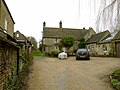
 6 Church Street, Wing (formerly Manor farmhouse) - geograph.org.uk - 4851092.jpg 1 280 × 960; 349 KB
-
 7 Middle Street, Wing and attached barn - geograph.org.uk - 4853148.jpg 1 280 × 960; 325 KB
-
 7 The Jetty, Wing - geograph.org.uk - 4851096.jpg 1 280 × 960; 437 KB
-
 8 Middle Street, Wing - geograph.org.uk - 4853151.jpg 1 280 × 960; 251 KB
-
 A field of field beans by a bridleway - geograph.org.uk - 814835.jpg 640 × 480; 114 KB
-
 Agricultural land - geograph.org.uk - 5511574.jpg 640 × 480; 54 KB
-
 Agricultural land - geograph.org.uk - 5511683.jpg 640 × 506; 60 KB
-
 Allotment Gardens - geograph.org.uk - 2534204.jpg 480 × 640; 116 KB
-
 Barn at Wing House, Wing - geograph.org.uk - 4851115.jpg 960 × 1 280; 296 KB
-
 Barns at former Manor Farm - geograph.org.uk - 4851093.jpg 1 280 × 960; 296 KB
-
 Barns at former Manor Farm - geograph.org.uk - 4851103.jpg 1 280 × 960; 295 KB
-
 Bench mark, Corner Farmhouse, Wing - geograph.org.uk - 4851072.jpg 1 280 × 960; 346 KB
-
 Bench mark, Crown Well Bridge, Manton - geograph.org.uk - 4853170.jpg 1 280 × 923; 356 KB
-
 Bridge over railway - geograph.org.uk - 168407.jpg 640 × 401; 86 KB
-
 Bridge over railway 2012 - geograph.org.uk - 2838078.jpg 640 × 449; 97 KB
-
 Bridge repairs - geograph.org.uk - 5511579.jpg 640 × 480; 117 KB
-
 Bridleway heading south - geograph.org.uk - 4407662.jpg 640 × 426; 50 KB
-
 Bridleway leading north from Wing - geograph.org.uk - 5709108.jpg 3 776 × 2 520; 2,83 MB
-
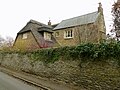
 Cedar House, Bottom Street, Wing - geograph.org.uk - 4853126.jpg 1 280 × 895; 336 KB
-
 Centre of the Maze - geograph.org.uk - 4902916.jpg 5 600 × 3 733; 7,84 MB
-
 Church of St Peter and St Paul, Wing - geograph.org.uk - 4851066.jpg 1 280 × 960; 338 KB
-
 Church of St Peter and St Paul, Wing - geograph.org.uk - 4851069.jpg 948 × 1 280; 333 KB
-
 Church of St Peter and St Paul, Wing - geograph.org.uk - 5709105.jpg 3 776 × 2 520; 4,25 MB
-
 Church Street, Wing - geograph.org.uk - 4007449.jpg 640 × 480; 87 KB
-
 Church Street, Wing - geograph.org.uk - 4851109.jpg 1 280 × 960; 392 KB
-
 Churchfield, Top Street, Wing - geograph.org.uk - 4851090.jpg 1 280 × 960; 361 KB
-
 City Yard House, Top Street, Wing - geograph.org.uk - 4853139.jpg 1 280 × 960; 389 KB
-
 Corby this way - geograph.org.uk - 168408.jpg 585 × 640; 119 KB
-
 Corner Farmhouse - geograph.org.uk - 4851060.jpg 1 280 × 960; 338 KB
-
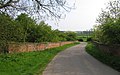
 Country lane near the village of Wing - geograph.org.uk - 3900159.jpg 1 600 × 1 200; 719 KB
-
 Country road - geograph.org.uk - 5511555.jpg 640 × 480; 67 KB
-
 Cromwell Farmhouse - geograph.org.uk - 4853167.jpg 1 280 × 960; 226 KB
-
 Crop field east of Wing - geograph.org.uk - 4007454.jpg 640 × 480; 64 KB
-
 Crown Well Bridge, Wing Hollow - geograph.org.uk - 4853172.jpg 1 280 × 960; 388 KB
-
 Datestone, 7 Middle Street, Wing - geograph.org.uk - 4853149.jpg 1 280 × 960; 318 KB
-
 Entrance to Wing - geograph.org.uk - 5511557.jpg 640 × 480; 68 KB
-
 Entrance to Wing Hall Fishing Lakes - geograph.org.uk - 2838079.jpg 640 × 465; 108 KB
-
 Farmland in the Chater valley - geograph.org.uk - 3900220.jpg 1 600 × 1 032; 459 KB
-
 Fingerpost along Wing Hill - geograph.org.uk - 3898529.jpg 1 600 × 1 200; 765 KB
-
 Fingerpost, Preston Road, Wing - geograph.org.uk - 4853162.jpg 960 × 1 280; 471 KB
-
 Fingerpost, Preston Road-Station Road, Wing - geograph.org.uk - 4853165.jpg 1 280 × 960; 468 KB
-
 Footpath through crop field - geograph.org.uk - 4007455.jpg 640 × 480; 60 KB
-
 Former Methodist Chapel, Middle Street, Wing - geograph.org.uk - 4851125.jpg 1 280 × 960; 288 KB
-
 Garden Cottage, Top Street, Wing - geograph.org.uk - 4853153.jpg 1 280 × 960; 439 KB
-
 Gateway near Wing Burrows - geograph.org.uk - 2904481.jpg 640 × 486; 103 KB
-
 Glenbervie Farm - geograph.org.uk - 4407669.jpg 640 × 426; 37 KB
-
 Grazing and woodland, Wing - geograph.org.uk - 4007451.jpg 640 × 480; 57 KB
-
 Hedgerow and crop field - geograph.org.uk - 4007453.jpg 640 × 480; 79 KB
-
 In a wide cutting - geograph.org.uk - 4407671.jpg 640 × 426; 51 KB
-
 Inglewood Cottage, Church Street, Wing - geograph.org.uk - 4851101.jpg 1 280 × 960; 287 KB
-
 Interpretation board at the maze - geograph.org.uk - 4902921.jpg 6 300 × 4 200; 7,98 MB
-
 Jacob sheep at Wing Hall - geograph.org.uk - 573600.jpg 640 × 480; 112 KB
-
 Kings Arms - geograph.org.uk - 5511686.jpg 640 × 480; 66 KB
-
 Maze pattern - geograph.org.uk - 4902912.jpg 5 300 × 3 533; 7,79 MB
-
 Meadow opposite the maze at Wing - geograph.org.uk - 6197250.jpg 1 024 × 768; 242 KB
-
 Morcott Road - geograph.org.uk - 4007450.jpg 640 × 480; 91 KB
-
 Morcott Road out of Wing - geograph.org.uk - 5709115.jpg 3 776 × 2 520; 2,84 MB
-
 Morcott Water Treatment Works - geograph.org.uk - 4851052.jpg 1 280 × 960; 270 KB
-
 Morcott Water Treatment Works entrance - geograph.org.uk - 4851053.jpg 1 280 × 960; 340 KB
-
 Near Wing - geograph.org.uk - 4407654.jpg 640 × 426; 81 KB
-
 New style label on railway bridge - geograph.org.uk - 2838080.jpg 640 × 538; 188 KB
-

-

-
 Old style label on railway bridge - geograph.org.uk - 2838081.jpg 640 × 524; 177 KB
-
 Organ, Ss Peter ^ Paul church, Wing - geograph.org.uk - 5756959.jpg 3 712 × 5 568; 5,28 MB
-
 Over Wing Tunnel - geograph.org.uk - 5002140.jpg 4 608 × 3 456; 3,35 MB
-
 Passing Wing - geograph.org.uk - 4853130.jpg 1 280 × 960; 282 KB
-
 Pastures north of Wing - geograph.org.uk - 865882.jpg 640 × 308; 155 KB
-
 Preston Road - geograph.org.uk - 4007444.jpg 640 × 480; 64 KB
-
 Preston Road approaching the junction with Station Road - geograph.org.uk - 5709016.jpg 3 776 × 2 520; 3,03 MB
-
 Railway heading west - geograph.org.uk - 4007456.jpg 640 × 480; 83 KB
-
 Railway line to Oakham - geograph.org.uk - 3898507.jpg 1 600 × 1 340; 509 KB
-

-
 Road junction - geograph.org.uk - 5511687.jpg 640 × 480; 114 KB
-
 Room with a View. - geograph.org.uk - 2534178.jpg 1 024 × 768; 218 KB
-
 Sign by Wing Turf Maze - geograph.org.uk - 745008.jpg 640 × 572; 100 KB
-
 Skew Bridge near Pilton - geograph.org.uk - 4851047.jpg 1 280 × 960; 438 KB
-
 South arcade, Ss Peter ^ Paul church, Wing - geograph.org.uk - 5756791.jpg 4 102 × 2 454; 7,07 MB
-
 Ss Peter ^ Paul church, Wing - geograph.org.uk - 5756796.jpg 3 705 × 2 498; 5,99 MB
-
 Stable Cottage, Middle Street, Wing - geograph.org.uk - 4853145.jpg 960 × 1 280; 333 KB
-
 Stained glass window, Ss Peter ^ Paul church, Wing - geograph.org.uk - 5756942.jpg 3 053 × 5 039; 5,35 MB
-
 Station Road leading to Manton - geograph.org.uk - 5002142.jpg 4 608 × 3 456; 3,41 MB
-
 Station Road leading to Manton - geograph.org.uk - 5709024.jpg 3 776 × 2 520; 3,4 MB
-
 Stubble field - geograph.org.uk - 5511679.jpg 640 × 480; 75 KB
-
 Stubble field - geograph.org.uk - 5511682.jpg 640 × 480; 97 KB
-
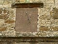 Sundial, 20 Church Street, Wing - geograph.org.uk - 4851120.jpg 1 280 × 960; 422 KB
-
 The Chater Valley - geograph.org.uk - 4407650.jpg 640 × 426; 67 KB
-
 The Cuckoo, Top Street, Wing - geograph.org.uk - 4853157.jpg 1 280 × 859; 285 KB
-
 The Jetty.jpg 3 712 × 3 729; 3,58 MB
-
 The King's Arms, Wing - geograph.org.uk - 4853144.jpg 1 280 × 960; 288 KB
-
 The Old Chapel - geograph.org.uk - 3877348.jpg 1 600 × 1 200; 455 KB
-
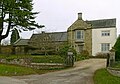
 The Old Hall, Wing - geograph.org.uk - 4853142.jpg 1 280 × 960; 323 KB
-
 The road to Glaston - geograph.org.uk - 4853163.jpg 1 280 × 960; 421 KB
-
 Top Street in the village of Wing - geograph.org.uk - 3902026.jpg 1 600 × 1 308; 481 KB
-
 Top Street in Wing - geograph.org.uk - 3902013.jpg 1 600 × 1 204; 466 KB
-
 Top Street, Wing - geograph.org.uk - 5709092.jpg 3 776 × 2 520; 2,89 MB
-
 Towards Oakham by rail - geograph.org.uk - 745006.jpg 640 × 480; 79 KB
-

-
 Towards Wing - geograph.org.uk - 2904485.jpg 640 × 457; 102 KB
-
 Towards Wing - geograph.org.uk - 2904486.jpg 640 × 461; 104 KB
-
 Towards Wing - geograph.org.uk - 2999902.jpg 640 × 473; 111 KB
-
 Towards Wing Burrows - geograph.org.uk - 2904487.jpg 640 × 479; 109 KB
-
 Towards Wing Burrows - geograph.org.uk - 2904488.jpg 640 × 479; 86 KB
-
 Towards Wing Hollow - geograph.org.uk - 2838087.jpg 640 × 480; 91 KB
-
 Townsend House, Morcott Road, Wing - geograph.org.uk - 4851082.jpg 1 280 × 960; 301 KB
-
 Townsend House, Morcott Road, Wing - geograph.org.uk - 4851087.jpg 1 280 × 960; 307 KB
-
 Track to farm buildings - geograph.org.uk - 745007.jpg 640 × 480; 85 KB
-
 Tree lined driveway to Wing Hall - geograph.org.uk - 3900285.jpg 1 179 × 1 600; 817 KB
-
 Turf maze and playing field - geograph.org.uk - 4902909.jpg 5 200 × 3 467; 7,78 MB
-
 Van, Wing Sewage Works - geograph.org.uk - 4407656.jpg 640 × 426; 77 KB
-
 Viaduct at Wing Hollow - geograph.org.uk - 4853168.jpg 1 280 × 960; 437 KB
-
 View across the valley of the River Chater - geograph.org.uk - 4853127.jpg 1 280 × 960; 320 KB
-
 Wall with gateway on Church Street - geograph.org.uk - 4851106.jpg 1 280 × 960; 310 KB
-
 Westcott, Reeves Lane, Wing - geograph.org.uk - 4853134.jpg 960 × 1 280; 381 KB
-
 Westthorpe Farmhouse, Reeves Lane, Wing - geograph.org.uk - 4853137.jpg 1 280 × 960; 380 KB
-
 Wing - geograph.org.uk - 4407660.jpg 640 × 426; 41 KB
-
 Wing Grange along Preston Road - geograph.org.uk - 3902058.jpg 1 600 × 1 242; 662 KB
-
 Wing Hall - geograph.org.uk - 5511564.jpg 640 × 480; 92 KB
-
 Wing Hall Fishing Lakes - geograph.org.uk - 2838084.jpg 640 × 531; 106 KB
-
 Wing Hill in the Rutland village of Wing - geograph.org.uk - 3901949.jpg 1 600 × 1 258; 535 KB
-
 Wing House, Church Street, Wing - geograph.org.uk - 4851112.jpg 1 280 × 968; 293 KB
-
 Wing maze, 2001 - geograph.org.uk - 5571376.jpg 911 × 600; 106 KB
-
 Wing on the hill top - geograph.org.uk - 4407657.jpg 640 × 426; 53 KB
-
 Wing village hall - geograph.org.uk - 4851084.jpg 1 280 × 960; 473 KB
-
 Wing Water Treatment Works - geograph.org.uk - 4851055.jpg 1 280 × 837; 253 KB
-
 Wingwell Farmhouse, Top Street, Wing - geograph.org.uk - 4853155.jpg 1 280 × 902; 429 KB
-
 Woodland next to Wing Road and Wing Tunnel - geograph.org.uk - 3898514.jpg 1 600 × 1 124; 820 KB
-
 Bridge over the River Chater, Rutland - geograph.org.uk - 209901.jpg 640 × 427; 84 KB
-
 Farm track at Glaston - geograph.org.uk - 364704.jpg 640 × 427; 90 KB
-
 Farmland near Glaston - geograph.org.uk - 364645.jpg 640 × 480; 83 KB
-
 Fields - geograph.org.uk - 172154.jpg 640 × 480; 91 KB
-
 Glaston Road - geograph.org.uk - 745005.jpg 640 × 434; 91 KB
-
 Railway Embankment - geograph.org.uk - 172130.jpg 640 × 480; 95 KB


_-_geograph.org.uk_-_4851092.jpg)


