Category:Wingerworth
Aller à la navigation
Aller à la recherche
English: Wingerworth is a relatively large village and parish near to Chesterfield, Derbyshire, England. It is one of the largest and most populous villages in the district of North East Derbyshire. Wingerworth is only two miles south west of the town of Chesterfield, 12 miles south of Sheffield and 120 miles north of the United Kingdom's capital, London. The settlements of Tupton, Clay Cross, Grassmoor and Ashover are also nearby. Wingerworth or 'Wingy' for short is a semi-rural village with a large town to the north but English countryside to the south with Buxton and Ripley as popular places to visit and Chatsworth House as a popular tourist destination.
localité britannique du comté anglais de Derbyshire  | |||||
| Téléverser des médias | |||||
| Nature de l’élément | |||||
|---|---|---|---|---|---|
| Lieu | North East Derbyshire, Derbyshire, Midlands de l'Est, Angleterre | ||||
 | |||||
Sous-catégories
Cette catégorie comprend 3 sous-catégories, dont les 3 ci-dessous.
A
- Avenue Coking Works (8 F)
S
- Stubbing Court (3 F)
Média dans la catégorie « Wingerworth »
Cette catégorie comprend 355 fichiers, dont les 200 ci-dessous.
(page précédente) (page suivante)-
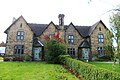
 "Wychwood" - house on Bole Hill - geograph.org.uk - 3959818.jpg 2 468 × 1 763 ; 1,71 Mio
-
 158812, Avenue Wetlands Nature Reserve (4315619021).jpg 2 575 × 1 500 ; 3,03 Mio
-
 238 and 240 Longedge Lane.jpg 3 646 × 2 430 ; 2,12 Mio
-
 25 years on at Grassmoor - geograph.org.uk - 635203.jpg 640 × 435 ; 59 kio
-
 A Field of Corn - geograph.org.uk - 2005297.jpg 640 × 480 ; 104 kio
-
 A haze of bluebells - geograph.org.uk - 4463288.jpg 1 000 × 750 ; 318 kio
-
 A61 towards Chesterfield - geograph.org.uk - 2334505.jpg 1 600 × 1 200 ; 765 kio
-
 A61 towards Chesterfield - geograph.org.uk - 2334556.jpg 1 600 × 1 200 ; 340 kio
-
 A61 towards Chesterfield - geograph.org.uk - 2334565.jpg 1 600 × 1 200 ; 417 kio
-
 A632 Matlock Road junction at Slatepit Dale - geograph.org.uk - 2465271.jpg 950 × 691 ; 292 kio
-
 A632 Matlock Road towards Chesterfield - geograph.org.uk - 4067535.jpg 4 000 × 2 248 ; 5,26 Mio
-
 Above the Great Pond of Stubbing - geograph.org.uk - 4067480.jpg 4 000 × 2 248 ; 6,33 Mio
-
 All Saints Church in Wingerworth - geograph.org.uk - 4208909.jpg 3 576 × 2 670 ; 1,96 Mio
-
 All Saints, Wingerworth - Font - geograph.org.uk - 3270277.jpg 692 × 1 000 ; 202 kio
-
 All Saints, Wingerworth - geograph.org.uk - 3270275.jpg 1 000 × 707 ; 249 kio
-
 Allotments at Harperhill Farm - geograph.org.uk - 3228504.jpg 4 000 × 3 000 ; 1,88 Mio
-
 Approaching Spitewinter in Ashover Parish - geograph.org.uk - 3955612.jpg 800 × 533 ; 126 kio
-
 At the lychgate, Wingerworth All Saints Church - geograph.org.uk - 4208921.jpg 2 617 × 3 489 ; 1,74 Mio
-
 Avenue Farm - geograph.org.uk - 4283016.jpg 640 × 430 ; 38 kio
-
 Avenue Washlands Nature Reserve - geograph.org.uk - 2981879.jpg 640 × 324 ; 42 kio
-
 Barley Mow Inn, Wingerworth - geograph.org.uk - 2425780.jpg 950 × 775 ; 337 kio
-
 Barley Mow, Wingerworth 194070.jpg 640 × 480 ; 74 kio
-
 Bateman's Mill Hotel - geograph.org.uk - 3959713.jpg 2 592 × 1 944 ; 1,76 Mio
-
 Batemans mill country hotel. - geograph.org.uk - 5806539.jpg 640 × 480 ; 43 kio
-
 Beginning of the B5057 - geograph.org.uk - 4911811.jpg 640 × 426 ; 65 kio
-
 Bend, A632 - geograph.org.uk - 4911814.jpg 640 × 426 ; 69 kio
-
 Birdholme Brook - geograph.org.uk - 2796484.jpg 2 144 × 2 848 ; 1,43 Mio
-
 Birdholme Farm - geograph.org.uk - 2334571.jpg 1 600 × 1 200 ; 300 kio
-
 Birdholme Farm by the A61 - geograph.org.uk - 2423377.jpg 950 × 518 ; 225 kio
-
 Birkin Lane - geograph.org.uk - 2463558.jpg 950 × 684 ; 292 kio
-
 Bluebells in Cowlishaw Wood - geograph.org.uk - 3959775.jpg 2 592 × 1 944 ; 2,71 Mio
-
 Boat house - The Great Pond of Stubbing - geograph.org.uk - 5215003.jpg 3 705 × 5 038 ; 5,32 Mio
-
 Boat house on The Great Pond of Stubbing - geograph.org.uk - 4230891.jpg 4 858 × 3 673 ; 5,55 Mio
-
 Boathouse at the Great Pond of Stubbing - geograph.org.uk - 3228541.jpg 4 000 × 3 000 ; 3,57 Mio
-
 Boathouse reflection - geograph.org.uk - 3955595.jpg 800 × 550 ; 99 kio
-
 Bolehill Farm - geograph.org.uk - 2335037.jpg 1 600 × 1 200 ; 187 kio
-
 Bolehill Farm from Birkin Lane - geograph.org.uk - 2463564.jpg 950 × 470 ; 200 kio
-
 Bolehill Lane - geograph.org.uk - 2335040.jpg 1 600 × 1 200 ; 679 kio
-
 Bolehill Lane heading north - geograph.org.uk - 3959804.jpg 2 592 × 1 944 ; 2,62 Mio
-
 Bridleway and footpath in leafy sunshine - geograph.org.uk - 2005256.jpg 640 × 480 ; 131 kio
-
 Bus shelter on Langer Lane - geograph.org.uk - 2334814.jpg 1 600 × 1 200 ; 354 kio
-
 By the Midland Main Line - geograph.org.uk - 4763880.jpg 640 × 426 ; 51 kio
-
 Central Drive, Wingerworth - geograph.org.uk - 2005192.jpg 640 × 480 ; 116 kio
-
 Central Drive, Wingerworth - geograph.org.uk - 6518997.jpg 1 024 × 576 ; 132 kio
-
 Closed railway bridge - geograph.org.uk - 5675884.jpg 4 876 × 2 743 ; 3,59 Mio
-
 Closed-down Garden Centre near Wingerworth - geograph.org.uk - 3228572.jpg 3 677 × 2 430 ; 1,45 Mio
-
 Cottage on Hillhouses Lane - geograph.org.uk - 2334830.jpg 1 600 × 1 200 ; 556 kio
-
 Cycle and walking route - geograph.org.uk - 5675899.jpg 5 202 × 2 926 ; 3,32 Mio
-
 Cycle route and footpath - geograph.org.uk - 5675843.jpg 5 202 × 2 926 ; 4,28 Mio
-
 Cycle route and footpath - geograph.org.uk - 5675847.jpg 5 091 × 2 864 ; 3,8 Mio
-
 Cycle route and footpath - geograph.org.uk - 5675853.jpg 5 030 × 2 829 ; 5,25 Mio
-
 Derby Road and Nottingham Drive - geograph.org.uk - 2425762.jpg 950 × 738 ; 279 kio
-
 Derby Road approaching Chesterfield - geograph.org.uk - 2423356.jpg 950 × 567 ; 230 kio
-
 Derbyshire UK parish map highlighting Wingerworth.svg 888 × 1 308 ; 2,35 Mio
-
 Descending off Stone Edge, A632 - geograph.org.uk - 4911812.jpg 640 × 426 ; 70 kio
-
 Disused buildings at Harper Hill Farm - geograph.org.uk - 4231174.jpg 5 013 × 3 760 ; 4,87 Mio
-
 Dryad's Saddle - geograph.org.uk - 4463142.jpg 1 000 × 750 ; 255 kio
-
 Ducks on Wall Pond - geograph.org.uk - 5844877.jpg 768 × 1 024 ; 152 kio
-
 Entrance to Lothlorien and Branbury Wood - geograph.org.uk - 3583157.jpg 640 × 480 ; 100 kio
-
 Evening Sunshine - geograph.org.uk - 5844872.jpg 1 024 × 768 ; 174 kio
-
 Extensive view from the Matlock Road - geograph.org.uk - 3957657.jpg 800 × 533 ; 104 kio
-
 Farm buildings at Swathwick from above - geograph.org.uk - 2463506.jpg 950 × 436 ; 182 kio
-
 Farm land and industrial land - geograph.org.uk - 2057338.jpg 640 × 480 ; 61 kio
-
 Farm track from Stone Edge Farm - geograph.org.uk - 2465255.jpg 950 × 700 ; 278 kio
-
 Farm track to Stone Edge Farm - geograph.org.uk - 2465264.jpg 950 × 713 ; 288 kio
-
 Farmers track over River Rother - geograph.org.uk - 6504059.jpg 1 024 × 768 ; 242 kio
-
 Farmland near Wingerworth - geograph.org.uk - 2335035.jpg 1 600 × 1 200 ; 486 kio
-
 Farmland near Woodthorpe Grange - geograph.org.uk - 2005292.jpg 640 × 480 ; 88 kio
-
 Farmland off Matlock Road (A632) - geograph.org.uk - 5056137.jpg 640 × 480 ; 43 kio
-
 Farmland towards Stone Edge Plantation - geograph.org.uk - 5056119.jpg 640 × 469 ; 58 kio
-
 Field adjacent to Nethermoor Farm - geograph.org.uk - 6502111.jpg 1 024 × 576 ; 69 kio
-
 Field by Stubbings Court Home Farm - geograph.org.uk - 4067499.jpg 4 000 × 2 248 ; 6,66 Mio
-
 Field of Buttercups near Moorside farm - geograph.org.uk - 4012505.jpg 4 000 × 3 000 ; 2,77 Mio
-
 Field view from woodland edge - geograph.org.uk - 2431449.jpg 950 × 673 ; 300 kio
-
 Fields around Stone Edge Farm - geograph.org.uk - 2465247.jpg 950 × 713 ; 324 kio
-
 Flat-bed trailer at Bole Hill Farm - geograph.org.uk - 1984489.jpg 640 × 480 ; 61 kio
-

-
 Footpath and track to Stubbing Court Home Farm - geograph.org.uk - 3955600.jpg 800 × 533 ; 190 kio
-
 Footpath beside woodland - geograph.org.uk - 2005236.jpg 640 × 480 ; 86 kio
-
 Footpath by Carr Plantation - geograph.org.uk - 2431454.jpg 713 × 950 ; 310 kio
-
 Footpath by Hardwick Wood - geograph.org.uk - 2463581.jpg 950 × 544 ; 260 kio
-
 Footpath in Stone Edge Plantation - geograph.org.uk - 5340397.jpg 1 600 × 1 200 ; 327 kio
-
 Footpath off the A61 - geograph.org.uk - 2334496.jpg 1 600 × 1 200 ; 782 kio
-
 Footpath Overlooking Stubbing Court Home Farm - geograph.org.uk - 3228518.jpg 4 000 × 3 000 ; 2,4 Mio
-
 Footpath sign and closure notice - geograph.org.uk - 2423364.jpg 713 × 950 ; 331 kio
-
 Footpath to Bolehill Farm - geograph.org.uk - 2335036.jpg 1 600 × 1 200 ; 470 kio
-
 Footpath to Old Tupton - geograph.org.uk - 194072.jpg 640 × 480 ; 119 kio
-
 Ford at Nether Moor - geograph.org.uk - 3432943.jpg 3 264 × 2 448 ; 3,94 Mio
-
 Ford at Stubbing - geograph.org.uk - 3432929.jpg 3 264 × 2 448 ; 4,43 Mio
-
 Former Inn with 1669 datestone - geograph.org.uk - 178524.jpg 640 × 480 ; 122 kio
-

-
 Grange Farm - geograph.org.uk - 4283020.jpg 640 × 430 ; 54 kio
-
 Grangewood Roundabout - geograph.org.uk - 585837.jpg 640 × 480 ; 106 kio
-
 Grassland and Woodland near Wingerworth - geograph.org.uk - 3228861.jpg 4 000 × 3 000 ; 2,44 Mio
-
 Grassland near Birdholme Farm - geograph.org.uk - 4012539.jpg 4 000 × 3 000 ; 1,91 Mio
-
 Hardwick Wood Entrance - Footpath Straight Ahead - geograph.org.uk - 1147679.jpg 640 × 480 ; 150 kio
-
 Hardwick Wood Entrance - Footpath Straight Ahead - geograph.org.uk - 785857.jpg 640 × 480 ; 155 kio
-
 Hardwick Wood Entrance - Footpath to the Left - geograph.org.uk - 785836.jpg 640 × 480 ; 168 kio
-
 Hardwick Wood Entrance - Footpaths to the Right - geograph.org.uk - 785863.jpg 640 × 480 ; 168 kio
-
 Harper Hill House Farm - geograph.org.uk - 4067466.jpg 3 900 × 2 052 ; 4,42 Mio
-
 Harry Ramsden's at The Wingerworth - geograph.org.uk - 5112517.jpg 800 × 577 ; 94 kio
-
 Hillhouses Lane - geograph.org.uk - 2334835.jpg 1 600 × 1 200 ; 490 kio
-
 Hillside above Stone Edge Farm - geograph.org.uk - 2465239.jpg 950 × 712 ; 303 kio
-
 Hillside below the A632 Matlock Road - geograph.org.uk - 2465234.jpg 950 × 690 ; 270 kio
-
 Hockley Lane looking North - geograph.org.uk - 6518911.jpg 1 024 × 576 ; 212 kio
-
 Hockley Lane, Hockley - geograph.org.uk - 2005199.jpg 640 × 480 ; 95 kio
-
 House in Malthouse Lane - geograph.org.uk - 4064922.jpg 1 000 × 690 ; 243 kio
-
 House just off Matlock Rd - geograph.org.uk - 4911816.jpg 640 × 475 ; 74 kio
-
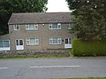
 House on Chartwell Avenue, Wingerworth - geograph.org.uk - 4231183.jpg 4 674 × 3 773 ; 4,33 Mio
-
 House on Nethermoor Road, Tupton - geograph.org.uk - 2334536.jpg 1 600 × 1 054 ; 392 kio
-
 Houses on Derby Road (A61) - geograph.org.uk - 2334527.jpg 1 600 × 1 348 ; 213 kio
-
 Hunloke Arms - geograph.org.uk - 2796508.jpg 2 848 × 2 144 ; 1,52 Mio
-
 Hunloke Arms, Derby Road - geograph.org.uk - 222019.jpg 640 × 426 ; 54 kio
-
 Junction of Walton Way and Langer Lane - geograph.org.uk - 2932899.jpg 640 × 480 ; 70 kio
-
 Junction of Windsor Drive and Walton Way - geograph.org.uk - 2932893.jpg 640 × 480 ; 90 kio
-
 Keith's Pond - geograph.org.uk - 5675881.jpg 5 070 × 2 852 ; 4,06 Mio
-
 Lake - Wingerworth lido - geograph.org.uk - 2463576.jpg 950 × 713 ; 288 kio
-
 Lane above Harper Hill - geograph.org.uk - 2463466.jpg 950 × 760 ; 282 kio
-
 Lane by the Great Pond of Stubbing - geograph.org.uk - 2463519.jpg 950 × 727 ; 324 kio
-
 Lane junction, Pearce Lane - geograph.org.uk - 2463511.jpg 950 × 713 ; 288 kio
-
 Lane to Stubbings Court Home Farm - geograph.org.uk - 4067491.jpg 4 000 × 2 248 ; 6,91 Mio
-
 Langer Lane - geograph.org.uk - 2334818.jpg 1 600 × 1 200 ; 330 kio
-
 Large house on Derby Road (A61) - geograph.org.uk - 2334554.jpg 1 600 × 1 200 ; 505 kio
-
 Longedge Lane towards Wingerworth - geograph.org.uk - 2334576.jpg 1 600 × 1 200 ; 655 kio
-
 Looking along Mill Lane - geograph.org.uk - 2425753.jpg 950 × 611 ; 270 kio
-
 Lych Gate and Tower of All Saints' Church, Wingerworth - geograph.org.uk - 3228853.jpg 4 000 × 3 000 ; 2,8 Mio
-
 Matlock Road (A632) - geograph.org.uk - 5056141.jpg 640 × 480 ; 64 kio
-
 Meadow and farm buildings by Carr Plantation - geograph.org.uk - 2431458.jpg 950 × 477 ; 201 kio
-
 Mill Lane - geograph.org.uk - 5675859.jpg 5 298 × 2 980 ; 3,41 Mio
-
 Mill Lane - geograph.org.uk - 5675863.jpg 5 103 × 3 402 ; 3,08 Mio
-
 Mill Lane - geograph.org.uk - 5675902.jpg 5 340 × 3 003 ; 4,86 Mio
-
 Mill Lane, Hunloke Estate - geograph.org.uk - 3228823.jpg 4 000 × 3 000 ; 3,19 Mio
-
 Minor road towards the A632 - geograph.org.uk - 2566690.jpg 3 648 × 2 736 ; 1,73 Mio
-
 Nether House Farm - geograph.org.uk - 3955605.jpg 800 × 533 ; 71 kio
-
 Nether Moor, Wingerworth - geograph.org.uk - 2005218.jpg 640 × 480 ; 72 kio
-
 Nethermoor Farm Track - Bridleway - geograph.org.uk - 6502144.jpg 1 024 × 576 ; 128 kio
-
 Nethermoor Farm Track - Bridleway - geograph.org.uk - 6502146.jpg 1 024 × 576 ; 127 kio
-
 Nethermoor Road - geograph.org.uk - 6502110.jpg 1 024 × 576 ; 96 kio
-
 Nethermoor Road at Nether Moor - geograph.org.uk - 4208879.jpg 3 648 × 2 736 ; 2,18 Mio
-
 Nethermoor Road towards the A61 - geograph.org.uk - 2431470.jpg 900 × 549 ; 233 kio
-
 Nethermoor Road towards Wingerworth - geograph.org.uk - 2431462.jpg 950 × 713 ; 286 kio
-
 Nethermoor Road, Tupton - geograph.org.uk - 2334534.jpg 1 600 × 1 200 ; 351 kio
-
 New Road, Wingerworth - geograph.org.uk - 6518994.jpg 1 024 × 576 ; 102 kio
-
 Nick's Bench and the track to Stocksmoor Farm - geograph.org.uk - 3959767.jpg 2 510 × 1 793 ; 2,65 Mio
-
 Northern Entrance to Britton Wood - geograph.org.uk - 2582382.jpg 3 296 × 2 472 ; 1,09 Mio
-
 Notice board, Salem Methodist Independent Chapel - geograph.org.uk - 4064918.jpg 1 000 × 724 ; 185 kio
-
 Nottingham Drive, Wingerworth - geograph.org.uk - 2425768.jpg 640 × 422 ; 72 kio
-
 Old House - geograph.org.uk - 408045.jpg 640 × 480 ; 112 kio
-
 Old Milepost by the A61, Derby Road, Tupton (geograph 5623793).jpg 997 × 1 608 ; 208 kio
-
 Old Milepost by the A61, Wingerworth (geograph 5623794).jpg 997 × 1 608 ; 236 kio
-

-
 Overlooking Farmland and Moorspring Wood - geograph.org.uk - 2582397.jpg 3 296 × 2 472 ; 1,25 Mio
-
 Parade of shops, Wingerworth - geograph.org.uk - 2425785.jpg 950 × 603 ; 270 kio
-
 Parish Hall and Library, Wingerworth - geograph.org.uk - 2005175.jpg 640 × 480 ; 52 kio
-
 Pasture land and Moonspring Wood - geograph.org.uk - 2005262.jpg 640 × 480 ; 79 kio
-
 Paved Footpath towards Malthouse Lane - geograph.org.uk - 1454167.jpg 640 × 480 ; 82 kio
-
 Pear Tree Farm - geograph.org.uk - 3583202.jpg 1 024 × 768 ; 236 kio
-
 Pearce Lane - geograph.org.uk - 365083.jpg 640 × 480 ; 96 kio
-
 Pearce Lane - View across field to Malthouse Lane - geograph.org.uk - 365075.jpg 640 × 480 ; 126 kio
-
 Pearce Lane Junction with Watson Lane - geograph.org.uk - 365062.jpg 640 × 480 ; 159 kio
-
 Ploughed Field near Widdowson Spring Wood - geograph.org.uk - 3228891.jpg 4 000 × 3 000 ; 1,88 Mio
-
 Press Farm from Redcar Hillside Plantation - geograph.org.uk - 3959811.jpg 2 531 × 1 808 ; 1,56 Mio
-
 Public art installation - geograph.org.uk - 5675891.jpg 4 853 × 2 730 ; 3,89 Mio
-
 Public right of way - geograph.org.uk - 5675878.jpg 5 259 × 2 958 ; 4,64 Mio
-
 Railway Underpass - geograph.org.uk - 6504051.jpg 1 440 × 1 080 ; 342 kio
-
 Recreational Area near Wingerworth - geograph.org.uk - 3228877.jpg 4 000 × 3 000 ; 2,2 Mio
-
 Remains of Saw Mill - geograph.org.uk - 4463126.jpg 750 × 1 000 ; 229 kio
-
 Rising field by Hardwick Wood - geograph.org.uk - 2463585.jpg 950 × 713 ; 278 kio
-
 River Rother - geograph.org.uk - 306578.jpg 480 × 640 ; 93 kio
-
 River Rother - geograph.org.uk - 6504034.jpg 1 440 × 1 080 ; 591 kio
-
 River Rother and Pipeline - geograph.org.uk - 6504033.jpg 1 440 × 1 080 ; 655 kio
-
 River Rother valley and route of closed footpath - geograph.org.uk - 2423371.jpg 950 × 713 ; 252 kio
-
 Road junction and houses, Wingerworth - geograph.org.uk - 2463571.jpg 950 × 713 ; 280 kio
-
 Rough ground - geograph.org.uk - 4763882.jpg 640 × 350 ; 45 kio
-
 Rough ground near Avenue Farm - geograph.org.uk - 4283019.jpg 640 × 430 ; 45 kio
-
 Roundabout on the A61 at Tupton - geograph.org.uk - 3228599.jpg 3 914 × 2 884 ; 1,11 Mio
-
 Roundabout on the A61, Tupton - geograph.org.uk - 2334516.jpg 1 600 × 1 200 ; 425 kio
-
 Salem Chapel - geograph.org.uk - 1984457.jpg 640 × 480 ; 109 kio
-
 Salem Chapel on Malthouse Lane - geograph.org.uk - 4230879.jpg 4 960 × 3 720 ; 4,93 Mio
-
 Salem Independent Methodist Chapel - geograph.org.uk - 4064914.jpg 1 000 × 705 ; 214 kio
-

-
 Scrubland in the Rother Valley - geograph.org.uk - 4283015.jpg 640 × 430 ; 46 kio
-
 Sign for the Peak Edge Hotel, Stone Edge - geograph.org.uk - 5056131.jpg 513 × 640 ; 44 kio
-

-
 Start of footpath by Redleadmill Brook - geograph.org.uk - 2431485.jpg 950 × 713 ; 309 kio
-
 Start of footpath that ends at the Barley Mow Pub - geograph.org.uk - 4463169.jpg 1 000 × 750 ; 226 kio
-
 Stone Edge road junction - geograph.org.uk - 3743821.jpg 4 884 × 3 489 ; 4,27 Mio
-
 Stone footbridge over a brook at Wingerworth - geograph.org.uk - 1984470.jpg 640 × 480 ; 98 kio
-
 Stubbing Boathouse and Winter Visitor (Scaup) - geograph.org.uk - 320113.jpg 640 × 480 ; 152 kio
-
 Stubbing Great Pond and Boathouse - geograph.org.uk - 319628.jpg 640 × 480 ; 122 kio
-
 Swathwick Cottage - geograph.org.uk - 3583184.jpg 1 024 × 768 ; 205 kio
-
 The Avenue Washlands - geograph.org.uk - 5675870.jpg 5 319 × 2 991 ; 6,11 Mio
-
 The Avenue Washlands - geograph.org.uk - 5675888.jpg 5 025 × 2 827 ; 4,42 Mio
-
 The boat house in late autumn - geograph.org.uk - 5214988.jpg 5 031 × 3 677 ; 4,89 Mio
-
 The Great Pond of Stubbing - geograph.org.uk - 4067483.jpg 4 000 × 2 248 ; 4,3 Mio
-
 The Great Pond of Stubbing - geograph.org.uk - 4067484.jpg 3 936 × 2 128 ; 4,83 Mio
-
 The Hunloke Arms, Wingerworth - geograph.org.uk - 2334561.jpg 1 600 × 1 200 ; 321 kio
-
 The Peak Edge Hotel, Stone Edge - geograph.org.uk - 5056127.jpg 640 × 480 ; 41 kio
-
 The Red Lion on Darley Road - geograph.org.uk - 2952615.jpg 3 180 × 2 310 ; 1,08 Mio
-
 The River Rother west of Grassmoor - geograph.org.uk - 4208792.jpg 2 736 × 3 648 ; 2,1 Mio

.jpg)


_-_geograph.org.uk_-_5056137.jpg)


_-_geograph.org.uk_-_2334527.jpg)


_-_geograph.org.uk_-_2334554.jpg)


_-_geograph.org.uk_-_5056141.jpg)


.jpg)
.jpg)


_-_geograph.org.uk_-_320113.jpg)


