Category:Winshill
Aller à la navigation
Aller à la recherche
English: Winshill is a suburb to the east of Burton upon Trent, in the borough of East Staffordshire, England.
village britannique  | |||||
| Téléverser des médias | |||||
| Nature de l’élément | |||||
|---|---|---|---|---|---|
| Lieu | East Staffordshire, Staffordshire, Midlands de l'Ouest, Angleterre | ||||
 | |||||
Sous-catégories
Cette catégorie comprend 2 sous-catégories, dont les 2 ci-dessous.
S
- St Mark's church, Winshill (4 F)
W
- Winshill Ford (3 F)
Média dans la catégorie « Winshill »
Cette catégorie comprend 73 fichiers, dont les 73 ci-dessous.
-
 A private road into Scalpcliffe Grange - geograph.org.uk - 5713573.jpg 2 000 × 1 333 ; 1,88 Mio
-
 A511 Ashby Road - geograph.org.uk - 4239552.jpg 1 142 × 857 ; 345 kio
-
 A511 Ashby Road in Winshill - geograph.org.uk - 4622781.jpg 800 × 655 ; 144 kio
-
 Alexandra Road - geograph.org.uk - 5713561.jpg 2 000 × 1 333 ; 2,45 Mio
-
 Ashby Road (A511) - geograph.org.uk - 3557033.jpg 640 × 480 ; 64 kio
-
 Ashby Road (A511) - geograph.org.uk - 3557039.jpg 640 × 480 ; 56 kio
-
 Ashby Road in Burton upon Trent - geograph.org.uk - 4622645.jpg 800 × 660 ; 145 kio
-
 Bench mark on Burton Bridge - geograph.org.uk - 4003558.jpg 960 × 1 280 ; 273 kio
-
 Boundary post on Newton Road - geograph.org.uk - 4142101.jpg 1 280 × 960 ; 480 kio
-
 Boundary post on Newton Road - geograph.org.uk - 4142103.jpg 883 × 1 280 ; 463 kio
-
 Bretby Lane in Winshill - geograph.org.uk - 4622786.jpg 800 × 609 ; 130 kio
-
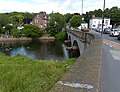
 Burton Bridge - geograph.org.uk - 5713578.jpg 2 000 × 1 333 ; 1,98 Mio
-
 Burton Bridge crossing the River Trent - geograph.org.uk - 4622639.jpg 800 × 616 ; 143 kio
-
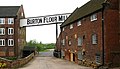
 Burton Flour Mill, Winshill - geograph.org.uk - 1069659.jpg 640 × 480 ; 114 kio
-
 Burton Flour Mills - geograph.org.uk - 1314759.jpg 640 × 325 ; 47 kio
-
 Burton Flour Mills - geograph.org.uk - 1314760.jpg 640 × 369 ; 69 kio
-
 Burton Flour Mills - geograph.org.uk - 2209534.jpg 640 × 425 ; 91 kio
-
 Burton Flour Mills - geograph.org.uk - 2301779.jpg 3 296 × 2 472 ; 1,06 Mio
-
 Burton Flour Mills - geograph.org.uk - 5713585.jpg 2 000 × 1 333 ; 2,6 Mio
-
 Burton Flour Mills - Old Mill - geograph.org.uk - 1888399.jpg 480 × 640 ; 175 kio
-
 Car parking rear of Kimberley Drive - geograph.org.uk - 2503468.jpg 608 × 640 ; 82 kio
-
 Cottages on Newton Road - geograph.org.uk - 5030920.jpg 4 535 × 3 292 ; 3,27 Mio
-
 Entering South Derbyshire - geograph.org.uk - 3199368.jpg 640 × 473 ; 99 kio
-
 Entering South Derbyshire - geograph.org.uk - 3557042.jpg 640 × 480 ; 72 kio
-
 Houses on Newton Road - geograph.org.uk - 3199286.jpg 640 × 480 ; 66 kio
-
 Housing in Winshill - geograph.org.uk - 5737595.jpg 2 000 × 1 333 ; 1,88 Mio
-
 Looking along Ashby Road - geograph.org.uk - 5737598.jpg 2 000 × 1 333 ; 2,04 Mio
-
 Looking down on the River Trent - geograph.org.uk - 5713581.jpg 2 000 × 1 333 ; 2,45 Mio
-
 Milepost, Ashby Road, Burton.jpg 1 280 × 1 280 ; 239 kio
-
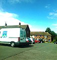
 Mill Coach House - geograph.org.uk - 1305777.jpg 640 × 378 ; 81 kio
-
 Newton Road (B5008) - geograph.org.uk - 3199289.jpg 640 × 480 ; 118 kio
-
 Newton Road (B5008) - geograph.org.uk - 3199364.jpg 640 × 480 ; 77 kio
-
 Newton Road at the Dale Brook bridge - geograph.org.uk - 4142107.jpg 1 280 × 927 ; 338 kio
-
 OS benchmark - Winshill, Ashby Road - geograph.org.uk - 4239545.jpg 857 × 1 142 ; 573 kio
-
 OS flush bracket - Winshill, Bleak House - geograph.org.uk - 4383282.jpg 857 × 1 142 ; 546 kio
-
 Pipe bridge over the River Trent (geograph 3199383).jpg 640 × 432 ; 50 kio
-
 Postbox along Ashby Road in Winshill - geograph.org.uk - 4622772.jpg 800 × 600 ; 163 kio
-
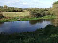
 River Trent - geograph.org.uk - 4358311.jpg 640 × 427 ; 91 kio
-

-
 River Trent, Burton upon Trent - geograph.org.uk - 3557028.jpg 640 × 480 ; 79 kio
-
 Roundabout on Ashby Road - geograph.org.uk - 4383296.jpg 1 142 × 857 ; 334 kio
-
 Rowbury Drive, Winshill - geograph.org.uk - 4239553.jpg 1 142 × 857 ; 387 kio
-
 Scalpcliffe Road Corner - geograph.org.uk - 5713569.jpg 2 000 × 1 333 ; 2,79 Mio
-
 Service station on Ashby Road - geograph.org.uk - 3557036.jpg 640 × 437 ; 48 kio
-
 The east end of Burton Bridge - geograph.org.uk - 4009881.jpg 1 280 × 853 ; 556 kio
-
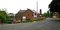
 The former Swan Inn - geograph.org.uk - 4003560.jpg 1 280 × 909 ; 191 kio
-
 The Mill Coach House - geograph.org.uk - 1069655.jpg 640 × 480 ; 89 kio
-
 The Mill Coach House - geograph.org.uk - 3199359.jpg 640 × 480 ; 76 kio
-
 The River Trent at Winshill - geograph.org.uk - 5030916.jpg 4 608 × 3 456 ; 3,94 Mio
-
 The River Trent, Burton upon Trent - geograph.org.uk - 3199293.jpg 640 × 480 ; 86 kio
-
 The Sump - geograph.org.uk - 1314507.jpg 640 × 384 ; 57 kio
-
 The Swan, Burton upon Trent - geograph.org.uk - 3199281.jpg 640 × 480 ; 77 kio
-
 The Waterloo - geograph.org.uk - 1306816.jpg 640 × 385 ; 55 kio
-
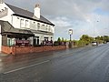 The Waterloo pub - geograph.org.uk - 4239549.jpg 1 142 × 857 ; 314 kio
-
 The Waterloo pub on Ashby Road - geograph.org.uk - 4622651.jpg 800 × 514 ; 101 kio
-
 The weir on the River Trent - geograph.org.uk - 4730276.jpg 1 600 × 1 060 ; 360 kio
-
 Tram tracks on Burton Bridge - geograph.org.uk - 5821480.jpg 1 280 × 960 ; 489 kio
-
 Trent Rowing Club - geograph.org.uk - 3895425.jpg 2 000 × 1 363 ; 798 kio
-
 Trent Rowing Club - geograph.org.uk - 5512806.jpg 800 × 584 ; 127 kio
-
 Trent Rowing Club - geograph.org.uk - 5713576.jpg 2 000 × 1 333 ; 1,94 Mio
-
 Weir on the River Trent - geograph.org.uk - 1888355.jpg 640 × 480 ; 208 kio
-
 William Coltman VC Peace Wood - geograph.org.uk - 4139316.jpg 640 × 480 ; 116 kio
-
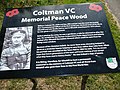 William Coltman VC Peace Wood - geograph.org.uk - 4139330.jpg 640 × 480 ; 117 kio
-
 Winshill Ashby Road.jpg 375 × 500 ; 82 kio
-
 Winshill Bearwood Hill Road.jpg 500 × 375 ; 105 kio
-
 Winshill Milestone - geograph.org.uk - 1306437.jpg 491 × 640 ; 115 kio
-
 Winshill Travellers Rest April 2008.JPG 712 × 534 ; 62 kio
-
 Winshill Water Tower - geograph.org.uk - 178902.jpg 427 × 640 ; 115 kio
-
 Winshill Water Tower - geograph.org.uk - 4646362.jpg 1 076 × 1 600 ; 286 kio
-
 Winshill Water Tower.jpg 375 × 500 ; 103 kio
-
 Wm Coltman VC Peace Wood - geograph.org.uk - 4139338.jpg 640 × 480 ; 137 kio
-
 Island in West Winshill - geograph.org.uk - 396877.jpg 640 × 481 ; 54 kio
-
 Winshill Village Primary School - geograph.org.uk - 396896.jpg 640 × 481 ; 84 kio


_-_geograph.org.uk_-_3557033.jpg)
_-_geograph.org.uk_-_3557039.jpg)


_-_geograph.org.uk_-_3199289.jpg)
_-_geograph.org.uk_-_3199364.jpg)


.jpg)


