Category:Winstone
Aller à la navigation
Aller à la recherche
village britannique _(29925865865).jpg) | |||||
| Téléverser des médias | |||||
| Nature de l’élément | |||||
|---|---|---|---|---|---|
| Lieu | Cotswold, Gloucestershire, Angleterre du Sud-Ouest, Angleterre | ||||
 | |||||

English: Winstone is a village and civil parish in the English county of Gloucestershire. The population taken at the 2011 census was 270. (→Winstone)
Polski: Winstone – wieś w Anglii, w hrabstwie Gloucestershire, w dystrykcie Cotswold. Leży 16 km na południowy wschód od miasta Gloucester i 137 km na zachód od Londynu. (→Winstone)
Português: Winstone é uma paróquia e aldeia do distrito de Cotswold, no condado de Gloucestershire, na Inglaterra. De acordo com o Censo de 2011, tinha 270 habitantes. Tem uma área de 8,57 km². (→Winstone)
Sous-catégories
Cette catégorie comprend seulement la sous-catégorie ci-dessous.
S
Média dans la catégorie « Winstone »
Cette catégorie comprend 90 fichiers, dont les 90 ci-dessous.
-
 A mossy barn - geograph.org.uk - 311473.jpg 640 × 480 ; 133 kio
-

-
 A417 1 mile to Parking and Toilets - geograph.org.uk - 3684962.jpg 2 286 × 1 480 ; 1,73 Mio
-
 A417 along the Ermin Way - geograph.org.uk - 3684961.jpg 2 082 × 1 236 ; 1,46 Mio
-
 A417 at Beechpike - geograph.org.uk - 4242163.jpg 640 × 481 ; 44 kio
-
 A417 near Cotswold Farm - geograph.org.uk - 2091314.jpg 640 × 480 ; 51 kio
-
 A417 northbound near The Highwayman Inn - geograph.org.uk - 6264877.jpg 640 × 467 ; 45 kio
-
 A417 opposite Fosse Cottage - geograph.org.uk - 5526396.jpg 640 × 401 ; 53 kio
-
 A417 The Highwayman Inn - geograph.org.uk - 3684964.jpg 2 190 × 1 398 ; 1,62 Mio
-
 Alder Bank - geograph.org.uk - 4266157.jpg 800 × 531 ; 153 kio
-
 Arable field above Alder Bank - geograph.org.uk - 2761636.jpg 1 024 × 680 ; 192 kio
-
 Barn and garages at Croft Farmhouse.jpg 4 000 × 3 000 ; 5,02 Mio
-
 Barn at Croft Farm, Winstone.jpg 4 000 × 3 000 ; 4,92 Mio
-
 Bull's Bank - geograph.org.uk - 2712210.jpg 1 024 × 680 ; 163 kio
-
 Byway at Ashgrove Farm - geograph.org.uk - 3771493.jpg 800 × 450 ; 192 kio
-
 Byway to Gloucester Beeches - geograph.org.uk - 3771480.jpg 800 × 600 ; 316 kio
-
-
 Centurion car sales - geograph.org.uk - 1104962.jpg 640 × 427 ; 46 kio
-
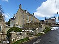
 Cotswold Village House, Winstone - geograph.org.uk - 525928.jpg 640 × 427 ; 116 kio
-
 Country road near Gaskill's Farm - geograph.org.uk - 2715438.jpg 1 024 × 680 ; 230 kio
-
 Croft Farmhouse, Winstone.jpg 4 000 × 3 000 ; 4,97 Mio
-
 Derelict building - geograph.org.uk - 3770696.jpg 800 × 450 ; 218 kio
-

-
 Entrance to Ashgrove Farm - geograph.org.uk - 2710607.jpg 1 024 × 680 ; 202 kio
-
 Farmland next to Ermin Way - geograph.org.uk - 1104941.jpg 640 × 427 ; 80 kio
-
 Flytip^ - geograph.org.uk - 2715454.jpg 1 024 × 680 ; 309 kio
-
 Forestry operations - geograph.org.uk - 5847025.jpg 1 200 × 1 800 ; 492 kio
-
 Fosse Lodge - geograph.org.uk - 1104937.jpg 640 × 427 ; 84 kio
-
 Gatehouse, Misarden Park - geograph.org.uk - 3771486.jpg 800 × 600 ; 291 kio
-
 High Cottages, Winstone 01.jpg 4 000 × 3 000 ; 4,78 Mio
-
 High Cottages, Winstone 02.jpg 4 000 × 3 000 ; 4,38 Mio
-
 Highwayman Inn, Elkstone - geograph.org.uk - 3410717.jpg 640 × 480 ; 413 kio
-
 Into the valley bottom - geograph.org.uk - 1105019.jpg 427 × 640 ; 112 kio
-
 Junction on the old A417 - geograph.org.uk - 2761644.jpg 1 024 × 680 ; 216 kio
-
 Lodge to Miserden Park - geograph.org.uk - 2715444.jpg 1 024 × 680 ; 221 kio
-
 Manor Farmhouse, Winstone.jpg 4 000 × 3 000 ; 4,89 Mio
-
 Misarden Park Lake - geograph.org.uk - 5846492.jpg 1 600 × 988 ; 382 kio
-
 New road from the old - geograph.org.uk - 1104959.jpg 640 × 427 ; 99 kio
-
 Old Ermin Way - geograph.org.uk - 1104915.jpg 640 × 427 ; 105 kio
-
 Old Ermin Way - geograph.org.uk - 1104929.jpg 640 × 427 ; 75 kio
-
 Old Pub. (The New Inn) - geograph.org.uk - 1539331.jpg 616 × 640 ; 108 kio
-
 Ordnance Survey Bench Mark - geograph.org.uk - 6390792.jpg 576 × 1 024 ; 252 kio
-
 Pot hole^ - geograph.org.uk - 1515797.jpg 640 × 480 ; 131 kio
-
 Reservoir Cot Abbey - geograph.org.uk - 1554004.jpg 640 × 480 ; 109 kio
-
 River Frome - geograph.org.uk - 5847020.jpg 1 600 × 1 067 ; 448 kio
-
 Road near Cotswold Park - geograph.org.uk - 2761632.jpg 1 024 × 680 ; 247 kio
-
 Road past Gaskill's Farm - geograph.org.uk - 2710616.jpg 1 024 × 680 ; 188 kio
-
 Road to village from The Church - geograph.org.uk - 1539318.jpg 640 × 480 ; 84 kio
-
 Rumble strips, Pike Road - geograph.org.uk - 3770699.jpg 800 × 450 ; 265 kio
-
 School Hill, Winstone - geograph.org.uk - 3771474.jpg 800 × 450 ; 250 kio
-
 School Hill, Winstone - geograph.org.uk - 5357281.jpg 640 × 360 ; 69 kio
-
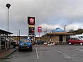
 Services on the A417, southbound - geograph.org.uk - 1635813.jpg 640 × 480 ; 98 kio
-
 Sinister, dexter, sinister, dexter ... - geograph.org.uk - 1104954.jpg 427 × 640 ; 75 kio
-
 St Bartholomew and Manor Farm, Winstone - geograph.org.uk - 5357261.jpg 640 × 360 ; 95 kio
-
 St Bartholomew and Manor Farm, Winstone - geograph.org.uk - 5357267.jpg 640 × 360 ; 84 kio
-
 St Bartholomew's church, Winstone - geograph.org.uk - 5357255.jpg 640 × 360 ; 49 kio
-
 St Bartholomew's Church, Winstone - geograph.org.uk - 6390790.jpg 1 024 × 576 ; 266 kio
-
 St. Bartholomew's church, Winstone - geograph.org.uk - 3770703.jpg 800 × 600 ; 328 kio
-
 St. Bartholomew's church, Winstone - interior - geograph.org.uk - 3771463.jpg 800 × 451 ; 192 kio
-
 The Arkell's stagecoach - geograph.org.uk - 1104877.jpg 640 × 427 ; 67 kio
-
 The bottom of the valley - geograph.org.uk - 1554017.jpg 640 × 480 ; 123 kio
-
 The centre of Winstone - geograph.org.uk - 5357277.jpg 640 × 360 ; 68 kio
-
 The colours of autumn - geograph.org.uk - 4266159.jpg 800 × 531 ; 178 kio
-
 The Highway Man Inn - geograph.org.uk - 3690237.jpg 3 642 × 1 810 ; 1,55 Mio
-
 The Highwayman - geograph.org.uk - 1105854.jpg 640 × 426 ; 45 kio
-
 The Highwayman and Arkell's Stagecoach - geograph.org.uk - 3770693.jpg 800 × 450 ; 216 kio
-
 The Highwayman Inn and A417, Elkstone - geograph.org.uk - 2811758.jpg 640 × 480 ; 67 kio
-
 The Notch - geograph.org.uk - 1553998.jpg 640 × 531 ; 113 kio
-

-
 The Old Salt Way from Winstone towards Smiths X - geograph.org.uk - 1539164.jpg 640 × 480 ; 112 kio
-
 The valley bottom - geograph.org.uk - 1105028.jpg 640 × 427 ; 79 kio
-
 Track into Shewell Wood - geograph.org.uk - 1105016.jpg 640 × 427 ; 104 kio
-
 Track past Selscombe Wood - geograph.org.uk - 1105011.jpg 640 × 427 ; 123 kio
-
 Tree-line road to Winstone - geograph.org.uk - 2715448.jpg 1 024 × 680 ; 315 kio
-
 Trees beside a country road - geograph.org.uk - 2715434.jpg 680 × 1 024 ; 280 kio
-
 Valley below Cotswold Park - geograph.org.uk - 4268319.jpg 800 × 531 ; 156 kio
-
 View to Winstone - geograph.org.uk - 2715440.jpg 1 024 × 680 ; 222 kio
-
 Winstone radio mast - geograph.org.uk - 1104892.jpg 640 × 427 ; 60 kio
-
 Winstone Radio Mast - geograph.org.uk - 170597.jpg 426 × 640 ; 122 kio
-
 Winstone Radio Station - geograph.org.uk - 3770698.jpg 800 × 450 ; 267 kio
-

-
 Woodland on Winstone Hill - geograph.org.uk - 2712961.jpg 1 024 × 680 ; 369 kio
-
 A417 services - geograph.org.uk - 1104972.jpg 640 × 427 ; 52 kio
-
 Broad Ride - geograph.org.uk - 321719.jpg 640 × 480 ; 118 kio
-
 In Cotswold Park - geograph.org.uk - 311517.jpg 640 × 480 ; 151 kio
-
 Sapperton Triangulation Pillar. - geograph.org.uk - 354292.jpg 640 × 480 ; 127 kio
-
 Services on the A417 - geograph.org.uk - 170226.jpg 640 × 426 ; 105 kio
-
 The valley bottom - geograph.org.uk - 311489.jpg 640 × 480 ; 97 kio
-
 Trig point detail - geograph.org.uk - 321721.jpg 427 × 640 ; 113 kio
-
 Winstone Radio Station - geograph.org.uk - 130915.jpg 640 × 479 ; 46 kio


_-_geograph.org.uk_-_1539331.jpg)


