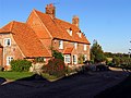
Category:Winterbourne, Berkshire
Aller à la navigation
Aller à la recherche
English: Winterbourne is a small village and civil parish in the English county of Berkshire, located at .
village britannique (Berkshire)  | |||||
| Téléverser des médias | |||||
| Nature de l’élément | |||||
|---|---|---|---|---|---|
| Lieu | West Berkshire, Berkshire, Angleterre du Sud-Est, Angleterre | ||||
 | |||||
Sous-catégories
Cette catégorie comprend seulement la sous-catégorie ci-dessous.
W
Média dans la catégorie « Winterbourne, Berkshire »
Cette catégorie comprend 180 fichiers, dont les 180 ci-dessous.
-
 A glimpse of Winterbourne Holt - geograph.org.uk - 4191158.jpg 640 × 480 ; 140 kio
-
 An unwell tree near Winterbourne - geograph.org.uk - 5933326.jpg 3 880 × 3 102 ; 1,47 Mio
-
 Arable land by the B4494 - geograph.org.uk - 4875367.jpg 1 600 × 901 ; 788 kio
-
 Autumn in Winterbourne Wood - geograph.org.uk - 71358.jpg 450 × 600 ; 557 kio
-
 B4494 near North Heath - geograph.org.uk - 4875365.jpg 1 600 × 901 ; 662 kio
-
 Barn at Winterbourne Farm - geograph.org.uk - 597481.jpg 640 × 477 ; 72 kio
-
 Base of building, Snelsmore Common - geograph.org.uk - 4191181.jpg 640 × 480 ; 176 kio
-
 Behind the toilet block - geograph.org.uk - 2277738.jpg 640 × 427 ; 220 kio
-
 Beside the Stream - geograph.org.uk - 3915589.jpg 1 600 × 1 149 ; 634 kio
-
 Branches beside the Winterbourne - geograph.org.uk - 1804727.jpg 2 048 × 1 536 ; 1,42 Mio
-
 Brick shed - geograph.org.uk - 596530.jpg 477 × 640 ; 112 kio
-
 Bridleway towards Winterbourne - geograph.org.uk - 596517.jpg 640 × 477 ; 51 kio
-
 Byway from North Heath - geograph.org.uk - 1271526.jpg 640 × 480 ; 76 kio
-
 Byway looking east - geograph.org.uk - 596315.jpg 640 × 477 ; 103 kio
-
 Byway to Pope's Wood - geograph.org.uk - 2158492.jpg 640 × 480 ; 94 kio
-
 Byway west of B4494 - geograph.org.uk - 596313.jpg 640 × 477 ; 110 kio
-
 Clearing in Penclose Wood - geograph.org.uk - 4920490.jpg 4 000 × 3 000 ; 4,36 Mio
-
 Countryside near Penclose Farm - geograph.org.uk - 2293166.jpg 640 × 430 ; 36 kio
-
 Cowslips on the Verge - geograph.org.uk - 4920119.jpg 1 600 × 1 200 ; 898 kio
-
 Cyclist in the road through Winterbourne Wood - geograph.org.uk - 2457504.jpg 640 × 480 ; 132 kio
-
 Descent to Winterbourne - geograph.org.uk - 596525.jpg 640 × 477 ; 116 kio
-
 Dry Ford at Hazelhanger Farm - geograph.org.uk - 5349462.jpg 4 500 × 3 000 ; 7,26 Mio
-
 Easy for cycling - Snelsmore Common - geograph.org.uk - 2450204.jpg 640 × 480 ; 141 kio
-
 Farmhouse near Winterbourne - geograph.org.uk - 71365.jpg 640 × 480 ; 419 kio
-
 Farmland above Winterbourne - geograph.org.uk - 596523.jpg 640 × 477 ; 98 kio
-
 Farmland near Chieveley - geograph.org.uk - 39195.jpg 640 × 480 ; 202 kio
-
 Farmland near Winterbourne (geograph 4920478).jpg 4 000 × 3 000 ; 3,26 Mio
-
 Farmland near Winterbourne - geograph.org.uk - 596519.jpg 640 × 477 ; 59 kio
-
 Farmland north of the M4 - geograph.org.uk - 5777673.jpg 1 024 × 812 ; 238 kio
-
 Farmland, Winterbourne - geograph.org.uk - 2122412.jpg 640 × 480 ; 164 kio
-
 Farmland, Winterbourne - geograph.org.uk - 2122542.jpg 640 × 480 ; 158 kio
-
 Farmland, Winterbourne - geograph.org.uk - 2122583.jpg 640 × 480 ; 156 kio
-
 Farmland, Winterbourne - geograph.org.uk - 2122592.jpg 640 × 480 ; 163 kio
-
 Farmland, Winterbourne - geograph.org.uk - 2817110.jpg 640 × 480 ; 134 kio
-
 Farmland, Winterbourne - geograph.org.uk - 4374940.jpg 640 × 480 ; 184 kio
-
 Farmland, Winterbourne - geograph.org.uk - 936796.jpg 640 × 480 ; 154 kio
-
 Farmland, Winterbourne, Berkshire - geograph.org.uk - 4705324.jpg 3 337 × 3 329 ; 5,84 Mio
-
 Fire beater - Snelsmore Common - geograph.org.uk - 2376161.jpg 480 × 640 ; 104 kio
-
 Fire beater - Snelsmore Common - geograph.org.uk - 2450196.jpg 480 × 640 ; 108 kio
-
 Fire tower on Snelsmore Common - geograph.org.uk - 2277731.jpg 640 × 427 ; 174 kio
-
 Fire ^ Flood - geograph.org.uk - 4906739.jpg 2 763 × 3 256 ; 2,61 Mio
-
 Footpath towards Bussock Mayne - geograph.org.uk - 597488.jpg 640 × 477 ; 112 kio
-
 Forest fire watch tower - geograph.org.uk - 2451668.jpg 465 × 639 ; 73 kio
-
 From the Church to the Pub - geograph.org.uk - 4919480.jpg 4 000 × 3 000 ; 3,62 Mio
-
 Frozen Puddle Pattern - geograph.org.uk - 4800136.jpg 4 000 × 3 000 ; 6,2 Mio
-
 Gate on a path in Snelsmore Common Country Park - geograph.org.uk - 3739396.jpg 1 500 × 999 ; 358 kio
-
 Gazebo at Winterbourne Farm - geograph.org.uk - 3915560.jpg 1 600 × 1 200 ; 639 kio
-
 Green Lane Bridge, M4 - geograph.org.uk - 3655739.jpg 640 × 430 ; 39 kio
-
 Hawthorne Cottage, Winterbourne, Berkshire - geograph.org.uk - 4729155.jpg 640 × 468 ; 109 kio
-
 Hazelhanger Farm - geograph.org.uk - 4800116.jpg 4 000 × 3 000 ; 3,2 Mio
-
 Heathland, Snelsmore Common - geograph.org.uk - 4191133.jpg 640 × 480 ; 144 kio
-
 House on Winterbourne Road - geograph.org.uk - 5125342.jpg 1 990 × 1 454 ; 922 kio
-
 Junction with the B4494 - geograph.org.uk - 2158454.jpg 640 × 480 ; 70 kio
-
 Lane across Snelsmore Common - geograph.org.uk - 2450082.jpg 640 × 480 ; 148 kio
-
 Lane across Snelsmore Common - geograph.org.uk - 2450147.jpg 640 × 480 ; 146 kio
-
 Lane on Snelsmore Common - geograph.org.uk - 2450144.jpg 640 × 480 ; 155 kio
-
 Lane on Snelsmore Common - geograph.org.uk - 2450149.jpg 640 × 480 ; 144 kio
-
 Lane on Snelsmore Common - geograph.org.uk - 2450154.jpg 640 × 480 ; 141 kio
-
 Lane through Snelsmore Common - geograph.org.uk - 2450075.jpg 640 × 480 ; 144 kio
-
 Lane to Penclose Farm - geograph.org.uk - 2158481.jpg 640 × 480 ; 72 kio
-
 Lane to Winterbourne Holt - geograph.org.uk - 2376155.jpg 640 × 480 ; 139 kio
-
 Leafy path - Snelsmore Common - geograph.org.uk - 2450137.jpg 640 × 480 ; 171 kio
-
 Line of the Footpath at Mud Hall Cottage - geograph.org.uk - 71362.jpg 640 × 480 ; 402 kio
-
 Local map - Snelsmore Common - geograph.org.uk - 2450068.jpg 480 × 640 ; 101 kio
-
 Logpile in Mary Bayliss Wood - geograph.org.uk - 4795458.jpg 1 600 × 1 036 ; 960 kio
-
 Looking into the woods - geograph.org.uk - 2450152.jpg 640 × 480 ; 168 kio
-
 Lower Farm, Winterbourne - geograph.org.uk - 4920011.jpg 3 797 × 2 507 ; 2,65 Mio
-
 M4 lorries and footbridge - geograph.org.uk - 3630901.jpg 2 346 × 1 381 ; 1,65 Mio
-
 M4 westbound - geograph.org.uk - 3630897.jpg 2 196 × 1 323 ; 1,37 Mio
-
 M4 westbound near Pound Cottage - geograph.org.uk - 4240096.jpg 640 × 481 ; 42 kio
-
 M4, 1 mile to Junction 13 - geograph.org.uk - 3351988.jpg 640 × 324 ; 46 kio
-
 Minor road through farmland south of the M4 - geograph.org.uk - 5776690.jpg 1 024 × 794 ; 184 kio
-
 Near Penclose Farm - geograph.org.uk - 4920471.jpg 4 000 × 3 000 ; 3,73 Mio
-
 No high vehicles - geograph.org.uk - 2448420.jpg 640 × 480 ; 136 kio
-
 No Winterbourne this year (so far) - geograph.org.uk - 4800103.jpg 4 000 × 3 000 ; 4,54 Mio
-
 North Heath, Winterbourne - geograph.org.uk - 2122633.jpg 640 × 480 ; 165 kio
-
 Old AA sign. Winterbourne, Berkshire - geograph.org.uk - 5778889.jpg 850 × 1 024 ; 220 kio
-
 Old Stuff at Penclose Farm - geograph.org.uk - 4920102.jpg 4 000 × 3 000 ; 3,38 Mio
-
 Part of Winterbourne Village - geograph.org.uk - 3915522.jpg 1 024 × 768 ; 181 kio
-
 Path between the trees - geograph.org.uk - 3739403.jpg 999 × 1 500 ; 342 kio
-
 Path on Snelsmore Common - geograph.org.uk - 2376163.jpg 800 × 558 ; 135 kio
-
 Path on Snelsmore Common - geograph.org.uk - 2383251.jpg 640 × 480 ; 84 kio
-
 Path on Snelsmore Common - geograph.org.uk - 2450062.jpg 640 × 480 ; 152 kio
-
 Path on Snelsmore Common - geograph.org.uk - 2450159.jpg 640 × 480 ; 164 kio
-
 Path on Snelsmore Common - geograph.org.uk - 2450194.jpg 639 × 446 ; 98 kio
-
 Paths on Snelsmore Common - geograph.org.uk - 2450198.jpg 640 × 480 ; 155 kio
-
 Paved path - Snelsmore Common - geograph.org.uk - 2450199.jpg 640 × 480 ; 147 kio
-
 Paved path on Snelsmore Common - geograph.org.uk - 2376175.jpg 640 × 483 ; 127 kio
-
 Picnic area in Snelsmore Common Country Park - geograph.org.uk - 3739407.jpg 1 500 × 999 ; 284 kio
-
 Politics at Penclose Farm - geograph.org.uk - 4920109.jpg 1 600 × 949 ; 442 kio
-
 Pump house by Winterbourne Stream - geograph.org.uk - 4191215.jpg 640 × 480 ; 124 kio
-
 Rebuilding a Barn - geograph.org.uk - 4921003.jpg 3 314 × 2 188 ; 1,93 Mio
-
 Road beside the Winterbourne Stream - geograph.org.uk - 503403.jpg 640 × 480 ; 159 kio
-
 Road junction south of Winterbourne - geograph.org.uk - 2457511.jpg 640 × 480 ; 129 kio
-
 Sign on Snelsmore Common - geograph.org.uk - 2450212.jpg 480 × 640 ; 157 kio
-
 Snelsmore Common - geograph.org.uk - 2276505.jpg 415 × 640 ; 208 kio
-
 Snelsmore Common - geograph.org.uk - 2276510.jpg 640 × 446 ; 258 kio
-
 Snelsmore Common - geograph.org.uk - 2383242.jpg 640 × 480 ; 100 kio
-
 Snelsmore Common - geograph.org.uk - 2383245.jpg 640 × 480 ; 109 kio
-
 Snelsmore Common - geograph.org.uk - 2383248.jpg 640 × 480 ; 98 kio
-
 Snelsmore Common - geograph.org.uk - 2383249.jpg 640 × 480 ; 96 kio
-
 Snelsmore Common - geograph.org.uk - 2450058.jpg 640 × 480 ; 113 kio
-
 Snelsmore Common - geograph.org.uk - 2450161.jpg 640 × 480 ; 168 kio
-
 Snelsmore Common - geograph.org.uk - 2450202.jpg 640 × 482 ; 142 kio
-
 Snelsmore Common - geograph.org.uk - 2450209.jpg 640 × 480 ; 81 kio
-
 Snelsmore Common - geograph.org.uk - 2450210.jpg 640 × 480 ; 163 kio
-
 Snelsmore Common - geograph.org.uk - 5632565.jpg 1 599 × 2 399 ; 853 kio
-
 Snelsmore Common Country Park - geograph.org.uk - 2276519.jpg 640 × 508 ; 273 kio
-
 Snelsmore Common is wet - geograph.org.uk - 2277735.jpg 495 × 640 ; 273 kio
-
 Snelsmore Common Valley Mire - geograph.org.uk - 2214396.jpg 2 560 × 1 920 ; 1,26 Mio
-
 Snelsmore Common, Winterbourne - geograph.org.uk - 2122660.jpg 640 × 480 ; 175 kio
-
 Spash of blue on Snelsmore Common - geograph.org.uk - 2450071.jpg 640 × 480 ; 179 kio
-

-
 Start of a restricted byway - geograph.org.uk - 2450141.jpg 640 × 480 ; 160 kio
-
 T-junction with the B4494 - geograph.org.uk - 2457514.jpg 640 × 480 ; 71 kio
-
 The centre of Winterbourne - geograph.org.uk - 5065729.jpg 2 048 × 1 536 ; 1,58 Mio
-
 The centre of Winterbourne - geograph.org.uk - 5065730.jpg 2 048 × 1 536 ; 1,13 Mio
-
 The lone larch, Snelsmore Common - geograph.org.uk - 1068050.jpg 640 × 428 ; 59 kio
-
 The Orange Way after Wiltshire (67) - geograph.org.uk - 3506807.jpg 800 × 600 ; 159 kio
-
 The Orange Way after Wiltshire (68) - geograph.org.uk - 3506811.jpg 682 × 800 ; 180 kio
-
 The Orange Way after Wiltshire (69) - geograph.org.uk - 3506822.jpg 600 × 800 ; 156 kio
-
 The Orange Way after Wiltshire (70) - geograph.org.uk - 3506831.jpg 800 × 600 ; 167 kio
-
 The Orange Way after Wiltshire (71) - geograph.org.uk - 3506834.jpg 600 × 800 ; 154 kio
-
 The Orange Way after Wiltshire (72) - geograph.org.uk - 3506842.jpg 800 × 600 ; 219 kio
-
 The Orange Way after Wiltshire (73) - geograph.org.uk - 3506846.jpg 600 × 800 ; 209 kio
-
 The Orange Way after Wiltshire (74) - geograph.org.uk - 3506850.jpg 800 × 600 ; 214 kio
-
 The Orange Way after Wiltshire (75) - geograph.org.uk - 3506855.jpg 800 × 600 ; 102 kio
-
 The Orange Way after Wiltshire (76) - geograph.org.uk - 3506860.jpg 800 × 600 ; 182 kio
-
 The Orange Way after Wiltshire (77) - geograph.org.uk - 3506876.jpg 800 × 600 ; 102 kio
-
 The Orange Way after Wiltshire (78) - geograph.org.uk - 3506880.jpg 800 × 600 ; 149 kio
-
 The Winterbourne in the Road - geograph.org.uk - 3915602.jpg 1 600 × 1 262 ; 579 kio
-
 The Winterbourne leaves Chapel Wood - geograph.org.uk - 1804688.jpg 1 692 × 1 276 ; 723 kio
-
 The Winterbourne Stream - geograph.org.uk - 3915562.jpg 1 600 × 1 200 ; 643 kio
-
 The Winterbourne Stream - geograph.org.uk - 5775773.jpg 768 × 1 024 ; 305 kio
-
 The Winterbourne Stream in the Woods - geograph.org.uk - 3916997.jpg 1 024 × 768 ; 340 kio
-
 Towards Winterbourne Holt - geograph.org.uk - 3915577.jpg 800 × 572 ; 114 kio
-
 Track in Snelsmore Common Country Park - geograph.org.uk - 3739392.jpg 1 500 × 999 ; 331 kio
-
 Track into Bussock Wood - geograph.org.uk - 2457521.jpg 640 × 480 ; 101 kio
-
 Track into Winterbourne Wood - geograph.org.uk - 4191397.jpg 640 × 480 ; 193 kio
-
 Track through the farmyard, Penclose Farm - geograph.org.uk - 5808484.jpg 951 × 1 024 ; 168 kio
-
 Track, Snelsmore Common - geograph.org.uk - 4191187.jpg 640 × 480 ; 187 kio
-
 Unusual barn at Wyfield Manor Farm - geograph.org.uk - 596487.jpg 640 × 477 ; 76 kio
-
 View across Snelsmore Common - geograph.org.uk - 2383254.jpg 640 × 480 ; 78 kio
-
 View of Snelsmore Common - geograph.org.uk - 2376168.jpg 640 × 480 ; 85 kio
-
 View on Snelsmore Common - geograph.org.uk - 2450213.jpg 640 × 480 ; 89 kio
-

-
 Walking through the woods - geograph.org.uk - 2448425.jpg 640 × 480 ; 169 kio
-
 Wantage Road going under the M4 - geograph.org.uk - 5065727.jpg 2 048 × 1 536 ; 930 kio
-
 Warning sign, M4 - geograph.org.uk - 2293169.jpg 640 × 430 ; 36 kio
-
 West Berkshire , M4 Motorway - geograph.org.uk - 5725434.jpg 6 000 × 4 000 ; 7,78 Mio
-
 West Berkshire , M4 Motorway - geograph.org.uk - 5725435.jpg 6 000 × 4 000 ; 7,71 Mio
-
 Westbound M4 - geograph.org.uk - 6373377.jpg 1 024 × 512 ; 107 kio
-
 Westbound M4 - geograph.org.uk - 6373387.jpg 1 024 × 512 ; 140 kio
-
 Willows by the Winterbourne - geograph.org.uk - 3915568.jpg 1 024 × 708 ; 213 kio
-
 Barn at Penclose Farm - geograph.org.uk - 596444.jpg 640 × 477 ; 87 kio
-
 Winterbourne Farm Pumping Station - geograph.org.uk - 3915498.jpg 1 024 × 768 ; 207 kio
-
 Winterbourne Grain Store - geograph.org.uk - 4191199.jpg 640 × 480 ; 73 kio
-
 Winterbourne Manor OBH - geograph.org.uk - 4795425.jpg 4 000 × 3 000 ; 6,03 Mio
-
 Winterbourne Stream - geograph.org.uk - 2158443.jpg 640 × 480 ; 94 kio
-
 Winterbourne Stream - geograph.org.uk - 596527.jpg 477 × 640 ; 115 kio
-
 Winterbourne, Berkshire, Bourne Cottage - geograph.org.uk - 5778916.jpg 768 × 1 024 ; 151 kio
-
 Winterbourne, Berkshire, the village street - geograph.org.uk - 5775720.jpg 753 × 1 024 ; 183 kio
-
 Woodland - Snelsmore Common - geograph.org.uk - 2448422.jpg 640 × 480 ; 169 kio
-
 Woodland track, Winterbourne, Berkshire - geograph.org.uk - 4703802.jpg 4 585 × 4 000 ; 4,14 Mio
-
 Young woodland - Snelsmore Common - geograph.org.uk - 2450065.jpg 640 × 480 ; 184 kio
-
 Country Road near Snelsmore Common - geograph.org.uk - 73700.jpg 640 × 480 ; 134 kio
-
 Fallen Tree, Snelsmore Common Country Park - geograph.org.uk - 35407.jpg 640 × 480 ; 158 kio
-
 Farm buildings near Honeybottom - geograph.org.uk - 73694.jpg 640 × 480 ; 127 kio
-
 Farm near Boxford - geograph.org.uk - 71359.jpg 640 × 480 ; 468 kio
-
 Farm near Winterbourne - geograph.org.uk - 71363.jpg 450 × 600 ; 350 kio
-
 Farmland near Ogdown House, Chieveley - geograph.org.uk - 39200.jpg 640 × 480 ; 142 kio
-
 Farmland near Winterbourne - geograph.org.uk - 71375.jpg 640 × 480 ; 486 kio
-
 Hillside Pasture near Boxford - geograph.org.uk - 71361.jpg 640 × 480 ; 348 kio
-
 Horse riding through Winterbourne Wood - geograph.org.uk - 71360.jpg 640 × 480 ; 508 kio
-
 Lane to Penrose Farm - geograph.org.uk - 71377.jpg 640 × 480 ; 492 kio
-
 Pastoral Tranquility near Winterbourne - geograph.org.uk - 74101.jpg 640 × 480 ; 116 kio
-
 Track through Popes Wood - geograph.org.uk - 71367.jpg 640 × 480 ; 488 kio
-
 Trees on Farmland at Winterbourne - geograph.org.uk - 71373.jpg 640 × 480 ; 448 kio
-
 Verge and Farmland near North Heath - geograph.org.uk - 39194.jpg 640 × 480 ; 230 kio
-
 Winterbourne - geograph.org.uk - 53217.jpg 640 × 494 ; 164 kio


.jpg)


_-_geograph.org.uk_-_4800103.jpg)


_-_geograph.org.uk_-_3506807.jpg)
_-_geograph.org.uk_-_3506811.jpg)
_-_geograph.org.uk_-_3506822.jpg)
_-_geograph.org.uk_-_3506831.jpg)
_-_geograph.org.uk_-_3506834.jpg)
_-_geograph.org.uk_-_3506842.jpg)
_-_geograph.org.uk_-_3506846.jpg)
_-_geograph.org.uk_-_3506850.jpg)
_-_geograph.org.uk_-_3506855.jpg)
_-_geograph.org.uk_-_3506860.jpg)
_-_geograph.org.uk_-_3506876.jpg)
_-_geograph.org.uk_-_3506880.jpg)


