Category:Wishaw, Warwickshire
Aller à la navigation
Aller à la recherche
village britannique  | |||||
| Téléverser des médias | |||||
| Nature de l’élément | |||||
|---|---|---|---|---|---|
| Lieu | North Warwickshire, Warwickshire, Midlands de l'Ouest, Angleterre | ||||
| Population |
| ||||
| Superficie |
| ||||
 | |||||
English: Wishaw is a village and civil parish (as Wishaw and Moxhull) in the north-west of Warwickshire, England. It is located within the district of North Warwickshire and is the home of The Belfry golf club.
Article Wikipédia principal : Wishaw, Warwickshire.

Sous-catégories
Cette catégorie comprend 3 sous-catégories, dont les 3 ci-dessous.
Média dans la catégorie « Wishaw, Warwickshire »
Cette catégorie comprend 77 fichiers, dont les 77 ci-dessous.
-
 'Ad Your Wings Clipped ^ - geograph.org.uk - 2164107.jpg 2 816 × 2 112 ; 1,4 Mio
-
 A4091 crossed by power lines - geograph.org.uk - 2725065.jpg 640 × 480 ; 63 kio
-
 A4091 north of The Belfry roundabout - geograph.org.uk - 2725063.jpg 640 × 480 ; 54 kio
-
 A446 approaching The Belfry roundabout - geograph.org.uk - 2725059.jpg 640 × 480 ; 52 kio
-
 A446 at Grange Farm Cottages - geograph.org.uk - 2725060.jpg 640 × 480 ; 74 kio
-
 A446 Lichfield Road near the Belfry - geograph.org.uk - 4676527.jpg 800 × 698 ; 222 kio
-

-
 AA Rescue Box - geograph.org.uk - 3394903.jpg 1 200 × 1 600 ; 351 kio
-

-
 Car boot site has moved sign near The Belfry - geograph.org.uk - 3671840.jpg 1 024 × 768 ; 106 kio
-
 Car-Boot site near the Belfry Roundabout - geograph.org.uk - 2833878.jpg 640 × 428 ; 79 kio
-
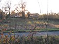 Church Farm, Wishaw - geograph.org.uk - 2164118.jpg 2 272 × 1 704 ; 1,38 Mio
-

-

-
 Farm building on Grove Lane - geograph.org.uk - 4676497.jpg 800 × 586 ; 151 kio
-
 Farm land and woodland near Wishaw, Warwickshire - geograph.org.uk - 1747486.jpg 640 × 437 ; 137 kio
-
 Farm land near Wishaw, Warwickshire - geograph.org.uk - 1747472.jpg 800 × 457 ; 302 kio
-
 Farmland north of Grove Lane - geograph.org.uk - 4676471.jpg 800 × 607 ; 170 kio
-
 Folly in the grounds of Moxhull Hall Hotel - geograph.org.uk - 5830151.jpg 1 600 × 1 194 ; 555 kio
-

-
 Footbridge over the M6 toll - geograph.org.uk - 4464329.jpg 3 413 × 1 777 ; 3 Mio
-
 Footbridge, M6 (Toll) - geograph.org.uk - 2661668.jpg 640 × 271 ; 28 kio
-
 Footpath near The Belfry - geograph.org.uk - 2164099.jpg 2 272 × 1 704 ; 1,54 Mio
-
 Gantry over the M6 Toll - geograph.org.uk - 4464323.jpg 2 046 × 1 286 ; 1,25 Mio
-
 Grove Lane Bridge, M6 (Toll) - geograph.org.uk - 2661663.jpg 640 × 430 ; 44 kio
-
 Holly Lane crosses the M6 Toll - geograph.org.uk - 3195447.jpg 4 608 × 2 423 ; 2,08 Mio
-
 How Did We Get Here ^ - geograph.org.uk - 2270421.jpg 1 600 × 898 ; 355 kio
-
 Junction of Grove Lane and Ryefield Lane - geograph.org.uk - 4676510.jpg 800 × 578 ; 146 kio
-
 Lakeside, M6 Toll near Wishaw - geograph.org.uk - 2164094.jpg 1 600 × 1 200 ; 576 kio
-
 Lane to Cuttle Mill Farm and Fishery - geograph.org.uk - 2833817.jpg 640 × 428 ; 89 kio
-
 Langley Mill MF radio station - geograph.org.uk - 2416838.jpg 1 280 × 959 ; 458 kio
-
 Long Shadows, Wishaw - geograph.org.uk - 2164115.jpg 2 272 × 1 704 ; 1,38 Mio
-
 Looking north along the M6 Toll Motorway - geograph.org.uk - 4676520.jpg 800 × 559 ; 96 kio
-
 M6 (Toll), heading south - geograph.org.uk - 2661676.jpg 640 × 430 ; 39 kio
-
 M6 Motorway Approaching Grove Lane Bridge - geograph.org.uk - 3673516.jpg 640 × 480 ; 226 kio
-
 M6 Toll - geograph.org.uk - 2416865.jpg 1 280 × 959 ; 507 kio
-
 M6 toll at Junction T2 - geograph.org.uk - 3703446.jpg 2 145 × 1 954 ; 752 kio
-
 M6 Toll near The Belfry - geograph.org.uk - 2826355.jpg 640 × 481 ; 28 kio
-
 M6 Toll Road (northbound) near Rye Farm - geograph.org.uk - 3673525.jpg 640 × 427 ; 212 kio
-
 M6 Toll Road (Southbound) - geograph.org.uk - 3673528.jpg 640 × 480 ; 244 kio
-
 M6 Toll Road near The Belfry - geograph.org.uk - 3673519.jpg 640 × 480 ; 221 kio
-
 M6 Toll Road, Exit at Junction T2 - geograph.org.uk - 3673076.jpg 640 × 480 ; 237 kio
-
 M6 Toll Road, Holly Lane Bridge - geograph.org.uk - 3673057.jpg 640 × 427 ; 219 kio
-
 M6 Toll Road, Southbound - geograph.org.uk - 3673041.jpg 640 × 480 ; 240 kio
-
 M6 Toll Road, Southbound - geograph.org.uk - 3673052.jpg 640 × 480 ; 222 kio
-
 M6 Toll Road, Southbound - geograph.org.uk - 3673070.jpg 640 × 480 ; 228 kio
-
 Middleton Lane meeting the A446 London Road - geograph.org.uk - 2833961.jpg 640 × 413 ; 43 kio
-
 Moxhull Wood Cottage - geograph.org.uk - 2416871.jpg 1 280 × 959 ; 608 kio
-

-
 Parallel lines - geograph.org.uk - 2415132.jpg 1 280 × 959 ; 678 kio
-
 Ryefield Lane, Wishaw - geograph.org.uk - 2164098.jpg 1 600 × 1 200 ; 735 kio
-
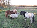 Saying Hello to the Locals - geograph.org.uk - 2164117.jpg 2 272 × 1 704 ; 1,67 Mio
-
 Slip road from M6 Toll to A446 - geograph.org.uk - 2413051.jpg 640 × 480 ; 69 kio
-
 Small lake next to the M6 Toll Motorway - geograph.org.uk - 4676505.jpg 800 × 547 ; 158 kio
-

-
 Surrounded by roses - geograph.org.uk - 5830161.jpg 1 600 × 1 194 ; 636 kio
-
-
 The Cock Inn - geograph.org.uk - 285572.jpg 640 × 417 ; 58 kio
-
 The Cock Inn - geograph.org.uk - 4676445.jpg 800 × 561 ; 123 kio
-
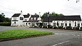 The Cock Inn - geograph.org.uk - 5491320.jpg 4 601 × 2 589 ; 2,63 Mio
-
 The Gravel and FP near The Belfry - geograph.org.uk - 2164101.jpg 2 272 × 1 704 ; 1,07 Mio
-
 The Gravel, M6 Toll Road - geograph.org.uk - 2164120.jpg 3 648 × 2 048 ; 2,62 Mio
-
 The Imaginary Oak Tree Farm - geograph.org.uk - 285953.jpg 480 × 640 ; 94 kio
-
 The M6 Toll runs under a footbridge - geograph.org.uk - 5985411.jpg 2 700 × 2 009 ; 325 kio
-
 The M6 Toll runs under Grove Lane - geograph.org.uk - 5985415.jpg 2 700 × 1 948 ; 291 kio
-
 The remains of an old church^ - geograph.org.uk - 5830153.jpg 1 600 × 1 194 ; 564 kio
-
 The remains of Oak Tree Farm ^ - geograph.org.uk - 285956.jpg 640 × 404 ; 90 kio
-
 The Wilderness - geograph.org.uk - 5520737.jpg 4 608 × 2 592 ; 2,5 Mio
-
 To The North West - geograph.org.uk - 3673511.jpg 640 × 427 ; 201 kio
-
 Tollbooth on the M6 Toll - geograph.org.uk - 2416859.jpg 1 280 × 959 ; 659 kio
-
 Where Does This Go To ^ - geograph.org.uk - 2270417.jpg 1 200 × 1 600 ; 706 kio
-
 Church Pit, Wishaw - geograph.org.uk - 285949.jpg 640 × 480 ; 136 kio
-
 Field at Wishaw - geograph.org.uk - 23642.jpg 610 × 458 ; 60 kio
-
 Grove End junction - geograph.org.uk - 270920.jpg 640 × 512 ; 92 kio
-
 North from Ox Leys Road - geograph.org.uk - 23640.jpg 610 × 458 ; 58 kio
-
 Signs - geograph.org.uk - 23643.jpg 610 × 458 ; 54 kio
-
 The Cock at Over Green - geograph.org.uk - 23641.jpg 610 × 458 ; 54 kio


_-_geograph.org.uk_-_2661668.jpg)


_-_geograph.org.uk_-_2661663.jpg)


,_heading_south_-_geograph.org.uk_-_2661676.jpg)


_near_Rye_Farm_-_geograph.org.uk_-_3673525.jpg)
_-_geograph.org.uk_-_3673528.jpg)


