Category:Witchampton
Aller à la navigation
Aller à la recherche
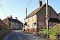
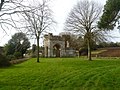
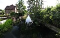
English: Witchampton is a village in East Dorset, England, situated on the River Allen five miles north of Wimborne Minster. The village has a population of 377 ..

village britannique  | |||||
| Téléverser des médias | |||||
| Nature de l’élément | |||||
|---|---|---|---|---|---|
| Lieu | Dorset, Angleterre du Sud-Ouest, Angleterre | ||||
| Réputé identique à | Witchampton (page en doublon, paroisse civile) | ||||
 | |||||
Sous-catégories
Cette catégorie comprend 3 sous-catégories, dont les 3 ci-dessous.
A
- Abbey House, Witchampton (8 F)
W
- Witchampton War Memorial (3 F)
Média dans la catégorie « Witchampton »
Cette catégorie comprend 166 fichiers, dont les 166 ci-dessous.
-
 A Roman road - geograph.org.uk - 5299418.jpg 640 × 480 ; 97 kio
-
 Bench Mark and sign, Witchampton - geograph.org.uk - 1938006.jpg 480 × 640 ; 209 kio
-
 Bend in the road - geograph.org.uk - 318597.jpg 480 × 640 ; 71 kio
-
 Bridge, Witchampton - geograph.org.uk - 1937978.jpg 640 × 480 ; 162 kio
-
 Bridleway to King Down - geograph.org.uk - 5299412.jpg 640 × 480 ; 224 kio
-
 Cottage, New Town - geograph.org.uk - 5162944.jpg 4 000 × 2 667 ; 1,94 Mio
-
 Cottages opposite the churchyard, Witchampton - geograph.org.uk - 6239824.jpg 1 024 × 683 ; 201 kio
-
 Cottages, Primrose Hill - geograph.org.uk - 5299432.jpg 640 × 480 ; 119 kio
-
 Cows feeding in New Town - geograph.org.uk - 591548.jpg 640 × 430 ; 146 kio
-
 Crossroads west of Witchampton - geograph.org.uk - 5299415.jpg 640 × 480 ; 99 kio
-
 Curved Wall, Lower Street, Witchampton - geograph.org.uk - 2831225.jpg 1 600 × 1 200 ; 734 kio
-

-
 Door, Ivy House - geograph.org.uk - 1149295.jpg 479 × 640 ; 122 kio
-
 Entrance to Hemsworth Farm and Manor - geograph.org.uk - 3389676.jpg 640 × 480 ; 84 kio
-
 Farm near Hemsworth - geograph.org.uk - 391025.jpg 640 × 430 ; 120 kio
-
 Farm track near Hemsworth - geograph.org.uk - 391033.jpg 430 × 640 ; 105 kio
-
 Finger-post, Sheephouse Drove - geograph.org.uk - 1940494.jpg 480 × 640 ; 109 kio
-
 Flour Mill House - Witchampton - geograph.org.uk - 600186.jpg 640 × 427 ; 142 kio
-
 Footpath and stile, King Down - geograph.org.uk - 1438405.jpg 640 × 480 ; 160 kio
-
 Footpath Bridge, South Of Witchampton - geograph.org.uk - 2831198.jpg 1 024 × 768 ; 241 kio
-
 Footpath, Witchampton - geograph.org.uk - 1285739.jpg 480 × 640 ; 154 kio
-
 Fountain, Witchampton - geograph.org.uk - 1285762.jpg 640 × 481 ; 218 kio
-
 Fountain, Witchampton - geograph.org.uk - 5299385.jpg 640 × 480 ; 234 kio
-
 Grass Footpath, Witchampton - geograph.org.uk - 2831215.jpg 1 600 × 1 200 ; 712 kio
-
 Hemsworth, postbox No. BH21 88 - geograph.org.uk - 1064153.jpg 640 × 480 ; 74 kio
-
 Houses in Witchampton - geograph.org.uk - 3390469.jpg 640 × 480 ; 66 kio
-
 Houses on Lower Street, Witchampton - geograph.org.uk - 5299374.jpg 640 × 428 ; 129 kio
-
 Ivy House, Witchampton - geograph.org.uk - 934182.jpg 640 × 480 ; 104 kio
-
 Lane towards King Down - geograph.org.uk - 5299405.jpg 640 × 480 ; 115 kio
-

-
 Manswood, bridleway - geograph.org.uk - 2464814.jpg 1 024 × 768 ; 347 kio
-
 Manswood, phone box - geograph.org.uk - 2464805.jpg 1 024 × 768 ; 330 kio
-
 Muddy Lane - geograph.org.uk - 317500.jpg 640 × 480 ; 80 kio
-
 Muddy path - geograph.org.uk - 317359.jpg 480 × 640 ; 96 kio
-
 New Town, cottages - geograph.org.uk - 2804088.jpg 1 024 × 768 ; 177 kio
-
 New Town, country lane - geograph.org.uk - 2804099.jpg 1 024 × 768 ; 198 kio
-
 New Town, gatehouse - geograph.org.uk - 2804116.jpg 1 024 × 764 ; 266 kio
-
 New Town, gates - geograph.org.uk - 2804224.jpg 1 024 × 758 ; 300 kio
-
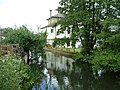
 New Town, River Allen - geograph.org.uk - 2804043.jpg 1 024 × 768 ; 232 kio
-
 Newtown, footpath - geograph.org.uk - 2804033.jpg 1 024 × 768 ; 277 kio
-
 Nicky House Cottage - geograph.org.uk - 5299426.jpg 640 × 480 ; 125 kio
-
 NT sign Boundary Drove - geograph.org.uk - 317375.jpg 640 × 480 ; 146 kio
-
 Old Bridge Marker on Witchampton Bridge, Witchampton Lane (geograph 6072028).jpg 800 × 600 ; 183 kio
-
 Old Bridge Marker on Witchampton Bridge, Witchampton Lane (geograph 6094070).jpg 800 × 600 ; 143 kio
-

-

-
 Pamphill, stile - geograph.org.uk - 3457056.jpg 1 024 × 768 ; 152 kio
-
 Pines in Barley - geograph.org.uk - 5162931.jpg 5 184 × 3 456 ; 1,85 Mio
-
 Postbox in New Town - geograph.org.uk - 466211.jpg 640 × 602 ; 163 kio
-
 Recycling area, Witchampton - geograph.org.uk - 1285746.jpg 640 × 480 ; 104 kio
-
 River Allen, New Town - geograph.org.uk - 5162957.jpg 5 060 × 3 192 ; 2,08 Mio
-
 River Allen, Witchampton - geograph.org.uk - 1938057.jpg 640 × 480 ; 214 kio
-
 Road junction, Sheephouse Drove - geograph.org.uk - 1940259.jpg 640 × 480 ; 92 kio
-
 Road to Dean Leaze Farm - geograph.org.uk - 156464.jpg 640 × 481 ; 77 kio
-
 Roman Cross Roads - geograph.org.uk - 3390452.jpg 640 × 480 ; 62 kio
-
 Sign detail, Sheephouse Drove - geograph.org.uk - 1940514.jpg 480 × 640 ; 86 kio
-
 Sign, Witchampton Lane - geograph.org.uk - 1938042.jpg 640 × 480 ; 157 kio
-
 Sports ground Witchampton Dorset - geograph.org.uk - 187812.jpg 640 × 480 ; 142 kio
-
 St Mary's Church, Witchampton - geograph.org.uk - 6239823.jpg 1 024 × 683 ; 231 kio
-
 Stile and footpath near Witchampton - geograph.org.uk - 1285806.jpg 640 × 481 ; 131 kio
-
 Stile, South Of Witchampton - geograph.org.uk - 2831207.jpg 1 024 × 768 ; 287 kio
-
 Tarrant Rushton, bridleway - geograph.org.uk - 4768446.jpg 1 024 × 768 ; 144 kio
-
 Tarrant Rushton, horse jump - geograph.org.uk - 4768406.jpg 1 024 × 768 ; 147 kio
-
 Tarrant Rushton, trough - geograph.org.uk - 4768459.jpg 1 024 × 768 ; 140 kio
-
 Telephone box, Witchampton - geograph.org.uk - 1149287.jpg 482 × 640 ; 116 kio
-
 Thatched cottage in New Town - geograph.org.uk - 466231.jpg 640 × 480 ; 96 kio
-
 The Watermill - Witchampton - geograph.org.uk - 600191.jpg 640 × 465 ; 188 kio
-
 Track Junction, Dean Hill - geograph.org.uk - 2836929.jpg 1 600 × 1 200 ; 596 kio
-
 Track to Dean Farm - geograph.org.uk - 3390437.jpg 640 × 480 ; 41 kio
-
 Track towards Dean Farm - geograph.org.uk - 2836922.jpg 1 024 × 768 ; 212 kio
-
 War memorial in the churchyard at Witchampton - geograph.org.uk - 6239826.jpg 1 024 × 683 ; 217 kio
-
 Water Management - River Allen at New Town - geograph.org.uk - 657137.jpg 430 × 640 ; 164 kio
-
 Watermill wheel pit - Witchampton - geograph.org.uk - 600192.jpg 427 × 640 ; 169 kio
-
 Weather vane, Witchampton - geograph.org.uk - 934186.jpg 640 × 480 ; 25 kio
-
 Witchampton - geograph.org.uk - 3390489.jpg 640 × 480 ; 99 kio
-
 Witchampton - geograph.org.uk - 61746.jpg 640 × 480 ; 61 kio
-
 Witchampton - geograph.org.uk - 61747.jpg 640 × 480 ; 60 kio
-
 Witchampton Bridge - geograph.org.uk - 2800858.jpg 1 024 × 768 ; 244 kio
-
 Witchampton Club ^ Shop - geograph.org.uk - 2801042.jpg 1 024 × 768 ; 153 kio
-
 Witchampton cottage ca 1980 - geograph.org.uk - 3826243.jpg 1 024 × 639 ; 1,02 Mio
-
 Witchampton Garage - geograph.org.uk - 2804265.jpg 1 024 × 759 ; 155 kio
-
 Witchampton Sports Ground - geograph.org.uk - 2804131.jpg 1 024 × 768 ; 177 kio
-
 Witchampton Village Hall - geograph.org.uk - 2800960.jpg 1 024 × 768 ; 157 kio
-
 Witchampton, archway of Crichel House - geograph.org.uk - 539992.jpg 640 × 439 ; 120 kio
-
 Witchampton, barn - geograph.org.uk - 4768399.jpg 1 024 × 768 ; 135 kio
-
 Witchampton, bridleway - geograph.org.uk - 4768440.jpg 1 024 × 769 ; 218 kio
-
 Witchampton, cattle grazing - geograph.org.uk - 4768390.jpg 1 024 × 769 ; 123 kio
-
 Witchampton, cattle grazing - geograph.org.uk - 4768431.jpg 1 024 × 768 ; 139 kio
-
 Witchampton, churchyard - geograph.org.uk - 2800996.jpg 1 024 × 768 ; 234 kio
-
 Witchampton, cottages - geograph.org.uk - 539983.jpg 640 × 448 ; 92 kio
-
 Witchampton, country lane - geograph.org.uk - 3457219.jpg 1 024 × 768 ; 180 kio
-
 Witchampton, Crichel Lane - geograph.org.uk - 2804916.jpg 1 024 × 768 ; 225 kio
-
 Witchampton, cropland - geograph.org.uk - 3457207.jpg 1 024 × 768 ; 253 kio
-

-
 Witchampton, drain - geograph.org.uk - 3456862.jpg 1 024 × 759 ; 177 kio
-
 Witchampton, farm entrance - geograph.org.uk - 2804914.jpg 1 024 × 768 ; 191 kio
-
 Witchampton, first school - geograph.org.uk - 2801223.jpg 1 024 × 768 ; 136 kio
-
 Witchampton, Flour Mill House - geograph.org.uk - 2800874.jpg 1 024 × 768 ; 197 kio
-
 Witchampton, footbridge and stiles - geograph.org.uk - 3456883.jpg 1 024 × 768 ; 164 kio
-
 Witchampton, footpath - geograph.org.uk - 3456805.jpg 768 × 1 024 ; 320 kio
-
 Witchampton, footpath - geograph.org.uk - 3456818.jpg 768 × 1 024 ; 192 kio
-
 Witchampton, footpath - geograph.org.uk - 4768382.jpg 1 024 × 768 ; 148 kio
-
 Witchampton, footpath - geograph.org.uk - 4768425.jpg 1 024 × 768 ; 153 kio
-
 Witchampton, gate - geograph.org.uk - 4768436.jpg 1 024 × 768 ; 222 kio
-
 Witchampton, Home Covert - geograph.org.uk - 3457141.jpg 1 024 × 768 ; 359 kio
-
 Witchampton, Ivy House - geograph.org.uk - 954021.jpg 640 × 480 ; 73 kio
-
 Witchampton, Lawrence Lane - geograph.org.uk - 2804254.jpg 1 024 × 768 ; 332 kio
-
 Witchampton, Malthouse Cottage - geograph.org.uk - 3456776.jpg 1 024 × 768 ; 180 kio
-
 Witchampton, Methodist church - geograph.org.uk - 1165551.jpg 640 × 488 ; 63 kio
-
 Witchampton, millstream - geograph.org.uk - 2800844.jpg 1 024 × 768 ; 316 kio
-
 Witchampton, New Town - geograph.org.uk - 2804052.jpg 1 024 × 768 ; 187 kio
-

-
 Witchampton, postbox No. BH21 16 - geograph.org.uk - 1405764.jpg 480 × 640 ; 101 kio
-
 Witchampton, Rest and Be Thankful - geograph.org.uk - 474187.jpg 640 × 429 ; 96 kio
-
 Witchampton, River Allen - geograph.org.uk - 2800833.jpg 1 024 × 768 ; 274 kio
-
 Witchampton, road junction - geograph.org.uk - 2800909.jpg 1 024 × 768 ; 189 kio
-
 Witchampton, road junction - geograph.org.uk - 3457196.jpg 1 024 × 768 ; 224 kio
-
 Witchampton, Roman road - geograph.org.uk - 3457085.jpg 768 × 1 024 ; 199 kio
-
 Witchampton, Roman road - geograph.org.uk - 3457154.jpg 768 × 1 024 ; 207 kio
-
 Witchampton, seating - geograph.org.uk - 2804918.jpg 1 024 × 768 ; 312 kio
-
 Witchampton, signpost at Sheephouse Drove - geograph.org.uk - 1064159.jpg 640 × 480 ; 72 kio
-
 Witchampton, stile - geograph.org.uk - 2800888.jpg 1 024 × 768 ; 222 kio
-
 Witchampton, stile - geograph.org.uk - 3456844.jpg 1 024 × 768 ; 276 kio
-
 Witchampton, street furniture - geograph.org.uk - 2801070.jpg 1 024 × 757 ; 245 kio
-
 Witchampton, the old old post office - geograph.org.uk - 539988.jpg 640 × 426 ; 86 kio
-

-
 Witchampton, the telephone box - geograph.org.uk - 3299587.jpg 640 × 480 ; 117 kio
-
 Witchampton, village street - geograph.org.uk - 2801205.jpg 1 024 × 768 ; 145 kio
-
 Zannies Coppice - geograph.org.uk - 318603.jpg 640 × 480 ; 88 kio
-
 Bradford Farm - geograph.org.uk - 318617.jpg 640 × 480 ; 102 kio
-
 Cottages in New Town - geograph.org.uk - 466176.jpg 640 × 480 ; 83 kio
-
 Crossroad - geograph.org.uk - 317431.jpg 480 × 640 ; 135 kio
-
 Downland beside Witchampton Lane - geograph.org.uk - 330740.jpg 640 × 430 ; 109 kio
-
 East of New Town - geograph.org.uk - 18947.jpg 640 × 481 ; 157 kio
-
 Farmland near Hemsworth - geograph.org.uk - 317517.jpg 640 × 480 ; 91 kio
-
 Follow the Roman Road from Sheephouse Drove - geograph.org.uk - 283944.jpg 480 × 640 ; 59 kio
-
 Footpath - geograph.org.uk - 318568.jpg 640 × 480 ; 127 kio
-
 Footpath end - geograph.org.uk - 318572.jpg 640 × 480 ; 144 kio
-
 Footpath gate - geograph.org.uk - 317484.jpg 640 × 480 ; 150 kio
-
 Footpath in Crichel Park - geograph.org.uk - 466323.jpg 640 × 480 ; 146 kio
-
 Footpath in New Town - geograph.org.uk - 466113.jpg 640 × 480 ; 123 kio
-
 Footpath near River Allen, New Town - geograph.org.uk - 466088.jpg 640 × 480 ; 141 kio
-
 Gate on woodland path Moor Crichel Dorset - geograph.org.uk - 187826.jpg 640 × 480 ; 162 kio
-
 Gatehouse New Town Dorset - geograph.org.uk - 187312.jpg 640 × 480 ; 111 kio
-
 Gatehouse New Town Dorset - geograph.org.uk - 187320.jpg 640 × 480 ; 119 kio
-
 Gatehouse to Crichel House - geograph.org.uk - 466284.jpg 640 × 480 ; 104 kio
-
 Hedge - geograph.org.uk - 317495.jpg 480 × 640 ; 103 kio
-
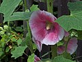 Hollyhock - geograph.org.uk - 466144.jpg 640 × 480 ; 75 kio
-
 Junction at Sheephouse Drove - geograph.org.uk - 283941.jpg 640 × 480 ; 63 kio
-
 Lane near Hemsworth - geograph.org.uk - 317503.jpg 640 × 480 ; 79 kio
-
 Lodge Cottage - geograph.org.uk - 466218.jpg 640 × 480 ; 151 kio
-
 Looking back towards Little Coppice - geograph.org.uk - 318586.jpg 480 × 640 ; 135 kio
-
 Looking towards Zannies Cottages - geograph.org.uk - 318580.jpg 480 × 640 ; 87 kio
-

-
 New Town - geograph.org.uk - 18945.jpg 640 × 481 ; 151 kio
-
 River Allen flowing to New Town - geograph.org.uk - 657138.jpg 640 × 430 ; 171 kio
-
 River Allen in the Crichel Estate - geograph.org.uk - 591544.jpg 640 × 430 ; 271 kio
-
 Road to Dean Farm Dairy - geograph.org.uk - 156461.jpg 640 × 481 ; 99 kio
-
 Sign Post to Witchampton - geograph.org.uk - 61745.jpg 640 × 480 ; 60 kio
-
 Signpost at Sheephouse Drove junction - geograph.org.uk - 283942.jpg 480 × 640 ; 87 kio
-
 Skyline Trees - geograph.org.uk - 466306.jpg 640 × 480 ; 84 kio
-
 Sluice Gates - River Allen at New Town - geograph.org.uk - 657134.jpg 640 × 430 ; 137 kio
-
 Snowdrops - geograph.org.uk - 317511.jpg 640 × 480 ; 158 kio
-
 Tributary of the River Allen - geograph.org.uk - 318608.jpg 480 × 640 ; 131 kio
-
 View towards River Allen from Witchampton Lane - geograph.org.uk - 330752.jpg 640 × 430 ; 114 kio
-
 White Gate - geograph.org.uk - 466317.jpg 640 × 480 ; 146 kio


.jpg)
.jpg)


