Category:Withcote
Aller à la navigation
Aller à la recherche
Cebuano: Withcote maoy parokya sa Hiniusang Gingharian. Ang Withcote nahimutang sa kondado sa Leicestershire ug apil sa nasod sa Inglatera, sa habagatan-sidlakang bahin sa nasod, km sa amihanan sa ulohang dakbayan London.
Cymraeg: Pentref a chymuned yn Lloegr ydy Withcote.
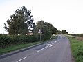
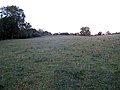
English: Withcote is a small parish comprising a number of scattered dwellings in Harborough , a local government district of Leicestershire. The population is included in the civil parish of Braunston-in-Rutland.
Polski: Withcote – wieś w Anglii, w hrabstwie Leicestershire, w dystrykcie Harborough. Leży 22 km na wschód od miasta Leicester i 135 km na północ od Londynu.
Svenska: Withcote är en parish i Storbritannien. Den ligger i grevskapet Leicestershire och riksdelen England, i den sydöstra delen av landet, km norr om huvudstaden London.
Article Wikipédia principal : Withcote.

localité britannique du comté anglais de Leicestershire  | |||||
| Téléverser des médias | |||||
| Nature de l’élément | |||||
|---|---|---|---|---|---|
| Lieu | Harborough, Leicestershire, Midlands de l'Est, Angleterre | ||||
 | |||||
Sous-catégories
Cette catégorie comprend 2 sous-catégories, dont les 2 ci-dessous.
W
- Withcote chapel (5 F)
- Withcote Hall (3 F)
Média dans la catégorie « Withcote »
Cette catégorie comprend 80 fichiers, dont les 80 ci-dessous.
-
 After the harvest - geograph.org.uk - 2562091.jpg 1 024 × 683 ; 251 kio
-
 Barn near Withcote Hall - geograph.org.uk - 2552443.jpg 640 × 480 ; 92 kio
-
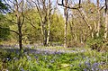 Bluebells in Launde Big Wood - geograph.org.uk - 168303.jpg 640 × 421 ; 158 kio
-
 Castle Hill near the River Chater - geograph.org.uk - 4167099.jpg 1 600 × 1 078 ; 327 kio
-
 Cattle trough near the site of Sauvey Castle - geograph.org.uk - 4167136.jpg 1 279 × 1 600 ; 700 kio
-

-
 Electric fence step over - geograph.org.uk - 3992539.jpg 800 × 600 ; 265 kio
-
 Farm buildings at Withcote Hall - geograph.org.uk - 6358257.jpg 3 776 × 2 520 ; 1,93 Mio
-
 Farm vehicles on the move from front - geograph.org.uk - 5935711.jpg 640 × 481 ; 105 kio
-
 Farm vehicles on the move from rear - geograph.org.uk - 5935712.jpg 640 × 467 ; 108 kio
-
 Farmland near the site of Sauvey Castle - geograph.org.uk - 4167144.jpg 1 600 × 1 246 ; 624 kio
-
 Footpath and Fire Hydrant signs - geograph.org.uk - 5935578.jpg 640 × 522 ; 76 kio
-
 Footpath towards Braunstone - geograph.org.uk - 5935713.jpg 640 × 471 ; 82 kio
-
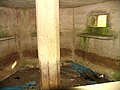 Interior of pillbox at Withcote - geograph.org.uk - 2593862.jpg 640 × 480 ; 76 kio
-
 Lake at Withcote Hall - geograph.org.uk - 2552430.jpg 640 × 480 ; 82 kio
-
 Launde Big Wood - geograph.org.uk - 601081.jpg 640 × 435 ; 43 kio
-
 Launde Big Wood, with derelict cottage - geograph.org.uk - 168431.jpg 640 × 421 ; 80 kio
-

-
 Looking across the valley of the River Chater - geograph.org.uk - 6358284.jpg 3 776 × 2 520 ; 1,28 Mio
-
 Oakham Road - geograph.org.uk - 2593860.jpg 640 × 504 ; 118 kio
-
 Owston Woods - geograph.org.uk - 205533.jpg 640 × 480 ; 127 kio
-
 Pill Box - geograph.org.uk - 183176.jpg 640 × 451 ; 72 kio
-
 Pill box near Sauvey Castle Farm - geograph.org.uk - 2552414.jpg 640 × 480 ; 69 kio
-
 Sauvey Castle plan.png 2 187 × 1 866 ; 1 020 kio
-
 Sauvey Castle.jpg 1 200 × 797 ; 731 kio
-
 Severn Trent cover - geograph.org.uk - 5935580.jpg 640 × 472 ; 118 kio
-
 Severn Trent covers - geograph.org.uk - 5935581.jpg 640 × 528 ; 168 kio
-
 Severn Trent Fire Hydrant cover - geograph.org.uk - 5935582.jpg 640 × 437 ; 129 kio
-
 Severn Trent meter cover - geograph.org.uk - 5935583.jpg 640 × 468 ; 139 kio
-
 Site of Sauvey Castle - geograph.org.uk - 4167128.jpg 1 600 × 1 222 ; 520 kio
-
 Site of Sauvey Castle - geograph.org.uk - 4167132.jpg 1 600 × 1 200 ; 644 kio
-
 Speed limit for a bend - geograph.org.uk - 2552409.jpg 640 × 480 ; 88 kio
-
 STWBB Stop Valve cover - geograph.org.uk - 5935579.jpg 640 × 416 ; 124 kio
-
 Towards Castle Hill - geograph.org.uk - 2593861.jpg 640 × 480 ; 108 kio
-
 Towards Launde Abbey - geograph.org.uk - 5935585.jpg 640 × 469 ; 86 kio
-
 Towards Oakham Road - geograph.org.uk - 2593863.jpg 640 × 467 ; 114 kio
-
 Towards Withcote Hall - geograph.org.uk - 3591403.jpg 640 × 468 ; 50 kio
-
 Track towards Braunston-in-Rutland - geograph.org.uk - 3349679.jpg 640 × 477 ; 65 kio
-
 Type 22 concrete pillbox at Withcote - geograph.org.uk - 2593864.jpg 640 × 421 ; 64 kio
-
 Type 22 concrete pillbox at Withcote - geograph.org.uk - 2593865.jpg 640 × 441 ; 68 kio
-
 What castle^ - geograph.org.uk - 2552406.jpg 640 × 480 ; 112 kio
-
 Wide track below Withcote Lodge - geograph.org.uk - 2562101.jpg 640 × 480 ; 101 kio
-
 Withcote Hall - geograph.org.uk - 2552427.jpg 640 × 480 ; 63 kio
-
 Withcote Lodge - geograph.org.uk - 2552226.jpg 1 024 × 768 ; 167 kio
-
 Withcote Lodge - geograph.org.uk - 3349659.jpg 640 × 436 ; 47 kio
-
 Withcote.jpg 640 × 424 ; 94 kio
-
 Bales - geograph.org.uk - 165828.jpg 640 × 480 ; 106 kio
-
 Bridleway to Launde Farm - geograph.org.uk - 208356.jpg 640 × 427 ; 90 kio
-
 Broad bridleway running east to Leigh Lodge - geograph.org.uk - 348363.jpg 640 × 480 ; 70 kio
-

-
 Brook Farm from Oakham Road - geograph.org.uk - 757698.jpg 640 × 531 ; 93 kio
-
 Countryside from Launde Big Wood - geograph.org.uk - 168297.jpg 640 × 426 ; 62 kio
-
 Dairy herd near Launde Abbey - geograph.org.uk - 600183.jpg 640 × 473 ; 84 kio
-
 Derelict cottage, Launde Big Wood - geograph.org.uk - 168432.jpg 640 × 421 ; 108 kio
-
 Entrance to College Farm - geograph.org.uk - 139063.jpg 640 × 480 ; 60 kio
-
 Entrance to Hill Farm - geograph.org.uk - 600202.jpg 640 × 444 ; 81 kio
-
 Farmland and Lane - geograph.org.uk - 522426.jpg 495 × 640 ; 131 kio
-
 Farmland near Launde Abbey - geograph.org.uk - 208368.jpg 640 × 427 ; 82 kio
-
 Farmland north of Owston Woods - geograph.org.uk - 757745.jpg 640 × 519 ; 85 kio
-
 Farmland south of Oakham Road - geograph.org.uk - 757702.jpg 640 × 464 ; 60 kio
-
 Fields - geograph.org.uk - 205513.jpg 640 × 480 ; 72 kio
-
 Fields with Launde Park Wood in the distance - geograph.org.uk - 352372.jpg 640 × 480 ; 87 kio
-
 Lane through Launde Park - geograph.org.uk - 600201.jpg 640 × 445 ; 117 kio
-
 Lane towards Launde Abbey, Leicestershire - geograph.org.uk - 600190.jpg 640 × 473 ; 107 kio
-
 Launde Park Wood - geograph.org.uk - 139750.jpg 640 × 480 ; 49 kio
-
 Leicestershire farmland - geograph.org.uk - 522448.jpg 640 × 500 ; 140 kio
-
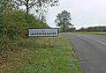 Leicestershire-Rutland border - geograph.org.uk - 600128.jpg 640 × 443 ; 95 kio
-
 Oakham Road junction, Rutland - geograph.org.uk - 600135.jpg 640 × 444 ; 93 kio
-
 Quad bikes this way - geograph.org.uk - 352357.jpg 640 × 480 ; 108 kio
-
 Ridge track to Ridlington - geograph.org.uk - 139806.jpg 640 × 480 ; 54 kio
-
 Robin - a - Tiptoe Hill - geograph.org.uk - 423660.jpg 640 × 480 ; 120 kio
-
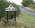 Rutland-Leicestershire border - geograph.org.uk - 600122.jpg 640 × 508 ; 133 kio
-
 Small pond north of Launde Abbey - geograph.org.uk - 600195.jpg 640 × 480 ; 129 kio
-
 Steep downwards hill - geograph.org.uk - 165827.jpg 640 × 480 ; 87 kio
-
 T junction - geograph.org.uk - 165825.jpg 640 × 385 ; 122 kio
-
 Towards Launde Abbey - geograph.org.uk - 352378.jpg 640 × 480 ; 103 kio
-
 View north across Rutland - geograph.org.uk - 347208.jpg 640 × 480 ; 69 kio
-
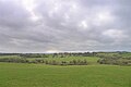
 View south across the upper Chater valley - geograph.org.uk - 348429.jpg 640 × 480 ; 64 kio
-
 Withcote Hall and Chapel - geograph.org.uk - 147912.jpg 640 × 575 ; 95 kio
-
 Withcote Lodge from the Leicestershire Round - geograph.org.uk - 347192.jpg 640 × 480 ; 64 kio


