Category:Witherley
Aller à la navigation
Aller à la recherche
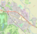
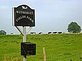
English: Witherley is a village and civil parish in the Hinckley and Bosworth district of Leicestershire, England. It is in the far south-west of Leicestershire. The Warwickshire/Leicestershire border runs along the parish boundary, along the River Anker to the west and the A5 to the south, with Witherley village close by the town of Atherstone and the village of Mancetter. One of its notable features is the church of St Peter, noted for its very tall steeple, "”. The village school is located next to the church - Witherley C of E primary school.
localité britannique du comté anglais de Leicestershire | |||||
| Téléverser des médias | |||||
| Nature de l’élément | |||||
|---|---|---|---|---|---|
| Lieu | Hinckley and Bosworth, Leicestershire, Midlands de l'Est, Angleterre | ||||
 | |||||
Sous-catégories
Cette catégorie comprend 4 sous-catégories, dont les 4 ci-dessous.
Média dans la catégorie « Witherley »
Cette catégorie comprend 149 fichiers, dont les 149 ci-dessous.
-
 A foggy country lane - geograph.org.uk - 5632376.jpg 1 600 × 900 ; 221 kio
-
 A walk between a hedge and a fence - geograph.org.uk - 5653773.jpg 1 600 × 900 ; 591 kio
-
 A44 northwards past Fenny Drayton - geograph.org.uk - 5181048.jpg 640 × 470 ; 120 kio
-
 A44 southwards from Fenny Drayton - geograph.org.uk - 5181049.jpg 640 × 483 ; 94 kio
-
 A444 approaching the A5 - geograph.org.uk - 4708530.jpg 640 × 426 ; 64 kio
-
 A444, Atherstone Rd - geograph.org.uk - 4708519.jpg 640 × 426 ; 64 kio
-
 A444, entering Fenny Drayton - geograph.org.uk - 4708524.jpg 640 × 426 ; 38 kio
-
 A444, southbound - geograph.org.uk - 4708512.jpg 640 × 426 ; 49 kio
-
 A444, southbound - geograph.org.uk - 4708521.jpg 640 × 426 ; 52 kio
-
 Approaching Ratcliffe Culey - geograph.org.uk - 2496824.jpg 3 496 × 2 657 ; 2 Mio
-
 Arable farmland near Hill Farm - geograph.org.uk - 5880622.jpg 1 024 × 683 ; 231 kio
-
 Atherstone & Mancetter map.png 1 077 × 987 ; 1,31 Mio
-
 Atherstone Road towards Atterton - geograph.org.uk - 5181052.jpg 640 × 442 ; 89 kio
-
 Atterton Road junction - geograph.org.uk - 3623840.jpg 3 996 × 2 844 ; 3,3 Mio
-
 Bench along Kennel Lane - geograph.org.uk - 3616847.jpg 4 000 × 3 000 ; 3,42 Mio
-
 Bench and notice board in Atterton - geograph.org.uk - 3623776.jpg 3 000 × 3 664 ; 3,67 Mio
-
 Bend in Mythe Lane - geograph.org.uk - 3621693.jpg 4 000 × 3 000 ; 3,46 Mio
-
 Bikers at the Atherstone Road junction - geograph.org.uk - 3610593.jpg 2 744 × 2 627 ; 2,36 Mio
-
 Bridge and stile - geograph.org.uk - 5181029.jpg 640 × 488 ; 199 kio
-
 Climbing Atterton Road near Hill Farm - geograph.org.uk - 3621937.jpg 3 762 × 2 984 ; 3,38 Mio
-
 Community notices along Kennel Lane - geograph.org.uk - 3616872.jpg 4 000 × 3 000 ; 3,49 Mio
-
 Construction machinery near Drayton Grange Farm - geograph.org.uk - 3615285.jpg 2 083 × 1 737 ; 1,13 Mio
-
 Cottages along Church Lane - geograph.org.uk - 3611881.jpg 4 000 × 3 000 ; 3,4 Mio
-
 Cows in a field near Atterton - geograph.org.uk - 3623770.jpg 2 561 × 2 013 ; 1,51 Mio
-
 Derelict Barn Farm - geograph.org.uk - 672066.jpg 640 × 388 ; 37 kio
-
 Derelict Barn Farm hidden in the trees - geograph.org.uk - 3616760.jpg 3 583 × 2 919 ; 2,96 Mio
-
 Disused gate onto farmland - geograph.org.uk - 3610569.jpg 3 104 × 2 482 ; 2,62 Mio
-
 Drayton Grange Farm sign - geograph.org.uk - 3615287.jpg 4 000 × 3 000 ; 3,43 Mio
-
 Drayton Lane - geograph.org.uk - 5654604.jpg 1 600 × 900 ; 336 kio
-
 Drayton Lane heading towards Fenny Drayton - geograph.org.uk - 3615255.jpg 3 015 × 2 497 ; 2,21 Mio
-
 Drayton Lane heading towards Fenny Drayton - geograph.org.uk - 3616747.jpg 4 000 × 3 000 ; 3,36 Mio
-
 Driveway to Drayton Grange Farm - geograph.org.uk - 3615281.jpg 3 858 × 2 829 ; 3,43 Mio
-
 Driveway to Hill Farm - geograph.org.uk - 5181624.jpg 640 × 474 ; 89 kio
-
 Driveway to Hill Farm - geograph.org.uk - 5880618.jpg 1 024 × 683 ; 218 kio
-
 Farmland along the A444 Atherstone Road - geograph.org.uk - 3623904.jpg 4 000 × 3 000 ; 5,06 Mio
-
 Farmland near Witherley - geograph.org.uk - 3616768.jpg 3 704 × 2 907 ; 3,32 Mio
-
 Farmland west of Fenny Drayton - geograph.org.uk - 3611842.jpg 3 723 × 2 930 ; 3,17 Mio
-
 Fenn Lanes eastwards - geograph.org.uk - 5181053.jpg 640 × 471 ; 94 kio
-
 Fenn Lanes eastwards - geograph.org.uk - 5181071.jpg 640 × 415 ; 102 kio
-
 Fenn Lanes westwards - geograph.org.uk - 5181054.jpg 640 × 486 ; 99 kio
-
 Fenn Lanes westwards - geograph.org.uk - 5181072.jpg 640 × 461 ; 105 kio
-
 Fenny Drayton from the West - geograph.org.uk - 863057.jpg 640 × 437 ; 52 kio
-
 Fenny Drayton Redgate Steak ^ Alehouse - geograph.org.uk - 2859010.jpg 640 × 480 ; 108 kio
-
 Fenny Drayton turning, A444 - geograph.org.uk - 4708528.jpg 640 × 426 ; 62 kio
-
 Fenny Drayton-Cottages - geograph.org.uk - 6138616.jpg 1 600 × 1 200 ; 504 kio
-
 Fenny Drayton-The Royal Redgate - geograph.org.uk - 6138620.jpg 1 600 × 1 091 ; 335 kio
-
 Field entrance - geograph.org.uk - 5181030.jpg 640 × 526 ; 165 kio
-
 Fields near Atterton Farm - geograph.org.uk - 3623772.jpg 3 690 × 2 816 ; 2,91 Mio
-
 Fields north of Fenn Lanes - geograph.org.uk - 5181055.jpg 640 × 483 ; 107 kio
-
 Fields south of Fenn Lanes - geograph.org.uk - 5181073.jpg 640 × 471 ; 105 kio
-
 Footbridge along Mythe Lane - geograph.org.uk - 3621668.jpg 2 766 × 2 363 ; 2 Mio
-
 Footpath signpost along Atterton Road - geograph.org.uk - 3621918.jpg 2 988 × 2 785 ; 2,5 Mio
-
 Footpath through the crops - geograph.org.uk - 3621902.jpg 4 000 × 3 000 ; 4,52 Mio
-
 Four ducks in Atterton - geograph.org.uk - 3623784.jpg 1 160 × 998 ; 418 kio
-
 Gas pipeline marker along Atterton Road - geograph.org.uk - 3623767.jpg 4 000 × 3 000 ; 4,86 Mio
-
 Gate onto farmland - geograph.org.uk - 3621969.jpg 4 000 × 3 000 ; 3,5 Mio
-
 Gates across the track to Barn Farm - geograph.org.uk - 3615299.jpg 4 000 × 3 000 ; 3,41 Mio
-
 Gateway opposite Willow Farm entrance - geograph.org.uk - 5181074.jpg 640 × 457 ; 101 kio
-
 Gateway to fields south of Fenn Lanes - geograph.org.uk - 5181056.jpg 640 × 466 ; 118 kio
-
 George Fox Lane, Fenny Drayton - geograph.org.uk - 3568790.jpg 640 × 480 ; 94 kio
-
 Heading east along Atterton Road - geograph.org.uk - 3621934.jpg 3 127 × 2 261 ; 2,42 Mio
-
 Heading north east along Atterton Road - geograph.org.uk - 3621928.jpg 4 000 × 3 000 ; 4,92 Mio
-
 Hill Farm - geograph.org.uk - 5181626.jpg 640 × 404 ; 60 kio
-
 Hill Farm in the distance - geograph.org.uk - 5464215.jpg 480 × 640 ; 46 kio
-
 Hill Farm sign - geograph.org.uk - 5181625.jpg 640 × 563 ; 59 kio
-
 House and footpath on the edge of Fenny Drayton - geograph.org.uk - 3611865.jpg 3 551 × 2 414 ; 2,86 Mio
-
 Houses on Ratcliffe House Lane - geograph.org.uk - 5181038.jpg 640 × 498 ; 81 kio
-
 Hunters Lane, Fenny Drayton - geograph.org.uk - 3568787.jpg 640 × 480 ; 51 kio
-
 Interior of All Saints Church - geograph.org.uk - 2496807.jpg 2 736 × 3 648 ; 2,59 Mio
-
 Islet in the Anker - geograph.org.uk - 3385185.jpg 1 333 × 1 000 ; 1,44 Mio
-
 Kennel Lane, Witherley - geograph.org.uk - 683355.jpg 640 × 430 ; 88 kio
-
 Lodge Farm driveway - geograph.org.uk - 5181050.jpg 640 × 470 ; 82 kio
-
 Lodge Farm sign - geograph.org.uk - 5181051.jpg 640 × 422 ; 80 kio
-
 Lodge Farm sign - geograph.org.uk - 5181622.jpg 640 × 406 ; 119 kio
-
 Looking south along the A444 Atherstone Road - geograph.org.uk - 3623894.jpg 4 000 × 3 000 ; 3,27 Mio
-
 Main Road sign - geograph.org.uk - 5181031.jpg 640 × 441 ; 148 kio
-
 Main Road sign - geograph.org.uk - 5181039.jpg 640 × 502 ; 158 kio
-
 Main Road towards Ratcliffe Culey - geograph.org.uk - 5181032.jpg 640 × 490 ; 122 kio
-
 Main Road towards Ratcliffe Culey - geograph.org.uk - 5181040.jpg 640 × 508 ; 85 kio
-
 Modern houses - geograph.org.uk - 5654603.jpg 1 600 × 900 ; 279 kio
-
 Monkey Puzzle tree in front of St Peter's - geograph.org.uk - 3385180.jpg 1 000 × 1 272 ; 1,04 Mio
-
 Muddy Track - geograph.org.uk - 1440014.jpg 480 × 640 ; 135 kio
-
 Mythe Lane bridge - geograph.org.uk - 3621680.jpg 4 000 × 3 000 ; 3,61 Mio
-
 Mythe Lane Cottage in Witherley - geograph.org.uk - 3616880.jpg 4 000 × 3 000 ; 4,87 Mio
-
 North along the A444 Atherstone Road - geograph.org.uk - 3623901.jpg 4 000 × 3 000 ; 4,95 Mio
-
 Passing place on Atterton Road - geograph.org.uk - 3621845.jpg 3 882 × 2 566 ; 3,03 Mio
-
 Passing place on Atterton Road - geograph.org.uk - 3621951.jpg 4 000 × 3 000 ; 4,64 Mio
-
 Pasture and cows at Kennel Farm - geograph.org.uk - 3621837.jpg 2 201 × 2 111 ; 1,41 Mio
-
 Phone box along Old Forge Road - geograph.org.uk - 3615220.jpg 3 118 × 2 393 ; 2,31 Mio
-
 Public footpath to Atterton - geograph.org.uk - 3623862.jpg 4 000 × 3 000 ; 3,53 Mio
-
 Quaker Close, Fenny Drayton - geograph.org.uk - 3568784.jpg 640 × 480 ; 69 kio
-
 Ratcliffe Bridge - geograph.org.uk - 1563769.jpg 640 × 480 ; 106 kio
-
 Ratcliffe Bridge - geograph.org.uk - 5181033.jpg 640 × 478 ; 122 kio
-
 Ratcliffe Bridge crosses the River Sence - geograph.org.uk - 4904853.jpg 800 × 600 ; 148 kio
-
 Ratcliffe Culey Main Road - geograph.org.uk - 6251536.jpg 1 600 × 1 067 ; 446 kio
-
 Ratcliffe House Lane sign - geograph.org.uk - 5181041.jpg 640 × 417 ; 100 kio
-
 River Sence at Ratcliffe Bridge - geograph.org.uk - 2496838.jpg 3 648 × 2 736 ; 3,43 Mio
-
 River Sence from Ratcliffe Bridge - geograph.org.uk - 684795.jpg 640 × 425 ; 105 kio
-
 Road to Lodge Farm from Sibson Road - geograph.org.uk - 5181623.jpg 640 × 495 ; 94 kio
-
 Roadside sign near Ratcliffe Bridge - geograph.org.uk - 5181034.jpg 640 × 538 ; 111 kio
-
 Roadside sign near Ratcliffe Bridge - geograph.org.uk - 5181035.jpg 640 × 578 ; 125 kio
-
 Roller in Field - geograph.org.uk - 1439994.jpg 640 × 480 ; 75 kio
-
 Sharp bend, A444 - geograph.org.uk - 4708515.jpg 640 × 351 ; 57 kio
-
 Sheep pasture near Ratcliffe Culey - geograph.org.uk - 2496798.jpg 3 428 × 2 531 ; 2,63 Mio
-
 Sibson from the air - geograph.org.uk - 2408648.jpg 480 × 640 ; 91 kio
-
 Sibson Road sign - geograph.org.uk - 5181042.jpg 640 × 406 ; 156 kio
-
 Sibson Road towards Ratcliffe Culey - geograph.org.uk - 5181044.jpg 640 × 462 ; 65 kio
-
 Sibson Road towards Sibson - geograph.org.uk - 5181043.jpg 640 × 476 ; 89 kio
-
 Sibson Road towards Sibson - geograph.org.uk - 5181045.jpg 640 × 464 ; 73 kio
-
 Springtime on the A444 - geograph.org.uk - 2895084.jpg 2 048 × 1 536 ; 601 kio
-
 Stile along the A444 Atherstone Road - geograph.org.uk - 3623860.jpg 3 568 × 2 873 ; 3,2 Mio
-
 Stream near Mythe Lane - geograph.org.uk - 3621687.jpg 2 925 × 2 843 ; 2,92 Mio
-
 The Blue Lion, Witherley - geograph.org.uk - 3385208.jpg 1 457 × 1 000 ; 1,08 Mio
-
 The Bull Inn - geograph.org.uk - 3835443.jpg 2 822 × 1 740 ; 2,26 Mio
-
 The Bull Inn, Witherley - geograph.org.uk - 683357.jpg 640 × 394 ; 57 kio
-
 The church and churchyard - geograph.org.uk - 5654600.jpg 1 600 × 900 ; 352 kio
-
 Tiger trap along Atterton Road - geograph.org.uk - 3621855.jpg 2 954 × 2 385 ; 2,14 Mio
-
 Towards Hill Farm - geograph.org.uk - 5181627.jpg 640 × 428 ; 91 kio
-

-
 Track to fields - geograph.org.uk - 5181037.jpg 640 × 512 ; 139 kio
-
 Tractor and car along Fenn Lanes - geograph.org.uk - 3610588.jpg 2 293 × 1 779 ; 1,29 Mio
-
 Tree along Upton Lane - geograph.org.uk - 3625481.jpg 3 151 × 2 525 ; 2,43 Mio
-
 Upton Lane westwards - geograph.org.uk - 5181058.jpg 640 × 468 ; 86 kio
-
 View towards St Peter's Church in Witherley - geograph.org.uk - 3615340.jpg 4 000 × 3 000 ; 3,31 Mio
-
 View towards Witherley Church - geograph.org.uk - 673091.jpg 640 × 500 ; 52 kio
-
 Wheat field at Hill Farm - geograph.org.uk - 3610575.jpg 4 000 × 3 000 ; 3,36 Mio
-
 Wheat field on the edge of Witherley - geograph.org.uk - 3616831.jpg 3 540 × 2 559 ; 2,42 Mio
-
 Wheat fields near Hill Farm - geograph.org.uk - 3610583.jpg 3 690 × 2 561 ; 2,56 Mio
-
 Willow Farm - geograph.org.uk - 5181628.jpg 640 × 398 ; 72 kio
-
 Willow Farm along Fenn Lanes - geograph.org.uk - 3610563.jpg 4 000 × 3 000 ; 4,96 Mio
-
 Willow Farm sign - geograph.org.uk - 5181629.jpg 640 × 478 ; 124 kio
-
 Witherely Mythe Lane Cottage.JPG 5 152 × 3 864 ; 5,37 Mio
-
 St Peters Avenue, Witherley - geograph.org.uk - 683354.jpg 640 × 398 ; 76 kio
-
 Witherley Blue Lion pub.JPG 4 884 × 3 518 ; 3,3 Mio
-
 Witherley House.JPG 3 607 × 2 705 ; 2,11 Mio
-
 Witherley in Leicestershire - geograph.org.uk - 683351.jpg 640 × 418 ; 98 kio
-
 Witherley Lodge Railings.JPG 1 681 × 1 109 ; 503 kio
-
 Witherley Lodge.JPG 3 280 × 2 496 ; 1,75 Mio
-
 Witherley Riverside - geograph.org.uk - 6251261.jpg 1 600 × 1 067 ; 560 kio
-
 Witherley the Old House.JPG 5 152 × 3 864 ; 6,1 Mio
-
 Witherley village sign - geograph.org.uk - 3616836.jpg 3 765 × 2 877 ; 3,26 Mio
-
 Witherley village sign along Mythe Lane - geograph.org.uk - 3621674.jpg 3 502 × 2 276 ; 2,27 Mio
-
 Atterton Lane, Witherley - geograph.org.uk - 260512.jpg 640 × 480 ; 130 kio
-
 Entering Leicestershire along Atherstone Road - geograph.org.uk - 672063.jpg 640 × 452 ; 82 kio
-
 Footpath to Atterton - geograph.org.uk - 260522.jpg 640 × 480 ; 132 kio
-
 Hill Farm - geograph.org.uk - 260527.jpg 640 × 480 ; 87 kio
-
 Kennel Farm along Atterton Lane - geograph.org.uk - 683349.jpg 640 × 406 ; 77 kio
-
 Stoke Road in Leicestershire - geograph.org.uk - 673152.jpg 640 × 479 ; 97 kio
-
 Witherley Fields Farm - geograph.org.uk - 260506.jpg 640 × 480 ; 77 kio


