Category:Wiveton
Aller à la navigation
Aller à la recherche
localité britannique du comté anglais de Norfolk  | |||||
| Téléverser des médias | |||||
| Nature de l’élément | |||||
|---|---|---|---|---|---|
| Lieu | North Norfolk, Norfolk, Angleterre de l'Est, Angleterre | ||||
| Superficie |
| ||||
 | |||||
Sous-catégories
Cette catégorie comprend 2 sous-catégories, dont les 2 ci-dessous.
M
W
- Wiveton Hall (11 F)
Média dans la catégorie « Wiveton »
Cette catégorie comprend 200 fichiers, dont les 200 ci-dessous.
-
 "Slow You Down" - geograph.org.uk - 5996430.jpg 3 456 × 2 592 ; 5,61 Mio
-
 A blown cannon barrel on Wiveton Green - geograph.org.uk - 1542045.jpg 640 × 480 ; 94 kio
-
 A close up of the jammed cannon ball - geograph.org.uk - 1542059.jpg 640 × 480 ; 101 kio
-
 A lane in Wiveton - geograph.org.uk - 2084291.jpg 640 × 480 ; 92 kio
-

-
 A149 at Cley-next-the-Sea village boundary - geograph.org.uk - 3618228.jpg 640 × 480 ; 53 kio
-
 A149 at Wiverton Hall Farm - geograph.org.uk - 3618227.jpg 640 × 480 ; 58 kio
-
 An attempt to hold back the sea at Cley - geograph.org.uk - 4196870.jpg 1 600 × 810 ; 293 kio
-
 Bell public house, Wiveton, 24th March 2009.JPG 2 560 × 1 920 ; 2,89 Mio
-
 Blakeney Esker - geograph.org.uk - 4998462.jpg 1 600 × 1 200 ; 696 kio
-
 Blakeney Esker SSSI - geograph.org.uk - 100092.jpg 640 × 480 ; 119 kio
-
 Blakeney Fresh marsh flooded - geograph.org.uk - 4057306.jpg 4 000 × 3 000 ; 3,72 Mio
-
 Bracken and foxgloves - geograph.org.uk - 841139.jpg 480 × 640 ; 201 kio
-
 Bridleway to Wiveton Downs - geograph.org.uk - 4907270.jpg 1 600 × 1 200 ; 562 kio
-
 By the Coast Road - geograph.org.uk - 4031065.jpg 640 × 430 ; 42 kio
-
 Cannon barrel, Wiveton - geograph.org.uk - 3149481.jpg 768 × 1 024 ; 372 kio
-
 Channel near Cley - geograph.org.uk - 4809863.jpg 1 920 × 1 280 ; 1 006 kio
-
 Church of St Mary the Virgin - Wiveton, Norfolk - geograph.org.uk - 5911420.jpg 1 024 × 787 ; 157 kio
-
 Cley across the reedbeds - geograph.org.uk - 4809712.jpg 1 920 × 1 208 ; 603 kio
-
 Cley across the reedbeds - geograph.org.uk - 4809756.jpg 1 920 × 1 280 ; 731 kio
-
 Cley from the coast path - geograph.org.uk - 4809869.jpg 2 527 × 1 718 ; 984 kio
-
 Cley Mill - geograph.org.uk - 3895024.jpg 640 × 430 ; 38 kio
-
 Cley Windmill - geograph.org.uk - 2585286.jpg 4 288 × 2 848 ; 5,02 Mio
-
 Cley Windmill - geograph.org.uk - 5367903.jpg 2 000 × 1 333 ; 2,1 Mio
-

-
 Coast path near Cley - geograph.org.uk - 4810803.jpg 1 920 × 1 129 ; 549 kio
-
 Coast Road (A149) - geograph.org.uk - 5559151.jpg 640 × 480 ; 64 kio
-
 Coastal Path by the flood wall - geograph.org.uk - 3894999.jpg 640 × 430 ; 53 kio
-
 Cottages near Wiveton Hall - geograph.org.uk - 3895022.jpg 640 × 430 ; 62 kio
-
 Cottages on Blakeney Road - geograph.org.uk - 841475.jpg 480 × 640 ; 140 kio
-
 Dining at Desmond's - Normal for Norfolk - geograph.org.uk - 5813370.jpg 4 686 × 3 472 ; 4,26 Mio
-
 Ditch, Fresh Marshes - geograph.org.uk - 3888440.jpg 640 × 430 ; 53 kio
-
 Drain, Cley next the Sea - geograph.org.uk - 5559154.jpg 640 × 480 ; 77 kio
-
 Drainage channel, Cley - geograph.org.uk - 3450453.jpg 1 600 × 1 153 ; 556 kio
-
 Drained marshes - geograph.org.uk - 3894982.jpg 640 × 430 ; 45 kio
-
 Entering Cley next the Sea - geograph.org.uk - 5559159.jpg 640 × 480 ; 59 kio
-
 Exposure at Wiveton Downs - geograph.org.uk - 4998443.jpg 1 600 × 1 200 ; 1,03 Mio
-
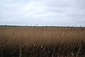
 Extensive reed beds - geograph.org.uk - 3895008.jpg 640 × 430 ; 55 kio
-
 Farmyard at Wiveton Hall - Normal for Norfolk - geograph.org.uk - 5813391.jpg 5 184 × 3 888 ; 5,76 Mio
-
 Field by the A149 - geograph.org.uk - 4031061.jpg 640 × 430 ; 40 kio
-
 Flint wall beside The Street - geograph.org.uk - 841485.jpg 480 × 640 ; 170 kio
-
 Ford and Footbridge, River Glaven - geograph.org.uk - 504993.jpg 640 × 480 ; 93 kio
-
 Free range chickens at Wiveton Hall, Norfolk - geograph.org.uk - 5813380.jpg 5 183 × 3 717 ; 6,43 Mio
-
 Fresh marsh near Wiveton Hall in Norfolk - geograph.org.uk - 5813364.jpg 5 184 × 3 888 ; 7,19 Mio
-
 Fresh Marshes - geograph.org.uk - 3894899.jpg 640 × 430 ; 47 kio
-
 Fresh Marshes - geograph.org.uk - 3894975.jpg 640 × 396 ; 48 kio
-
 Fresh Marshes - geograph.org.uk - 3894977.jpg 640 × 430 ; 50 kio
-
 Fresh Marshes and Cley next the Sea - geograph.org.uk - 5607392.jpg 800 × 492 ; 114 kio
-
 Glaven Estuary - geograph.org.uk - 3888416.jpg 640 × 430 ; 43 kio
-
 Glaven Flood Barrier - geograph.org.uk - 3894981.jpg 640 × 430 ; 58 kio
-
 Glaven Valley - geograph.org.uk - 3888420.jpg 640 × 430 ; 44 kio
-
 Glaven Valley - geograph.org.uk - 3888424.jpg 640 × 430 ; 66 kio
-
 In the Glaven Valley - geograph.org.uk - 3895015.jpg 640 × 430 ; 66 kio
-
 Inside St Mary, Wiveton (a) - geograph.org.uk - 5389299.jpg 480 × 640 ; 47 kio
-
 Inside St Mary, Wiveton (c) - geograph.org.uk - 5389302.jpg 640 × 480 ; 49 kio
-
 Inside St Mary, Wiveton (d) - geograph.org.uk - 5389303.jpg 480 × 640 ; 63 kio
-
 Inside St Mary, Wiveton (e) - geograph.org.uk - 5389304.jpg 640 × 480 ; 87 kio
-
 Inside St Mary, Wiveton (f) - geograph.org.uk - 5389306.jpg 480 × 640 ; 62 kio
-
 Inside St Mary, Wiveton (g) - geograph.org.uk - 5389307.jpg 640 × 480 ; 87 kio
-
 Inside St Mary, Wiveton (h) - geograph.org.uk - 5389308.jpg 640 × 480 ; 82 kio
-
 Inside St Mary, Wiveton (i) - geograph.org.uk - 5389309.jpg 480 × 640 ; 57 kio
-
 Inside St Mary, Wiveton (j) - geograph.org.uk - 5389310.jpg 640 × 480 ; 65 kio
-
 Junction with Blakeney Long Lane - geograph.org.uk - 841011.jpg 640 × 457 ; 116 kio
-
 Kissing gate - geograph.org.uk - 841132.jpg 480 × 640 ; 191 kio
-
 Marshes by the River Glaven - geograph.org.uk - 3888418.jpg 640 × 430 ; 60 kio
-
 Marshes in the Glaven Valley - geograph.org.uk - 3888432.jpg 640 × 430 ; 64 kio
-
 Marshes in the Glaven Valley - geograph.org.uk - 3894851.jpg 640 × 430 ; 48 kio
-
 Mind your step - geograph.org.uk - 841477.jpg 480 × 640 ; 184 kio
-
 Minor road by Wiveton Down - geograph.org.uk - 4907275.jpg 1 600 × 1 200 ; 583 kio
-
 Norfolk Coast Path - geograph.org.uk - 3895016.jpg 640 × 430 ; 68 kio
-
 Norfolk Coast Path 037 - geograph.org.uk - 4091779.jpg 640 × 425 ; 50 kio
-
 Norfolk Coast Path on the seawall - geograph.org.uk - 3888429.jpg 640 × 430 ; 53 kio
-
 North from Wiveton Down - geograph.org.uk - 928839.jpg 640 × 430 ; 137 kio
-
 North Norfolk Coast Path - geograph.org.uk - 6233616.jpg 5 184 × 3 456 ; 1,75 Mio
-
 Outdoor reared pigs - geograph.org.uk - 4908373.jpg 1 600 × 1 200 ; 605 kio
-
 Outdoor reared pigs from Wiveton Downs - geograph.org.uk - 4998455.jpg 1 600 × 1 200 ; 641 kio
-
 Outdoor reared pigs near Glandford - geograph.org.uk - 4907308.jpg 1 600 × 1 200 ; 599 kio
-
 Path by A149 - geograph.org.uk - 5102438.jpg 1 600 × 1 200 ; 734 kio
-
 Path on Wiveton Downs - geograph.org.uk - 4998447.jpg 1 600 × 1 200 ; 695 kio
-
 Path on Wiveton Downs - geograph.org.uk - 4998453.jpg 1 600 × 1 200 ; 1 021 kio
-
 Path on Wiveton Downs - geograph.org.uk - 4998460.jpg 1 600 × 1 200 ; 529 kio
-
 Peddars Way - geograph.org.uk - 3895009.jpg 640 × 430 ; 61 kio
-
 Peddars Way ^ Norfolk Coast Path - geograph.org.uk - 5607348.jpg 800 × 502 ; 79 kio
-
 Pick your own, Wiveton Hall - geograph.org.uk - 1958645.jpg 3 072 × 2 304 ; 2,59 Mio
-
 Pool by the coast path north of Cley - geograph.org.uk - 4810814.jpg 2 779 × 1 825 ; 1,15 Mio
-
 Possible remains of an old chapel - geograph.org.uk - 841506.jpg 480 × 640 ; 158 kio
-
 Red telephone box - geograph.org.uk - 841481.jpg 480 × 640 ; 200 kio
-
 Reed beds - geograph.org.uk - 3895018.jpg 640 × 430 ; 55 kio
-
 Reed beds in the Glaven Valley - geograph.org.uk - 3895012.jpg 640 × 430 ; 62 kio
-
 Reed beds in the Glaven Valley - geograph.org.uk - 3895023.jpg 640 × 430 ; 61 kio
-
 Reed Bundles, Cley Marsh - geograph.org.uk - 2336109.jpg 2 560 × 1 920 ; 1,66 Mio
-
 Reed Cutting, Cley Marsh - geograph.org.uk - 2336097.jpg 2 560 × 1 920 ; 1,93 Mio
-
 Reed marshes, windmill and Cley - geograph.org.uk - 2081095.jpg 640 × 480 ; 85 kio
-
 Reeds at Cley Next The Sea - geograph.org.uk - 6233614.jpg 5 184 × 3 456 ; 1,88 Mio
-
 Reeds by the River Glaven - geograph.org.uk - 3885301.jpg 640 × 430 ; 55 kio
-
 Reeds, River Glaven - geograph.org.uk - 3885303.jpg 640 × 430 ; 51 kio
-
 River Glaven - geograph.org.uk - 3888414.jpg 640 × 430 ; 44 kio
-
 River Glaven - geograph.org.uk - 4998577.jpg 1 600 × 1 200 ; 526 kio
-
 River Glaven reaches Cley Next The Sea - geograph.org.uk - 3450447.jpg 1 600 × 1 160 ; 469 kio
-
 Road through Summer House Hill Plantation - geograph.org.uk - 6328334.jpg 1 067 × 1 600 ; 638 kio
-
 Road to Wiveton Hall - geograph.org.uk - 4031057.jpg 640 × 430 ; 73 kio
-
 Rough grassland - pasture - geograph.org.uk - 3895013.jpg 640 × 430 ; 59 kio
-
 Rural land, Wiveton - geograph.org.uk - 1474193.jpg 640 × 480 ; 85 kio
-
 Seat and spigot mortar on Wiveton Green - geograph.org.uk - 4592053.jpg 3 456 × 2 592 ; 4 Mio
-
 Secondary flood defence bank - geograph.org.uk - 4808498.jpg 1 600 × 1 200 ; 1,02 Mio
-
 Sign in the nettles - geograph.org.uk - 841532.jpg 480 × 640 ; 160 kio
-
 Signpost by road junction - geograph.org.uk - 841025.jpg 480 × 640 ; 121 kio
-
 South from Wiveton Downs - geograph.org.uk - 1062377.jpg 640 × 426 ; 79 kio
-
 St Mary Parish Church Wiveton (2) - geograph.org.uk - 6189350.jpg 4 608 × 3 456 ; 3,96 Mio
-
 St Mary Parish Church Wiveton - geograph.org.uk - 6189344.jpg 4 608 × 3 456 ; 3,58 Mio
-
 St Mary's church - war memorial - geograph.org.uk - 840897.jpg 480 × 640 ; 151 kio
-
 St Mary, Wiveton - Altar - geograph.org.uk - 3127820.jpg 1 000 × 667 ; 125 kio
-
 St Mary, Wiveton - Ledger slab - geograph.org.uk - 3127812.jpg 1 000 × 667 ; 203 kio
-
 St Mary, Wiveton - Ledger slab - geograph.org.uk - 3127814.jpg 1 000 × 637 ; 183 kio
-
 St Mary, Wiveton - Ledger slab - geograph.org.uk - 3127816.jpg 1 000 × 667 ; 170 kio
-
 St Mary, Wiveton - Ledger slab - geograph.org.uk - 3127817.jpg 1 000 × 667 ; 153 kio
-
 St Mary, Wiveton, aisle - geograph.org.uk - 5389315.jpg 480 × 640 ; 71 kio
-
 St Mary, Wiveton, banner - geograph.org.uk - 5389317.jpg 480 × 640 ; 51 kio
-
 St Mary, Wiveton, box pews - geograph.org.uk - 5389318.jpg 640 × 480 ; 73 kio
-
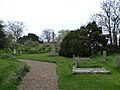 St Mary, Wiveton, churchyard (a) - geograph.org.uk - 5389296.jpg 640 × 480 ; 86 kio
-
 St Mary, Wiveton, churchyard (b) - geograph.org.uk - 5389297.jpg 640 × 480 ; 71 kio
-
 St Mary, Wiveton, churchyard (c) - geograph.org.uk - 5389298.jpg 640 × 480 ; 74 kio
-
 St Mary, Wiveton, font - geograph.org.uk - 5389312.jpg 640 × 480 ; 51 kio
-
 St Mary, Wiveton, ledger slab (A) - geograph.org.uk - 5389328.jpg 640 × 480 ; 71 kio
-
 St Mary, Wiveton, ledger slab (B) - geograph.org.uk - 5389337.jpg 480 × 640 ; 64 kio
-
 St Mary, Wiveton, ledger slab (C) - geograph.org.uk - 5389338.jpg 446 × 640 ; 65 kio
-
 St Mary, Wiveton, ledger slab (D) - geograph.org.uk - 5389339.jpg 480 × 640 ; 84 kio
-
 St Mary, Wiveton, memorial (a) - geograph.org.uk - 5389320.jpg 480 × 640 ; 44 kio
-
 St Mary, Wiveton, memorial (b) - geograph.org.uk - 5389322.jpg 480 × 640 ; 56 kio
-
 St Mary, Wiveton, memorial (c) - geograph.org.uk - 5389324.jpg 480 × 640 ; 49 kio
-
 St Mary, Wiveton, memorial (d) - geograph.org.uk - 5389326.jpg 640 × 480 ; 74 kio
-
 St Mary, Wiveton, memorial (e) - geograph.org.uk - 5389327.jpg 480 × 640 ; 48 kio
-
 St Mary, Wiveton, memorial (f) - geograph.org.uk - 5389334.jpg 640 × 480 ; 85 kio
-
 St Mary, Wiveton, organ - geograph.org.uk - 5389313.jpg 480 × 640 ; 65 kio
-
 St Mary, Wiveton, pulpit - geograph.org.uk - 5389316.jpg 640 × 480 ; 77 kio
-
 St Mary, Wiveton, vault entrance - geograph.org.uk - 5389336.jpg 640 × 480 ; 44 kio
-
 St.Mary, Wiveton, spring 2017 - geograph.org.uk - 5351856.jpg 640 × 480 ; 56 kio
-
 Storm damaged seawall - geograph.org.uk - 3888442.jpg 640 × 430 ; 83 kio
-
 Sunset over the River Glaven from Cley quayside - geograph.org.uk - 6138549.jpg 4 608 × 3 456 ; 2,84 Mio
-
 The Blakeney Esker SSSI - geograph.org.uk - 841114.jpg 480 × 640 ; 209 kio
-
 The Glaven Valley - geograph.org.uk - 3895007.jpg 640 × 430 ; 62 kio
-
 The Glaven Valley - geograph.org.uk - 3895027.jpg 640 × 430 ; 43 kio
-
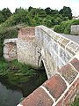
 The old bridge over the River Glaven - geograph.org.uk - 841502.jpg 640 × 455 ; 123 kio
-
 The River Glaven - geograph.org.uk - 841534.jpg 640 × 480 ; 126 kio
-
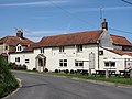 The Wiveton Bell - geograph.org.uk - 841473.jpg 640 × 480 ; 151 kio
-
 The Wiveton Bell from the village green - geograph.org.uk - 6189355.jpg 4 608 × 3 456 ; 3,89 Mio
-
 The Wiveton Bell pub and signpost - geograph.org.uk - 1514915.jpg 640 × 480 ; 325 kio
-
 Thirsty work on a bicycle^ - geograph.org.uk - 500980.jpg 640 × 480 ; 95 kio
-
 Track into Summer House Hill Plantation - geograph.org.uk - 3853843.jpg 3 088 × 2 056 ; 4,23 Mio
-
 Track to Summer House Hill - geograph.org.uk - 928831.jpg 426 × 640 ; 91 kio
-
 View across barleyfield - geograph.org.uk - 841411.jpg 640 × 480 ; 150 kio
-
 View along The Street - geograph.org.uk - 841483.jpg 640 × 480 ; 154 kio
-
 View east along Bridgefoot Lane - geograph.org.uk - 841505.jpg 640 × 480 ; 137 kio
-
 View from Church Tower, St Nicholas Parish Church, Blakeney, Norfolk - geograph.org.uk - 5374329.jpg 4 000 × 3 000 ; 2,37 Mio
-
 View from Church Tower, St Nicholas Parish Church, Blakeney, Norfolk - geograph.org.uk - 5374330.jpg 4 000 × 3 000 ; 2,52 Mio
-
 View NE across stubble towards Hull Wood - geograph.org.uk - 547786.jpg 640 × 480 ; 54 kio
-
 View to Oulton Hill - geograph.org.uk - 555161.jpg 640 × 480 ; 90 kio
-
 View towards Wiveton - geograph.org.uk - 2983188.jpg 1 024 × 768 ; 272 kio
-
 Views across the marshes - geograph.org.uk - 3894973.jpg 640 × 430 ; 58 kio
-
 War memorial in the grounds of St Mary's Church, Wiveton - geograph.org.uk - 3601113.jpg 2 448 × 3 264 ; 2,05 Mio
-
 War memorial inside St Mary's Church, Wiveton - geograph.org.uk - 3601120.jpg 2 448 × 3 264 ; 1,64 Mio
-
 Wet entrance to a pig field - geograph.org.uk - 6328321.jpg 1 600 × 1 067 ; 226 kio
-
 Wet grassland by the River Glaven - geograph.org.uk - 4998569.jpg 1 600 × 1 200 ; 667 kio
-
 Wild poppies (Papaver rhoeas) - geograph.org.uk - 841412.jpg 480 × 640 ; 167 kio
-
 Wild poppies (Papaver rhoeas) - geograph.org.uk - 841415.jpg 480 × 640 ; 160 kio
-
 Wind farm cable works - geograph.org.uk - 4907286.jpg 1 600 × 1 200 ; 569 kio
-
 Wiveton Antiques - geograph.org.uk - 5102443.jpg 1 600 × 1 200 ; 533 kio
-
 Wiveton Bridge - geograph.org.uk - 841511.jpg 640 × 471 ; 165 kio
-
 Wiveton cafe and shop - Normal for Norfolk - geograph.org.uk - 5813358.jpg 5 184 × 3 888 ; 5,89 Mio
-
 Wiveton Church - geograph.org.uk - 2084310.jpg 640 × 480 ; 111 kio
-
 Wiveton church and red brick house - geograph.org.uk - 2084299.jpg 640 × 480 ; 80 kio
-
 Wiveton Downs - geograph.org.uk - 1055953.jpg 640 × 426 ; 125 kio
-
 Wiveton Downs - geograph.org.uk - 1062740.jpg 640 × 426 ; 111 kio
-
 Wiveton Downs car park - geograph.org.uk - 4998440.jpg 1 600 × 1 200 ; 629 kio
-
 Wiveton Hall - Normal for Norfolk - geograph.org.uk - 5811213.jpg 5 184 × 3 888 ; 5,43 Mio
-
 Wiveton Hall Fruit Farm - geograph.org.uk - 4133088.jpg 4 320 × 3 240 ; 3,71 Mio
-
 Wiveton Hall Fruit Farm - geograph.org.uk - 5102433.jpg 1 600 × 1 200 ; 633 kio
-
 Wiveton Hall PYO - geograph.org.uk - 1959213.jpg 1 600 × 1 200 ; 384 kio
-
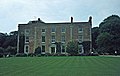
 Wiveton Hall, Blakeney - geograph.org.uk - 2470454.jpg 1 343 × 820 ; 205 kio
-
 Wiveton village - geograph.org.uk - 3149474.jpg 1 024 × 768 ; 205 kio
-

-
 Working on the sea wall - geograph.org.uk - 4808492.jpg 1 600 × 1 200 ; 823 kio
-
 Young swans on the River Glaven - geograph.org.uk - 1514895.jpg 640 × 480 ; 325 kio
-
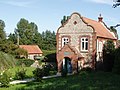
 A glimpse of Stonebridge House - geograph.org.uk - 841543.jpg 640 × 480 ; 180 kio
-
 A private marsh - geograph.org.uk - 841536.jpg 640 × 480 ; 205 kio
-
 Along between the hedges of Hurdle Lane - geograph.org.uk - 515786.jpg 480 × 640 ; 175 kio
-
 Approaching Wiveton from the east - geograph.org.uk - 841540.jpg 632 × 461 ; 135 kio
-
 Approaching Wiveton from the west - geograph.org.uk - 841410.jpg 640 × 457 ; 111 kio
-
 Barn belonging to Church Farm - geograph.org.uk - 841482.jpg 480 × 640 ; 178 kio
-
 Bayfield Hall, near Holt, Norfolk - geograph.org.uk - 49720.jpg 640 × 406 ; 64 kio
-
 Bayfield Hall, near Holt, Norfolk - geograph.org.uk - 72714.jpg 640 × 420 ; 94 kio
-
 Bayfield Lake in the grounds of Bayfield Hall - geograph.org.uk - 72831.jpg 426 × 640 ; 94 kio
-
 Blakeney Esker - geograph.org.uk - 645088.jpg 640 × 480 ; 100 kio
-
 Blakeney Esker quarry - geograph.org.uk - 645093.jpg 640 × 480 ; 125 kio
-
 Blakeney Road past Green Farm - geograph.org.uk - 841480.jpg 640 × 480 ; 182 kio
-
 Entry to Hurdle Lane - geograph.org.uk - 515788.jpg 640 × 480 ; 162 kio
-

-
 Museum of shells - geograph.org.uk - 242242.jpg 640 × 480 ; 115 kio
-
 Public Footpath near Smoker's Hole - geograph.org.uk - 529845.jpg 480 × 640 ; 93 kio
-


_and_stinking_chamomile_(Anthemis_cotula_L.)_-_geograph.org.uk_-_555183.jpg)


_-_geograph.org.uk_-_5559151.jpg)


_-_geograph.org.uk_-_5389299.jpg)
_-_geograph.org.uk_-_5389302.jpg)
_-_geograph.org.uk_-_5389303.jpg)
_-_geograph.org.uk_-_5389304.jpg)
_-_geograph.org.uk_-_5389306.jpg)
_-_geograph.org.uk_-_5389307.jpg)
_-_geograph.org.uk_-_5389308.jpg)
_-_geograph.org.uk_-_5389309.jpg)
_-_geograph.org.uk_-_5389310.jpg)


_-_geograph.org.uk_-_6189350.jpg)


_-_geograph.org.uk_-_5389296.jpg)
_-_geograph.org.uk_-_5389297.jpg)
_-_geograph.org.uk_-_5389298.jpg)

_-_geograph.org.uk_-_5389328.jpg)
_-_geograph.org.uk_-_5389337.jpg)
_-_geograph.org.uk_-_5389338.jpg)
_-_geograph.org.uk_-_5389339.jpg)
_-_geograph.org.uk_-_5389320.jpg)
_-_geograph.org.uk_-_5389322.jpg)
_-_geograph.org.uk_-_5389324.jpg)
_-_geograph.org.uk_-_5389326.jpg)
_-_geograph.org.uk_-_5389327.jpg)
_-_geograph.org.uk_-_5389334.jpg)


_-_geograph.org.uk_-_841412.jpg)
_-_geograph.org.uk_-_841415.jpg)


