Category:Wolfsegg
Vai alla navigazione
Vai alla ricerca
comune tedesco    | |||||
| Carica un file multimediale | |||||
| Istanza di |
| ||||
|---|---|---|---|---|---|
| Parte di |
| ||||
| Luogo | circondario di Ratisbona, distretto dell'Alto Palatinato, Baviera, Germania | ||||
| Capo del governo |
| ||||
| Popolazione |
| ||||
| Superficie |
| ||||
| Altezza sul mare |
| ||||
| Distinto da | |||||
| sito web ufficiale | |||||
 | |||||
Sottocategorie
Questa categoria contiene le 2 sottocategorie indicate di seguito, su un totale di 2.
!
D
File nella categoria "Wolfsegg"
Questa categoria contiene 15 file, indicati di seguito, su un totale di 15.
-
 DEU Wolfsegg COA.svg 917 × 1 016; 23 KB
-
 Wappen Wolfsegg.png 116 × 141; 11 KB
-
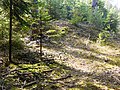
 Bodenkundlicher Lehrpfad Schwaighauser Forst.jpg 2 448 × 3 264; 1,28 MB
-
 Burg Wolfsegg Wanderweg.JPG 3 264 × 2 448; 2,81 MB
-
 Dürrloch höhle.jpg 3 264 × 2 448; 2,2 MB
-
 Dürrwiesweiher.jpg 3 264 × 2 448; 2,03 MB
-
 Keltischer Grabhügel (Schwaighauser Forst).JPG 3 264 × 2 448; 3,32 MB
-
 Kohlebrecher Kohlgrube.jpg 2 625 × 1 742; 510 KB
-
 Logo Bodenkundlicher Lehrpfad Schwaighauser Forst.jpg 2 448 × 3 264; 787 KB
-
 Marienfigur (Wolfgang-Kapelle von Heitzenhofen).PNG 272 × 501; 312 KB
-
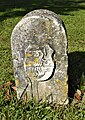 Wappenstein der Freiherren von Teufel.JPG 1 763 × 2 495; 1,87 MB
-
 Wolfsegg in R.svg 829 × 691; 689 KB
-
 WOLFSEGG nieder.png 480 × 360; 5 KB
-
 WOLFSEGG nieder.svg 512 × 427; 21 KB
-
 Wolfsegg, Nistkästen.jpg 3 264 × 4 928; 6,32 MB


.JPG)


.PNG)


