Category:Woodchester
Aller à la navigation
Aller à la recherche
localité britannique du comté anglais de Gloucestershire  | |||||
| Téléverser des médias | |||||
| Nature de l’élément | |||||
|---|---|---|---|---|---|
| Lieu | Stroud, Gloucestershire, Angleterre du Sud-Ouest, Angleterre | ||||
 | |||||
English: Woodchester is a Gloucestershire village in the Nailsworth (or Woodchester) Valley, a valley in the South Cotswolds in England, running southwards from Stroud along the A46 road to Nailsworth.
Sous-catégories
Cette catégorie comprend 5 sous-catégories, dont les 5 ci-dessous.
P
- Woodchester Park (12 F)
W
- Woodchester Roman Villa (2 F)
Média dans la catégorie « Woodchester »
Cette catégorie comprend 314 fichiers, dont les 200 ci-dessous.
(page précédente) (page suivante)-
 40 mph speed limit, Station Road, Woodchester - geograph.org.uk - 5117829.jpg 800 × 722 ; 181 kio
-
 A Golden Watery Grave - geograph.org.uk - 1038426.jpg 640 × 426 ; 119 kio
-
 A lone walker on Selsley Common - geograph.org.uk - 3274114.jpg 1 024 × 498 ; 94 kio
-
 A track through Woodchester Park - geograph.org.uk - 931723.jpg 640 × 479 ; 163 kio
-
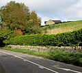
 A vineyard at Woodchester - geograph.org.uk - 3741600.jpg 1 024 × 680 ; 320 kio
-
 A vineyard at Woodchester - geograph.org.uk - 3741604.jpg 1 024 × 680 ; 315 kio
-
 A46 junction with Station road - geograph.org.uk - 5534895.jpg 640 × 427 ; 94 kio
-
 A46 northbound - geograph.org.uk - 4398940.jpg 640 × 432 ; 65 kio
-
 A46 northbound - geograph.org.uk - 4398948.jpg 640 × 461 ; 63 kio
-
 A46 northbound - geograph.org.uk - 4398952.jpg 640 × 500 ; 62 kio
-
 A46 northbound - geograph.org.uk - 4398956.jpg 640 × 509 ; 64 kio
-
 A46 northbound - geograph.org.uk - 4398970.jpg 640 × 516 ; 66 kio
-
 An autumn walk - geograph.org.uk - 6311093.jpg 1 024 × 768 ; 369 kio
-
 Angled Steps In South Churchyard Wall.jpg 4 000 × 3 000 ; 5,46 Mio
-
 Antique Clocks business, Inchbrook - geograph.org.uk - 4785774.jpg 800 × 658 ; 137 kio
-
 Arable land and vineyard - geograph.org.uk - 3749231.jpg 1 024 × 680 ; 332 kio
-
 Autumn above the Nailsworth Valley - geograph.org.uk - 3749226.jpg 1 024 × 680 ; 318 kio
-
 Autumn colour in Break-heart-hill Wood - geograph.org.uk - 5179348.jpg 600 × 800 ; 251 kio
-
 Autumn colours in Break-heart-hill Wood - geograph.org.uk - 5179350.jpg 600 × 800 ; 258 kio
-
 Autumn colours, Woodchester Park - geograph.org.uk - 3741577.jpg 1 024 × 680 ; 262 kio
-
 Autumn trees - geograph.org.uk - 5581840.jpg 768 × 1 024 ; 395 kio
-
 Autumn trees, Woodchester Park - geograph.org.uk - 3740702.jpg 680 × 1 024 ; 426 kio
-
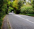
 B4066 in woods on Pen Hill - geograph.org.uk - 5641412.jpg 1 600 × 1 200 ; 809 kio
-

-

-
 Bath Road towards Nailsworth - geograph.org.uk - 4731031.jpg 800 × 642 ; 135 kio
-
 Bath Road, Inchbrook - geograph.org.uk - 4787550.jpg 800 × 528 ; 119 kio
-
 Bath Road, South Woodchester - geograph.org.uk - 4774314.jpg 800 × 624 ; 119 kio
-
 Bath Road, Woodchester - geograph.org.uk - 5117863.jpg 800 × 566 ; 119 kio
-
 Bath taps - Woodchester Mansion - geograph.org.uk - 4697512.jpg 640 × 480 ; 59 kio
-
 Beech Grove, North Woodchester - geograph.org.uk - 4723141.jpg 800 × 579 ; 98 kio
-
 Beech trees in Woodchester Park - geograph.org.uk - 1042182.jpg 426 × 640 ; 142 kio
-
 Beech trees, Woodchester Park - geograph.org.uk - 3741582.jpg 1 024 × 680 ; 402 kio
-
 Beech trees, Woodchester Park - geograph.org.uk - 3741585.jpg 680 × 1 024 ; 397 kio
-
 Bend in the A46, Inchbrook - geograph.org.uk - 4777573.jpg 800 × 540 ; 117 kio
-
 Birds Crossing, Woodchester - geograph.org.uk - 5117933.jpg 800 × 793 ; 269 kio
-

-
 Bottom of Rooksmoor Hill, Rooksmoor - geograph.org.uk - 4708024.jpg 800 × 660 ; 220 kio
-
 Bownhill Farm, near Woodchester, Gloucestershire - geograph.org.uk - 932920.jpg 640 × 480 ; 111 kio
-
 Break-Heart-Hill Wood - geograph.org.uk - 3740697.jpg 1 024 × 680 ; 352 kio
-
 Bridge over Nailsworth Stream, Woodchester - geograph.org.uk - 4729984.jpg 800 × 600 ; 170 kio
-

-
 Brownhill Farm - geograph.org.uk - 3749216.jpg 1 024 × 680 ; 262 kio
-
 Building, Selsey Road, North Woodchester, Stroud, Glos - geograph.org.uk - 3609935.jpg 3 000 × 4 000 ; 5,28 Mio
-
 Butter Row Gate toll house - geograph.org.uk - 271226.jpg 640 × 480 ; 113 kio
-
 Butter Row Gate tolls - geograph.org.uk - 271229.jpg 480 × 640 ; 142 kio
-
 Cattle grid on road from Selsey Common to Woodchester - geograph.org.uk - 5641406.jpg 1 600 × 1 200 ; 745 kio
-
 Chancel Arch And Section Of North Wall To Former Church Of St Mary.jpg 4 000 × 3 000 ; 5,74 Mio
-
-
 Click Property Services in Woodchester - geograph.org.uk - 5117642.jpg 800 × 600 ; 140 kio
-
 Closed today ... for ever? Woodchester, Glos. (2177804043).jpg 1 280 × 960 ; 258 kio
-
 Convent Lane, Inchbrook - geograph.org.uk - 4784420.jpg 800 × 581 ; 128 kio
-
 Convent of Poor Clares, Woodchester-geograph-192465.jpg 640 × 480 ; 274 kio
-
 Convent Road, Woodchester - geograph.org.uk - 1042410.jpg 426 × 640 ; 102 kio
-
 Cow Lane, Inchbrook - geograph.org.uk - 4784413.jpg 800 × 611 ; 192 kio
-
 Cycle route this way, North Woodchester - geograph.org.uk - 4723681.jpg 782 × 800 ; 279 kio
-
 Cycle trail along disused railway line - geograph.org.uk - 1076295.jpg 640 × 480 ; 115 kio
-

-

-
 Dam at Parkmill Pond - geograph.org.uk - 2530984.jpg 1 024 × 638 ; 255 kio
-
 Dappled Sunlight in Woodchester Park - geograph.org.uk - 5493615.jpg 3 264 × 2 448 ; 3,61 Mio
-
 Direction sign, North Woodchester - geograph.org.uk - 4723623.jpg 800 × 610 ; 194 kio
-
 Down Selsley Road, North Woodchester - geograph.org.uk - 4723759.jpg 800 × 615 ; 163 kio
-
 Drain spout, Woodchester Mansion - geograph.org.uk - 5857058.jpg 1 600 × 1 200 ; 695 kio
-
 Dunkirk Mills - geograph.org.uk - 299707.jpg 427 × 640 ; 77 kio
-
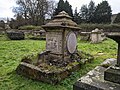
 Dunn Monument In The Churchyard Approximately 20M North East Of Chancel Arch.jpg 4 000 × 3 000 ; 5,8 Mio
-
 Enquiries office, T.R.King, Woodchester - geograph.org.uk - 4729568.jpg 800 × 471 ; 105 kio
-
 Entrance drive to Pud Hill, Inchbrook - geograph.org.uk - 4777588.jpg 799 × 800 ; 210 kio
-
-
 Entrance to Rooksmoor Mills, Rooksmoor - geograph.org.uk - 4708062.jpg 800 × 585 ; 123 kio
-
 Entrance to Woodchester House, Woodchester - geograph.org.uk - 4731082.jpg 800 × 611 ; 177 kio
-
 Farmland above the Stroud valley - geograph.org.uk - 3749221.jpg 1 024 × 680 ; 264 kio
-
 Field entrance from Bath Road, Woodchester - geograph.org.uk - 5117920.jpg 800 × 719 ; 121 kio
-
 Footpath above the Nailsworth Valley - geograph.org.uk - 3749229.jpg 1 024 × 680 ; 327 kio
-
 Footpath across a field - geograph.org.uk - 3741608.jpg 1 024 × 680 ; 205 kio
-
 Footpath and electricity poles - geograph.org.uk - 3749204.jpg 680 × 1 024 ; 275 kio
-
 Former railway route, North Woodchester - geograph.org.uk - 4723669.jpg 800 × 578 ; 231 kio
-
 Former Woodchester Mill - geograph.org.uk - 2159407.jpg 640 × 427 ; 53 kio
-
 Frogmarsh Mill - former wool drying stove - geograph.org.uk - 3721422.jpg 419 × 640 ; 118 kio
-
 Frogmarsh Mill - geograph.org.uk - 192468.jpg 640 × 480 ; 141 kio
-
 Fungi in Woodchester Park - geograph.org.uk - 3740712.jpg 1 024 × 680 ; 272 kio
-
 Fungi on an old tree stump - geograph.org.uk - 6311108.jpg 1 024 × 768 ; 300 kio
-
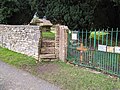
 Gate into the Old St Mary's Church site, Woodchester - geograph.org.uk - 3609847.jpg 4 000 × 3 000 ; 6,59 Mio
-
 Gated entrance to Manor Gardens, Woodchester - geograph.org.uk - 4729576.jpg 800 × 600 ; 119 kio
-
 Grade II listed Grey Gables, Woodchester - geograph.org.uk - 5117928.jpg 800 × 644 ; 113 kio
-
 Grit tub on an Inchbrook corner - geograph.org.uk - 4784416.jpg 800 × 676 ; 238 kio
-

-
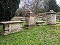 Group Of 4 Monuments In The Churchyard Approximately 6M West Of Churchyard Entry Steps.jpg 4 000 × 3 000 ; 5,34 Mio
-
 Group Of 5 Monuments In The Churchyard Approximately 20M East Of Chancel Arch.jpg 4 000 × 3 000 ; 5,57 Mio
-

-
 Group Of Five Monuments In The Churchyard Approximately 30M South Of Chancel Arch.jpg 4 000 × 3 000 ; 5,37 Mio
-
 Hillgrove House, Woodchester - geograph.org.uk - 4729981.jpg 800 × 606 ; 111 kio
-
 Hillgrove Villas, Woodchester - geograph.org.uk - 4729587.jpg 800 × 671 ; 134 kio
-
 Hillman Monument In The Churchyard Approximately 30M South East Of Chancel Arch.jpg 3 000 × 4 000 ; 5,59 Mio
-
 Hillside church and graveyard, Inchbrook - geograph.org.uk - 4787652.jpg 800 × 670 ; 136 kio
-
 Hillside church, Inchbrook - geograph.org.uk - 4785733.jpg 618 × 800 ; 136 kio
-
 Hillside house, Inchbrook - geograph.org.uk - 4787690.jpg 619 × 800 ; 157 kio
-
 Hilltop house in Rodborough - geograph.org.uk - 4708150.jpg 800 × 711 ; 185 kio
-
 Honeywell Pond - geograph.org.uk - 3740709.jpg 1 024 × 680 ; 303 kio
-
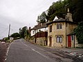
 Houses on Bath Road, Nailsworth - geograph.org.uk - 5014238.jpg 1 600 × 1 065 ; 473 kio
-
 How did it come to be called-Woodchester, Glos - geograph.org.uk - 3632855.jpg 3 072 × 2 304 ; 4,68 Mio
-

-

-
 Industrial buildings, Nailsworth - geograph.org.uk - 1042417.jpg 640 × 426 ; 69 kio
-
 Industrial yard, Woodchester - geograph.org.uk - 4732817.jpg 800 × 532 ; 117 kio
-
 Interior view of Poor Clares Convent, Woodchester, Stroud, early 1900s (7930942698).jpg 1 279 × 998 ; 126 kio
-
 Ivy-clad building in Rooksmoor - geograph.org.uk - 4708015.jpg 800 × 624 ; 140 kio
-
 Jogging from Woodchester towards Stroud - geograph.org.uk - 5117937.jpg 800 × 600 ; 220 kio
-

-
 Keep clear zone, St Mary's Hill, Inchbrook - geograph.org.uk - 4784442.jpg 800 × 600 ; 108 kio
-
 Kennel Pond, Woodchester Park - geograph.org.uk - 931955.jpg 640 × 480 ; 167 kio
-
 Lake at Woodchester Park - geograph.org.uk - 5.jpg 640 × 480 ; 110 kio
-
 Lake in Woodchester Park - geograph.org.uk - 3741591.jpg 1 024 × 680 ; 285 kio
-
 Little Britain Farm, Woodchester - geograph.org.uk - 5117839.jpg 800 × 586 ; 131 kio
-

-
 Manor Drive, Woodchester - geograph.org.uk - 5117912.jpg 800 × 578 ; 117 kio
-
 Maynard, Woodchester - geograph.org.uk - 4785610.jpg 800 × 689 ; 120 kio
-
 Memorial plates Old Woodchester Church - geograph.org.uk - 1046911.jpg 640 × 480 ; 115 kio
-
 Mill Building, North Woodchester - geograph.org.uk - 5493632.jpg 3 264 × 2 448 ; 2,05 Mio
-
 Millpond End, North Woodchester - geograph.org.uk - 4729989.jpg 800 × 600 ; 199 kio
-
 Muddy surface, Park Lane, Inchbrook - geograph.org.uk - 4784410.jpg 800 × 752 ; 232 kio
-
 Nailsworth Garden Machinery, South Woodchester - geograph.org.uk - 5394798.jpg 787 × 800 ; 159 kio
-
 Nailsworth Stream - geograph.org.uk - 6230202.jpg 4 032 × 3 024 ; 4,95 Mio
-

-
 Nailsworth Stream, North Woodchester - geograph.org.uk - 4723182.jpg 800 × 731 ; 208 kio
-
 Nailsworth Stream, Woodchester - geograph.org.uk - 4729986.jpg 800 × 723 ; 284 kio
-
 Narrow streets sign, Woodchester - geograph.org.uk - 4731077.jpg 800 × 769 ; 211 kio
-

-
 NCN Millennium Milepost MP691 Woodchester Gloucestershire.jpeg 4 032 × 3 024 ; 5,12 Mio
-
 NCN Route 45 near Nailsworth-Woodchester, Glos - geograph.org.uk - 3632843.jpg 3 072 × 2 304 ; 5,29 Mio
-
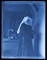 Nun inside Poor Clares Priory, Woodchester, early 1900s (7931023034).jpg 998 × 1 279 ; 110 kio
-
 Oak Tree Cottage, North Woodchester - geograph.org.uk - 4723202.jpg 800 × 598 ; 146 kio
-
 Old Fleece, Rooksmoor - geograph.org.uk - 4708011.jpg 800 × 624 ; 149 kio
-
 Old St Mary's Church Site, Woodchester - geograph.org.uk - 3609776.jpg 4 000 × 3 000 ; 6,56 Mio
-
 Open air activities, Bath Road, Woodchester - geograph.org.uk - 5117851.jpg 800 × 572 ; 132 kio
-
 Outflow from Parkmill Pond - geograph.org.uk - 5493620.jpg 3 264 × 2 448 ; 4,66 Mio
-
 Outflow from the Middle Pond, Woodchester - geograph.org.uk - 1860918.jpg 1 200 × 1 600 ; 689 kio
-

-
 Park Lane house, Inchbrook - geograph.org.uk - 4784403.jpg 800 × 490 ; 112 kio
-
 Park Lane stile, Inchbrook - geograph.org.uk - 4784408.jpg 800 × 706 ; 200 kio
-
 Park Lane, Inchbrook - geograph.org.uk - 4784385.jpg 800 × 655 ; 216 kio
-
 Path from Woodchester towards Nailsworth - geograph.org.uk - 5117940.jpg 800 × 642 ; 224 kio
-
 Path in Break-heart-hill Wood, Woodchester Park - geograph.org.uk - 5857015.jpg 1 600 × 1 200 ; 836 kio
-
 Path through Woodchester Park - geograph.org.uk - 931897.jpg 640 × 480 ; 206 kio
-
 Paul's Rise houses, North Woodchester - geograph.org.uk - 4729987.jpg 800 × 614 ; 116 kio
-
 Poor Clares Convent, Woodchester - geograph.org.uk - 1042405.jpg 640 × 426 ; 110 kio
-
 Poor Clares Priory in Woodchester, Stroud, Gloucestershire.jpg 998 × 1 279 ; 196 kio
-
 Post Office at North Woodchester, Gloucestershire. (4606352230).jpg 3 072 × 2 304 ; 3,13 Mio
-
 Post Ofice at North Woodchester, Gloucestershire ... (2391641267).jpg 1 280 × 960 ; 244 kio
-

-
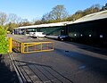
 Q Park, Woodchester - geograph.org.uk - 4731035.jpg 800 × 522 ; 102 kio
-
 Queen Elizabeth II postbox, Rooksmoor - geograph.org.uk - 4708032.jpg 585 × 800 ; 140 kio
-

-
 Rabbit Warren Wood - geograph.org.uk - 425281.jpg 480 × 640 ; 159 kio
-
 Red postbox in greenery, Rooksmoor - geograph.org.uk - 4708038.jpg 800 × 753 ; 234 kio
-
 Redevelopment works - geograph.org.uk - 6230192.jpg 4 032 × 3 024 ; 3,35 Mio
-
 Reflections in Parkmill Pond - geograph.org.uk - 6311237.jpg 1 024 × 768 ; 281 kio
-
 Remains of stables, Woodchester Park - geograph.org.uk - 5464828.jpg 2 000 × 1 500 ; 1,37 Mio
-
 Renishaw northern entrance, Inchbrook - geograph.org.uk - 4787537.jpg 800 × 556 ; 144 kio
-

-
 Road bridge over disused Midland Railway line - geograph.org.uk - 6230201.jpg 4 032 × 3 024 ; 3,7 Mio
-
 Road bridge over Nailsworth Stream, Woodchester - geograph.org.uk - 5117667.jpg 800 × 682 ; 183 kio
-
 Rooksmoor Hill off Bath Road - geograph.org.uk - 5014231.jpg 1 600 × 1 065 ; 814 kio
-
 Rooksmoor houses - geograph.org.uk - 4723820.jpg 800 × 579 ; 116 kio
-
 Rooksmoor Mill electricity substation, Rooksmoor - geograph.org.uk - 4708067.jpg 600 × 800 ; 150 kio
-
 Rooksmoor Mills lorries, Rooksmoor - geograph.org.uk - 4708108.jpg 800 × 599 ; 134 kio
-
 Ruined cottage on Water Lane, Woodchester - geograph.org.uk - 546641.jpg 640 × 480 ; 113 kio
-
 Ruins of Old Woodchester Church - geograph.org.uk - 1046904.jpg 640 × 480 ; 78 kio
-
 Scumble Goosie warehouse, South Woodchester - geograph.org.uk - 4774430.jpg 800 × 594 ; 114 kio
-
 Sealey Power Products, Woodchester - geograph.org.uk - 4785605.jpg 800 × 626 ; 127 kio
-
 See-saw and play equipment, Woodchester Park - geograph.org.uk - 5857009.jpg 1 600 × 1 200 ; 803 kio
-
 Selsley Road bridge, North Woodchester - geograph.org.uk - 4723686.jpg 800 × 553 ; 149 kio
-
 Selsley Road, North Woodchester - geograph.org.uk - 4723169.jpg 800 × 663 ; 145 kio
-

-
 Smith Adams Monument In The Churchyard Approximately 20M South West Of Chancel Arch.jpg 4 000 × 3 000 ; 4,15 Mio
-
 South Woodchester ... closed P.O. (2775178971) (2).jpg 1 280 × 960 ; 257 kio
-
 St Dominic's Catholic Primary School, Inchbrook - geograph.org.uk - 4784436.jpg 603 × 800 ; 117 kio
-
 Start of the 30 zone, Station Road, Woodchester - geograph.org.uk - 4732815.jpg 800 × 661 ; 190 kio
-
 Station Road Woodchester - geograph.org.uk - 5117660.jpg 800 × 756 ; 184 kio
-
 Station Road, Woodchester - geograph.org.uk - 4732372.jpg 800 × 800 ; 190 kio
-

-
 Stroud Recovery, Rooksmoor - geograph.org.uk - 4708115.jpg 800 × 649 ; 148 kio
-
 Sun shining on Woodchester Mansion - geograph.org.uk - 6304148.jpg 4 032 × 3 024 ; 2,77 Mio
-
 T.R.King premises in Woodchester - geograph.org.uk - 4729560.jpg 800 × 581 ; 132 kio
-
 Teasel Tower - geograph.org.uk - 192470.jpg 480 × 640 ; 137 kio
-
 The A46 at Rooksmoor - geograph.org.uk - 5060192.jpg 6 000 × 4 000 ; 7,78 Mio
-
 The boathouse at Woochester Mansion - geograph.org.uk - 2267810.jpg 800 × 400 ; 273 kio
-
 The east front of Woodchester Mansion - geograph.org.uk - 5857048.jpg 1 600 × 1 200 ; 815 kio
-
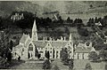 The English Dominicans (1921) (14784310155).jpg 2 864 × 1 888 ; 1,2 Mio
-
 The Middle Pond, Woodchester Park - geograph.org.uk - 5857019.jpg 1 600 × 1 200 ; 758 kio
-
 The Old Fleece on the A46 - geograph.org.uk - 5535091.jpg 640 × 427 ; 85 kio
-
 The Old Fleece, Rooksmoor - geograph.org.uk - 5011075.jpg 1 600 × 1 065 ; 562 kio
-
 The Old Fleece, Rooksmoor - geograph.org.uk - 5011079.jpg 1 600 × 1 065 ; 702 kio
-
 The Old Fleece, Rooksmoor - geograph.org.uk - 5011082.jpg 1 065 × 1 600 ; 320 kio
-
 The Old Fleece, Rooksmoor - geograph.org.uk - 5060187.jpg 6 000 × 4 000 ; 3,42 Mio
-
 The Old Rectory, North Woodchester - geograph.org.uk - 5493629.jpg 3 264 × 2 448 ; 2,36 Mio
-
 The Poor Clares Convent - geograph.org.uk - 526373.jpg 640 × 417 ; 97 kio
-
 The south front of Woodchester Mansion - geograph.org.uk - 5857050.jpg 1 600 × 1 200 ; 832 kio
-
 The Tower, Woodchester Park - geograph.org.uk - 5180694.jpg 1 024 × 768 ; 246 kio
-
 Three-storey building, Renishaw, Inchbrook - geograph.org.uk - 4787541.jpg 800 × 517 ; 134 kio


.jpg)


.jpg)


.jpg)


.jpg)
.jpg)


_(2).jpg)


_(14784310155).jpg)


