Category:Woodford, Northamptonshire
Vai alla navigazione
Vai alla ricerca
English: Woodford is a large village in the East Northamptonshire district of Northamptonshire, England.
village and civil parish in Northamptonshire, England, UK | |||||
| Carica un file multimediale | |||||
| Istanza di | |||||
|---|---|---|---|---|---|
| Luogo | North Northamptonshire, Northamptonshire, Midlands Orientali, Inghilterra | ||||
 | |||||
Sottocategorie
Questa categoria contiene un'unica sottocategoria, indicata di seguito.
File nella categoria "Woodford, Northamptonshire"
Questa categoria contiene 68 file, indicati di seguito, su un totale di 68.
-
 Animal feed silo's near Woodford - geograph.org.uk - 2657436.jpg 2 560 × 1 920; 963 KB
-
 Bridge or ford - geograph.org.uk - 4170376.jpg 640 × 480; 76 KB
-
 Bridleway below Woodford Shrubbery - geograph.org.uk - 130451.jpg 640 × 480; 84 KB
-
 By the turn for Woodwell - geograph.org.uk - 1335754.jpg 640 × 425; 98 KB
-
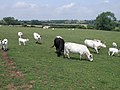 Cattle grazing near Woodford - geograph.org.uk - 1381887.jpg 640 × 480; 87 KB
-
 Cottages just off the railway track - geograph.org.uk - 4516540.jpg 640 × 480; 82 KB
-

-
 Denford in the distance - geograph.org.uk - 4516537.jpg 480 × 640; 62 KB
-
 Disused Railway - geograph.org.uk - 4516539.jpg 480 × 640; 57 KB
-
 Empty pub and Fish ^ Chip shop in Woodford - geograph.org.uk - 3297906.jpg 2 560 × 1 920; 1,19 MB
-
 Entrance to Stanwick Lakes - geograph.org.uk - 4516538.jpg 480 × 640; 58 KB
-
 Family Cycle Route To Thrapston - geograph.org.uk - 2546366.jpg 1 496 × 1 122; 943 KB
-
 Field view - geograph.org.uk - 4516548.jpg 480 × 640; 69 KB
-

-

-
 Houses in Woodford - geograph.org.uk - 4516526.jpg 640 × 480; 75 KB
-
 Lay-by on the eastbound A14 - geograph.org.uk - 3580366.jpg 640 × 480; 45 KB
-
 Layby on A14 westbound - geograph.org.uk - 2767644.jpg 2 640 × 1 980; 650 KB
-
 Licensed to Brew - geograph.org.uk - 3297913.jpg 2 560 × 1 920; 1,13 MB
-
 Log pile - geograph.org.uk - 4516543.jpg 480 × 640; 74 KB
-
 Looking towards Woodford - geograph.org.uk - 4516529.jpg 640 × 480; 58 KB
-
-
 New warehouse - geograph.org.uk - 4516544.jpg 640 × 480; 62 KB
-
 New warehouse - geograph.org.uk - 4516546.jpg 640 × 480; 49 KB
-
 Path alongside the River Nene - geograph.org.uk - 4516530.jpg 480 × 640; 106 KB
-
 Path near Great Addington - geograph.org.uk - 4575436.jpg 480 × 640; 109 KB
-
 Path near Great Addington - geograph.org.uk - 4575437.jpg 480 × 640; 122 KB
-
 Path near Woodford - geograph.org.uk - 4575434.jpg 480 × 640; 88 KB
-
 River Nene - geograph.org.uk - 4516531.jpg 640 × 480; 124 KB
-
 River Nene - geograph.org.uk - 4516534.jpg 480 × 640; 106 KB
-
 River Nene - geograph.org.uk - 4516536.jpg 480 × 640; 90 KB
-
 River Nene approaching Denford - geograph.org.uk - 130456.jpg 640 × 480; 86 KB
-
 River Nene from Woodford Church - geograph.org.uk - 2557.jpg 640 × 427; 238 KB
-
 River Nene near Woodford Mill - geograph.org.uk - 130424.jpg 640 × 480; 59 KB
-
 River Nene north of Denford - geograph.org.uk - 2995756.jpg 640 × 480; 79 KB
-
 Stanwick Lakes Rail Trail - geograph.org.uk - 714563.jpg 640 × 480; 89 KB
-
 The Dukes, Woodford - geograph.org.uk - 2547591.jpg 1 496 × 1 122; 574 KB
-

-
 Towards the River Nene - geograph.org.uk - 4575415.jpg 480 × 640; 74 KB
-
 Utility works on Mill Road - geograph.org.uk - 3297894.jpg 2 560 × 1 920; 1,1 MB
-
 View along Nene Way - geograph.org.uk - 4575421.jpg 480 × 640; 90 KB
-
 View along Nene Way - geograph.org.uk - 4575422.jpg 480 × 640; 81 KB
-
 View along Nene Way - geograph.org.uk - 4575423.jpg 480 × 640; 102 KB
-
 View along Nene Way - geograph.org.uk - 4575424.jpg 480 × 640; 117 KB
-
 View along Nene Way - geograph.org.uk - 4575425.jpg 640 × 480; 96 KB
-
 View along Nene Way - geograph.org.uk - 4575427.jpg 480 × 640; 102 KB
-
 View along Nene Way - geograph.org.uk - 4575429.jpg 480 × 640; 102 KB
-
 View along Nene Way - geograph.org.uk - 4575430.jpg 640 × 480; 80 KB
-
 View along Nene Way - geograph.org.uk - 4575432.jpg 480 × 640; 127 KB
-
 View along Nene Way - geograph.org.uk - 4575433.jpg 480 × 640; 97 KB
-
 View along the old railway track - geograph.org.uk - 4575419.jpg 480 × 640; 73 KB
-
 View of the old railway track - geograph.org.uk - 4575417.jpg 480 × 640; 76 KB
-
 Woodford Ford - geograph.org.uk - 3019918.jpg 3 264 × 2 448; 3,41 MB
-
 Woodford Ford and the drier option - geograph.org.uk - 3298114.jpg 2 560 × 1 920; 1,09 MB
-
 Woodford Lock - geograph.org.uk - 2059159.jpg 640 × 480; 84 KB
-
 Woodford Shrubbery - geograph.org.uk - 4516549.jpg 480 × 640; 125 KB
-
 Woodford Shrubbery - geograph.org.uk - 4516550.jpg 480 × 640; 89 KB
-
 Woodford Temperance building - geograph.org.uk - 4516555.jpg 480 × 640; 73 KB
-
 Woodford War Memorial - geograph.org.uk - 4516524.jpg 480 × 640; 80 KB
-
 Woodford Wesleyan Chapel - geograph.org.uk - 4516553.jpg 640 × 480; 93 KB
-
 Woodford Wesleyan Chapel - geograph.org.uk - 4516554.jpg 480 × 640; 75 KB
-
 Woodford, a view from the allotment gardens - geograph.org.uk - 3297923.jpg 2 560 × 1 920; 1,1 MB
-
 Farmland and Footpaths - geograph.org.uk - 130431.jpg 640 × 480; 63 KB
-
 Footpath through horse-paddocks - geograph.org.uk - 130447.jpg 640 × 480; 73 KB
-
 Home Farm - geograph.org.uk - 55259.jpg 640 × 480; 128 KB
-
 Islip Lodge - geograph.org.uk - 55270.jpg 640 × 480; 121 KB
-
 Storage Silos and Barns - geograph.org.uk - 55266.jpg 640 × 480; 120 KB
-
 The Nene Valley - geograph.org.uk - 125829.jpg 640 × 480; 102 KB


