Category:Woolfardisworthy, Mid Devon
Aller à la navigation
Aller à la recherche
English: Woolfardisworthy is a village in Mid Devon.
village britannique  | |||||
| Téléverser des médias | |||||
| Nature de l’élément | |||||
|---|---|---|---|---|---|
| Lieu | Mid Devon, Devon, Angleterre du Sud-Ouest, Angleterre | ||||
 | |||||
Sous-catégories
Cette catégorie comprend 2 sous-catégories, dont les 2 ci-dessous.
B
- Black Dog, Devon (6 F)
S
Média dans la catégorie « Woolfardisworthy, Mid Devon »
Cette catégorie comprend 117 fichiers, dont les 117 ci-dessous.
-
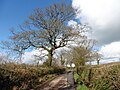
 Approaching Tree from the south - geograph.org.uk - 3282749.jpg 1 024 × 768 ; 705 kio
-
 Barn at South Emlett - geograph.org.uk - 2341229.jpg 640 × 480 ; 95 kio
-
 Barton Hill Copse - geograph.org.uk - 5258817.jpg 1 600 × 1 200 ; 954 kio
-
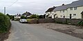
 Black Dog , Houses - geograph.org.uk - 6361762.jpg 3 264 × 1 836 ; 3 Mio
-
 Black Dog , Road - geograph.org.uk - 6361763.jpg 3 648 × 1 824 ; 1,04 Mio
-
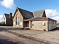 Black Dog Methodist church - geograph.org.uk - 6403908.jpg 1 024 × 768 ; 171 kio
-
 Bridge near Bowerhay - geograph.org.uk - 5258821.jpg 1 600 × 1 280 ; 928 kio
-
 Church Cottage, Woolfardisworthy - geograph.org.uk - 2402067.jpg 640 × 455 ; 95 kio
-
 Church Cottage, Woolfardisworthy - geograph.org.uk - 5907833.jpg 1 024 × 768 ; 222 kio
-
 Country road west of Woolfardisworthy - geograph.org.uk - 3282701.jpg 1 024 × 768 ; 661 kio
-
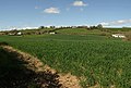
 Countryside around South Emlett - geograph.org.uk - 2244997.jpg 640 × 410 ; 73 kio
-
 Countryside near Washford Moor - geograph.org.uk - 2368835.jpg 640 × 400 ; 62 kio
-
 Covered well at Black Dog, by Well Cottage - geograph.org.uk - 3282770.jpg 1 024 × 769 ; 560 kio
-
 Crossroads, Black Dog - geograph.org.uk - 3146794.jpg 640 × 360 ; 209 kio
-
 Crossroads, Black Dog - geograph.org.uk - 6404532.jpg 1 024 × 811 ; 140 kio
-
 Densham Lane - geograph.org.uk - 6403751.jpg 1 024 × 804 ; 179 kio
-
 Densham Lane - geograph.org.uk - 6403764.jpg 1 024 × 787 ; 212 kio
-
 Dip between low hills near Little Densham - geograph.org.uk - 3282706.jpg 1 024 × 768 ; 515 kio
-
 East side of Emlett Hill - geograph.org.uk - 2244948.jpg 640 × 480 ; 100 kio
-
 Emlett Hill - geograph.org.uk - 2244958.jpg 640 × 480 ; 119 kio
-
 Emlett Hill - geograph.org.uk - 2244985.jpg 640 × 429 ; 130 kio
-
 Emlett Hill - geograph.org.uk - 453192.jpg 640 × 480 ; 91 kio
-
 Entrance to Woolfardisworthy churchyard - geograph.org.uk - 5909497.jpg 1 024 × 768 ; 322 kio
-
 Farmland near Black Dog - geograph.org.uk - 3460444.jpg 640 × 480 ; 68 kio
-
 Field by Stone Ash Lane - geograph.org.uk - 2341233.jpg 640 × 480 ; 113 kio
-
 Field entrance near Bowerhay - geograph.org.uk - 5258822.jpg 1 600 × 1 200 ; 897 kio
-
 Field, Little Tridley - geograph.org.uk - 3146801.jpg 640 × 360 ; 231 kio
-
 Field, South Emlett - geograph.org.uk - 2244992.jpg 640 × 460 ; 74 kio
-
 Fields near Hudgery - geograph.org.uk - 2402105.jpg 640 × 454 ; 94 kio
-
 Fields near Hudgery - geograph.org.uk - 6403694.jpg 1 024 × 768 ; 232 kio
-
 Gateway on to Stone Ash Lane - geograph.org.uk - 5909469.jpg 1 024 × 768 ; 286 kio
-
 Grass field and gateway - geograph.org.uk - 5909453.jpg 1 024 × 768 ; 177 kio
-
 Grass field at Brownstone Moor Cross - geograph.org.uk - 5909479.jpg 1 024 × 768 ; 220 kio
-
 Grass field below Densham - geograph.org.uk - 5909494.jpg 1 024 × 768 ; 137 kio
-
 Grass field off Stone Ash Lane - geograph.org.uk - 5909461.jpg 1 024 × 768 ; 202 kio
-
 Grassland off Tridley Foot Hill - geograph.org.uk - 2908528.jpg 640 × 360 ; 199 kio
-
 Green Lane, Emlett - geograph.org.uk - 2908531.jpg 640 × 360 ; 217 kio
-
 Green Lane, Emlett - geograph.org.uk - 2908535.jpg 640 × 360 ; 244 kio
-
 Hele Lane Methodist Church - geograph.org.uk - 2908522.jpg 640 × 360 ; 220 kio
-
 Interior, St Mary’s church, Woolfardisworthy - geograph.org.uk - 5907831.jpg 1 024 × 768 ; 138 kio
-
 Lane at Woolfardisworthy - geograph.org.uk - 2402053.jpg 640 × 480 ; 113 kio
-
 Lane heading east - geograph.org.uk - 3460441.jpg 640 × 480 ; 62 kio
-
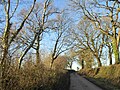
 Lane north of Woolfardisworthy - geograph.org.uk - 2376919.jpg 640 × 474 ; 91 kio
-
 Lane to Cann's Mill - geograph.org.uk - 1059944.jpg 640 × 480 ; 62 kio
-
 Lane to Littleborough - geograph.org.uk - 2402080.jpg 480 × 640 ; 130 kio
-
 Lane to Woolfardisworthy - geograph.org.uk - 2368412.jpg 640 × 449 ; 69 kio
-
 Lane towards Black Dog - geograph.org.uk - 3460447.jpg 640 × 480 ; 51 kio
-
 Little Densham - geograph.org.uk - 2908520.jpg 640 × 360 ; 226 kio
-
 Mid Devon , Black Dog Studios - geograph.org.uk - 1196139.jpg 447 × 640 ; 108 kio
-
 Mid Devon , Country Lane - geograph.org.uk - 1196084.jpg 640 × 480 ; 110 kio
-
 Mid Devon , Country Lane - geograph.org.uk - 1196090.jpg 640 × 480 ; 102 kio
-
 Mid Devon , Country Lane - geograph.org.uk - 1196103.jpg 640 × 480 ; 103 kio
-
 Mid Devon , Country Lane - geograph.org.uk - 5617921.jpg 6 000 × 4 000 ; 6,78 Mio
-
 Mid Devon , Country Road - geograph.org.uk - 1196110.jpg 640 × 480 ; 100 kio
-
 Mid Devon , Country Road - geograph.org.uk - 1196299.jpg 640 × 306 ; 52 kio
-
 Mid Devon , Countryside - geograph.org.uk - 1187910.jpg 640 × 480 ; 91 kio
-
 Mid Devon , Countryside - geograph.org.uk - 1196099.jpg 640 × 480 ; 72 kio
-
 Mid Devon , Countryside - geograph.org.uk - 1196145.jpg 640 × 347 ; 83 kio
-
 Mid Devon , Countryside - geograph.org.uk - 1196163.jpg 640 × 298 ; 58 kio
-
 Mid Devon , Countryside and Sheep - geograph.org.uk - 1196131.jpg 640 × 296 ; 60 kio
-
 Mid Devon , Countryside and Sheep - geograph.org.uk - 1196289.jpg 640 × 217 ; 36 kio
-
 Mid Devon , Densham Lane - geograph.org.uk - 5617925.jpg 6 000 × 4 000 ; 6,9 Mio
-
 Mid Devon , Track - geograph.org.uk - 5617942.jpg 6 000 × 4 000 ; 5,91 Mio
-
 Minor road to Black Dog - geograph.org.uk - 6403759.jpg 1 024 × 768 ; 279 kio
-
 Minor road to Littleborough - geograph.org.uk - 6403715.jpg 1 024 × 768 ; 245 kio
-
 Moor Farm - geograph.org.uk - 2368403.jpg 640 × 480 ; 113 kio
-
 Muddy start to the path to Berry Castle - geograph.org.uk - 3282759.jpg 1 024 × 768 ; 637 kio
-
 Muddy track, Brownstone - geograph.org.uk - 3459334.jpg 640 × 480 ; 101 kio
-
 Old track, Hudgery - geograph.org.uk - 2402102.jpg 640 × 480 ; 130 kio
-
 Ordnance Survey Cut Mark - geograph.org.uk - 4453602.jpg 480 × 640 ; 101 kio
-
 Remains of a woodland - geograph.org.uk - 2907981.jpg 640 × 360 ; 281 kio
-
 Riverside Cross - geograph.org.uk - 2376856.jpg 640 × 483 ; 115 kio
-
 Riverside Cross - geograph.org.uk - 2401996.jpg 640 × 480 ; 126 kio
-
 Riverside Cross - geograph.org.uk - 5907848.jpg 1 024 × 768 ; 225 kio
-
 Road along the ridge north of Bowerhay - geograph.org.uk - 5258826.jpg 1 600 × 1 200 ; 909 kio
-
 Road at Tree - geograph.org.uk - 2368449.jpg 640 × 464 ; 96 kio
-
 Road drops past Tridley Foot - geograph.org.uk - 1612006.jpg 640 × 480 ; 67 kio
-
 Road past Tree - geograph.org.uk - 2368472.jpg 640 × 419 ; 109 kio
-
 Road to Black Dog - geograph.org.uk - 2368425.jpg 640 × 454 ; 94 kio
-
 Road to Kennerleigh - geograph.org.uk - 2368324.jpg 640 × 455 ; 68 kio
-
 Road to Littleborough - geograph.org.uk - 2368533.jpg 640 × 480 ; 128 kio
-
 St Mary’s church, Woolfardisworthy - geograph.org.uk - 5907829.jpg 1 024 × 768 ; 229 kio
-
 Swannaton Lane - geograph.org.uk - 2887256.jpg 2 592 × 1 936 ; 2,64 Mio
-
 Thatched cottage, Black Dog - geograph.org.uk - 6404527.jpg 1 024 × 768 ; 208 kio
-
 Thatched cottages, near Woolfardisworthy - geograph.org.uk - 5907861.jpg 1 024 × 768 ; 234 kio
-
 The Barton, Woolfardisworthy with Victorian postbox - geograph.org.uk - 3282351.jpg 1 024 × 771 ; 527 kio
-
 The Black Dog Inn - geograph.org.uk - 3460451.jpg 640 × 480 ; 54 kio
-
 The Black Dog Inn, Black Dog - geograph.org.uk - 3282766.jpg 1 024 × 512 ; 372 kio
-
 The Black Dog Inn, Black Dog - geograph.org.uk - 6403888.jpg 1 024 × 783 ; 172 kio
-
 The road to St Mary’s church, Woolfardisworthy - geograph.org.uk - 3282345.jpg 1 024 × 768 ; 711 kio
-
 The second bridge at Cann's Mill - geograph.org.uk - 3851778.jpg 1 536 × 1 152 ; 1,52 Mio
-
 Towards Tridley Foot - geograph.org.uk - 2368348.jpg 640 × 434 ; 79 kio
-
 Track to Higher Densham - geograph.org.uk - 3460458.jpg 640 × 480 ; 52 kio
-
 Track to Hudgery - geograph.org.uk - 6403717.jpg 1 024 × 776 ; 197 kio
-
 Track to Little Densham - geograph.org.uk - 5909490.jpg 1 024 × 768 ; 149 kio
-
 Trees and hedgebanks near Hudgery - geograph.org.uk - 5258831.jpg 1 600 × 1 200 ; 920 kio
-
 Trees on Emlett Hill - geograph.org.uk - 2244973.jpg 640 × 497 ; 153 kio
-
 Trees on the top of Emlett Hill - geograph.org.uk - 5909473.jpg 1 024 × 768 ; 250 kio
-
 Tridley Foot Cross - geograph.org.uk - 2366411.jpg 480 × 640 ; 160 kio
-
 Tridley Foot Cross - geograph.org.uk - 3282735.jpg 1 024 × 768 ; 715 kio
-
 Turning for Higher Menchinedown - geograph.org.uk - 6403720.jpg 1 024 × 768 ; 270 kio
-
 Two footpaths at Little Densham - geograph.org.uk - 3282728.jpg 1 024 × 768 ; 548 kio
-
 West Emlett from Emlett Hill - geograph.org.uk - 2244978.jpg 640 × 422 ; 105 kio
-
 Woods west of Woolfardisworthy - geograph.org.uk - 2368361.jpg 640 × 434 ; 90 kio
-
 Woolfardisworthy Cross - geograph.org.uk - 3282347.jpg 1 024 × 767 ; 700 kio
-
 Woolfardisworthy, by Tridley Foot Cross - geograph.org.uk - 218815.jpg 640 × 427 ; 204 kio
-
 Woolfardisworthy, Emlett Hill - geograph.org.uk - 409637.jpg 640 × 427 ; 216 kio
-
 Woolfardisworthy, footpath to East Emlett - geograph.org.uk - 218783.jpg 640 × 427 ; 298 kio
-
 Woolfardisworthy, Glebe Cottage - geograph.org.uk - 255043.jpg 640 × 427 ; 207 kio
-
 Woolfardisworthy, near Brownstone Moor Cross - geograph.org.uk - 409623.jpg 640 × 427 ; 180 kio
-
 Woolfardisworthy, near Hudgery - geograph.org.uk - 364379.jpg 640 × 427 ; 127 kio
-
 Woolfardisworthy, towards Kennerleigh - geograph.org.uk - 218814.jpg 640 × 427 ; 171 kio
-
 Woolfardisworthy, towards Langham - geograph.org.uk - 409646.jpg 640 × 427 ; 152 kio
-
 Woolfardisworthy, towards Moor Farm - geograph.org.uk - 218812.jpg 640 × 427 ; 155 kio
-
 Woolfardisworthy, Woolsery Mill Farm - geograph.org.uk - 94640.jpg 640 × 434 ; 120 kio
-
 Woolsery Mill Farm - geograph.org.uk - 5907857.jpg 1 024 × 768 ; 221 kio
-
 Yard at Glebe Farm, Woolfardisworthy - geograph.org.uk - 5907840.jpg 1 024 × 768 ; 180 kio


