Category:Wootton, Bedfordshire
Aller à la navigation
Aller à la recherche
village britannique   | |||||
| Téléverser des médias | |||||
| Nature de l’élément | |||||
|---|---|---|---|---|---|
| Lieu | Bedford, Bedfordshire, Angleterre de l'Est, Angleterre | ||||
 | |||||
Sous-catégories
Cette catégorie comprend 4 sous-catégories, dont les 4 ci-dessous.
H
K
Pages dans la catégorie « Wootton, Bedfordshire »
Cette catégorie comprend seulement la page ci-dessous.
Média dans la catégorie « Wootton, Bedfordshire »
Cette catégorie comprend 97 fichiers, dont les 97 ci-dessous.
-
 21 and 23, Church Row.jpg 4 032 × 2 294 ; 8,6 Mio
-
 A fenced garden at the end of Keeley Lane - geograph.org.uk - 3637399.jpg 1 600 × 1 068 ; 591 kio
-
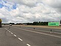 A421 lay-by - geograph.org.uk - 5454354.jpg 640 × 480 ; 48 kio
-
 A421 lay-by - geograph.org.uk - 5454359.jpg 640 × 480 ; 68 kio
-
 A421 lay-by - geograph.org.uk - 5786034.jpg 640 × 480 ; 50 kio
-
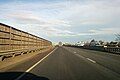
 A421 northbound - geograph.org.uk - 4431326.jpg 640 × 464 ; 45 kio
-
 A421 northbound, footbridge - geograph.org.uk - 4431332.jpg 640 × 480 ; 46 kio
-
 A421 passing under Fields Road - geograph.org.uk - 2677669.jpg 640 × 480 ; 40 kio
-
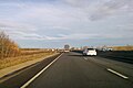
 A421 towards Bedford - geograph.org.uk - 5623712.jpg 640 × 428 ; 65 kio
-
 A421 towards Bedford - geograph.org.uk - 5623785.jpg 640 × 428 ; 65 kio
-
 A421 towards Bedford - geograph.org.uk - 5623992.jpg 640 × 428 ; 72 kio
-
 AmazonEarthHill.JPG 2 816 × 2 112 ; 2,54 Mio
-
 AmazonWooton.JPG 4 000 × 3 000 ; 4,19 Mio
-
 Beauchamp Road - geograph.org.uk - 3164151.jpg 640 × 480 ; 81 kio
-
 Bedford not Burnley. - geograph.org.uk - 407418.jpg 640 × 512 ; 71 kio
-
 Bourne End Road - geograph.org.uk - 3639599.jpg 1 600 × 1 067 ; 492 kio
-
 Bourne End Road at the junction of Keeley Lane - geograph.org.uk - 5309369.jpg 2 048 × 1 536 ; 907 kio
-
 Bridge over A421, Wootton - geograph.org.uk - 5623892.jpg 640 × 428 ; 75 kio
-
 Bridleway and barn at Bourne End Farm - geograph.org.uk - 3639983.jpg 1 600 × 1 068 ; 543 kio
-
 Bridleway by Wootton Woods - geograph.org.uk - 3637533.jpg 1 600 × 1 068 ; 643 kio
-
 Bridleway off the old Bedford road - geograph.org.uk - 3595594.jpg 1 600 × 1 068 ; 399 kio
-
 Bridleway towards Wootton Wood - geograph.org.uk - 3638467.jpg 1 600 × 1 068 ; 495 kio
-
 Bridleway under the A421 - geograph.org.uk - 3595585.jpg 1 600 × 1 068 ; 501 kio
-
 CarInDitch.JPG 2 816 × 2 112 ; 2,65 Mio
-
 Church Road, Wootton - geograph.org.uk - 3188259.jpg 640 × 480 ; 94 kio
-
 Church Road, Wootton - geograph.org.uk - 5314276.jpg 2 048 × 1 536 ; 858 kio
-
 Church Road, Wootton - geograph.org.uk - 5314277.jpg 2 048 × 1 536 ; 983 kio
-
 Church yard in Wootton, Bedfordshire with John Evelyn's monu Wellcome V0018697.jpg 3 034 × 2 305 ; 3,12 Mio
-
 Copse in the field - geograph.org.uk - 3595566.jpg 1 600 × 1 068 ; 581 kio
-
 Cottages near Wootton (Beds) - geograph.org.uk - 563921.jpg 640 × 502 ; 60 kio
-
 Cottages on Hall End Road - geograph.org.uk - 3637337.jpg 1 600 × 1 067 ; 329 kio
-
 Country lanes near Wootton - geograph.org.uk - 3188227.jpg 640 × 480 ; 83 kio
-

-
 Cranfield Road at the junction of Church Road - geograph.org.uk - 5309476.jpg 2 048 × 1 536 ; 1,48 Mio
-
 Cranfield Road, Wootton - geograph.org.uk - 3188275.jpg 640 × 480 ; 82 kio
-
 Cranfield Road, Wootton - geograph.org.uk - 5309491.jpg 2 000 × 1 470 ; 698 kio
-
 Cranfield Road, Wootton Green - geograph.org.uk - 3188295.jpg 640 × 480 ; 102 kio
-
 Cranfield Road, Wootton Green - geograph.org.uk - 5312072.jpg 2 048 × 1 536 ; 908 kio
-
 Dead tree on the path into Wootton - geograph.org.uk - 3637535.jpg 1 600 × 1 068 ; 418 kio
-
 Development at Woodford - geograph.org.uk - 5845000.jpg 3 264 × 2 448 ; 3,03 Mio
-
 Drive through Wootton Wood - geograph.org.uk - 3637540.jpg 1 200 × 1 600 ; 864 kio
-
 Farmland near Wootton - geograph.org.uk - 2708241.jpg 640 × 480 ; 58 kio
-
 Farmland, Wootton - geograph.org.uk - 1564999.jpg 640 × 480 ; 148 kio
-
 Fields Road - geograph.org.uk - 3338587.jpg 640 × 480 ; 55 kio
-
 Fields Road Bridge, A421 - geograph.org.uk - 5449145.jpg 640 × 348 ; 35 kio
-
 Fields Road to Wootton over Woburn Road - geograph.org.uk - 3770223.jpg 1 600 × 1 070 ; 536 kio
-
 Footbridge by Elm Farm - geograph.org.uk - 2677674.jpg 640 × 489 ; 38 kio
-
 Footbridge over A421 - geograph.org.uk - 4873405.jpg 640 × 480 ; 37 kio
-
 Footpath by Wootton Wood - geograph.org.uk - 3637538.jpg 1 600 × 1 068 ; 601 kio
-
 Footpath to Bell Farm - geograph.org.uk - 3676858.jpg 1 600 × 1 068 ; 540 kio
-
 Footpath to Bourne End Road - geograph.org.uk - 3639990.jpg 1 600 × 1 067 ; 592 kio
-
 Footpath to Kempston Hardwick - geograph.org.uk - 3770226.jpg 1 200 × 1 600 ; 752 kio
-
 Footpath to Wootton - geograph.org.uk - 3595410.jpg 1 600 × 1 068 ; 576 kio
-
 Footpath to Wootton - geograph.org.uk - 3595591.jpg 1 600 × 1 067 ; 598 kio
-
 Footpath under the A421 - geograph.org.uk - 3595414.jpg 1 600 × 1 068 ; 613 kio
-
 Footpaths at Hall End - geograph.org.uk - 3637363.jpg 1 600 × 1 069 ; 612 kio
-
 Grovebury Court - geograph.org.uk - 3163967.jpg 640 × 480 ; 77 kio
-
 Hall End Road at the junction of Keeley Lane - geograph.org.uk - 5309359.jpg 2 048 × 1 536 ; 1,5 Mio
-
 Haycroft - geograph.org.uk - 3164289.jpg 480 × 640 ; 70 kio
-
 John Evelyn's monument in Wootton. Wood engraving. Wellcome V0018698.jpg 2 715 × 2 617 ; 2,81 Mio
-
 Lay-by A421 - geograph.org.uk - 4873400.jpg 640 × 480 ; 29 kio
-
 Moat at Bourne End Farm - geograph.org.uk - 3639986.jpg 1 600 × 1 067 ; 609 kio
-
 New houses on Hall End Road - geograph.org.uk - 5309475.jpg 2 048 × 1 536 ; 1,48 Mio
-
 Path to Wootton by a stand of trees round a pond - geograph.org.uk - 3595512.jpg 1 600 × 1 066 ; 588 kio
-
 Path towards Elm Farm - geograph.org.uk - 3676867.jpg 1 200 × 1 600 ; 606 kio
-
 Phone mast at Bourne End Farm - geograph.org.uk - 3639978.jpg 1 200 × 1 600 ; 470 kio
-
 Pond in the field - geograph.org.uk - 3595572.jpg 1 600 × 1 067 ; 791 kio
-
 Power lines over the stubble - geograph.org.uk - 3639594.jpg 1 200 × 1 600 ; 498 kio
-
 Power lines over the wheat - geograph.org.uk - 3638460.jpg 1 600 × 1 072 ; 399 kio
-
 Pylon and straw by Whitworth's Farm - geograph.org.uk - 3637418.jpg 1 200 × 1 600 ; 570 kio
-
 Pylon in the pasture - geograph.org.uk - 3639565.jpg 1 200 × 1 600 ; 566 kio
-
 Road bridge over A421 near Wootton - geograph.org.uk - 5895656.jpg 1 024 × 612 ; 107 kio
-
 St. Mary's Church, Wootton, Bedfordshire. (50312138761).jpg 4 032 × 3 024 ; 8,38 Mio
-
 Stewart Court - geograph.org.uk - 3164565.jpg 640 × 480 ; 78 kio
-
 Straw field by Moral Man Farm - geograph.org.uk - 3639588.jpg 1 600 × 1 068 ; 544 kio
-
 Stream crosses under Wood End Road - geograph.org.uk - 3637416.jpg 1 600 × 1 067 ; 570 kio
-
 Summerfield Drive - geograph.org.uk - 3168897.jpg 640 × 480 ; 66 kio
-
 Sunset over Keeley Lane, Wood End - geograph.org.uk - 5309373.jpg 2 048 × 1 536 ; 938 kio
-
 The beginning of Bourne End Road - geograph.org.uk - 3639597.jpg 1 600 × 1 067 ; 518 kio
-
 The Chequers Inn, Hall End - geograph.org.uk - 5309248.jpg 2 048 × 1 536 ; 1,05 Mio
-
 The John Bunyan Trail at Wootton - geograph.org.uk - 3637336.jpg 1 600 × 1 068 ; 602 kio
-
 The John Bunyan Trail towards Wood End - geograph.org.uk - 3637331.jpg 1 600 × 1 068 ; 558 kio
-
 The lane to Gadfly Farm - geograph.org.uk - 3639584.jpg 1 600 × 1 068 ; 660 kio
-
 The Old Post Office - geograph.org.uk - 363266.jpg 616 × 445 ; 92 kio
-
 Top Farm - geograph.org.uk - 3639603.jpg 1 600 × 1 068 ; 472 kio
-
 Track down to Wood Farm by Wootton Wood - geograph.org.uk - 3638459.jpg 1 600 × 1 070 ; 527 kio
-
 War Memorial, Wootton - geograph.org.uk - 3188270.jpg 640 × 480 ; 67 kio
-
 Wood End cottage - geograph.org.uk - 3637405.jpg 1 200 × 1 600 ; 857 kio
-
 Wootton - geograph.org.uk - 3162545.jpg 640 × 480 ; 82 kio
-
 Wootton - geograph.org.uk - 3162605.jpg 640 × 480 ; 63 kio
-
 Wootton - geograph.org.uk - 3162794.jpg 640 × 480 ; 63 kio
-
 Wootton - geograph.org.uk - 363238.jpg 640 × 480 ; 92 kio
-
 Wootton, Bedfordshire.JPG 3 023 × 4 227 ; 1,21 Mio
-
 WoottonBedsAerial.jpg 2 272 × 1 704 ; 1,84 Mio
-
 John Bunyan Trail at Hall End, Wootton - geograph.org.uk - 474342.jpg 640 × 480 ; 91 kio
-
 John Bunyan Trail enters Wootton - geograph.org.uk - 474346.jpg 640 × 480 ; 245 kio
-
 Pasture and hedge, Hall End of Wootton - geograph.org.uk - 471996.jpg 640 × 480 ; 264 kio


_-_geograph.org.uk_-_563921.jpg)


.jpg)


