Category:Worcestershire Beacon
Aller à la navigation
Aller à la recherche
montagne britannique | |||||
| Téléverser des médias | |||||
| Nature de l’élément | |||||
|---|---|---|---|---|---|
| Lieu |
| ||||
| Chaîne de montagnes | |||||
| Altitude |
| ||||
| Sommet parent | |||||
 | |||||
Sous-catégories
Cette catégorie comprend 2 sous-catégories, dont les 2 ci-dessous.
W
- Worcestershire Beacon toposcope (23 F)
- Worcestershire Beacon Trig point (19 F)
Média dans la catégorie « Worcestershire Beacon »
Cette catégorie comprend 69 fichiers, dont les 69 ci-dessous.
-
 Bin, seat and beacon - geograph.org.uk - 1337074.jpg 480 × 640 ; 154 kio
-
 Blue Granite^ - geograph.org.uk - 728885.jpg 640 × 427 ; 287 kio
-
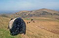
 Cattle and sheep on the Worcestershire Beacon - geograph.org.uk - 646666.jpg 640 × 480 ; 73 kio
-
 East flank of the Worcestershire Beacon - geograph.org.uk - 1604259.jpg 640 × 471 ; 113 kio
-
 Eastern flank of North Hill - geograph.org.uk - 1338732.jpg 640 × 480 ; 158 kio
-
 Flock of sheep on the Worcestershire Beacon - geograph.org.uk - 754945.jpg 640 × 480 ; 78 kio
-
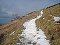
 Frosty morning on the Rushy Valley path - geograph.org.uk - 761292.jpg 640 × 480 ; 76 kio
-
-
 Galloway cattle on the Worcestershire Beacon - geograph.org.uk - 1386525.jpg 640 × 480 ; 143 kio
-
 Galloway cattle on the Worcestershire Beacon - geograph.org.uk - 760577.jpg 640 × 424 ; 68 kio
-
 High-level path on the Worcestershire Beacon - geograph.org.uk - 761154.jpg 640 × 475 ; 67 kio
-

-

-
 Malvern Hills Panorama.jpg 16 472 × 1 792 ; 4,99 Mio
-
 New Bench, Worcestershire Beacon - geograph.org.uk - 728892.jpg 640 × 427 ; 272 kio
-
 Old and new tracks to Worcestershire Beacon - geograph.org.uk - 1421976.jpg 640 × 366 ; 230 kio
-
 On Summer Hill - geograph.org.uk - 1337063.jpg 640 × 480 ; 109 kio
-
 Paragliding off Worcestershire Beacon - geograph.org.uk - 1424944.jpg 640 × 426 ; 48 kio
-
 Path ascending the Worcestershire Beacon - geograph.org.uk - 1424878.jpg 640 × 426 ; 58 kio
-
 Path down from Worcestershire Beacon - geograph.org.uk - 1422935.jpg 640 × 383 ; 243 kio
-
 Path from the Worcester Beacon to Wyche Cutting - geograph.org.uk - 446985.jpg 640 × 480 ; 111 kio
-

-
 Rock outcrop on the Worcestershire Beacon - geograph.org.uk - 1636029.jpg 640 × 426 ; 101 kio
-
 Saddle south of the Worcestershire Beacon - geograph.org.uk - 645983.jpg 640 × 480 ; 88 kio
-
 Seat on the Worcestershire Beacon - geograph.org.uk - 646640.jpg 640 × 480 ; 93 kio
-
 Seat on the Worcestershire Beacon path - 1 - geograph.org.uk - 645957.jpg 640 × 480 ; 74 kio
-
 Seat on the Worcestershire Beacon path - 2 - geograph.org.uk - 645961.jpg 640 × 480 ; 87 kio
-
 Sinuous path towards the Worcestershire Beacon - geograph.org.uk - 825641.jpg 480 × 640 ; 251 kio
-
 Snow-covered path to the Worcester Beacon - geograph.org.uk - 1386377.jpg 640 × 480 ; 108 kio
-
 Snowy conditions on the Worcestershire Beacon - geograph.org.uk - 1386518.jpg 640 × 480 ; 103 kio
-

-
 Sugarloaf and Worcestershire Beacon - geograph.org.uk - 253086.jpg 640 × 427 ; 99 kio
-
 Summit of Worcestershire Beacon - geograph.org.uk - 313970.jpg 640 × 426 ; 131 kio
-
 The modern track down Worcestershire Beacon - geograph.org.uk - 1422930.jpg 640 × 427 ; 276 kio
-
 The Southern Slopes of Worcestershire Beacon - geograph.org.uk - 728851.jpg 640 × 427 ; 244 kio
-

-
 Track to the top of the Worcestershire Beacon - geograph.org.uk - 646626.jpg 640 × 480 ; 79 kio
-
 Trees beside New Pool (geograph 5631132).jpg 1 024 × 768 ; 289 kio
-
 View north from Perseverance Hill - geograph.org.uk - 638040.jpg 640 × 401 ; 69 kio
-
 Well-worn path towards the Worcestershire Beacon - geograph.org.uk - 825773.jpg 461 × 640 ; 217 kio
-
 Western flank of the Worcestershire Beacon - geograph.org.uk - 646663.jpg 640 × 480 ; 73 kio
-
 Worcestershire Beacon - geograph.org.uk - 1488388.jpg 640 × 447 ; 264 kio
-
 Worcestershire Beacon - geograph.org.uk - 1491355.jpg 640 × 367 ; 235 kio
-
 Worcestershire Beacon from South.jpg 4 104 × 2 848 ; 4,14 Mio
-
 Worcestershire Beacon in the clouds - geograph.org.uk - 1422536.jpg 640 × 365 ; 175 kio
-
 Worcestershire Beacon Malvern England.jpg 1 068 × 824 ; 143 kio
-
 Worcestershire Beacon viewed from Welland - geograph.org.uk - 3209865.jpg 3 273 × 1 919 ; 3,91 Mio
-
 Worcestershire Beacon, Malvern, England-LCCN2002697059.jpg 3 670 × 2 695 ; 2,81 Mio
-
 Worcestershire Beacon, Malvern, England-LCCN2002697059.tif 3 670 × 2 695 ; 28,3 Mio
-
 Worcestershire Beacon.jpg 2 048 × 1 536 ; 1,31 Mio
-
 Approach to Wyche Cutting from the south - geograph.org.uk - 825707.jpg 640 × 480 ; 194 kio
-
 Bilberry growing on the Worcestershire Beacon - geograph.org.uk - 1424932.jpg 640 × 426 ; 102 kio
-

-

-
 Eastern flank of the Worcestershire Beacon - geograph.org.uk - 646623.jpg 640 × 480 ; 70 kio
-

-

-

-
 Sugarloaf Hill (and Worcestershire Beacon) - geograph.org.uk - 313937.jpg 640 × 426 ; 108 kio
-
 Sugarloaf Hill and the Worcester Beacon - geograph.org.uk - 446418.jpg 640 × 480 ; 100 kio
-
 Summit of the Worcester Beacon - geograph.org.uk - 447084.jpg 640 × 480 ; 376 kio
-
 Track leading from Worcester Beacon summit - geograph.org.uk - 446961.jpg 640 × 480 ; 95 kio
-
 Waymarker between Worcester Beacon and North Hill - geograph.org.uk - 447016.jpg 640 × 480 ; 105 kio
-
 Western flank of the Worcester Beacon - geograph.org.uk - 446898.jpg 640 × 480 ; 98 kio
-
 Worcestershire Beacon - geograph.org.uk - 675543.jpg 640 × 399 ; 144 kio
-
 Worcestershire Beacon Alight - geograph.org.uk - 82007.jpg 640 × 480 ; 23 kio
-

-
 Worcestershire Beacon from Sugarloaf Hill - geograph.org.uk - 313952.jpg 640 × 426 ; 102 kio
-
 Worcestershire Beacon in Fog Bound Britain - geograph.org.uk - 297281.jpg 640 × 427 ; 198 kio


.jpg)


_-_geograph.org.uk_-_313937.jpg)