Category:Wormley, Surrey
Aller à la navigation
Aller à la recherche
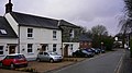
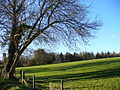
English: Wormley is a village in Surrey, England. It is a dispersed village largely consisting of a scattering of houses on the A283 Petworth Road between Witley and Chiddingfold and Combe Lane, a turning off the A283 where Witley station and further houses are situated. The village is part of the census area Witley which has a population of 7,703.
village britannique  | |||||
| Téléverser des médias | |||||
| Nature de l’élément | |||||
|---|---|---|---|---|---|
| Lieu | Witley, Waverley, Surrey, Angleterre du Sud-Est, Angleterre | ||||
 | |||||
Sous-catégories
Cette catégorie comprend 4 sous-catégories, dont les 4 ci-dessous.
Média dans la catégorie « Wormley, Surrey »
Cette catégorie comprend 43 fichiers, dont les 43 ci-dessous.
-
 Bus shelter at Wormley on the A283 - geograph.org.uk - 1546177.jpg 640 × 480 ; 97 kio
-

-
 Church Lane - geograph.org.uk - 1571594.jpg 480 × 640 ; 167 kio
-
 Combe Court Parkland - geograph.org.uk - 291810.jpg 640 × 480 ; 171 kio
-
 Cottage, Sandhills - geograph.org.uk - 306831.jpg 640 × 480 ; 149 kio
-
 Down train at Wormley - geograph.org.uk - 1135921.jpg 640 × 360 ; 88 kio
-
 Fine hedge in Brook Road - geograph.org.uk - 1543885.jpg 640 × 480 ; 93 kio
-
 Houses at Wormley - geograph.org.uk - 1135902.jpg 640 × 360 ; 50 kio
-
 Junction of the A283 and Brook Road - geograph.org.uk - 1546217.jpg 640 × 480 ; 99 kio
-
 Lay-by at Wormley on the A283 - geograph.org.uk - 1546188.jpg 640 × 480 ; 86 kio
-
 Logging near Noddings Farm - geograph.org.uk - 291815.jpg 640 × 480 ; 157 kio
-

-
 Looking from Brook Road into Bridewell Close - geograph.org.uk - 1545774.jpg 640 × 480 ; 80 kio
-

-
 Looking northwards up Combe Lane - geograph.org.uk - 1543834.jpg 640 × 480 ; 80 kio
-
 Looking out onto the A283 from Brook Road - geograph.org.uk - 1546219.jpg 640 × 480 ; 113 kio
-
 Modest building in Station Approach - geograph.org.uk - 1543852.jpg 640 × 480 ; 76 kio
-
 MOT and servicing centre by the A283 - geograph.org.uk - 2678381.jpg 4 000 × 3 000 ; 3,47 Mio
-
 Parkland - geograph.org.uk - 291808.jpg 640 × 480 ; 117 kio
-
 Path from Witley Station to Brook Road - geograph.org.uk - 1542803.jpg 480 × 640 ; 121 kio
-
 Railway Cutting, Wormley - geograph.org.uk - 1572872.jpg 480 × 640 ; 117 kio
-
 Sebastapol Lane, Sandhills - geograph.org.uk - 1571879.jpg 640 × 480 ; 114 kio
-
 Sharp bend on the A286 - geograph.org.uk - 1351859.jpg 640 × 360 ; 78 kio
-
 Sign for a disused public house - geograph.org.uk - 1255640.jpg 640 × 360 ; 84 kio
-
 Surrey Hills totem pole - geograph.org.uk - 1255655.jpg 360 × 640 ; 60 kio
-
 The Woodpigeon, Wormley - geograph.org.uk - 1769110.jpg 2 000 × 1 310 ; 163 kio
-
 Twilight in Brook Road - geograph.org.uk - 1546229.jpg 480 × 640 ; 40 kio
-
 View from the footpath below Church Lane - geograph.org.uk - 1546124.jpg 640 × 480 ; 67 kio
-
 Village boundary sign on the A283 - geograph.org.uk - 1546168.jpg 640 × 480 ; 116 kio
-
 Wealden Field, Prestwick - geograph.org.uk - 291798.jpg 640 × 480 ; 178 kio
-
 Wealden Oaks - geograph.org.uk - 291830.jpg 640 × 480 ; 144 kio
-
 Witley railway.jpg 1 600 × 1 007 ; 795 kio
-
 Witley, Railway line to Milford - geograph.org.uk - 705436.jpg 640 × 480 ; 119 kio
-
 Wormley Post Office - geograph.org.uk - 1571587.jpg 640 × 480 ; 108 kio
-
 Wormley, Coronation Cottages - geograph.org.uk - 1410161.jpg 640 × 480 ; 85 kio
-
 Wormley, phone box notice - geograph.org.uk - 1410453.jpg 480 × 640 ; 65 kio
-

-
 Wormley, Railway line to London - geograph.org.uk - 705584.jpg 640 × 480 ; 119 kio
-
 Wormley, Railway line to Portsmouth - geograph.org.uk - 705544.jpg 640 × 480 ; 104 kio
-
 Wormley, Ramp 3 yards - geograph.org.uk - 1410163.jpg 640 × 480 ; 81 kio
-
 Wormley, speed limit reminder - geograph.org.uk - 1410465.jpg 640 × 480 ; 75 kio
-
 Wormley, the post office - geograph.org.uk - 1410158.jpg 640 × 480 ; 92 kio
-
 Private Lane near Combe Court - geograph.org.uk - 291804.jpg 640 × 480 ; 165 kio


