Category:Worrall, South Yorkshire
Aller à la navigation
Aller à la recherche
village britannique  | |||||
| Téléverser des médias | |||||
| Nature de l’élément | |||||
|---|---|---|---|---|---|
| Lieu | Bradfield, Sheffield, Yorkshire du Sud, Yorkshire-et-Humber, Angleterre | ||||
 | |||||
Média dans la catégorie « Worrall, South Yorkshire »
Cette catégorie comprend 108 fichiers, dont les 108 ci-dessous.
-
 "The Shoulder of Mutton", Worrall - geograph.org.uk - 2594322.jpg 2 338 × 1 755 ; 931 kio
-

-
 64 Towngate Road, Worrall.jpg 2 672 × 2 043 ; 1,68 Mio
-
 66 Towngate Road, Worrall 2.jpg 2 793 × 2 269 ; 2,48 Mio
-

-
-
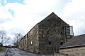 Barn in Worrall - geograph.org.uk - 723198.jpg 640 × 427 ; 59 kio
-
 Bilberry wall - geograph.org.uk - 2642566.jpg 3 648 × 2 736 ; 5,91 Mio
-
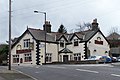 Blue Ball Pub at Worrall - geograph.org.uk - 726988.jpg 640 × 427 ; 64 kio
-
 Boggard Lane, Worrall, near Oughtibridge - geograph.org.uk - 1116887.jpg 640 × 480 ; 108 kio
-

-

-

-
-
 Bungalow, Towngate Road, Worrall - geograph.org.uk - 1157716.jpg 640 × 480 ; 51 kio
-
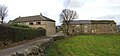
 Burnt Hill Farm - geograph.org.uk - 257192.jpg 640 × 466 ; 64 kio
-
 Celebrating the 2012 Olympics at Worrall, near Oughtibridge - geograph.org.uk - 3169700.jpg 1 983 × 2 699 ; 1,77 Mio
-
 Chapel in Worrall, from Hagg Stones Road - geograph.org.uk - 727004.jpg 640 × 427 ; 94 kio
-
 Corner House geese, Long Lane, near Worrall - geograph.org.uk - 1166932.jpg 640 × 480 ; 122 kio
-
 Corner House, Long Lane, near Worrall - geograph.org.uk - 1166924.jpg 640 × 427 ; 83 kio
-
 Cottage, Towngate Road, Worrall - geograph.org.uk - 1157708.jpg 640 × 480 ; 88 kio
-

-
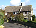
 Country House, off Mowson Lane, near Worrall - geograph.org.uk - 863888.jpg 640 × 480 ; 90 kio
-
-

-
 Don Valley above Middlewood - geograph.org.uk - 979862.jpg 640 × 480 ; 111 kio
-
 Elder Cottage, Mowson Lane, Worrall - geograph.org.uk - 755323.jpg 640 × 427 ; 77 kio
-

-
 Footpath off Mowson Lane, near Worrall - geograph.org.uk - 725457.jpg 640 × 427 ; 122 kio
-
 Footpath off Worrall Road, Wadsley - geograph.org.uk - 755424.jpg 640 × 426 ; 99 kio
-
 Footpath to Birtin, Worrall, Sheffield - geograph.org.uk - 1281893.jpg 640 × 480 ; 88 kio
-
 Footpath to Burnt Hill, Worrall, Sheffield - geograph.org.uk - 1281888.jpg 640 × 480 ; 75 kio
-

-

-
 Golfers at Long Lane, Worrall, near Oughtibridge - geograph.org.uk - 1117019.jpg 640 × 480 ; 126 kio
-

-
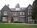
 Haighenfield House, Kirk Edge Road, Worrall - geograph.org.uk - 1110636.jpg 640 × 480 ; 73 kio
-

-

-
 Hillsborough Golf Course, near Worrall - geograph.org.uk - 176705.jpg 640 × 480 ; 100 kio
-
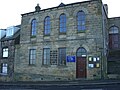 Worrall Independent Chapel.jpg 2 000 × 1 500 ; 531 kio
-
-

-

-
 Lang House Farm - 1, Stubbing Lane, near Worrall - geograph.org.uk - 1166615.jpg 640 × 427 ; 105 kio
-

-
 Lang House, Long Lane, near Worrall - geograph.org.uk - 1166604.jpg 640 × 480 ; 90 kio
-
 Lingard Well at Worrall - geograph.org.uk - 1054830.jpg 640 × 480 ; 131 kio
-
 Lodge Farm, Worrall, Sheffield - geograph.org.uk - 1166866.jpg 640 × 480 ; 102 kio
-

-

-

-
 Mast and Steps, Long Lane, near Worrall - geograph.org.uk - 1166939.jpg 480 × 640 ; 85 kio
-
 Middlewood Hall from Mowson Lane, near Worrall - geograph.org.uk - 725470.jpg 640 × 480 ; 113 kio
-

-
 New Path at Middlewood, Middlewood Road North, Sheffield - geograph.org.uk - 1734416.jpg 1 827 × 1 220 ; 852 kio
-
 Old School House, Worrall.jpg 2 200 × 1 650 ; 486 kio
-
 Pasture at Worrall - geograph.org.uk - 1373976.jpg 640 × 480 ; 69 kio
-

-

-

-
 Playground, Worrall near Oughtibridge - geograph.org.uk - 1112140.jpg 640 × 480 ; 49 kio
-
 Playing Fields at Worrall, near Oughtibridge - geograph.org.uk - 1112143.jpg 640 × 480 ; 86 kio
-

-
 Quarry Farm, Worrall, near Oughtibridge - geograph.org.uk - 1116894.jpg 640 × 480 ; 69 kio
-
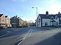
 Road Junction at Worrall - geograph.org.uk - 1054827.jpg 640 × 480 ; 76 kio
-
 Road sign in Worrall, near Oughtibridge - geograph.org.uk - 723192.jpg 640 × 427 ; 85 kio
-
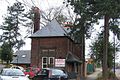
 School Buses outside Bradfield School - geograph.org.uk - 723203.jpg 640 × 426 ; 78 kio
-
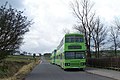
 School Buses waiting outside Bradfield School - geograph.org.uk - 723210.jpg 640 × 427 ; 70 kio
-
 Shaun The Sheep^ ... Worrall, Sheffield - geograph.org.uk - 1281925.jpg 640 × 427 ; 67 kio
-
 Shoulder of Mutton Pub at Worrall - geograph.org.uk - 176696.jpg 640 × 480 ; 80 kio
-
 Sky over Worrall - geograph.org.uk - 545017.jpg 640 × 480 ; 54 kio
-
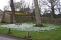 Snowdrops at The Yews, Long Lane, Worrall - geograph.org.uk - 1193173.jpg 640 × 427 ; 105 kio
-
 Square House on Mowson Lane, Worrall - geograph.org.uk - 755325.jpg 640 × 426 ; 58 kio
-

-
 Sunset over Worrall - geograph.org.uk - 547920.jpg 640 × 480 ; 62 kio
-

-
 Sycamore House, Worrall, near Oughtibridge - geograph.org.uk - 1112146.jpg 640 × 480 ; 93 kio
-
 The 'Old Village School' in Worrall - geograph.org.uk - 1157757.jpg 640 × 480 ; 75 kio
-

-

-

-
 The Yews - 1, Long Lane, Worrall - geograph.org.uk - 719850.jpg 640 × 480 ; 73 kio
-
 The Yews - 2, Long Lane, Worrall - geograph.org.uk - 719858.jpg 480 × 640 ; 76 kio
-
 The Yews - 3, Long Lane, Worrall - geograph.org.uk - 1193163.jpg 640 × 480 ; 87 kio
-

-
 Trig Point on Loxley Common - geograph.org.uk - 73073.jpg 640 × 480 ; 124 kio
-

-

-
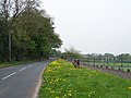
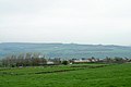
 View from Worrall Road towards Sheffield - geograph.org.uk - 723254.jpg 640 × 426 ; 40 kio
-
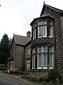
 View of Hawthorn House, off Stockarth Lane - geograph.org.uk - 725424.jpg 640 × 426 ; 46 kio
-

-
 Walshaw House, Worrall, Sheffield - geograph.org.uk - 1166855.jpg 640 × 426 ; 126 kio
-
 Water Tower outside Bradfield School - geograph.org.uk - 723215.jpg 640 × 480 ; 97 kio
-
 Weir on the River Don - geograph.org.uk - 702597.jpg 640 × 480 ; 114 kio
-
 Well Cottage, Towngate Road, Worrall - geograph.org.uk - 1157733.jpg 640 × 480 ; 80 kio
-
 Western section of Hillsborough golf course - geograph.org.uk - 903842.jpg 640 × 427 ; 81 kio
-

-
 Worrall centre.jpg 3 648 × 2 736 ; 517 kio
-
 Worrall from Boggard Lane, Oughtibridge - geograph.org.uk - 1281964.jpg 640 × 480 ; 66 kio
-

-

-
 Worrall Hall Farm.jpg 5 354 × 2 515 ; 930 kio
-
 Worrall Hall, Worrall, near Oughtibridge - 1 - geograph.org.uk - 1116873.jpg 640 × 480 ; 95 kio
-
 Worrall Hall, Worrall, near Oughtibridge - 2 - geograph.org.uk - 1116864.jpg 640 × 480 ; 91 kio
-
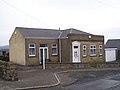
 Worrall Memorial Hall - geograph.org.uk - 723196.jpg 640 × 427 ; 71 kio
-
 Worrall Road viewpoint - geograph.org.uk - 1094380.jpg 640 × 342 ; 52 kio
-
 Worrall Village Sign - geograph.org.uk - 751081.jpg 640 × 427 ; 133 kio


